Category:Kirkconnel
Jump to navigation
Jump to search
town in Dumfries and Galloway, Scotland, UK  | |||||
| Upload media | |||||
| Instance of | |||||
|---|---|---|---|---|---|
| Location |
| ||||
| Population |
| ||||
 | |||||
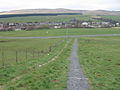
English: Kirkconnel ( Gaelic: Cille Chonaill) is a small parish and town in Dumfries and Galloway, southwestern Scotland. It is located on the A76 near the head of Nithsdale. Kirkconnel led a more quiet existence than neighboring towns like Sanquhar. Principally it has been a farming community. There are few buildings of any significance. The name comes from The Church of Saint Conal. In 1850 the village had only a single street 400 yards long.
Subcategories
This category has the following 8 subcategories, out of 8 total.
F
- Fingland Burn, Kirkconnel (1 F)
G
- Glengaber Hill, Kirkconnel (2 F)
- Glenwharrie Burn (3 F)
H
- High Cairn Farm (2 F)
K
- Kello Rovers F.C. (29 F)
- Kirkconnel railway station (9 F)
P
- Polbower Mill (1 F)
S
- St Conal's Kirk (5 F)
Media in category "Kirkconnel"
The following 144 files are in this category, out of 144 total.
-
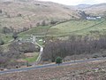
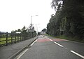 A 76 entering Kirkconnel.jpg 1,024 × 720; 122 KB
-
 A cairn at the site of St Conal's Church - geograph.org.uk - 1518505.jpg 640 × 427; 133 KB
-
 Above Duntercleuch - geograph.org.uk - 1473055.jpg 640 × 480; 92 KB
-
 After the rain - geograph.org.uk - 1454985.jpg 640 × 480; 50 KB
-
 Barr Moor - geograph.org.uk - 391458.jpg 640 × 480; 133 KB
-
 Branteth - geograph.org.uk - 414222.jpg 640 × 480; 65 KB
-
 Burnfoothill Wood - geograph.org.uk - 415170.jpg 640 × 480; 149 KB
-

-
 Covenanter commemorative wall - geograph.org.uk - 610230.jpg 640 × 480; 178 KB
-
 Dennigall Hill to Auchtitench Hill - geograph.org.uk - 248183.jpg 640 × 480; 100 KB
-
 Euchan Forest - geograph.org.uk - 391418.jpg 640 × 480; 149 KB
-
 Euchan Forest at Rowantree Craig - geograph.org.uk - 391424.jpg 640 × 480; 169 KB
-
 Euchan Water - geograph.org.uk - 394710.jpg 640 × 480; 169 KB
-
 Euchan Water and Glenglass - geograph.org.uk - 394689.jpg 640 × 480; 158 KB
-
 Euchanhead Ruin - geograph.org.uk - 393924.jpg 640 × 480; 258 KB
-
 Farmland near Kirkconnel - geograph.org.uk - 89007.jpg 640 × 427; 103 KB
-
 Fingland Lane - geograph.org.uk - 610220.jpg 640 × 480; 162 KB
-
 Fingland, from the Glengap Burn - geograph.org.uk - 1316550.jpg 640 × 480; 86 KB
-
 Forest Road - geograph.org.uk - 133006.jpg 640 × 480; 95 KB
-
 Friarminnan remains - geograph.org.uk - 610197.jpg 640 × 480; 155 KB
-
 Gareland Burn - geograph.org.uk - 610295.jpg 640 × 480; 170 KB
-
 Ghost Train - geograph.org.uk - 731596.jpg 640 × 480; 112 KB
-
 Glenaylmer Burn - geograph.org.uk - 245607.jpg 640 × 480; 95 KB
-
 Glengap Burn - geograph.org.uk - 1314084.jpg 640 × 480; 93 KB
-
 Glengap Burn - geograph.org.uk - 245609.jpg 640 × 480; 70 KB
-
 Glengap Burn - geograph.org.uk - 391522.jpg 640 × 480; 135 KB
-
 Glengap Burn looking south - geograph.org.uk - 1263996.jpg 640 × 428; 60 KB
-
 Glenharraw Burn - geograph.org.uk - 394703.jpg 640 × 480; 154 KB
-
 Grouse Butts on Kirklea - geograph.org.uk - 779618.jpg 640 × 480; 176 KB
-
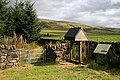 Information boards at Old Kirkland - geograph.org.uk - 1516436.jpg 640 × 427; 138 KB
-
 Kello Water below Corserig Hill - geograph.org.uk - 391408.jpg 640 × 480; 143 KB
-
 Kirkconnel - geograph.org.uk - 466431.jpg 640 × 418; 104 KB
-
 Kirkconnel Cemetery - geograph.org.uk - 672498.jpg 640 × 480; 72 KB
-
 Kirkconnel Hall Hotel - geograph.org.uk - 485828.jpg 640 × 480; 92 KB
-
 Kirkconnel in 2007.jpg 640 × 480; 114 KB
-
 Kirkland Hills from the site of Polbower Mill.jpg 4,608 × 3,456; 5.71 MB
-
 Kirklea hillside towards Gareland Burn - geograph.org.uk - 779622.jpg 640 × 480; 165 KB
-
 Kirklea hillside towards Spango Water - geograph.org.uk - 779628.jpg 640 × 480; 157 KB
-
 Knockenjig Farm - geograph.org.uk - 72072.jpg 640 × 480; 97 KB
-
 Lane near Kirkconnell - geograph.org.uk - 486317.jpg 640 × 480; 167 KB
-
 Loading area - geograph.org.uk - 387563.jpg 640 × 480; 88 KB
-
 Looking down the Polholm Burn - geograph.org.uk - 199306.jpg 640 × 480; 68 KB
-
 Looking north down the Reeve Burn - geograph.org.uk - 153061.jpg 480 × 640; 98 KB
-

-
 Mapa dg cille chonaill.jpg 2,004 × 1,363; 599 KB
-
 Niviston - geograph.org.uk - 1245987.jpg 640 × 480; 100 KB
-
 Polbower burn - geograph.org.uk - 245604.jpg 640 × 480; 97 KB
-
 Polbower Burn and Baker's Burn Trail.jpg 4,608 × 3,456; 6.86 MB
-
 Polbroc Burn near Corserig Farm - geograph.org.uk - 375821.jpg 640 × 480; 128 KB
-
 Polhote Burn - geograph.org.uk - 375794.jpg 640 × 480; 156 KB
-
 Polneul Burn - geograph.org.uk - 375770.jpg 640 × 480; 157 KB
-
 Polneul Burn - geograph.org.uk - 375788.jpg 640 × 480; 179 KB
-
 Priest Gill - geograph.org.uk - 354168.jpg 640 × 480; 172 KB
-
 Railway lines at Kirkconnel - geograph.org.uk - 89009.jpg 427 × 640; 106 KB
-
 Railway lines near kirkconnel - geograph.org.uk - 89010.jpg 427 × 640; 99 KB
-
 Remains of St. Connel's church - geograph.org.uk - 1464686.jpg 640 × 480; 96 KB
-
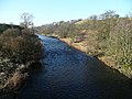 River Nith - geograph.org.uk - 686775.jpg 640 × 480; 90 KB
-
 Sheep in Kirkconnel - geograph.org.uk - 768785.jpg 640 × 450; 35 KB
-
 Source of the Polholm Burn - geograph.org.uk - 153095.jpg 480 × 640; 76 KB
-
 Southern Upland Way at Wether Hill - geograph.org.uk - 227356.jpg 640 × 480; 117 KB
-

-
 St Conal's Catholic Church - geograph.org.uk - 1455465.jpg 640 × 423; 130 KB
-
 St Conal's Kirk, Carved stones display, Kirkland, Kirkconnel.jpg 4,516 × 3,330; 6.57 MB
-
 St Conal's Kirk, Kirkland Hills, Kirkconnel.jpg 4,179 × 1,817; 2.36 MB
-
 St Conal's Kirk, Medieval carved stones detail, Kirkconnel, Scotland.jpg 4,528 × 3,348; 5.42 MB
-
 St Conal's Kirk, Medieval carved stones, Kirkconnel, Scotland.jpg 4,464 × 3,256; 4.89 MB
-
 Stones in St Conal's Stone Shelter - geograph.org.uk - 1518526.jpg 427 × 640; 127 KB
-
 The remains of St Conal's Church - geograph.org.uk - 1518517.jpg 640 × 427; 137 KB
-
 The River Nith. - geograph.org.uk - 434139.jpg 640 × 480; 84 KB
-
 Track from Gareland below Kirklea - geograph.org.uk - 779632.jpg 640 × 480; 159 KB
-
 Two cairns on Meikle Knypes - geograph.org.uk - 153069.jpg 480 × 640; 81 KB
-
 Up the Spothfore Burn - geograph.org.uk - 199307.jpg 640 × 480; 71 KB
-
 Upper reaches of the Grain Burn - geograph.org.uk - 153301.jpg 640 × 473; 77 KB
-
 Upper reaches of the Spothfore Burn - geograph.org.uk - 153104.jpg 480 × 640; 98 KB
-
 Valley of Glengap Burn - geograph.org.uk - 1316540.jpg 640 × 480; 89 KB
-
 Across Carcarse East - geograph.org.uk - 376230.jpg 640 × 480; 147 KB
-

-
 Benzien Craig - geograph.org.uk - 394722.jpg 640 × 480; 164 KB
-
 Beside Euchanhead Forest - geograph.org.uk - 376225.jpg 640 × 480; 153 KB
-
 Between river and railway - geograph.org.uk - 686761.jpg 640 × 480; 106 KB
-
 Burnt grazing on Peely Knowes - geograph.org.uk - 405009.jpg 640 × 480; 106 KB
-
 Come on Everybody, It's Gabion Time^ - geograph.org.uk - 731642.jpg 640 × 480; 122 KB
-
 Euchanhead Forest - geograph.org.uk - 376210.jpg 640 × 480; 99 KB
-
 Farmland near Drumbuie - geograph.org.uk - 391468.jpg 640 × 480; 138 KB
-
 Fence leading to Cocker Hill - geograph.org.uk - 152986.jpg 518 × 640; 77 KB
-
 Feuchaw Rig - geograph.org.uk - 394715.jpg 640 × 480; 144 KB
-
 Fishing in the Nith - geograph.org.uk - 775761.jpg 640 × 480; 93 KB
-
 Footbridge over River Nith at Kirkconnel - geograph.org.uk - 375862.jpg 640 × 480; 133 KB
-
 Forest - geograph.org.uk - 133010.jpg 640 × 480; 106 KB
-
 Forest edge on White Hill - geograph.org.uk - 375749.jpg 640 × 480; 157 KB
-
 Forest road at Corserig Hill - geograph.org.uk - 375799.jpg 640 × 480; 109 KB
-
 Forest road Polshag Hill - geograph.org.uk - 375815.jpg 640 × 480; 125 KB
-
 Forest track - geograph.org.uk - 133005.jpg 640 × 480; 108 KB
-
 Glengaber Hill to Stony Hill - geograph.org.uk - 248191.jpg 640 × 480; 79 KB
-
 Glenlarie Burn - geograph.org.uk - 394733.jpg 640 × 480; 136 KB
-
 Glenmaddie - geograph.org.uk - 391455.jpg 640 × 480; 118 KB
-
 Glenmuckloch opencast coal mine - geograph.org.uk - 1408799.jpg 640 × 480; 59 KB
-
 Hill road - geograph.org.uk - 399828.jpg 640 × 480; 104 KB
-
 Hillhead from coal conveyor - geograph.org.uk - 1408813.jpg 640 × 480; 78 KB
-
 Kello Water - geograph.org.uk - 376212.jpg 640 × 480; 153 KB
-
 Kello Water - geograph.org.uk - 391440.jpg 640 × 480; 148 KB
-
 Kello Water - geograph.org.uk - 391450.jpg 640 × 480; 147 KB
-
 Kello Water below Brunt Rig - geograph.org.uk - 391432.jpg 640 × 480; 164 KB
-
 Kirkconnel - geograph.org.uk - 768778.jpg 640 × 480; 48 KB
-
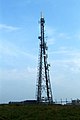 Kirkconnel TV-Relay tower - geograph.org.uk - 37538.jpg 427 × 640; 48 KB
-
 Kirkland Hill trig point S6091 - geograph.org.uk - 245608.jpg 640 × 480; 81 KB
-
 Lethans ruin - geograph.org.uk - 248170.jpg 640 × 480; 86 KB
-

-
 Lorg Burn - geograph.org.uk - 10501.jpg 480 × 640; 106 KB
-
 Magheuchan Rig - geograph.org.uk - 376207.jpg 640 × 480; 163 KB
-
 Millstone Knowe above Connelbush - geograph.org.uk - 391493.jpg 640 × 480; 143 KB
-
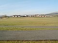
 Moorland becomes farmland - geograph.org.uk - 89006.jpg 640 × 427; 120 KB
-
 Moorland near Kirkconnel - geograph.org.uk - 89004.jpg 640 × 427; 96 KB
-
 Mount Stuart towards White Hill - geograph.org.uk - 610264.jpg 640 × 480; 174 KB
-

-
 Mynwhirr Hill trig point S5831 - geograph.org.uk - 375763.jpg 640 × 480; 149 KB
-
 Nithside Park, Kirkconnel - geograph.org.uk - 466429.jpg 640 × 427; 68 KB
-
 On Bank Hill - geograph.org.uk - 391403.jpg 640 × 480; 129 KB
-
 Open field in Kelloholm - geograph.org.uk - 697390.jpg 640 × 480; 62 KB
-
 Path Junction - geograph.org.uk - 133011.jpg 640 × 480; 90 KB
-
 Polstacher Burn - geograph.org.uk - 375730.jpg 640 × 480; 158 KB
-
 Pool on Black Hill - geograph.org.uk - 391413.jpg 640 × 480; 124 KB
-
 Pool on Rough Naze - geograph.org.uk - 394695.jpg 640 × 480; 155 KB
-
 Rig Plantation - geograph.org.uk - 375826.jpg 640 × 480; 145 KB
-
 Rough Shoulder towards Birk Grain - geograph.org.uk - 393955.jpg 640 × 480; 133 KB
-

-
 Sheepfold by March Burn and Kello Water - geograph.org.uk - 391415.jpg 640 × 480; 156 KB
-
 Sheepfold by the Mynwhirr Burn - geograph.org.uk - 375738.jpg 640 × 480; 183 KB
-
 St Conal's cross by Willie's Burn - geograph.org.uk - 248175.jpg 640 × 480; 92 KB
-
 Summit of Meikledod Hill - geograph.org.uk - 10502.jpg 640 × 395; 63 KB
-

-
 Towards Big Burn - geograph.org.uk - 376234.jpg 640 × 480; 160 KB
-
 Towards Birk Grain - geograph.org.uk - 393964.jpg 640 × 480; 123 KB
-
 Towards Cloud Hill and Mid Rig - geograph.org.uk - 394742.jpg 640 × 480; 158 KB
-
 Towards Magheuchan Rig - geograph.org.uk - 376196.jpg 640 × 480; 140 KB
-
 Track on Libry Moor - geograph.org.uk - 375804.jpg 640 × 480; 127 KB
-
 Track on Libry Moor - geograph.org.uk - 375810.jpg 640 × 480; 149 KB
-
 Track to Corserig - geograph.org.uk - 375838.jpg 640 × 480; 130 KB
-
 Track to Corserig - geograph.org.uk - 375848.jpg 640 × 480; 150 KB
-
 Track to Glenwharrie - geograph.org.uk - 245601.jpg 640 × 480; 106 KB
-
 Track to Vennel - geograph.org.uk - 245606.jpg 640 × 480; 72 KB
-

-
 Unmapped Bridge over Kello Water - geograph.org.uk - 391527.jpg 640 × 480; 167 KB
-
 Unusual cairn on Glenguffock Hill - geograph.org.uk - 153055.jpg 480 × 640; 75 KB


