Category:Kirkby Mallory
Jump to navigation
Jump to search

village and former civil parish in Leicestershire, United Kingdom  | |||||
| Upload media | |||||
| Instance of |
| ||||
|---|---|---|---|---|---|
| Location | Peckleton, Kirkby Mallory, Peckleton and Stapleton, Hinckley and Bosworth, Leicestershire, East Midlands, England | ||||
 | |||||
Subcategories
This category has the following 2 subcategories, out of 2 total.
A
- Kirkby Mallory - All Saints (34 F)
M
Media in category "Kirkby Mallory"
The following 23 files are in this category, out of 23 total.
-
 Bluebells along Bosworth Road - geograph.org.uk - 1332309.jpg 527 × 640; 129 KB
-
 Bluebells in Fox Covert - geograph.org.uk - 1332474.jpg 640 × 446; 104 KB
-
 Bluebells in Fox Covert - geograph.org.uk - 1332482.jpg 640 × 480; 96 KB
-

-
 Driveway to Folly Farm - geograph.org.uk - 159328.jpg 480 × 640; 59 KB
-

-
 Kirkby Lodge - geograph.org.uk - 1331886.jpg 640 × 381; 63 KB
-
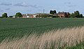
 Kirkby Mallory - geograph.org.uk - 5787004.jpg 1,600 × 900; 222 KB
-

-
 Newbold Road near Kirkby Fields Farm - geograph.org.uk - 1332447.jpg 640 × 397; 57 KB
-
 North along Newbold Road - geograph.org.uk - 1332401.jpg 640 × 450; 65 KB
-
 Small brook along Bosworth Road - geograph.org.uk - 1331812.jpg 640 × 499; 112 KB
-
 Desford Lane in Kirkby Mallory - geograph.org.uk - 703232.jpg 640 × 403; 63 KB
-
 Fields by Mallory Park - geograph.org.uk - 207714.jpg 640 × 483; 100 KB
-
 Footpath to the Church - geograph.org.uk - 158780.jpg 640 × 480; 140 KB
-
 Kirkby Fields Farm - geograph.org.uk - 245385.jpg 640 × 427; 83 KB
-
 Kirkby Lane towards Kirkby Mallory - geograph.org.uk - 703251.jpg 640 × 480; 54 KB
-

-
 Shilton Road near Glebe Farm - geograph.org.uk - 703222.jpg 640 × 490; 87 KB
-
 Shilton Road south of Kirkby Mallory - geograph.org.uk - 703214.jpg 640 × 447; 69 KB
-
 Shilton Road towards Kirkby Mallory - geograph.org.uk - 703218.jpg 640 × 439; 84 KB
-
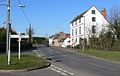
 Welcome to Kirkby Mallory - geograph.org.uk - 703228.jpg 640 × 446; 73 KB
-
 Winding Lane - geograph.org.uk - 158778.jpg 640 × 480; 67 KB


