Category:Kirchgemeindehaus Märstetten
Jump to navigation
Jump to search
| Object location | | View all coordinates using: OpenStreetMap |
|---|
 | |||||
| Upload media | |||||
| Instance of | |||||
|---|---|---|---|---|---|
| Part of | |||||
| Location |
| ||||
| Street address |
| ||||
| Heritage designation |
| ||||
 | |||||
|
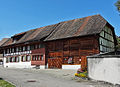
This is a category about a cultural property of regional significance in Switzerland with KGS number 11023
|
Media in category "Kirchgemeindehaus Märstetten"
The following 9 files are in this category, out of 9 total.
-
 Kirche St. Jakob & Kirchgemeindehaus in Märstetten.jpg 3,500 × 4,000; 8.04 MB
-
 Kirchgemeindehaus Märstetten TG.jpg 4,000 × 2,250; 6.07 MB
-
 MaerstettenKigehaus.jpg 1,209 × 873; 928 KB
-
 MaerstettenKigehausHohesHaus.jpg 1,810 × 1,025; 1.17 MB
-
 MaerstettenKigehausHolzwand.jpg 1,878 × 1,032; 1.58 MB
-
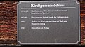 MaerstettenKigehausTafel.jpg 1,920 × 1,080; 1.73 MB
-
 MaerstettenKigehausWest.jpg 1,049 × 1,313; 936 KB
-
 MaerstettenKigehausWestcorner.jpg 1,676 × 1,080; 1.22 MB
-
 MaerstettenKirchgemKirche.jpg 1,080 × 1,628; 1.19 MB


