Category:Kirche Reinhardtsgrimma
Jump to navigation
Jump to search
| Object location | | View all coordinates using: OpenStreetMap |
|---|
church building in Glashütte, Saxony, Germany .jpg) _Kirche_zum_Altar.jpg) | |||||
| Upload media | |||||
| Instance of | |||||
|---|---|---|---|---|---|
| Location | Reinhardtsgrimma, Glashütte, Sächsische Schweiz-Osterzgebirge, Saxony, Germany | ||||
| Street address |
| ||||
| Architectural style | |||||
| Heritage designation | |||||
| Inception |
| ||||
 | |||||
| (Wikidata) |
Subcategories
This category has only the following subcategory.
I
Media in category "Kirche Reinhardtsgrimma"
The following 35 files are in this category, out of 35 total.
-
 2005-02-05 PICT1351.JPG 2,272 × 1,704; 1.98 MB
-
 2005-02-27 Kirche.JPG 1,600 × 1,200; 885 KB
-
 20130314200DR Reinhardtsgrimma (Glashütte) Dorfkirche.jpg 2,967 × 2,040; 2.77 MB
-
 20130314205DR Reinhardtsgrimma (Glashütte) Dorfkirche.jpg 2,863 × 2,135; 2.54 MB
-
 20130314210DR Reinhardtsgrimma (Glashütte) Dorfkirche.jpg 2,137 × 3,044; 2.72 MB
-
 20130314215DR Reinhardtsgrimma (Glashütte) Dorfkirche.jpg 2,895 × 2,325; 3.44 MB
-
 20130314220DR Reinhardtsgrimma (Glashütte) Dorfkirche.jpg 2,195 × 2,944; 3.41 MB
-
 20130314225MDR Reinhardtsgrimma (Glashütte) Dorfkirche.jpg 2,548 × 2,214; 2.57 MB
-
 20130314230DR Reinhardtsgrimma (Glashütte) Dorfkirche.jpg 2,448 × 2,868; 3.28 MB
-
 20130314235DR Reinhardtsgrimma (Glashütte) Dorfkirche.jpg 3,014 × 2,304; 3.02 MB
-
 20130314240MDR Reinhardtsgrimma Dorfkirche.jpg 4,307 × 2,590; 3.85 MB
-
 20130314241MDRG Reinhardtsgrimma (Glashütte) Dorfkirche Grafik.jpg 4,307 × 2,584; 13.39 MB
-
 20130314245DR Reinhardtsgrimma (Glashütte) Dorfkirche.jpg 3,057 × 2,439; 2.7 MB
-
 20130314250DR Reinhardtsgrimma (Glashütte) Dorfkirche Epitaph.jpg 2,064 × 2,968; 3.11 MB
-
 20130314255DR Reinhardtsgrimma (Glashütte) Dorfkirche.jpg 3,008 × 2,484; 2.48 MB
-
 20130314260DR Reinhardtsgrimma (Glashütte) Dorfkirche Epitaph.jpg 3,264 × 2,445; 3.23 MB
-
 20130314265DR Reinhardtsgrimma (Glashütte) Dorfkirche Epitaph.jpg 1,956 × 3,100; 3.66 MB
-
 20130314270DR Reinhardtsgrimma (Glashütte) Friedhof Grab H Collum.jpg 3,064 × 2,259; 2.62 MB
-
 20130314275DR Reinhardtsgrimma Grab H Collum.jpg 2,165 × 3,179; 2.76 MB
-
 20130314280DR Reinhardtsgrimma (Glashütte) Friedhof Grab H Collum.jpg 2,335 × 2,022; 2.62 MB
-
 20191031100DR Reinhardtsgrimma (Glashütte) Dorfkirche.jpg 3,409 × 2,469; 6.43 MB
-
 20191031105DR Reinhardtsgrimma (Glashütte) Dorfkirche.jpg 3,282 × 2,704; 4.98 MB
-
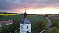 Dorfkirche Reinhardtsgrimma im Sonnenuntergang.jpg 2,000 × 1,125; 212 KB
-
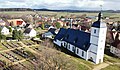
 Dorfkirche Reinhardtsgrimma mit Friedhof & Alte Schule.jpg 3,409 × 1,897; 2 MB
-
 Dorfkirche Reinhardtsgrimma mit Friedhof und Grimmscher Heide.jpg 3,382 × 1,961; 1.92 MB
-
 Dorfkirche Reinhardtsgrimma mit Friedhof.jpg 2,736 × 1,446; 1,003 KB
-
 PICT1354 2.jpg 1,600 × 1,200; 688 KB
-
 Reinhardtsgrimma - evangelische Kirche (02-2).jpg 1,280 × 759; 745 KB
-
 Reinhardtsgrimma Kirche (01).jpg 3,905 × 1,937; 5.59 MB
-
 Reinhardtsgrimma-Collum-Grab-1.jpg 2,071 × 3,107; 1.82 MB
-
 Reinhardtsgrimma-Collum-Grab-2.jpg 3,432 × 2,288; 1.67 MB
-
 Reinhardtsgrimma-Kirche-1.jpg 4,074 × 2,655; 2.25 MB
-
 Reinhardtsgrimma-Kirche-2.jpg 2,615 × 3,487; 1.68 MB
-
 Reinhardtsgrimma-Kirche-3.jpg 2,306 × 3,075; 1.64 MB
-
 Reinhardtsgrimma-Kirche-4.jpg 3,268 × 2,451; 2.22 MB


_Dorfkirche.jpg)
_Dorfkirche.jpg)
_Dorfkirche.jpg)
_Dorfkirche.jpg)
_Dorfkirche.jpg)
_Dorfkirche.jpg)
_Dorfkirche.jpg)
_Dorfkirche.jpg)

_Dorfkirche_Grafik.jpg)
_Dorfkirche.jpg)
_Dorfkirche_Epitaph.jpg)
_Dorfkirche.jpg)
_Dorfkirche_Epitaph.jpg)
_Dorfkirche_Epitaph.jpg)
_Friedhof_Grab_H_Collum.jpg)

_Friedhof_Grab_H_Collum.jpg)
_Dorfkirche.jpg)
_Dorfkirche.jpg)


.jpg)


