Category:Kirche Christus König (Radebeul)
Jump to navigation
Jump to search
| Object location | | View all coordinates using: OpenStreetMap |
|---|
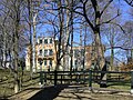
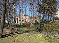
parish church in Radebeul, Germany  | |||||
| Upload media | |||||
| Instance of | |||||
|---|---|---|---|---|---|
| Made from material | |||||
| Location | Radebeul, Meissen District, Saxony, Germany | ||||
 | |||||
Media in category "Kirche Christus König (Radebeul)"
The following 4 files are in this category, out of 4 total.
-
 20080224275DR Radebeul Borstraße 11 Pfarrei Christus König.jpg 2,475 × 1,848; 4.57 MB
-
 20080224280DR Radebeul Borstraße 11 Pfarrei Christus König.jpg 2,491 × 1,857; 4.81 MB
-
 20080224285DR Radebeul Borstraße 11 Pfarrei Christus König.jpg 2,451 × 1,881; 4.37 MB
-
 Radebeul Christkönig.jpg 2,576 × 1,932; 941 KB


