Category:Kington Magna
Jump to navigation
Jump to search
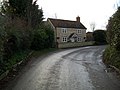
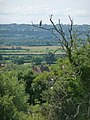
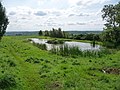
English: Kington Magna is a village in the Blackmore Vale area of north Dorset, England with a population of 376 (2001). It is west of Shaftesbury, north of Sturminster Newton and east of Sherborne. The village was founded in the 12th century, but most of the current buildings are no older than the 17th century.
village and civil parish in Dorset, England  | |||||
| Upload media | |||||
| Instance of | |||||
|---|---|---|---|---|---|
| Location | Dorset, South West England, England | ||||
 | |||||
Subcategories
This category has the following 2 subcategories, out of 2 total.
K
- Kington Magna War Memorial (2 F)
Media in category "Kington Magna"
The following 75 files are in this category, out of 75 total.
-
 A30 approaching junction for Nyland - geograph.org.uk - 4045579.jpg 640 × 466; 60 KB
-
 Blackmore Vale - geograph.org.uk - 3783106.jpg 1,600 × 1,200; 436 KB
-
 Bowden Cottage - geograph.org.uk - 1595327.jpg 640 × 480; 78 KB
-
 Chapel Hill, Kington Magna - geograph.org.uk - 1613914.jpg 640 × 480; 81 KB
-
 Chapel Hill, Kington Magna - geograph.org.uk - 5406103.jpg 640 × 427; 105 KB
-
 Church Hill, Kington Magna - geograph.org.uk - 5406109.jpg 640 × 427; 118 KB
-
 Cottages in Kington Magna - geograph.org.uk - 475348.jpg 640 × 480; 109 KB
-

-
 Entrance to Kington Manor Farm - geograph.org.uk - 475243.jpg 640 × 480; 102 KB
-
 Field above Tunnel Head - geograph.org.uk - 5406289.jpg 640 × 427; 92 KB
-
 Field beside Filley Brook - geograph.org.uk - 5406373.jpg 640 × 427; 101 KB
-
 Flytip beside the A30 - geograph.org.uk - 1155613.jpg 640 × 481; 153 KB
-
 Folly Farm - geograph.org.uk - 1595305.jpg 640 × 480; 74 KB
-
 Folly Lane - geograph.org.uk - 1595313.jpg 640 × 480; 131 KB
-
 Harpitts Lane - geograph.org.uk - 5406285.jpg 640 × 427; 101 KB
-
 Kington magna viewfromchurchlookingwest.JPG 2,032 × 1,520; 530 KB
-

-
-
 Kington Magna, Forge Cottage - geograph.org.uk - 2134010.jpg 640 × 480; 88 KB
-
 Kington Magna, old school house - geograph.org.uk - 1435957.jpg 640 × 480; 98 KB
-

-

-
 Kington Magna, Prospect Farm - geograph.org.uk - 1435975.jpg 480 × 640; 106 KB
-
 Kington Magna, sheep by the pond - geograph.org.uk - 1435960.jpg 640 × 480; 70 KB
-
 Kington Magna, the pond - geograph.org.uk - 1435963.jpg 640 × 480; 99 KB
-
 Kington Magna, two sheep and a view - geograph.org.uk - 1435974.jpg 640 × 480; 74 KB
-

-
 Little Kington Farm - geograph.org.uk - 1613882.jpg 640 × 480; 70 KB
-

-
 Mowing the grass, near Kington Magna - geograph.org.uk - 5406380.jpg 640 × 427; 75 KB
-
 New Town, Kington Magna - geograph.org.uk - 1613867.jpg 640 × 480; 76 KB
-

-
 Newly mown meadow - geograph.org.uk - 5406387.jpg 640 × 427; 85 KB
-

-

-

-

-

-

-

-

-

-

-

-

-

-

-

-

-

-

-

-

-

-
 Top of Chapel Hill - geograph.org.uk - 1589658.jpg 640 × 480; 93 KB
-
 Top of Church Hill - geograph.org.uk - 1589659.jpg 640 × 480; 118 KB
-
 Track at Gains Farm - geograph.org.uk - 1615214.jpg 640 × 480; 80 KB
-
 Track to Bowden Farm - geograph.org.uk - 1595319.jpg 640 × 480; 119 KB
-
 Tractor and trailer at Lower Farm - geograph.org.uk - 5406390.jpg 640 × 427; 99 KB
-

-

-
 Village Hall, Kington Magna - geograph.org.uk - 4527043.jpg 640 × 480; 67 KB
-
 Coking Farm - geograph.org.uk - 550169.jpg 640 × 430; 220 KB
-
 Cows on Coking Farm - geograph.org.uk - 550171.jpg 640 × 430; 282 KB
-

-
 Footpath leaving A30 - geograph.org.uk - 550172.jpg 640 × 430; 244 KB
-
 Footpath, Kington Magna - geograph.org.uk - 475255.jpg 640 × 480; 138 KB
-
 Kington Magna, view from churchyard - geograph.org.uk - 513931.jpg 640 × 429; 83 KB
-
 Medieval Fishpond - geograph.org.uk - 475284.jpg 640 × 440; 73 KB
-
 Near Kington Magna - geograph.org.uk - 327687.jpg 640 × 480; 148 KB
-
 Near Kington Magna - geograph.org.uk - 327690.jpg 640 × 480; 116 KB
-
 One of Five Bridges - geograph.org.uk - 550192.jpg 640 × 430; 330 KB
-
 River Cale at Five Bridges - geograph.org.uk - 550183.jpg 640 × 430; 469 KB
-
 River Cale passing under A30 - geograph.org.uk - 550184.jpg 640 × 430; 477 KB
-


_-_geograph.org.uk_-_3155800.jpg)
_-_geograph.org.uk_-_3155819.jpg)
_-_geograph.org.uk_-_3155828.jpg)
_-_geograph.org.uk_-_3155851.jpg)
_-_geograph.org.uk_-_3157760.jpg)
_-_geograph.org.uk_-_3157769.jpg)
_-_geograph.org.uk_-_3157775.jpg)
_-_geograph.org.uk_-_3157792.jpg)
_-_geograph.org.uk_-_3157796.jpg)
_-_geograph.org.uk_-_3157805.jpg)
_-_geograph.org.uk_-_3157817.jpg)
_-_geograph.org.uk_-_3157828.jpg)
_-_geograph.org.uk_-_3157854.jpg)
_-_geograph.org.uk_-_3157882.jpg)
_-_geograph.org.uk_-_3157893.jpg)
_-_geograph.org.uk_-_3157900.jpg)
_-_geograph.org.uk_-_3157928.jpg)
_-_geograph.org.uk_-_3157938.jpg)


