Category:Kingston by Ferring
Jump to navigation
Jump to search
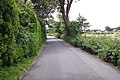
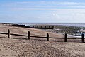
English: Kingston or Kingston by Ferring is a small civil parish in the Arun District of West Sussex, England. It comprises the three settlements of East and West Kingston, and Kingston Gorse and is located between Ferring and East Preston civil parishes, three miles (5km) to the west of Worthing. The parish covers an area of 228.72ha and has a population of 702 persons (2001 census).
Français : Kingston est une paroisse civile du district d'Arun dans le Sussex de l'Ouest dans la région de l'Angleterre du Sud-Est, en Angleterre au Royaume Uni.
civil parish in the Arun district of West Sussex, England  | |||||
| Upload media | |||||
| Instance of | |||||
|---|---|---|---|---|---|
| Location | Arun, West Sussex, South East England, England | ||||
| Area |
| ||||
 | |||||
Media in category "Kingston by Ferring"
The following 200 files are in this category, out of 301 total.
(previous page) (next page)-
 'To the Glory of God' - geograph.org.uk - 4280800.jpg 1,218 × 1,600; 814 KB
-
 11, Coastal Road, West Kingston - geograph.org.uk - 5502521.jpg 480 × 640; 71 KB
-
 Access road - Kingston Gorse - geograph.org.uk - 4283659.jpg 1,600 × 1,070; 637 KB
-
 Access to grazing paddocks - geograph.org.uk - 4280925.jpg 1,600 × 1,063; 592 KB
-
 Almost buried - geograph.org.uk - 4217210.jpg 1,081 × 1,600; 779 KB
-
 Almost buried - geograph.org.uk - 4217223.jpg 1,600 × 1,063; 579 KB
-
 Always a clear boundary marker - geograph.org.uk - 4218670.jpg 1,600 × 983; 593 KB
-
 Arable land - Kingston Gorse - geograph.org.uk - 4280807.jpg 1,600 × 1,043; 603 KB
-
 Arable land - Kingston Gorse - geograph.org.uk - 4283657.jpg 1,600 × 1,028; 634 KB
-
 Arable land west of Ferring Rife - geograph.org.uk - 4277799.jpg 1,600 × 1,090; 722 KB
-
 Back of rectory Kingston by Ferring West Sussex.jpg 560 × 364; 79 KB
-
 Beach access - Kingston Gorse - geograph.org.uk - 4283660.jpg 1,600 × 1,069; 590 KB
-
 Beach access - West Kingston - geograph.org.uk - 4930146.jpg 640 × 461; 83 KB
-
 Beach at Kingston Gorse - geograph.org.uk - 3686904.jpg 1,600 × 1,200; 443 KB
-
 Beach at West Kingston - geograph.org.uk - 4930138.jpg 640 × 479; 77 KB
-
 Beach at West Kingston - geograph.org.uk - 4930141.jpg 640 × 442; 91 KB
-
 Beach by Kingston Gorse - geograph.org.uk - 4824885.jpg 640 × 480; 72 KB
-
 Beach homes - West Kingston - geograph.org.uk - 4283704.jpg 1,600 × 980; 549 KB
-
 Beach homes - West Kingston - geograph.org.uk - 4283706.jpg 1,600 × 1,063; 612 KB
-

-
 Beach huts at Ferring - geograph.org.uk - 4824895.jpg 640 × 480; 106 KB
-
 Beach huts on Ferring beach - geograph.org.uk - 3590981.jpg 3,264 × 2,448; 4.61 MB
-
 Behind the beach - West Kingston - geograph.org.uk - 4217226.jpg 1,600 × 1,013; 565 KB
-
 Behind the beach - West Kingston - geograph.org.uk - 4217227.jpg 1,600 × 1,063; 451 KB
-
 Behind the beach - West Kingston - geograph.org.uk - 4217228.jpg 1,600 × 1,063; 526 KB
-
 Below the tide line - Kingston Gorse - geograph.org.uk - 4283674.jpg 1,600 × 1,025; 485 KB
-
 Bennett's Mead - geograph.org.uk - 5502607.jpg 640 × 465; 63 KB
-
 Brook Lane Caravan Park - geograph.org.uk - 4277794.jpg 1,600 × 1,063; 611 KB
-
 Built for the view - geograph.org.uk - 4217230.jpg 1,600 × 1,063; 443 KB
-
 Byway near Kingston Lane - geograph.org.uk - 4284176.jpg 1,600 × 1,012; 662 KB
-
 Byway off Kingston Lane - geograph.org.uk - 4215153.jpg 1,600 × 1,063; 625 KB
-
 Byway through West Kingston - geograph.org.uk - 4217233.jpg 1,600 × 1,021; 760 KB
-
 Byway through West Kingston - geograph.org.uk - 4217234.jpg 1,600 × 1,055; 794 KB
-
 Byway to the beach - geograph.org.uk - 4930283.jpg 640 × 473; 129 KB
-
 Byway to the sea - geograph.org.uk - 4756868.jpg 800 × 600; 120 KB
-
 Can you do that^ - geograph.org.uk - 4930282.jpg 640 × 461; 88 KB
-
 Cereal crop - West Kingston Farm - geograph.org.uk - 4061018.jpg 4,912 × 3,264; 6.47 MB
-
 Cereal crop by Kingston Lane - geograph.org.uk - 4201613.jpg 1,600 × 1,063; 521 KB
-
 Cereal crop by Kingston Lane - geograph.org.uk - 4201617.jpg 1,600 × 1,063; 472 KB
-
 Cereal crop by Kingston Lane - geograph.org.uk - 4201622.jpg 1,600 × 1,063; 515 KB
-
 Cereal crop by Kingston Lane - geograph.org.uk - 4201625.jpg 1,600 × 1,039; 583 KB
-
 Cereal crop off Kingston Lane - geograph.org.uk - 4218655.jpg 1,600 × 1,063; 545 KB
-
 Cereal crop off Kingston Lane - geograph.org.uk - 4218661.jpg 1,024 × 680; 186 KB
-
 Close to the sea - West Kingston - geograph.org.uk - 4932705.jpg 640 × 410; 58 KB
-
 Close to the sea - West Kingston - geograph.org.uk - 4932706.jpg 640 × 376; 62 KB
-
 Coastal delights - geograph.org.uk - 4217221.jpg 1,600 × 1,028; 642 KB
-
 Coastal housing - West Kingston - geograph.org.uk - 4215156.jpg 1,600 × 1,007; 364 KB
-
 Coastal Road, West Kingston - geograph.org.uk - 5502550.jpg 640 × 478; 60 KB
-
-
 Community land - geograph.org.uk - 4930277.jpg 640 × 471; 114 KB
-
 Converted farm buildings - geograph.org.uk - 4201619.jpg 1,600 × 1,063; 487 KB
-
 Deep water by the byway - geograph.org.uk - 4284173.jpg 1,600 × 1,063; 588 KB
-
 Ditch marks the field margin - geograph.org.uk - 4277815.jpg 1,600 × 1,050; 511 KB
-
 Drainage ditch - New Cote Farm - geograph.org.uk - 4280936.jpg 1,600 × 1,035; 615 KB
-
 Drainage ditch - New Cote Farm - geograph.org.uk - 4693531.jpg 1,600 × 1,062; 712 KB
-
 Drainage ditch north of Kingston Lane - geograph.org.uk - 3358247.jpg 3,264 × 2,448; 4.66 MB
-
 East Kingston from Sea Lane - geograph.org.uk - 3358255.jpg 3,264 × 2,448; 4 MB
-
 East Kingston House (geograph 6084165).jpg 1,024 × 753; 254 KB
-
 East Kingston Meadows - geograph.org.uk - 19431.jpg 640 × 480; 71 KB
-
 East Kingston, ditch - geograph.org.uk - 6084147.jpg 1,024 × 762; 248 KB
-
 East Kingston, footbridge - geograph.org.uk - 6084202.jpg 1,024 × 743; 203 KB
-
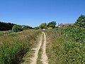
 East Kingston, path - geograph.org.uk - 6084170.jpg 1,024 × 768; 260 KB
-
 East Kingston, path - geograph.org.uk - 6084193.jpg 1,024 × 747; 174 KB
-
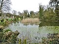 East Kingston, pond - geograph.org.uk - 6084154.jpg 1,024 × 768; 257 KB
-
 End of a groyne - West Kingston - geograph.org.uk - 4063106.jpg 3,264 × 4,912; 4.87 MB
-
 End of Kingston Lane - geograph.org.uk - 4280802.jpg 1,600 × 1,087; 709 KB
-
 Evidence of serious bush clearing - geograph.org.uk - 4261585.jpg 1,600 × 1,063; 546 KB
-
 Farm track - East Kingston - geograph.org.uk - 4280782.jpg 1,600 × 1,097; 726 KB
-
 Farmland by Ferring Rife - geograph.org.uk - 4277814.jpg 1,600 × 1,001; 592 KB
-
 Farmland by Ferring Rife - geograph.org.uk - 4277819.jpg 1,600 × 1,031; 716 KB
-
 Farmland by Kingston Lane - geograph.org.uk - 4284172.jpg 1,600 × 1,045; 425 KB
-
 Farmland near Kingston Manor - geograph.org.uk - 4930269.jpg 640 × 455; 87 KB
-
 Farmland ^ houses in Somerset Road - geograph.org.uk - 4693523.jpg 1,600 × 1,008; 341 KB
-
 Farmland ^ houses in Somerset Road - geograph.org.uk - 4693524.jpg 1,600 × 1,062; 322 KB
-
 Farmland ^ Kingston Lane - geograph.org.uk - 4284211.jpg 1,600 × 1,063; 622 KB
-
 Fatting Five Acres - geograph.org.uk - 5501237.jpg 640 × 480; 76 KB
-
 Ferring Beach - geograph.org.uk - 5547002.jpg 640 × 480; 56 KB
-
 Ferring Rife - down stream view - geograph.org.uk - 4277802.jpg 1,600 × 990; 595 KB
-
 Ferring Rife - geograph.org.uk - 2523230.jpg 1,600 × 1,200; 630 KB
-
 Ferring Rife - geograph.org.uk - 5488403.jpg 480 × 640; 62 KB
-
 Ferring Rife - geograph.org.uk - 6084210.jpg 1,024 × 768; 211 KB
-
 Ferring Rife - upstream view - geograph.org.uk - 4277784.jpg 1,600 × 1,034; 584 KB
-
 Field beside Kingston Lane - geograph.org.uk - 4284195.jpg 1,600 × 991; 662 KB
-
 Field beside Kingston Lane - geograph.org.uk - 4284203.jpg 1,600 × 1,023; 601 KB
-
 Field boundary off Kingston Lane - geograph.org.uk - 4201627.jpg 1,600 × 1,063; 557 KB
-
 Field west of Kingston Lane - geograph.org.uk - 4284184.jpg 1,600 × 1,024; 673 KB
-
 Field west of Kingston Lane - geograph.org.uk - 4284190.jpg 1,600 × 1,035; 646 KB
-
 Field west of Kingston Lane - geograph.org.uk - 4284191.jpg 1,600 × 992; 643 KB
-
 Field west of Kingston Lane - geograph.org.uk - 4284201.jpg 1,600 × 1,063; 605 KB
-
 Fields access east of Kingston Lane - geograph.org.uk - 4218685.jpg 1,600 × 1,103; 623 KB
-
 Fields behind Golden Avenue - geograph.org.uk - 4218651.jpg 1,600 × 1,063; 455 KB
-
 Fields behind Golden Avenue - geograph.org.uk - 4218654.jpg 1,600 × 1,063; 596 KB
-
 Fields behind Kingston Gorse - geograph.org.uk - 4283652.jpg 1,600 × 1,063; 537 KB
-
 Fields behind Russell's Close - geograph.org.uk - 4234418.jpg 1,600 × 1,026; 476 KB
-
 Fields behind Somerset Road - geograph.org.uk - 4061011.jpg 4,912 × 3,264; 6.28 MB
-
 Fields east of Kingston Lane - geograph.org.uk - 4218665.jpg 1,600 × 1,063; 583 KB
-
 Fields east of Kingston Lane - geograph.org.uk - 4218674.jpg 1,600 × 1,007; 642 KB
-
 Fields surrounding East Kingston Farm - geograph.org.uk - 4283651.jpg 1,600 × 1,063; 543 KB
-
 Fine restoration - geograph.org.uk - 4280791.jpg 1,600 × 1,063; 416 KB
-
 Fine rural home - geograph.org.uk - 4277824.jpg 1,600 × 1,046; 673 KB
-

-
 Following the ditch - geograph.org.uk - 4261581.jpg 1,600 × 1,063; 489 KB
-
 Following the drainage ditch - geograph.org.uk - 4284703.jpg 1,600 × 1,063; 621 KB
-
 Footbridge over Ferring Rife - geograph.org.uk - 4277800.jpg 1,600 × 1,015; 658 KB
-
 Footpath 2114-1 - direction Ferring Rife - geograph.org.uk - 4277700.jpg 1,217 × 1,600; 938 KB
-
 Footpath 2114-1 by Ferring Country Centre - geograph.org.uk - 4277696.jpg 1,600 × 1,020; 840 KB
-
 Footpath 2114-1, Ferring - geograph.org.uk - 4209781.jpg 640 × 428; 325 KB
-
 Footpath at Ferring - geograph.org.uk - 5824154.jpg 1,600 × 1,200; 588 KB
-
 Footpath at Ferring - geograph.org.uk - 5824158.jpg 1,600 × 1,200; 646 KB
-
 Footpath to East Kingston - geograph.org.uk - 892756.jpg 640 × 479; 87 KB
-
 Footpath towards East Preston - geograph.org.uk - 4280930.jpg 1,600 × 1,041; 659 KB
-
 Footpath towards East Preston - geograph.org.uk - 4280934.jpg 1,600 × 1,019; 570 KB
-
 Footpath towards Ferring - geograph.org.uk - 4280929.jpg 1,600 × 1,054; 839 KB
-
 Footpath ^ private access - geograph.org.uk - 4280927.jpg 1,600 × 1,045; 692 KB
-

-
 Gentle slope - shingle beach - geograph.org.uk - 4062140.jpg 4,836 × 3,016; 5.42 MB
-
 Gnarled groynes - Kingston Gorse - geograph.org.uk - 4283681.jpg 1,600 × 1,063; 397 KB
-
 Grazing paddocks - Ferring - geograph.org.uk - 4277505.jpg 1,600 × 966; 415 KB
-
 Green at West Kingston - geograph.org.uk - 3686878.jpg 1,600 × 1,200; 330 KB
-
 Green by Gorse Avenue - geograph.org.uk - 3686932.jpg 1,600 × 1,200; 367 KB
-
 Greensward, West Kingston Estate - geograph.org.uk - 605836.jpg 640 × 480; 90 KB
-
 Grey day at West Kingston - geograph.org.uk - 4217215.jpg 1,600 × 1,063; 290 KB
-
 Half buried groyne - Kingston Gorse - geograph.org.uk - 4283682.jpg 1,600 × 1,063; 398 KB
-
 Half buried groyne - Kingston Gorse - geograph.org.uk - 4283693.jpg 1,600 × 1,063; 554 KB
-
 Hinterland margins of Kingston Gorse - geograph.org.uk - 4283656.jpg 1,600 × 1,063; 543 KB
-
 Horse Brook - geograph.org.uk - 5501233.jpg 640 × 480; 79 KB
-
 Houses at West Kingston - geograph.org.uk - 5292259.jpg 640 × 480; 81 KB
-
 Houses at West Kingston - geograph.org.uk - 5292260.jpg 640 × 480; 85 KB
-
 Houses in Golden Avenue - geograph.org.uk - 4218658.jpg 1,600 × 1,063; 478 KB
-
 Houses in Somerset Road - geograph.org.uk - 4061008.jpg 1,600 × 1,063; 391 KB
-
 Houses in West Kingston - geograph.org.uk - 4932694.jpg 640 × 478; 84 KB
-
 Houses on Coastal Road, West Kingston - geograph.org.uk - 3358272.jpg 3,264 × 2,448; 3.75 MB
-
 Hurst - geograph.org.uk - 5502597.jpg 640 × 480; 63 KB
-
 I will survive - geograph.org.uk - 4217220.jpg 1,244 × 1,600; 475 KB
-
 It must get busy here - geograph.org.uk - 4930275.jpg 640 × 452; 65 KB
-
 Italian Restaurant on the beach - geograph.org.uk - 3686854.jpg 1,600 × 1,200; 514 KB
-
 Keep of the grass - geograph.org.uk - 4215150.jpg 1,024 × 639; 237 KB
-
 Kingston Beach - geograph.org.uk - 5502525.jpg 640 × 480; 85 KB
-
 Kingston Beach - geograph.org.uk - 5502545.jpg 640 × 553; 93 KB
-
 Kingston by Ferring 01.jpg 640 × 480; 87 KB
-
 Kingston by Ferring 02.jpg 2,592 × 1,944; 1.44 MB
-
 Kingston by Ferring 03.jpg 640 × 480; 84 KB
-
 Kingston by Ferring 04.jpg 640 × 480; 76 KB
-
 Kingston Gorse Private Estate notice - geograph.org.uk - 2523209.jpg 1,600 × 1,200; 865 KB
-
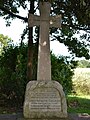 Kingston Gorse War Memorial, West Sussex - geograph.org.uk - 6218928.jpg 768 × 1,024; 229 KB
-
 Kingston Gorse, beach - geograph.org.uk - 6084100.jpg 1,024 × 737; 200 KB
-
 Kingston Gorse, coastal path - geograph.org.uk - 6084105.jpg 1,024 × 750; 138 KB
-
 Kingston Greensward - geograph.org.uk - 5502535.jpg 640 × 480; 55 KB
-
 Kingston Lane - direction coast - geograph.org.uk - 4218660.jpg 1,600 × 1,063; 522 KB
-
 Kingston Lane - direction coast - geograph.org.uk - 4218671.jpg 1,600 × 1,063; 475 KB
-
 Kingston Lane - direction hinterland - geograph.org.uk - 4218668.jpg 1,600 × 1,063; 470 KB
-
 Kingston Lane - direction hinterland - geograph.org.uk - 4218673.jpg 1,600 × 1,011; 715 KB
-
 Kingston Lane - direction inland - geograph.org.uk - 4061020.jpg 1,600 × 1,063; 446 KB
-
 Kingston Lane - Elm Avenue - geograph.org.uk - 4218711.jpg 1,600 × 1,063; 589 KB
-
 Kingston Lane - geograph.org.uk - 4061014.jpg 4,652 × 3,204; 5.08 MB
-
 Kingston Lane - geograph.org.uk - 4201624.jpg 1,600 × 1,063; 486 KB
-
 Kingston Lane - geograph.org.uk - 4215152.jpg 1,600 × 1,043; 502 KB
-
 Kingston Lane - geograph.org.uk - 4217236.jpg 1,600 × 1,047; 614 KB
-
 Kingston Lane - geograph.org.uk - 4930262.jpg 640 × 451; 80 KB
-
 Kingston Lane - geograph.org.uk - 5502553.jpg 635 × 640; 58 KB
-
 Kingston Lane - geograph.org.uk - 5502581.jpg 480 × 640; 129 KB
-
 Kingston Lane - geograph.org.uk - 6084140.jpg 1,024 × 768; 173 KB
-
 Kingston Lane approaching Elm Avenue - geograph.org.uk - 4261559.jpg 1,600 × 1,063; 515 KB
-
 Lake's Field - geograph.org.uk - 5502600.jpg 640 × 480; 58 KB
-
 Lane by East Kingston Farm - geograph.org.uk - 4228543.jpg 4,714 × 3,011; 5.51 MB
-
 Lane by East Kingston Farm - geograph.org.uk - 4277825.jpg 1,600 × 1,083; 760 KB
-
 Lane by West Kingston Farm - geograph.org.uk - 5638971.jpg 640 × 480; 101 KB
-
 Lighthouse Cottage - geograph.org.uk - 4283662.jpg 1,600 × 1,061; 527 KB
-
 Long Mead - geograph.org.uk - 5488405.jpg 640 × 480; 71 KB
-
 Looking up the beach - geograph.org.uk - 4283680.jpg 1,600 × 984; 521 KB
-
 Looking up West Kingston beach - geograph.org.uk - 4063091.jpg 4,912 × 3,264; 5.09 MB
-

-
 Low tide - West Kingston - geograph.org.uk - 4063093.jpg 4,912 × 3,264; 4.5 MB
-
 Low tide - West Kingston - geograph.org.uk - 4063107.jpg 4,912 × 3,264; 6.53 MB
-
 Low tide - West Kingston - geograph.org.uk - 4063109.jpg 4,912 × 3,264; 4.56 MB
-
 Low tide - West Kingston - geograph.org.uk - 4217206.jpg 1,600 × 1,008; 543 KB
-
 Low tide - West Kingston - geograph.org.uk - 4217207.jpg 1,600 × 998; 532 KB
-
 Low tide - West Kingston - geograph.org.uk - 4217212.jpg 1,600 × 1,063; 557 KB
-
 Low tide - West Kingston - geograph.org.uk - 4217213.jpg 1,600 × 1,063; 328 KB
-
 Low tide - West Kingston - geograph.org.uk - 4217214.jpg 1,600 × 1,063; 376 KB
-
 Low tide - West Kingston - geograph.org.uk - 4217217.jpg 1,600 × 1,063; 307 KB
-
 Low tide at Kingston Gorse - geograph.org.uk - 4283675.jpg 1,600 × 1,063; 594 KB
-
 Low tide at West Kingston - geograph.org.uk - 4059872.jpg 1,600 × 1,051; 225 KB
-
 Low tide at West Kingston - geograph.org.uk - 5292252.jpg 640 × 480; 97 KB
-
 Low tide at West Kingston - geograph.org.uk - 5292254.jpg 640 × 460; 73 KB
-
 Low tide at West Kingston - geograph.org.uk - 5292256.jpg 640 × 463; 61 KB
-
 Low tide at West Kingston - geograph.org.uk - 5292258.jpg 640 × 480; 69 KB
-
 Margins of East Preston - geograph.org.uk - 4261606.jpg 1,600 × 1,063; 513 KB
-
 Marsh Orchids by Ferring Rife - geograph.org.uk - 313252.jpg 640 × 480; 117 KB
-
 Middle Field-Old House Common-Hooks - geograph.org.uk - 5502604.jpg 640 × 480; 74 KB
-
 Mix of roof tops - geograph.org.uk - 4280793.jpg 1,600 × 1,063; 381 KB
-
 Moat and Cobden Field - geograph.org.uk - 5501259.jpg 640 × 480; 66 KB
-
 New Cote Farm - post harvest scene - geograph.org.uk - 4280937.jpg 1,600 × 1,020; 463 KB
-
 New fencing for paddocks - geograph.org.uk - 4284710.jpg 1,600 × 1,063; 522 KB
-
 New Routed Piece-Little Green Croft - geograph.org.uk - 5502561.jpg 640 × 480; 83 KB
-
 No notices, anymore - geograph.org.uk - 4217232.jpg 1,600 × 1,047; 621 KB
-

-
 Old farm building - geograph.org.uk - 4280786.jpg 1,600 × 1,019; 790 KB
-
 On show at low tide - geograph.org.uk - 4063088.jpg 4,912 × 3,264; 7.25 MB
-


.jpg)


