Category:Kilve
Jump to navigation
Jump to search
village in West Somerset, England | |||||
| Upload media | |||||
| Instance of | |||||
|---|---|---|---|---|---|
| Location | Somerset West and Taunton, Somerset, South West England, England | ||||
 | |||||
Subcategories
This category has the following 2 subcategories, out of 2 total.
C
- Kilve Chantry (6 F)
M
Media in category "Kilve"
The following 177 files are in this category, out of 177 total.
-
 A Boundary Stone - geograph.org.uk - 2661655.jpg 4,320 × 2,432; 3.59 MB
-
 Ammonite fossil (8606998286).jpg 4,000 × 3,000; 2.86 MB
-
 An ammonite - geograph.org.uk - 2541940.jpg 640 × 480; 87 KB
-
 Approaching Kilve - geograph.org.uk - 4182106.jpg 1,920 × 1,230; 744 KB
-
 Bird Watching Enthusiasts - geograph.org.uk - 2455367.jpg 800 × 531; 99 KB
-
 BlueAnchorLilstock2.jpg 5,268 × 2,208; 9.03 MB
-
 Brook flowing on to Beach - geograph.org.uk - 2535255.jpg 640 × 480; 118 KB
-
 Car park near Kilve Pill - geograph.org.uk - 4179236.jpg 1,920 × 2,560; 1.37 MB
-
 Car park near Kilve Pill - geograph.org.uk - 4179245.jpg 1,920 × 2,560; 1.74 MB
-
 Chantry Tea Garden - geograph.org.uk - 5499692.jpg 6,000 × 4,000; 6 MB
-
 Chantry Tea Gardens, Kilve - geograph.org.uk - 4179190.jpg 1,920 × 1,795; 977 KB
-
 Chantry, Kilve - geograph.org.uk - 4179183.jpg 1,920 × 1,322; 684 KB
-
 Church and chantry, Kilve - geograph.org.uk - 4182145.jpg 1,912 × 2,379; 851 KB
-
 Churchyard of St Mary's, Kilve - geograph.org.uk - 5498376.jpg 6,000 × 4,000; 6.64 MB
-
 Churchyard, Kilve - geograph.org.uk - 4179131.jpg 1,882 × 1,352; 834 KB
-
 Cliffs at Kilve - geograph.org.uk - 4179297.jpg 1,920 × 1,307; 742 KB
-
 Coast at Kilve Pill - geograph.org.uk - 4179637.jpg 1,920 × 1,244; 682 KB
-
 Coast at Kilve Pill - geograph.org.uk - 4179704.jpg 1,920 × 1,349; 799 KB
-
 Coastal path, near Kilve - geograph.org.uk - 3499123.jpg 1,024 × 768; 173 KB
-
 Confluence at Kilve - geograph.org.uk - 2541894.jpg 640 × 480; 132 KB
-
 Derelict shale oil still at Kilve Beach - geograph.org.uk - 3856395.jpg 2,346 × 3,128; 1.19 MB
-
 Dowsborough Hill - geograph.org.uk - 3140486.jpg 1,024 × 756; 214 KB
-
 Eroded cliff face, near Lilstock - geograph.org.uk - 3499098.jpg 768 × 1,024; 220 KB
-
 Farm buildings, Alfoxton Park - geograph.org.uk - 2052033.jpg 640 × 480; 329 KB
-
 Farm entrance at Kilve - geograph.org.uk - 5499673.jpg 6,000 × 4,000; 6.8 MB
-
 Farm track by Parkhouse Farm - geograph.org.uk - 5498368.jpg 6,000 × 4,000; 5.79 MB
-

-

-
 Farmyard, Kilve - geograph.org.uk - 3432400.jpg 640 × 394; 77 KB
-
 Field at Kilve - geograph.org.uk - 4179173.jpg 1,920 × 1,440; 696 KB
-
 Field at Kilve - geograph.org.uk - 4182063.jpg 1,920 × 1,070; 459 KB
-
 Field by the churchyard. Kilve - geograph.org.uk - 4182123.jpg 1,920 × 1,440; 941 KB
-
 Fields below Lower Pardlestone Farm - geograph.org.uk - 5498286.jpg 6,000 × 4,000; 5.21 MB
-
 Fire beaters and post below Longstone Hill - geograph.org.uk - 5445957.jpg 6,000 × 4,000; 6.12 MB
-
 Fire beaters at New Ground - geograph.org.uk - 3140507.jpg 1,024 × 768; 262 KB
-
 Flowers at Kilve Tea Gardens (2280827615).jpg 1,536 × 2,048; 905 KB
-
 Footpath to Kilve Beach - geograph.org.uk - 648164.jpg 640 × 427; 77 KB
-
 Footpath to Kilve Church - geograph.org.uk - 648166.jpg 640 × 427; 97 KB
-
 Footpath, Kilve - geograph.org.uk - 4178992.jpg 1,920 × 2,456; 1.26 MB
-
 Footpath, St Mary's Church - geograph.org.uk - 1896770.jpg 640 × 481; 169 KB
-

-
 Ford, Kilve - geograph.org.uk - 4182118.jpg 1,920 × 1,440; 1.06 MB
-
 Former Youth Hostel, Holford - geograph.org.uk - 2507915.jpg 1,230 × 1,024; 261 KB
-
 Guinea fowl, Kilve - geograph.org.uk - 1896739.jpg 640 × 480; 217 KB
-
 Hillside above Kilve - geograph.org.uk - 2030615.jpg 640 × 480; 351 KB
-
 Hilltop Lane - geograph.org.uk - 3498740.jpg 1,024 × 768; 250 KB
-
 Hilltop Lane, Kilve - geograph.org.uk - 3501008.jpg 1,024 × 768; 235 KB
-
 Holford Telephone Exchange (1) - geograph.org.uk - 3788381.jpg 3,072 × 2,304; 1.78 MB
-
 Holford Telephone Exchange (2) - geograph.org.uk - 3788390.jpg 3,072 × 2,304; 1.8 MB
-
 Inland from the coast path at Kilve - geograph.org.uk - 4179598.jpg 1,918 × 1,094; 583 KB
-
 Kilve - Church of The Blessed Virgin Mary - geograph.org.uk - 6015712.jpg 5,184 × 2,920; 5.41 MB
-
 Kilve Beach - geograph.org.uk - 1764516.jpg 1,024 × 681; 170 KB
-
 Kilve Beach - geograph.org.uk - 1998654.jpg 640 × 425; 94 KB
-
 Kilve beach - geograph.org.uk - 2624814.jpg 1,024 × 768; 284 KB
-
 Kilve beach - geograph.org.uk - 5378302.jpg 4,000 × 3,000; 4.72 MB
-
 Kilve beach - geograph.org.uk - 5378308.jpg 4,000 × 3,000; 6.79 MB
-
 Kilve beach - geograph.org.uk - 5378311.jpg 4,000 × 3,000; 5.53 MB
-
 Kilve beach - geograph.org.uk - 5378315.jpg 4,000 × 3,000; 3.9 MB
-
 Kilve Beach.JPG 3,264 × 2,448; 1.38 MB
-
 Kilve coastline B&W HDR (2358802484).jpg 3,888 × 1,892; 1.03 MB
-
 Kilve coastline HDR (2357972505).jpg 3,888 × 2,005; 1.37 MB
-
 Kilve coastline HDR (2358804096).jpg 3,869 × 1,608; 1.26 MB
-
 Kilve Court - geograph.org.uk - 2030601.jpg 640 × 480; 313 KB
-
 Kilve Court - geograph.org.uk - 2902514.jpg 1,024 × 768; 186 KB
-
 Kilve Cricket Club - geograph.org.uk - 2879302.jpg 1,280 × 856; 176 KB
-
 Kilve Cricket Club - geograph.org.uk - 5499733.jpg 6,000 × 4,000; 5.6 MB
-
 Kilve Ford - geograph.org.uk - 5135052.jpg 1,440 × 960; 2.32 MB
-
 Kilve Parish Church - Lych Gate - geograph.org.uk - 4790601.jpg 640 × 480; 144 KB
-
 Kilve Pill - geograph.org.uk - 2609373.jpg 640 × 480; 95 KB
-
 Kilve Pill - geograph.org.uk - 4179572.jpg 1,920 × 1,302; 658 KB
-
 Kilve sunset (2175194912).jpg 3,888 × 2,525; 1.72 MB
-
 Kilve Village Hall - geograph.org.uk - 2030606.jpg 640 × 480; 316 KB
-
 Kilve Village Hall - geograph.org.uk - 4178977.jpg 1,920 × 1,207; 390 KB
-
 Kilve village, on the A39 - geograph.org.uk - 2030589.jpg 640 × 480; 260 KB
-
 Kilve village, on the A39 - geograph.org.uk - 2030593.jpg 640 × 480; 247 KB
-
 Kilve, St Mary's Church - geograph.org.uk - 6084111.jpg 5,184 × 2,920; 6.89 MB
-
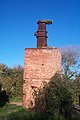 Kilvebrickretort.jpg 425 × 640; 86 KB
-
 Lagger Hill, Kilve - geograph.org.uk - 2884912.jpg 1,280 × 856; 273 KB
-
 Lane at Kilve Chantry - geograph.org.uk - 4179222.jpg 1,920 × 1,367; 602 KB
-
 Lane passing Lower Pardlestone Farm - geograph.org.uk - 5498250.jpg 6,000 × 4,000; 7.63 MB
-
 Longstone Hill - geograph.org.uk - 3166839.jpg 1,600 × 1,200; 776 KB
-
 Looking east-northeast from Hilltop Lane - geograph.org.uk - 4941650.jpg 3,264 × 2,448; 2.34 MB
-
 Looking inland, towards the Quantocks - geograph.org.uk - 3499117.jpg 1,024 × 768; 238 KB
-
 Looking north-northwest down Hilltop Lane - geograph.org.uk - 4941669.jpg 3,264 × 2,448; 2.15 MB
-

-
 Looking west from Hilltop Lane - geograph.org.uk - 4941676.jpg 3,264 × 2,448; 2.85 MB
-
 Maze at Kilve Court - geograph.org.uk - 5639916.jpg 1,024 × 776; 154 KB
-

-
 Minor road, to Kilton - geograph.org.uk - 2304733.jpg 1,024 × 768; 244 KB
-
 Oil retort house, Kilve Pill - geograph.org.uk - 4179263.jpg 1,913 × 1,375; 605 KB
-
 Oil Retort Kilve - geograph.org.uk - 1764531.jpg 681 × 1,024; 196 KB
-
 Oil Retort, Kilve - geograph.org.uk - 1896805.jpg 480 × 640; 114 KB
-
 Oil Retort, Kilve - geograph.org.uk - 2379213.jpg 1,944 × 2,592; 1.81 MB
-

-

-
 Old structure for extracting oil from shale at Kilve Pill - geograph.org.uk - 6015708.jpg 5,184 × 2,920; 5.18 MB
-
 Ordnance Survey Cut Mark - geograph.org.uk - 4485624.jpg 480 × 640; 130 KB
-
 Pardlestone Lane - geograph.org.uk - 5498315.jpg 6,000 × 4,000; 6.48 MB
-
 Pasture, above Sea Lane, Kilve - geograph.org.uk - 3501024.jpg 1,024 × 768; 184 KB
-
 Path below Longstone Hill - geograph.org.uk - 5445944.jpg 6,000 × 4,000; 5.75 MB
-
 Picnic table above Kilve Beach - geograph.org.uk - 2609362.jpg 640 × 480; 78 KB
-
 Plaque, Kilve church - geograph.org.uk - 4182156.jpg 1,721 × 1,157; 638 KB
-
 Ploughed field near East Wood - geograph.org.uk - 4182086.jpg 3,989 × 2,856; 1.61 MB
-
 Quantocks and coast.jpg 4,000 × 3,000; 8.15 MB
-
 Remains of a chantry, Sea Lane - geograph.org.uk - 4941630.jpg 3,264 × 2,448; 1.82 MB
-
 Remains of a oil mine near Kilve beach - geograph.org.uk - 2541933.jpg 480 × 640; 105 KB
-
 Remains of Chantry at Kilve - geograph.org.uk - 6015709.jpg 5,184 × 2,920; 5.14 MB
-
 Retort house at Kilve - geograph.org.uk - 5499746.jpg 5,761 × 3,841; 4.64 MB
-
 River flowing downstream to Kilve Beach - geograph.org.uk - 3856397.jpg 2,346 × 3,128; 2.66 MB
-
 River Holford 2.jpg 5,076 × 3,432; 12.21 MB
-
 River Holford 3.jpg 5,076 × 3,648; 12.81 MB
-
 Rowditch Lane, Kilve, Somerset - geograph.org.uk - 3432403.jpg 1,600 × 1,206; 582 KB
-
 Sea Lane, Kilve - geograph.org.uk - 3498707.jpg 1,024 × 768; 147 KB
-
 Sea Lane, Kilve - geograph.org.uk - 5498342.jpg 6,000 × 4,000; 4.5 MB
-
 Shaline Oil Retort - geograph.org.uk - 2455375.jpg 800 × 531; 112 KB
-
 Sheep pasture, near Kilve - geograph.org.uk - 2304773.jpg 1,024 × 768; 169 KB
-
 Spring at Kilve pill - geograph.org.uk - 2535280.jpg 640 × 480; 107 KB
-
 St Mary's church, Kilve - geograph.org.uk - 4182134.jpg 1,920 × 2,473; 1.32 MB
-
 Stream at Kilve - geograph.org.uk - 2541879.jpg 480 × 640; 130 KB
-
 Stream heading towards beach - geograph.org.uk - 2541925.jpg 640 × 480; 117 KB
-
 The A39 leaving Kilve - geograph.org.uk - 2030611.jpg 640 × 480; 352 KB
-
 The beach at Kilve - geograph.org.uk - 5499751.jpg 6,000 × 4,000; 5.67 MB
-
 The beach at Kilve, looking west - geograph.org.uk - 2029662.jpg 640 × 480; 310 KB
-
 The Gig House, Sea Lane - geograph.org.uk - 3498724.jpg 1,024 × 768; 195 KB
-
 The Hood Arms, Kilve - geograph.org.uk - 2188114.jpg 1,024 × 768; 140 KB
-
 The Hood Arms, Kilve - geograph.org.uk - 5273919.jpg 1,024 × 804; 149 KB
-
 The Oil Retort, Kilve - geograph.org.uk - 2029658.jpg 640 × 480; 299 KB
-
 The Old Post Office, Kilve - geograph.org.uk - 5639921.jpg 1,024 × 768; 132 KB
-
 The rocks of Kilve Beach, Somerset (4917206941).jpg 2,308 × 3,490; 5.56 MB
-
 The rocks of Kilve Beach, Somerset (4917226977).jpg 3,320 × 2,547; 8.9 MB
-
 The rocks of Kilve Beach, Somerset (4917799476).jpg 3,888 × 2,592; 6.36 MB
-
 The rocks of Kilve Beach, Somerset (4917814096).jpg 3,616 × 1,820; 5.73 MB
-
 Toilets and Facilities - geograph.org.uk - 2504957.jpg 800 × 531; 145 KB
-
 Track and lane, Kilve - geograph.org.uk - 4179143.jpg 1,920 × 1,399; 797 KB
-
 Track on Longstone Hill - geograph.org.uk - 3140499.jpg 1,024 × 768; 282 KB
-
 View from Pardlestone Hill - geograph.org.uk - 3141513.jpg 1,024 × 759; 282 KB
-
 View W along coast at Kilve Pill - geograph.org.uk - 6084116.jpg 5,184 × 2,920; 6.11 MB
-
 View W along coastal path approaching Kilve Pill - geograph.org.uk - 6015706.jpg 5,184 × 2,920; 5.92 MB
-
 Village shop and Post Office, Kilve - geograph.org.uk - 5273925.jpg 1,024 × 871; 156 KB
-
 Wave cut beach, near Kilve - geograph.org.uk - 3499042.jpg 1,024 × 768; 231 KB
-
 Wave cut platform at Kilve Beach - geograph.org.uk - 2688326.jpg 1,798 × 1,157; 371 KB
-
 Wave-cut platform at Kilve Beach - geograph.org.uk - 2609364.jpg 640 × 480; 93 KB
-
 Wave-cut platform, Kilve - geograph.org.uk - 4179625.jpg 1,920 × 1,440; 1,006 KB
-
 Wave-cut rock platform, near Kilve - geograph.org.uk - 6096779.jpg 1,024 × 768; 250 KB
-
 West Somerset , Quantock Hills - geograph.org.uk - 6014760.jpg 6,000 × 4,000; 5.75 MB
-
 West Somerset , Quantock Hills - Longstone Hill - geograph.org.uk - 6014763.jpg 6,000 × 4,000; 7.13 MB
-
 West Somerset , Quantock Hills - New Ground - geograph.org.uk - 6014765.jpg 4,000 × 6,000; 7.35 MB
-
 West Somerset , Quantock Hills - Short Combe - geograph.org.uk - 6014748.jpg 6,000 × 4,000; 7.63 MB
-
 West Somerset , Quantock Hills Footpath - geograph.org.uk - 6014766.jpg 6,000 × 4,000; 7.36 MB
-
 West Somerset , Quantock Hills Footpath - geograph.org.uk - 6014768.jpg 6,000 × 4,000; 7.84 MB
-
 West Somerset , Quantock Hills Footpath - geograph.org.uk - 6014770.jpg 6,000 × 4,000; 7.83 MB
-
 West Somerset , Quantock Hills Woodland - geograph.org.uk - 6014750.jpg 6,000 × 4,000; 7.77 MB
-
 West Somerset , Quantock Hills Woodland - geograph.org.uk - 6014753.jpg 4,000 × 6,000; 6.64 MB
-
 West Somerset , Quantock Hills Woodland - geograph.org.uk - 6014756.jpg 4,000 × 6,000; 7.38 MB
-
 West Somerset , Quantock Hills Woodland - geograph.org.uk - 6014758.jpg 6,000 × 4,000; 7.53 MB
-
 Wood near Kilve - geograph.org.uk - 4182078.jpg 1,920 × 1,177; 504 KB
-
 Woodland near Pardlestone - geograph.org.uk - 2052028.jpg 640 × 480; 402 KB
-
 Ammonite on Kilve Beach I - geograph.org.uk - 342219.jpg 640 × 480; 180 KB
-
 Ammonite on Kilve Beach II - geograph.org.uk - 342221.jpg 640 × 480; 180 KB
-
 Ammonites on Kilve Beach - geograph.org.uk - 342224.jpg 640 × 304; 196 KB
-
 Beach at Kilve - geograph.org.uk - 581845.jpg 640 × 446; 153 KB
-
 Cliff face at Quantock's Head - geograph.org.uk - 648163.jpg 640 × 427; 105 KB
-
 Cliff top track and gallop - geograph.org.uk - 698885.jpg 640 × 480; 64 KB
-
 Crooked Copse - geograph.org.uk - 7209.jpg 634 × 474; 435 KB
-
 Entrance to Combe House Hotel - geograph.org.uk - 648337.jpg 427 × 640; 98 KB
-
 Footpath to East Quantoxhead - geograph.org.uk - 648152.jpg 640 × 427; 102 KB
-
 Footpath to Lower Hill Farm. - geograph.org.uk - 80482.jpg 640 × 425; 170 KB
-
 Hawthorn tree above Lady's Edge - geograph.org.uk - 462158.jpg 640 × 427; 93 KB
-
 Holford Bowling Green - geograph.org.uk - 337602.jpg 640 × 480; 121 KB
-
 Kilve - geograph.org.uk - 7211.jpg 640 × 246; 104 KB
-
 Kilve Beach - geograph.org.uk - 299717.jpg 640 × 480; 106 KB
-
 Kilve Beach - geograph.org.uk - 349263.jpg 640 × 512; 92 KB
-
 Kilve Beach at high tide - geograph.org.uk - 648165.jpg 640 × 427; 61 KB
-
 Kilve Beach Rocks - geograph.org.uk - 581843.jpg 640 × 422; 112 KB
-
 Kilve Court - geograph.org.uk - 71391.jpg 640 × 425; 79 KB
-
 Kilve Pill - geograph.org.uk - 648280.jpg 427 × 640; 123 KB
-
 Permissive path from Quantock's Head - geograph.org.uk - 701580.jpg 640 × 480; 97 KB

.jpg)


.jpg)


_-_geograph.org.uk_-_3788381.jpg)
_-_geograph.org.uk_-_3788390.jpg)


.jpg)
.jpg)
.jpg)


.jpg)


.jpg)
.jpg)
.jpg)
.jpg)


