Category:Kilbucho
Jump to navigation
Jump to search
village in Scottish Borders, Scotland, UK   | |||||
| Upload media | |||||
| Instance of | |||||
|---|---|---|---|---|---|
| Location |
| ||||
 | |||||
English: Kilbucho ( Gaelic: Cille Bheagha) is a small settlement in the Local Government area of Scottish Borders, near Biggar and Broughton near the Lanarkshire border.
Media in category "Kilbucho"
The following 13 files are in this category, out of 13 total.
-
 Kilbucho Church.jpg 640 × 480; 109 KB
-

-
 Ruined church, Kilbucho - geograph.org.uk - 1395236.jpg 640 × 480; 129 KB
-
 Bend in the road to Broughton - geograph.org.uk - 101774.jpg 640 × 480; 64 KB
-
 Chert mine - geograph.org.uk - 364670.jpg 640 × 480; 71 KB
-
 Common Law Fence Junction - geograph.org.uk - 278435.jpg 640 × 480; 108 KB
-
 Farmland near Broughton - geograph.org.uk - 170503.jpg 640 × 413; 38 KB
-
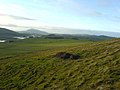
 Fort Remains - geograph.org.uk - 278432.jpg 640 × 480; 97 KB
-
 No Danger of Fire - geograph.org.uk - 278428.jpg 640 × 480; 102 KB
-
 Old shed, Cardon. - geograph.org.uk - 16651.jpg 640 × 480; 111 KB
-

-
 Peeblesshire farmland - geograph.org.uk - 170511.jpg 640 × 480; 67 KB
-
 Road to Broughton, and Spittal Burn - geograph.org.uk - 101561.jpg 640 × 480; 149 KB


