Category:Kettelersiedlung (Nürnberg)
Jump to navigation
Jump to search
  | |||||
| Upload media | |||||
| Instance of | |||||
|---|---|---|---|---|---|
| Location | Nuremberg, Middle Franconia, Bavaria, Germany | ||||
| Area |
| ||||
 | |||||
Subcategories
This category has the following 2 subcategories, out of 2 total.
Media in category "Kettelersiedlung (Nürnberg)"
The following 5 files are in this category, out of 5 total.
-
 Grundschule Ketteler-Schule 01.JPG 4,000 × 3,000; 4.33 MB
-
 Grundschule Ketteler-Schule 02.JPG 4,000 × 3,000; 3.74 MB
-
 Grundschule Ketteler-Schule 03.JPG 4,000 × 3,000; 4 MB
-
 Grundschule Ketteler-Schule 04.JPG 4,000 × 3,000; 3.75 MB
-
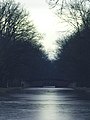 Winterstimmung am Alten Kanal.jpg 3,000 × 4,000; 2.72 MB


