Category:Kelvinhaugh
Jump to navigation
Jump to search
district of Glasgow, Scotland, UK  Kelvinhaugh | |||||
| Upload media | |||||
| Instance of | |||||
|---|---|---|---|---|---|
| Location |
| ||||
 | |||||
Kelvinhaugh is a neighbourhood in Glasgow, roughly bordered by Finnieston, Yorkhill, Kelvingrove Park and the River Clyde.
Subcategories
This category has the following 9 subcategories, out of 9 total.
Media in category "Kelvinhaugh"
The following 63 files are in this category, out of 63 total.
-
 1284 Argyle Street (geograph 6151477).jpg 1,024 × 763; 257 KB
-

-
 A814 Pointhouse Road (geograph 6195906).jpg 1,024 × 683; 142 KB
-
 Air ambulance G-SASB - geograph.org.uk - 2085997.jpg 616 × 640; 250 KB
-
 Argyle Street - geograph.org.uk - 890055.jpg 640 × 495; 105 KB
-
 Argyle Street - geograph.org.uk - 890071.jpg 530 × 640; 112 KB
-
 Argyle Street, Finneston - geograph.org.uk - 666291.jpg 640 × 480; 78 KB
-
 Blackie Street (geograph 5857982).jpg 1,024 × 521; 170 KB
-
 Boxing Statue on Kelvinhaugh Street (36511609584).jpg 2,448 × 3,264; 2.08 MB
-
 Brechin Street - geograph.org.uk - 2830591.jpg 640 × 430; 121 KB
-
 Bridge over Pointhouse Road - geograph.org.uk - 4391014.jpg 800 × 533; 241 KB
-
 Clydeside Expressway near Finnieston (geograph 4795531).jpg 1,024 × 682; 144 KB
-
 Crosstown traffic - geograph.org.uk - 631233.jpg 640 × 480; 86 KB
-
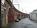
 Eastvale Place railway arches - geograph.org.uk - 5858054.jpg 1,024 × 557; 183 KB
-
 Footbridge over A814 (geograph 5485087).jpg 1,600 × 1,200; 778 KB
-
 Footbridge over Pointhouse Road - geograph.org.uk - 1472250.jpg 640 × 480; 135 KB
-
 Footbridge over the Clydeside Expressway (geograph 4145569).jpg 1,600 × 1,200; 398 KB
-
 Footbridge over the Clydeside Expressway (geograph 4795526).jpg 1,024 × 682; 209 KB
-
 Former Ronald McDonald House, Yorkhill (geograph 5875356).jpg 1,600 × 1,061; 295 KB
-
 Franklin Point and Sainsburys Local (geograph 6000562).jpg 1,320 × 1,600; 322 KB
-
 Glasgow Harbour - geograph.org.uk - 2366250.jpg 3,648 × 2,388; 2.79 MB
-
 Glasgow river scene - geograph.org.uk - 2085975.jpg 640 × 350; 92 KB
-
 Glasgow University and Art Gallery - geograph.org.uk - 882551.jpg 640 × 480; 88 KB
-
 Glasgow's Armadillo ^Exhibition Centre - panoramio.jpg 3,072 × 2,304; 2.49 MB
-
 Glasgow, helicopter above the Clyde - geograph.org.uk - 2089067.jpg 640 × 480; 41 KB
-
 Kelvingrove Cafe - geograph.org.uk - 367446.jpg 427 × 640; 124 KB
-
 Kelvinhaugh Ferry 19.jpg 1,815 × 1,210; 1.04 MB
-
 Kelvinhaugh ferry 20.jpg 1,210 × 1,815; 1.05 MB
-
 Kelvinhaugh footbridge (geograph 5858420).jpg 1,024 × 552; 223 KB
-
 Kelvinhaugh Street - geograph.org.uk - 1778681.jpg 800 × 531; 156 KB
-
 Kelvinhaugh Street - geograph.org.uk - 1778692.jpg 640 × 425; 73 KB
-
 Kelvinhaugh Street, Glasgow (geograph 6199646).jpg 1,280 × 851; 437 KB
-
 Kelvinhaugh Tunnel (geograph 6200150).jpg 1,280 × 851; 494 KB
-
 Kelvinhaugh.jpg 4,032 × 1,816; 2.05 MB
-
 Overnewton Recreation Centre (geograph 5876082).jpg 1,600 × 1,039; 342 KB
-
 Path by Pointhouse Road (geograph 6195917).jpg 1,024 × 683; 189 KB
-
 Queens Dock Tower 4.jpg 1,774 × 1,198; 2.2 MB
-
 River Clyde at Glasgow - geograph.org.uk - 3012611.jpg 640 × 323; 84 KB
-
 Sandyford Post Office (geograph 6000579).jpg 1,600 × 1,175; 378 KB
-
 Sandyford Street (geograph 4145545).jpg 1,600 × 1,200; 399 KB
-
 Sandyford-henderson Memorial Church (geograph 6140190).jpg 1,600 × 1,058; 412 KB
-

-
 St Mungo on the Clyde - geograph.org.uk - 2515776.jpg 640 × 454; 115 KB
-
 Stobcross Control Tower 219.jpg 2,274 × 1,500; 2.95 MB
-
 Tall Ship Glasgow - panoramio.jpg 3,072 × 2,304; 2.81 MB
-

-
 Tenement, Gray Street (geograph 6000593).jpg 1,289 × 1,600; 310 KB
-
 Tenements on Blackie Street (geograph 5876102).jpg 1,600 × 1,086; 281 KB
-
 The 78 (geograph 6000567).jpg 1,600 × 1,142; 295 KB
-
 The Ben Nevis bar (geograph 6000023).jpg 1,600 × 1,046; 287 KB
-
 The Clydeside Expressway (geograph 5858396).jpg 1,024 × 768; 304 KB
-

-
 The Islay Inn (geograph 5876137).jpg 1,600 × 1,100; 296 KB
-
 The Kelvingrove Cafe (geograph 5999978).jpg 1,600 × 1,232; 389 KB
-
 The oldest tree on Argyle Street (geograph 6000586).jpg 1,248 × 1,600; 389 KB
-
 The Park Bar (geograph 5999836).jpg 1,223 × 1,600; 333 KB
-
 The River Clyde at Partick (25643892474).jpg 1,600 × 1,521; 1.47 MB
-
 The Tall Ship - geograph.org.uk - 455660.jpg 640 × 427; 100 KB
-
 Underneath the arches - geograph.org.uk - 632029.jpg 640 × 480; 78 KB
-
 Walkway over the Clyde Expressway - geograph.org.uk - 2367283.jpg 3,370 × 2,591; 7.4 MB
-
 Yorkhill fire station (geograph 5858047).jpg 1,024 × 626; 208 KB
-
 Yorkhill fire station - geograph.org.uk - 5858045.jpg 1,024 × 531; 213 KB
-
 Yorkhill Quay, Glasgow - geograph.org.uk - 3463294.jpg 480 × 640; 137 KB
.jpg)

.jpg)


.jpg)
.jpg)


.jpg)


.jpg)

.jpg)
.jpg)
.jpg)
.jpg)


.jpg)


.jpg)
.jpg)
.jpg)
.jpg)


.jpg)
.jpg)
.jpg)


.jpg)
.jpg)
.jpg)
.jpg)
.jpg)

.jpg)
.jpg)
.jpg)
.jpg)
.jpg)


.jpg)

