Category:Kath. Kirche Rebstein
Jump to navigation
Jump to search
| Object location | | View all coordinates using: OpenStreetMap |
|---|
 | |||||
| Upload media | |||||
| Instance of | |||||
|---|---|---|---|---|---|
| Part of | |||||
| Named after | |||||
| Location | Rebstein, Rheintal Constituency, canton St. Gallen, Switzerland | ||||
| Street address |
| ||||
| Architect | |||||
| Heritage designation | |||||
 | |||||
Media in category "Kath. Kirche Rebstein"
The following 20 files are in this category, out of 20 total.
-
 ETH-BIB-Rebstein-LBS H1-023276.tif 6,179 × 4,893; 86.54 MB
-
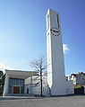
 Kirche St. Sebastian Rebstein aussen.jpg 2,304 × 3,456; 3.61 MB
-
 Kirche St. Sebastian Rebstein südost.jpg 3,456 × 2,304; 3.83 MB
-
 Kirche St. Sebastian Rebstein turm.jpg 2,304 × 3,456; 3.97 MB
-
 Rebstein - ortsmuseum - panoramio.jpg 2,592 × 1,944; 1.33 MB
-
 Rebstein Dorf kath. Kirche.jpg 2,377 × 3,431; 3.6 MB
-
 Rebstein Dorf Kirchen.jpg 4,413 × 2,914; 6.11 MB
-
 Rebstein kath. Kirche Beichtstuhl-Zi.JPG 4,523 × 2,926; 4.41 MB
-
 Rebstein kath. Kirche Grundstein.JPG 4,308 × 2,929; 4.91 MB
-
 Rebstein kath. Kirche Klapper s.JPG 2,991 × 2,404; 3.13 MB
-
 Rebstein kath. Kirche Klapper v.JPG 3,156 × 2,267; 2.94 MB
-
 Rebstein kath. Kirche n.JPG 2,952 × 4,363; 3.4 MB
-
 Rebstein kath. Kirche nw.JPG 4,337 × 3,056; 3.41 MB
-
 Rebstein kath. Kirche Sebastian s vw.jpg 2,105 × 4,111; 3.08 MB
-
 Rebstein kath. Kirche Sebastian.JPG 2,971 × 4,592; 4.96 MB
-
 Rebstein kath. Kirche Weihwasser L.JPG 2,933 × 3,952; 4.15 MB
-
 Rebstein kath. Kirche.JPG 3,056 × 3,842; 3.27 MB
-
 Rebstein Rätsche L.JPG 2,976 × 3,415; 3.54 MB
-
 Rebstein Rätsche s.JPG 2,779 × 3,698; 3.06 MB
-
 Rebstein Rätsche vw.jpg 2,892 × 2,949; 2.54 MB


