Category:Kalmthoutse Heide
Jump to navigation
Jump to search
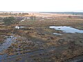
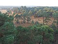
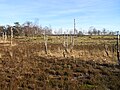
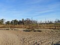
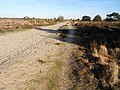
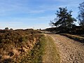
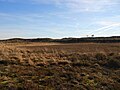
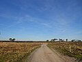
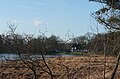
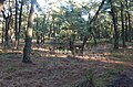
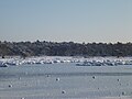
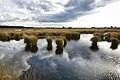
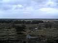
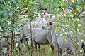
Nederlands: Afbeeldingen van het Grenspark De Zoom-Kalmthoutse Heide, een nationaal park en een grensoverschrijdend natuurgebied in het zuiden van de provincie Noord-Brabant in het zuiden van Nederland en het noorden van de provincie Antwerpen in het noorden van België. Het Grenspark De Zoom-Kalmthoutse Heide is nabij de gemeenten Woensdrecht, Essen, Wuustwezel, Kalmthout, Kapellen en Brasschaat. Het is in 2001 ingesteld en is ongeveer 37,5 km² groot. Het is een Natura 2000 gebied. (bron [1])
English: Pictures of the Grenspark De Zoom-Kalmthoutse Heide, a national park and a cross-border park on the Belgian-Dutch border in the south of the province Noth Brabant in the south of the Netherlands and the north of the province Antwerpen in the north of Belgium. Grenspark De Zoom-Kalmthoutse Heide is near the municipalities Woensdrecht, Essen, Wuustwezel, Kalmthout, Kapellen and Brasschaat. Started in 2001 and about 37,5 km². It is a Natura 2000 area
transnational protected area in Belgium and the Netherlands  | |||||
| Upload media | |||||
| Instance of | |||||
|---|---|---|---|---|---|
| Location |
| ||||
| Has part(s) | |||||
| Heritage designation | |||||
| IUCN protected areas category | |||||
| Inception |
| ||||
| Area |
| ||||
| official website | |||||
 | |||||
Subcategories
This category has the following 4 subcategories, out of 4 total.
Pages in category "Kalmthoutse Heide"
This category contains only the following page.
Media in category "Kalmthoutse Heide"
The following 185 files are in this category, out of 185 total.
-
 Kalmthoutse heide.jpg 2,272 × 1,704; 2.06 MB
-
 Kalmthoutse Heide 1001.jpg 3,888 × 2,592; 2.52 MB
-
 23985131575 Jpg (135266577).jpeg 2,048 × 1,365; 1.03 MB
-
 2920 Kalmthout, Belgium - panoramio (1).jpg 4,320 × 3,240; 5.54 MB
-
 2920 Kalmthout, Belgium - panoramio (10).jpg 2,592 × 1,944; 1.47 MB
-
 2920 Kalmthout, Belgium - panoramio (11).jpg 4,320 × 3,240; 5.73 MB
-
 2920 Kalmthout, Belgium - panoramio (12).jpg 4,320 × 3,240; 5.64 MB
-
 2920 Kalmthout, Belgium - panoramio (13).jpg 4,320 × 3,240; 5.03 MB
-
 2920 Kalmthout, Belgium - panoramio (14).jpg 4,320 × 3,240; 5.07 MB
-
 2920 Kalmthout, Belgium - panoramio (15).jpg 2,163 × 1,558; 1.25 MB
-
 2920 Kalmthout, Belgium - panoramio (16).jpg 4,320 × 3,240; 4.75 MB
-
 2920 Kalmthout, Belgium - panoramio (2).jpg 4,320 × 3,240; 5.43 MB
-
 2920 Kalmthout, Belgium - panoramio (3).jpg 4,320 × 3,240; 5.61 MB
-
 2920 Kalmthout, Belgium - panoramio (4).jpg 4,320 × 3,240; 5.65 MB
-
 2920 Kalmthout, Belgium - panoramio (5).jpg 2,592 × 1,944; 2.17 MB
-
 2920 Kalmthout, Belgium - panoramio (6).jpg 2,592 × 1,944; 2.59 MB
-
 2920 Kalmthout, Belgium - panoramio (7).jpg 2,592 × 1,944; 1.97 MB
-
 2920 Kalmthout, Belgium - panoramio (8).jpg 2,592 × 1,944; 2.81 MB
-
 2920 Kalmthout, Belgium - panoramio (9).jpg 2,592 × 1,944; 2.5 MB
-
 2920 Kalmthout, Belgium - panoramio.jpg 4,320 × 3,240; 5.77 MB
-
 Corn field in the sand of the Kalmthout Heath (11 September 2016).jpg 4,288 × 2,848; 2.7 MB
-
 De Kalmthoutse heide - 357045 - onroerenderfgoed.jpg 5,279 × 4,096; 15.71 MB
-
 De Zoom-Kalmthoutse Heide.jpg 3,648 × 2,736; 2.13 MB
-
 Geplagd stuk grond DSCN7456.JPG 4,608 × 3,456; 6.45 MB
-
 Grenspark Kalmthoutse Heide.jpg 2,048 × 1,536; 861 KB
-
 Heath Jpg (134998531).jpeg 2,048 × 1,365; 1.53 MB
-
 Heide - 357037 - onroerenderfgoed.jpg 5,279 × 4,096; 10.86 MB
-
 HEIDE KALMTHOUT - panoramio (1).jpg 2,816 × 2,112; 2.62 MB
-
 HEIDE KALMTHOUT - panoramio.jpg 2,816 × 2,112; 2.55 MB
-
 Heidebrand.jpg 1,600 × 1,200; 373 KB
-
 Heidebrand2.jpg 1,600 × 1,200; 385 KB
-
 Heidelandschap met berken, struikhei en grassen.jpg 3,779 × 2,834; 4.05 MB
-
 Informatiebord Kalmthoutse Heide DSCF0240.jpg 1,864 × 2,816; 2.34 MB
-
 Informatiebord P1050860.jpg 2,672 × 4,000; 5.34 MB
-
 Informatiebord P1050865.jpg 2,672 × 4,000; 5.63 MB
-
 Informatiebord P1050889.jpg 2,672 × 4,000; 5.74 MB
-
 Kalmhoutse Heide 2015 1.jpg 4,288 × 3,216; 3.75 MB
-
 Kalmhoutse Heide 2015 2.jpg 4,288 × 3,216; 3.75 MB
-
 Kalmhoutse Heide 2021 1.jpg 3,648 × 2,736; 2.05 MB
-
 Kalmhoutse Heide 2021 2.jpg 3,648 × 2,736; 1.97 MB
-
 KALMTHOUT - panoramio (10).jpg 2,816 × 2,112; 2.69 MB
-
 KALMTHOUT - panoramio (2).jpg 2,816 × 2,112; 2.73 MB
-
 KALMTHOUT - panoramio (3).jpg 2,816 × 2,112; 2.67 MB
-
 KALMTHOUT - panoramio (5).jpg 2,816 × 2,112; 2.37 MB
-
 KALMTHOUT - panoramio (6).jpg 2,816 × 2,112; 2.77 MB
-
 KALMTHOUT - panoramio (8).jpg 2,816 × 2,112; 2.24 MB
-
 KALMTHOUT - panoramio (9).jpg 2,816 × 2,112; 3.01 MB
-
 Kalmthout Jpg (134999389).jpeg 2,048 × 1,366; 1.32 MB
-
 Kalmthoutse hei bis.JPG 2,560 × 1,920; 2.37 MB
-
 Kalmthoutse hei quis.JPG 2,560 × 1,920; 1.76 MB
-
 Kalmthoutse hei tris.JPG 2,560 × 1,920; 2.21 MB
-
 Kalmthoutse hei.JPG 2,560 × 1,920; 2.19 MB
-
 Kalmthoutse Heide (1).JPG 4,320 × 3,240; 3.15 MB
-
 Kalmthoutse Heide (10).JPG 4,320 × 3,240; 3.2 MB
-
 Kalmthoutse Heide (11).JPG 4,320 × 3,240; 3.07 MB
-
 Kalmthoutse Heide (12).JPG 4,320 × 3,240; 3.08 MB
-
 Kalmthoutse Heide (13).JPG 4,320 × 3,240; 3.11 MB
-
 Kalmthoutse Heide (14).JPG 4,320 × 3,240; 3.15 MB
-
 Kalmthoutse Heide (15).JPG 4,320 × 3,240; 3.11 MB
-
 Kalmthoutse Heide (16).JPG 4,320 × 3,240; 3.07 MB
-
 Kalmthoutse Heide (17).JPG 4,320 × 3,240; 3.04 MB
-
 Kalmthoutse Heide (18).JPG 4,320 × 3,240; 3.05 MB
-
 Kalmthoutse Heide (19).JPG 4,320 × 3,240; 3.01 MB
-
 Kalmthoutse Heide (2).JPG 4,320 × 3,240; 3.06 MB
-
 Kalmthoutse Heide (20).JPG 4,320 × 3,240; 3.04 MB
-
 Kalmthoutse Heide (21).JPG 4,320 × 3,240; 3.06 MB
-
 Kalmthoutse Heide (22).JPG 4,320 × 3,240; 3.03 MB
-
 Kalmthoutse Heide (23).JPG 4,320 × 3,240; 3.08 MB
-
 Kalmthoutse Heide (24).JPG 4,320 × 3,240; 3.12 MB
-
 Kalmthoutse Heide (25).JPG 4,320 × 3,240; 3.01 MB
-
 Kalmthoutse Heide (26).JPG 4,320 × 3,240; 3.02 MB
-
 Kalmthoutse Heide (27).JPG 4,320 × 3,240; 3.04 MB
-
 Kalmthoutse Heide (28).JPG 4,320 × 3,240; 3.05 MB
-
 Kalmthoutse Heide (29).JPG 4,320 × 3,240; 3.05 MB
-
 Kalmthoutse Heide (3).JPG 4,320 × 3,240; 3.07 MB
-
 Kalmthoutse Heide (30).JPG 4,320 × 3,240; 3.04 MB
-
 Kalmthoutse Heide (31).JPG 4,320 × 3,240; 3.05 MB
-
 Kalmthoutse Heide (32).JPG 4,320 × 3,240; 3.04 MB
-
 Kalmthoutse Heide (33).JPG 4,320 × 3,240; 3.07 MB
-
 Kalmthoutse Heide (34).JPG 4,320 × 3,240; 3.09 MB
-
 Kalmthoutse Heide (35).JPG 4,320 × 3,240; 3.04 MB
-
 Kalmthoutse Heide (36).JPG 4,320 × 3,240; 3.17 MB
-
 Kalmthoutse Heide (37).JPG 4,320 × 3,240; 3.03 MB
-
 Kalmthoutse Heide (38).JPG 4,320 × 3,240; 3 MB
-
 Kalmthoutse Heide (39).JPG 4,320 × 3,240; 3.04 MB
-
 Kalmthoutse Heide (4).JPG 4,320 × 3,240; 3.09 MB
-
 Kalmthoutse Heide (40).JPG 4,320 × 3,240; 3.09 MB
-
 Kalmthoutse Heide (41).JPG 4,320 × 3,240; 2.99 MB
-
 Kalmthoutse Heide (42).JPG 4,320 × 3,240; 3.04 MB
-
 Kalmthoutse Heide (43).JPG 4,320 × 3,240; 3.02 MB
-
 Kalmthoutse Heide (44).JPG 4,320 × 3,240; 3.13 MB
-
 Kalmthoutse Heide (45).JPG 4,320 × 3,240; 3.06 MB
-
 Kalmthoutse Heide (46).JPG 4,320 × 3,240; 3.11 MB
-
 Kalmthoutse Heide (47).JPG 4,320 × 3,240; 3.08 MB
-
 Kalmthoutse Heide (48).JPG 4,320 × 3,240; 3.05 MB
-
 Kalmthoutse Heide (49).JPG 4,320 × 3,240; 3.07 MB
-
 Kalmthoutse Heide (5).JPG 4,320 × 3,240; 3.15 MB
-
 Kalmthoutse Heide (50).JPG 4,320 × 3,240; 3.06 MB
-
 Kalmthoutse Heide (51).JPG 4,320 × 3,240; 3.03 MB
-
 Kalmthoutse Heide (52).JPG 4,320 × 3,240; 3 MB
-
 Kalmthoutse Heide (53).JPG 4,320 × 3,240; 3.02 MB
-
 Kalmthoutse Heide (54).JPG 4,320 × 3,240; 2.99 MB
-
 Kalmthoutse Heide (55).JPG 4,320 × 3,240; 3 MB
-
 Kalmthoutse Heide (56).JPG 4,320 × 3,240; 3.05 MB
-
 Kalmthoutse Heide (57).JPG 4,320 × 3,240; 3.05 MB
-
 Kalmthoutse Heide (58).JPG 4,320 × 3,240; 3.08 MB
-
 Kalmthoutse Heide (59).JPG 4,320 × 3,240; 3.06 MB
-
 Kalmthoutse Heide (6).JPG 4,320 × 3,240; 3.09 MB
-
 Kalmthoutse Heide (60).JPG 4,320 × 3,240; 3 MB
-
 Kalmthoutse Heide (61).JPG 4,320 × 3,240; 3.1 MB
-
 Kalmthoutse Heide (62).JPG 4,320 × 3,240; 3.13 MB
-
 Kalmthoutse Heide (63).JPG 4,320 × 3,240; 3.44 MB
-
 Kalmthoutse Heide (64).JPG 4,320 × 3,240; 3.11 MB
-
 Kalmthoutse Heide (65).JPG 4,320 × 3,240; 3.01 MB
-
 Kalmthoutse Heide (66).JPG 4,320 × 3,240; 3.4 MB
-
 Kalmthoutse Heide (67).JPG 4,320 × 3,240; 3.02 MB
-
 Kalmthoutse Heide (68).JPG 4,320 × 3,240; 3.1 MB
-
 Kalmthoutse Heide (69).JPG 4,320 × 3,240; 3.05 MB
-
 Kalmthoutse Heide (7).JPG 4,320 × 3,240; 3.12 MB
-
 Kalmthoutse Heide (70).JPG 4,320 × 3,240; 3.13 MB
-
 Kalmthoutse Heide (71).JPG 4,320 × 3,240; 3.03 MB
-
 Kalmthoutse Heide (8).JPG 4,320 × 3,240; 3.04 MB
-
 Kalmthoutse Heide (9).JPG 4,320 × 3,240; 3.04 MB
-
 Kalmthoutse heide (vanop brandtoren).jpg 2,272 × 1,704; 1.27 MB
-
 Kalmthoutse heide - 356970 - onroerenderfgoed.jpg 5,279 × 4,096; 13.65 MB
-
 Kalmthoutse heide - 390337 - onroerenderfgoed.jpg 4,608 × 2,240; 6.32 MB
-
 Kalmthoutse heide - 390338 - onroerenderfgoed.jpg 4,608 × 2,240; 8.16 MB
-
 Kalmthoutse heide - 390339 - onroerenderfgoed.jpg 4,608 × 2,240; 6.09 MB
-
 Kalmthoutse heide - 390340 - onroerenderfgoed.jpg 4,608 × 2,240; 7.84 MB
-
 Kalmthoutse heide 1.jpg 4,288 × 3,216; 2.76 MB
-
 Kalmthoutse heide 2.jpg 4,288 × 3,216; 2.76 MB
-
 Kalmthoutse Heide 2.jpg 3,456 × 4,608; 4.28 MB
-
 Kalmthoutse Heide 2b.jpg 1,536 × 2,048; 553 KB
-
 Kalmthoutse Heide 2c.jpg 1,536 × 2,048; 621 KB
-
 Kalmthoutse heide 3.jpg 4,288 × 3,216; 2.93 MB
-
 Kalmthoutse Heide 3.jpg 4,608 × 3,456; 6.85 MB
-
 Kalmthoutse heide 4.jpg 4,288 × 3,216; 2.92 MB
-
 Kalmthoutse Heide bos in sneeuw.JPG 4,000 × 2,248; 2.24 MB
-
 Kalmthoutse Heide DSCF0227.jpg 2,816 × 1,864; 2.61 MB
-
 Kalmthoutse Heide DSCF0229.jpg 2,816 × 1,864; 2.53 MB
-
 Kalmthoutse Heide DSCF0232.jpg 2,816 × 1,864; 2.59 MB
-
 Kalmthoutse Heide DSCF0235.jpg 2,816 × 1,864; 2.51 MB
-
 Kalmthoutse Heide DSCF0236.jpg 2,816 × 1,864; 2.58 MB
-
 Kalmthoutse Heide DSCF0237.JPG 2,816 × 1,864; 2.57 MB
-
 Kalmthoutse Heide DSCF0238.jpg 2,816 × 1,864; 2.59 MB
-
 Kalmthoutse Heide DSCF0241.jpg 2,816 × 1,864; 2.56 MB
-
 Kalmthoutse Heide DSCF0242.jpg 2,816 × 1,864; 2.66 MB
-
 Kalmthoutse Heide DSCF0243.jpg 2,816 × 1,864; 2.62 MB
-
 Kalmthoutse Heide DSCF0244.jpg 2,816 × 1,864; 2.62 MB
-
 Kalmthoutse Heide DSCF0245.jpg 2,816 × 1,864; 2.6 MB
-
 Kalmthoutse Heide DSCF0246.jpg 2,816 × 1,864; 2.57 MB
-
 Kalmthoutse Heide DSCF0247.jpg 2,816 × 1,864; 2.53 MB
-
 Kalmthoutse Heide DSCF0248.jpg 2,816 × 1,864; 2.59 MB
-
 Kalmthoutse Heide DSCF0249.jpg 2,816 × 1,864; 2.57 MB
-
 Kalmthoutse Heide DSCF0252.jpg 2,816 × 1,864; 2.67 MB
-
 Kalmthoutse Heide DSCF0264.JPG 4,000 × 2,664; 4.41 MB
-
 Kalmthoutse heide DSCF0265.JPG 4,000 × 2,664; 4.19 MB
-
 Kalmthoutse heide DSCF0273.JPG 4,000 × 2,664; 4.01 MB
-
 Kalmthoutse heide DSCF0277.JPG 4,000 × 2,664; 4 MB
-
 Kalmthoutse Heide DSCF0289.JPG 4,000 × 2,664; 4.26 MB
-
 Kalmthoutse Heide DSCF0295.JPG 4,000 × 2,664; 4.17 MB
-
 Kalmthoutse Heide in de herfst.jpg 5,415 × 3,610; 5 MB
-
 Kalmthoutse Heide in de sneeuw 01.JPG 4,288 × 3,216; 3.55 MB
-
 Kalmthoutse Heide in de sneeuw 02.JPG 4,288 × 3,216; 3.54 MB
-
 Kalmthoutse Heide in de sneeuw 03.JPG 4,288 × 3,216; 3.4 MB
-
 Kalmthoutse Heide In December (91528583).jpeg 2,048 × 1,536; 1.08 MB
-
 Kalmthoutse Heide In December (91528585).jpeg 2,048 × 1,536; 1,019 KB
-
 Kalmthoutse Heide In December (91528761).jpeg 2,048 × 1,536; 1,023 KB
-
 Kalmthoutse Heide in February.jpg 1,815 × 1,260; 583 KB
-
 Kalmthoutse Heide met sneeuw en nevel I.JPG 4,288 × 3,216; 3.74 MB
-
 Kalmthoutse Heide met sneeuw en nevel II.JPG 4,288 × 3,216; 3.67 MB
-
 Kalmthoutse Heide Pluisven.jpg 5,425 × 3,617; 4.35 MB
-
 Kalmthoutse Heide vanuit brandtoren 1 11feb2007.JPG 1,600 × 1,200; 394 KB
-
 Kalmthoutse Heide vanuit brandtoren 4 11feb2007.JPG 1,600 × 1,200; 405 KB
-
 Kalmthoutse Heide.jpg 1,200 × 797; 1.24 MB
-
 KalmthoutseHeide.jpg 600 × 449; 58 KB
-
 Life project Helvex.jpg 536 × 800; 93 KB
-
-
 Path Jpg (135000049).jpeg 2,045 × 1,300; 508 KB
-
 SNCB excursions serie 6, 1939, excursion 4 et 5.jpg 1,620 × 1,735; 2.42 MB
-
 Uitkijk en brandtoren DSCF0274.JPG 2,664 × 4,000; 4.22 MB
-
 Veldkrekelbiotoop DSCN6038.JPG 4,608 × 3,456; 6.75 MB
-
 Ven in Kalmthoutse Heide.jpg 4,000 × 3,000; 4.61 MB
-
 Wildrooster Kalmthoutse hei detail.JPG 1,920 × 2,560; 2.38 MB
-
 Wildrooster Kalmthoutse hei.JPG 2,560 × 1,920; 2.37 MB

.jpeg)
.jpg)
.jpg)
.jpg)
.jpg)
.jpg)
.jpg)
.jpg)
.jpg)
.jpg)
.jpg)
.jpg)
.jpg)
.jpg)
.jpg)
.jpg)
.jpg)

.jpg)


.jpeg)

.jpg)


.jpg)
.jpg)
.jpg)
.jpg)
.jpg)
.jpg)
.jpg)
.jpeg)


.JPG)
.JPG)
.JPG)
.JPG)
.JPG)
.JPG)
.JPG)
.JPG)
.JPG)
.JPG)
.JPG)
.JPG)
.JPG)
.JPG)
.JPG)
.JPG)
.JPG)
.JPG)
.JPG)
.JPG)
.JPG)
.JPG)
.JPG)
.JPG)
.JPG)
.JPG)
.JPG)
.JPG)
.JPG)
.JPG)
.JPG)
.JPG)
.JPG)
.JPG)
.JPG)
.JPG)
.JPG)
.JPG)
.JPG)
.JPG)
.JPG)
.JPG)
.JPG)
.JPG)
.JPG)
.JPG)
.JPG)
.JPG)
.JPG)
.JPG)
.JPG)
.JPG)
.JPG)
.JPG)
.JPG)
.JPG)
.JPG)
.JPG)
.JPG)
.JPG)
.JPG)
.JPG)
.JPG)
.JPG)
.JPG)
.JPG)
.JPG)
.JPG)
.JPG)
.JPG)
.JPG)
.jpg)


.jpeg)
.jpeg)
.jpeg)


.jpg)
.jpeg)


Categories:
- Nature of Woensdrecht
- Nature of Putte, Netherlands
- Nature of Kalmthout
- Nature of Essen, Belgium
- National parks of the Netherlands
- Natura 2000 in the Netherlands
- Zandverstuiving
- Heathland of North Brabant
- Forests in North Brabant
- Ramsar sites in the Netherlands
- Nature reserves in Flanders
- Natura 2000 in Belgium
- Heathland of Belgium
- Forests in Belgium
- Agentschap voor Natuur en Bos
- Ramsar sites in Belgium
- National parks of Belgium
- European Atlantic mixed forests