Category:July 2014 in Alabama
Jump to navigation
Jump to search
English: Images/pictures taken in Alabama during July 2014. Note this is not the date of the upload, nor the date a photo was scanned.
States of the United States: Alabama · Alaska · Arizona · California · Colorado · Connecticut · Delaware · Florida · Georgia · Hawaii · Idaho · Illinois · Indiana · Iowa · Kansas · Kentucky · Louisiana · Maine · Maryland · Massachusetts · Michigan · Minnesota · Mississippi · Missouri · Nebraska · Nevada · New Hampshire · New Jersey · New Mexico · New York · North Carolina · North Dakota · Ohio · Oregon · Pennsylvania · Rhode Island · South Carolina · South Dakota · Tennessee · Texas · Utah · Vermont · Virginia · Washington · West Virginia · Wisconsin · Wyoming – Washington, D.C.
Puerto Rico
Puerto Rico
| July 2013 | ← | July 2014 | → | July 2015 | |||||||||
| Jan | Feb | Mar | Apr | May | Jun | Jul | Aug | Sep | Oct | Nov | Dec | ||
| ← | 55 | 134 | 14 | 99 | 8 | 38 | 148 | 17 | 9 | 13 | 1 | 18 | → |
|---|---|---|---|---|---|---|---|---|---|---|---|---|---|
Media in category "July 2014 in Alabama"
The following 148 files are in this category, out of 148 total.
-
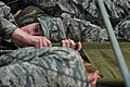
 Airman acts as causalty (14777085365).jpg 4,256 × 2,832; 4.52 MB
-
 Airmen climb high (14590436268).jpg 3,142 × 2,091; 618 KB
-
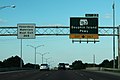
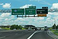
 AL102eRoad-AL129nsSigns (39944748262).jpg 2,400 × 1,600; 1.6 MB
-
 AL102eRoad-AL13nsSigns (39078266105).jpg 2,400 × 1,600; 1.67 MB
-
 AL102nRoad-NorthOfAL129 (25105831187).jpg 2,400 × 1,600; 1.54 MB
-
 AL13nRoad-AL118ewToUS78Xsigns (39944750602).jpg 2,400 × 1,600; 1.76 MB
-
 AL13nRoad-NorthOfAL102 (25105831877).jpg 2,400 × 1,600; 1.61 MB
-
 AL159 North - Gordo (39078263455).jpg 2,400 × 1,600; 2.03 MB
-
 AL159nRoad-DipFromHill (25105827677).jpg 2,400 × 1,600; 2.57 MB
-
 AL171nRoad-AL18ewUS43nsToAL96signs (25105828997).jpg 2,400 × 1,600; 1.66 MB
-
 AL171nRoadSign (28196528129).jpg 2,400 × 1,600; 1.79 MB
-
 AL171nUS43nRoadSplit-AL102eSigns (25105830237).jpg 2,400 × 1,600; 1.81 MB
-
 AL17nRoad-AL10ewSigns (39976063541).jpg 2,400 × 1,600; 1.6 MB
-
 AL17nRoad-AL14ewSigns-Aliceville (39078261005).jpg 2,400 × 1,600; 1.78 MB
-
 AL17nRoad-AL156eSigns (39265799524).jpg 2,400 × 1,600; 1.68 MB
-
 AL17nRoad-AL28eSigns (39078260675).jpg 2,400 × 1,600; 2.05 MB
-
 AL17nRoad-AL32wSign-MissingArrow (39944690062).jpg 2,400 × 1,600; 1.25 MB
-
 AL17nRoad-AL56ewSigns (39976062471).jpg 2,400 × 1,600; 2.1 MB
-
 AL17nRoad-AL86ewSigns (39078261585).jpg 2,400 × 1,600; 1.85 MB
-
 AL17nRoad-JctAL116sign (39265800974).jpg 2,400 × 1,600; 1.63 MB
-
 AL17nRoad-US11nsSigns-YorkAL (39265800244).jpg 2,400 × 1,600; 2.04 MB
-
 AL17nRoad-US80ewSigns (39944739152).jpg 2,400 × 1,600; 1.4 MB
-
 AL17nRoad-US82ewSigns-Reform (25105824567).jpg 2,400 × 1,600; 1.69 MB
-
 AL17nRoadSign-AfterUS45split (39265797204).jpg 2,400 × 1,600; 1.86 MB
-
 AL17nRoadSign2 (39265798194).jpg 2,400 × 1,600; 1.79 MB
-
 AL17nRoadSign3 (26103772838).jpg 2,400 × 1,600; 1.86 MB
-
 AL17nRoadSign4-Aliceville (25105823407).jpg 2,400 × 1,600; 1.94 MB
-
 AL69Roadside-FAP292B-FAS292-IronSigns (14937221777).jpg 2,400 × 1,600; 2.32 MB
-
 AL69sAL25s-AL14ewSigns (28196526389).jpg 2,400 × 1,600; 1.61 MB
-
 AL69sAL25sAL14wRoadSigns (26103733008).jpg 2,400 × 1,600; 2.13 MB
-
 AL69sAL25sLeft-AL14wSigns (39944701682).jpg 2,400 × 1,600; 2.44 MB
-
 AL69sAL5nRoad-ToAL5nAL195AL257-Jasper (39265772734).jpg 2,400 × 1,600; 1.57 MB
-
 AL69sAL5nRoadSign-Jasper (14937136050).jpg 2,400 × 1,600; 1.62 MB
-
 AL69sRoad-AL18wSigns (39265774174).jpg 2,400 × 1,552; 1.81 MB
-
 AL69sRoad-AL25nsSigns (26103732018).jpg 2,400 × 1,600; 1.63 MB
-
 AL69sRoad-AL25sSigns (39944700452).jpg 2,400 × 1,600; 2.03 MB
-
 AL69sRoad-AL269sSigns (26103722478).jpg 2,400 × 1,600; 1.71 MB
-
 AL69sRoad-AL269sToUS78ToAL4signs (39265773274).jpg 2,400 × 1,600; 1.59 MB
-
 AL69sRoad-AL60-CR55signs (39944697852).jpg 2,400 × 1,600; 1.75 MB
-
 AL69sRoad-AL91nSign (26103720588).jpg 2,400 × 1,600; 1.9 MB
-
 AL69sRoad-HavanaSign (26103730728).jpg 2,400 × 1,600; 1.84 MB
-
 AL69sRoad-JctUS82US43signs-Tuscaloosa (26103725328).jpg 2,400 × 1,576; 1.81 MB
-
 AL69sRoad-TollSignToInt20Int59-US82ewUS43ns-Tuscaloosa (39265774934).jpg 2,400 × 1,600; 1.81 MB
-
 AL69sRoad-ToUS78ewAL5nsSigns (39265772224).jpg 2,400 × 1,600; 1.57 MB
-
 AL69sRoad-US11nToUS82signs (26103729708).jpg 2,400 × 1,600; 1.83 MB
-
 AL69sRoad-US80ewSigns (26103733898).jpg 2,400 × 1,600; 1.72 MB
-
 AL69sRoadCurveTrees-SoJasperCounty (15100798136).jpg 2,400 × 1,600; 2.12 MB
-
 AL69sRoadSign-SouthOfJasper (26103723818).jpg 2,400 × 1,600; 2.56 MB
-
 AL69sUS11nInt359sRoad-Exit1-35thStreet (39944696972).jpg 2,400 × 1,600; 1.71 MB
-
 AL69sUS11nInt359sRoad-ToInt20Int59-US11sUS43sSignsBC (26103728448).jpg 2,400 × 1,600; 1.7 MB
-
 AL69sUS43sRoad-AL215nSigns (39944695502).jpg 2,400 × 1,600; 2.16 MB
-
 AL69sUS43sRoad-Bridge-Tuscaloosa (26103726488).jpg 2,400 × 1,600; 1.43 MB
-

-
 Conditioning course (15960991938).jpg 4,256 × 2,832; 3.85 MB
-
 De Soto Trail AL 69 (14937222478).jpg 2,400 × 1,600; 2.26 MB
-
 Don't look down (14796941183).jpg 3,245 × 2,160; 523 KB
-
 Guard and active duty plan for joint response to complex disaster 140724-A-IW994-002.jpg 3,774 × 2,586; 6.14 MB
-
 Int10eRampExit30-US98ewUS90ewToUS31nSigns (39944725022).jpg 2,400 × 1,600; 1.76 MB
-
 Int10eRoadAL-Exit22-AL163slat (26103749538).jpg 2,400 × 1,600; 1.81 MB
-
 Int10eRoadAL-Exit22-AL163slatHM (39944716692).jpg 2,400 × 1,600; 1.54 MB
-
 Int10eRoadAL-Exit22-AL163slatQM (39976043521).jpg 2,400 × 1,600; 1.86 MB
-
 Int10eRoadAL-Exit23-MichiganAve (39944718052).jpg 2,400 × 1,600; 1.66 MB
-
 Int10eRoadAL-Exit24-DuvalBroad-Int10-Slat (26103750808).jpg 2,400 × 1,600; 1.83 MB
-
 Int10eRoadAL-Exit24-DuvalBroad-Slat (39976044721).jpg 2,400 × 1,600; 1.75 MB
-
 Int10eRoadAL-Exit25-VirginiaSt (39944719332).jpg 2,400 × 1,600; 1.71 MB
-
 Int10eRoadAL-Exit26A-CanalSt-Mobile (39976046131).jpg 2,400 × 1,600; 1.81 MB
-
 Int10eRoadAL-Exit27-US90-US98 (39976048241).jpg 2,400 × 1,600; 1.38 MB
-
 Int10eRoadAL-Exit30-US90US98 (39976050221).jpg 2,400 × 1,600; 1.4 MB
-
 Int10eRoadAL-Exit30-US90US98slat1mi (26103755428).jpg 2,400 × 1,600; 1.62 MB
-
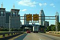 Int10eRoadAL-MM26B-DowntownMobile (26103752218).jpg 2,400 × 1,600; 1.92 MB
-
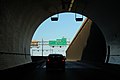
 Int10eRoadAL-MM27-MobileTunnelEntrance (39944720732).jpg 2,400 × 1,600; 1.74 MB
-
 Int10eRoadAL-MM29-Bridge-VarSpeedLimit55 (39976049371).jpg 2,400 × 1,600; 1.39 MB
-
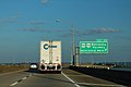
 Int10eRoadAL-MM29-BridgeOverMobileBay (39944722332).jpg 2,400 × 1,600; 1.32 MB
-
 Int10eRoadAL-MM29-Int10sign (39976049121).jpg 2,400 × 1,600; 1.45 MB
-
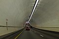
 Int10eRoadAL-MobileTunnelInterior1 (39976047531).jpg 2,400 × 1,600; 1.38 MB
-
 Int10eRoadAL-MobileTunnelInterior2 (26103753388).jpg 2,400 × 1,600; 1.3 MB
-
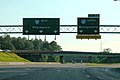 Int10wRoadAL-Exit20-Int65nSlats (39976053831).jpg 2,400 × 1,600; 1.66 MB
-
 Int10wRoadAL-Exit25A-TexasStMobile (26103759588).jpg 2,400 × 1,600; 1.68 MB
-
 Int10wRoadAL-MM26-Int10Sign (39976053251).jpg 2,400 × 1,600; 1.62 MB
-
 Int10wRoadAL-MobileTunnelInterior3blur (26103757588).jpg 2,400 × 1,600; 1.25 MB
-
 Int10wRoadAL-MobileTunnelInterior4 (39976052551).jpg 2,400 × 1,600; 1.42 MB
-
 Int10wRoadAL-RampFromUS98US90 (39976051361).jpg 2,400 × 1,600; 1.51 MB
-
 Int10wRoadAL-TunnelExit-Exit26B-WaterStreet (39976052891).jpg 2,400 × 1,600; 1.43 MB
-
 Int165nRoad-Exit1AB-Int65ns1Mile (26103767758).jpg 2,400 × 1,592; 1.66 MB
-
 Int165nRoad-Exit2-US90 (39976058651).jpg 2,400 × 1,600; 1.4 MB
-
 Int165nRoad-Exit2-US90sign1mile (39265793224).jpg 2,400 × 1,600; 1.35 MB
-
 Int165nRoad-US98ewUS90ewUS43Int10eSigns (39976057461).jpg 1,600 × 2,400; 1.99 MB
-
 Int165nRoadEnd-Exit1AB-Int65snSlats (39265794364).jpg 2,400 × 1,600; 1.45 MB
-
 Int165nRoadSign-MM2-UpcomingExit1C (39265793774).jpg 2,400 × 1,600; 1.49 MB
-
 Int165nUS90eOverSignRoad (39265792384).jpg 2,400 × 1,600; 1.41 MB
-
 Int65nRoad-Exit1-US90 (26103761028).jpg 2,400 × 1,600; 1.73 MB
-
 Int65nRoad-Exit3-AirportRoadMobile (39944689232).jpg 2,400 × 1,600; 1.87 MB
-
 Int65nRoad-Exit308-US278-Cullman-Feb2014 (27878415609).jpg 2,400 × 1,600; 1.56 MB
-
 Int65nRoad-Exit4-DauphinRoadMobileSlat (39976041781).jpg 2,400 × 1,600; 1.65 MB
-
 Int65sRoad-Exit0-Int10ewMobile-Daytime (26103748088).jpg 2,400 × 1,600; 1.62 MB
-
 Int65sRoad-Exit310-AL157 (28196525949) (cropped).jpg 1,141 × 703; 414 KB
-
 Int65sRoad-Exit310-AL157 (28196525949).jpg 2,400 × 1,600; 1.59 MB
-
 Int65sRoad-Exit5AB-US98-Night (39976041351).jpg 2,400 × 1,600; 834 KB
-
 Int65sRoad-Exit5B-US98-Night (28196542819).jpg 2,400 × 1,600; 402 KB
-
 Int65sRoad-Exit8-US45 (28196527539).jpg 2,400 × 1,600; 1.43 MB
-
 Int65sRoad-Exit8-US45-Night (39976041261).jpg 2,400 × 1,600; 500 KB
-
 Int65sRoad-Exit9-Int165s-Slatted (28196542679).jpg 2,400 × 1,600; 1 MB
-
 Int65sRoad-MM1-Int10ewSignsSlats (39976054431).jpg 2,400 × 1,600; 1.47 MB
-
 Int65sRoad-MM75-LateEvening (39976040681).jpg 2,400 × 1,600; 917 KB
-
 Just a little bit further (14776727452).jpg 4,256 × 2,832; 3.87 MB
-
 Low-crawl (14796942843).jpg 3,521 × 2,343; 691 KB
-
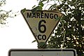 Marengo County 6 Triangle Sign (15120796101).jpg 2,400 × 1,600; 1.4 MB
-
 Rail laid in 1925 on low use Railroad in Alabama July 2014 - panoramio (1).jpg 2,592 × 1,936; 2.48 MB
-
 Ropes exercise course (14773915931).jpg 4,256 × 2,832; 3.01 MB
-
 South End of I-65 (15123793315).jpg 2,400 × 1,600; 314 KB
-
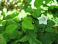 Stylisma humistrata.jpg 2,388 × 1,824; 811 KB
-
TGHHR Hosts 2014 Eid al-Fitr Fireworks.webm 54 s, 426 × 240; 3.75 MB
-
 ToInt10sign-US90eRoad (39265791284).jpg 1,600 × 2,400; 1.99 MB
-
 ToInt165Left-ToInt10RightSigns (39265790084).jpg 2,400 × 1,600; 2.22 MB
-
 ToInt165nSign-US90eRoad (26103763818).jpg 1,600 × 2,400; 1.84 MB
-
 U.S. 43 Error (15100795926).jpg 2,400 × 1,600; 1.7 MB
-
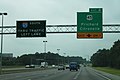
 US 43 at US 80 (15123794505).jpg 2,400 × 1,600; 2.41 MB
-
 US278eAL74eRoad-AL33nAL195sSigns (39078267335).jpg 2,400 × 1,600; 1.53 MB
-
 US43 Ramp MM 576 (26103742518).jpg 2,400 × 1,600; 1.17 MB
-
 US43sAL69sRoad-AL28ewSigns (26103736398).jpg 2,400 × 1,600; 1.94 MB
-
 US43sRoad-AL10ewSigns (39944707312).jpg 2,400 × 1,600; 1.67 MB
-
 US43sRoad-AL154sign-Thomasville (31410074706).jpg 2,400 × 1,600; 2 MB
-
 US43sRoad-AL178eSigns (26103741378).jpg 2,400 × 1,600; 1.51 MB
-
 US43sRoad-AL295sSign-GroveHill (30638817273).jpg 2,400 × 1,600; 1.25 MB
-
 US43sRoad-AL5nSigns (39944708672).jpg 2,400 × 1,600; 1.71 MB
-
 US43sRoad-AL69sSignsSplit (39944705852).jpg 2,400 × 1,600; 1.5 MB
-
 US43sRoad-CurveAndDip (26103740378).jpg 2,400 × 1,600; 1.9 MB
-
 US43sRoadSign-NorthOfLindenAL (39944704062).jpg 2,400 × 1,600; 1.9 MB
-
 US45nAL17nRoadSigns (39265796604).jpg 2,400 × 1,600; 2.19 MB
-
 US45nRoad-AL158eToInt65signs (26103769328).jpg 2,400 × 1,600; 1.46 MB
-
 US45nRoad-AL17nSplitSigns (26103770958).jpg 2,400 × 1,600; 1.97 MB
-
 US45nRoad-AL217nSigns (39265794904).jpg 2,400 × 1,600; 1.68 MB
-
 US45nRoadSign-NorthOfInt65 (39976059731).jpg 2,400 × 1,600; 1.73 MB
-
 US45nRoadSign2 (39265795574).jpg 2,400 × 1,600; 1.95 MB
-
 US45signInverse-NSarrows-CitronelleAL (39976060921).jpg 1,600 × 2,400; 1.59 MB
-
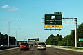
 US80eRoad-AL69nsSigns (26103734998).jpg 2,400 × 1,600; 1.76 MB
-
 US82 White Background Sign (14937132640).jpg 800 × 1,200; 1,008 KB
-
 US82eRoadSign-EastOfReform (39944743062).jpg 2,400 × 1,600; 2.27 MB
-
 US82signWhiteBackground-OldUS82-Gordo (25105825747).jpg 2,400 × 1,600; 1.98 MB
-
 US84 East - AL47 North + Truck Route (26103745408).jpg 2,400 × 1,600; 1.45 MB
-
 US84eAL41sRoad-AL136wSigns (28196542419).jpg 2,400 × 1,600; 1.9 MB
-
 US84eRoad-AL295nsSigns (25105793357).jpg 2,400 × 1,600; 1.78 MB
-
 US84eRoad-AL41nsAL21nsAL47nTruckSigns (39976040191).jpg 2,400 × 1,600; 1.44 MB
-
 US84eRoad-HillAtEvening (26103744438).jpg 4,272 × 2,848; 4.26 MB
-
 US84eRoadCurves-BlueClouds (15120795531).jpg 2,400 × 1,600; 1.62 MB
-
 US90eRoad-BankheadTunnelEntrance (39265789154).jpg 2,400 × 1,600; 1.72 MB
-
 US90eRoad-US98ewTruckSigns (26103761848).jpg 2,400 × 1,600; 2.11 MB
-
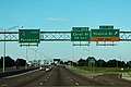
 US90wRoad-Int65nsSigns (26103747138).jpg 2,400 × 1,600; 1.55 MB
.jpg)
.jpg)
.jpg)
.jpg)
.jpg)
.jpg)
.jpg)
.jpg)
.jpg)
.jpg)
.jpg)
.jpg)
.jpg)
.jpg)
.jpg)
.jpg)
.jpg)
.jpg)
.jpg)
.jpg)
.jpg)
.jpg)
.jpg)
.jpg)
.jpg)
.jpg)
.jpg)
.jpg)
.jpg)
.jpg)
.jpg)
.jpg)
.jpg)
.jpg)
.jpg)
.jpg)
.jpg)
.jpg)
.jpg)
.jpg)
.jpg)
.jpg)
.jpg)
.jpg)
.jpg)
.jpg)
.jpg)
.jpg)
.jpg)
.jpg)
.jpg)
.jpg)

.jpg)
.jpg)
.jpg)

.jpg)
.jpg)
.jpg)
.jpg)
.jpg)
.jpg)
.jpg)
.jpg)
.jpg)
.jpg)
.jpg)
.jpg)
.jpg)
.jpg)
.jpg)
.jpg)
.jpg)
.jpg)
.jpg)
.jpg)
.jpg)
.jpg)
.jpg)
.jpg)
.jpg)
.jpg)
.jpg)
.jpg)
.jpg)
.jpg)
.jpg)
.jpg)
.jpg)
.jpg)
.jpg)
.jpg)
.jpg)
.jpg)
_(cropped).jpg)
.jpg)
.jpg)
.jpg)
.jpg)
.jpg)
.jpg)
.jpg)
.jpg)
.jpg)
.jpg)
.jpg)
.jpg)
.jpg)
.jpg)

.jpg)
.jpg)
.jpg)
.jpg)
.jpg)
.jpg)
.jpg)
.jpg)
.jpg)
.jpg)
.jpg)
.jpg)
.jpg)
.jpg)
.jpg)
.jpg)
.jpg)
.jpg)
.jpg)
.jpg)
.jpg)
.jpg)
.jpg)
.jpg)
.jpg)
.jpg)
.jpg)
.jpg)
.jpg)
.jpg)
.jpg)
.jpg)
.jpg)
.jpg)
.jpg)
.jpg)