Category:July 2007 in Worcestershire
Jump to navigation
Jump to search
Deutsch: Bilder, die im Juli 2007 in Worcestershire aufgenommen worden sind. Bitte beachten Sie, dass dies weder das Datum des Uploads noch das Datum des Scannens eines Fotos ist.
English: Images/pictures taken in Worcestershire during July 2007. Note this is not the date of the upload, nor the date a photo was scanned.
Español: Fotografías o imágenes tomadas en Worcestershire durante julio 2007. No es la fecha de subida ni escaneo, sino la fecha en que las fotografías o imágenes se crearon.
Esperanto: Bildoj faritaj en Worcestershire en julio 2007. Tio ne estas la dato, kiam la bildoj estis alŝutitaj aŭ skanitaj.
Français : Photographies ou images prises en Worcestershire durant juillet 2007. Ce n'est pas la date du téléchargement ou du scan.
Galego: Fotografías ou imaxes tomadas en Worcestershire durante xullo 2007. Non é a data de subida nin escaneamento, senón a data na que se crearon as fotografías ou imaxes.
Italiano: Fotografie o immagini scattate a Worcestershire nel luglio 2007. Nota bene: la data non si riferisce né a quella di upload né a quella in cui la foto è stata digitalizzata.
Norsk bokmål: Bilder tatt i Worcestershire i løpet av juli 2007. Merk at dette ikke er datoen for opplasting, eller når et bilde har blitt skannet.
Norsk nynorsk: Bilete teke i Worcestershire i løpet av juli 2007. Merk at dette ikkje er datoen for opplasting, eller når eit bilete har vorte skanna.
Русский: Изображения, сделанные в Worcestershire в течение июль 2007 (не дата загрузки изображения).
Українська: Зображення, зроблені в Worcestershire протягом липень 2007. Зауважте, що це не дата завантаження чи дата сканування фотографії.
| July 2006 | ← | July 2007 | → | July 2008 | |||||||
| Jan | Feb | Mar | Apr | May | Jun | Jul | Aug | Sep | Oct | Nov | Dec |
| 5 | 18 | 24 | 47 | 25 | 23 | 56 | 18 | 16 | 13 | 5 | 16 |
|---|---|---|---|---|---|---|---|---|---|---|---|
Subcategories
This category has only the following subcategory.
F
- 2007 Worcestershire floods (45 F)
Media in category "July 2007 in Worcestershire"
The following 55 files are in this category, out of 55 total.
-
 Gheluvelt Park pond outflow - geograph.org.uk - 504428.jpg 640 × 480; 130 KB
-

-
 St Andrew's Gardens, Worcester - geograph.org.uk - 894555.jpg 640 × 428; 127 KB
-
 Another passenger train at Oddingley - geograph.org.uk - 503786.jpg 640 × 471; 49 KB
-
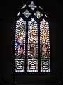
 Baxter United Reformed Church - geograph.org.uk - 499239.jpg 462 × 640; 96 KB
-
 Flooded War Memorial at Severn Stoke - geograph.org.uk - 502726.jpg 426 × 640; 88 KB
-
 Avenue at Kyre Park - geograph.org.uk - 493378.jpg 640 × 480; 126 KB
-
 Bayton Common - geograph.org.uk - 496195.jpg 640 × 480; 86 KB
-
 Berrow Vicarage - geograph.org.uk - 494371.jpg 640 × 430; 248 KB
-

-
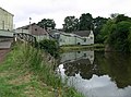
 Canal moorings - geograph.org.uk - 495575.jpg 640 × 451; 132 KB
-
 Chair in the car park - geograph.org.uk - 502825.jpg 640 × 480; 136 KB
-
 Damaged bridge over River Isbourne - geograph.org.uk - 506651.jpg 640 × 480; 96 KB
-
-
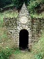
 Elan Valley Pipe Line - geograph.org.uk - 496033.jpg 640 × 480; 136 KB
-
 Elan Valley Pipeline - geograph.org.uk - 496043.jpg 640 × 469; 128 KB
-
-
 Factories at Cookley - geograph.org.uk - 495527.jpg 640 × 476; 111 KB
-
 Fields in Birlingham - geograph.org.uk - 1274590.jpg 640 × 480; 157 KB
-
 Flooded A38 near Severn Stoke - geograph.org.uk - 502749.jpg 640 × 426; 80 KB
-

-
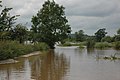 Flooded lane at Severn Stoke - geograph.org.uk - 502733.jpg 640 × 426; 101 KB
-
 Freight train at Oddingley - geograph.org.uk - 503762.jpg 640 × 480; 89 KB
-
 Garden sheds at Saleway - geograph.org.uk - 501318.jpg 640 × 480; 96 KB
-
 Kyre Park - geograph.org.uk - 493367.jpg 640 × 480; 148 KB
-
 Kyre Park - geograph.org.uk - 493373.jpg 640 × 480; 140 KB
-
 Lock keeper's cottage at Astwood Lock - geograph.org.uk - 503504.jpg 640 × 480; 110 KB
-

-
 Narrowboats and flotsam - geograph.org.uk - 505580.jpg 640 × 480; 82 KB
-
 Old Birmingham Road flooded - geograph.org.uk - 1053098.jpg 640 × 427; 264 KB
-
 Regal Cinema, Port Street, Evesham - geograph.org.uk - 502863.jpg 640 × 480; 96 KB
-
-
 Roundabout - geograph.org.uk - 499076.jpg 640 × 486; 101 KB
-
 Skips in Powick - geograph.org.uk - 491783.jpg 640 × 427; 238 KB
-
 Speeding train at Dunhampstead - 1 - geograph.org.uk - 501326.jpg 640 × 480; 135 KB
-
 Speeding train at Dunhampstead - 2 - geograph.org.uk - 501328.jpg 640 × 480; 94 KB
-
 Stourport Basin - geograph.org.uk - 499488.jpg 640 × 461; 115 KB
-
 The flooded A38 through Severn Stoke - geograph.org.uk - 502811.jpg 640 × 426; 114 KB
-

-
 The Leys - geograph.org.uk - 505501.jpg 640 × 480; 71 KB
-
 The Lily Pond at Kyre Park Garden - geograph.org.uk - 493349.jpg 640 × 480; 151 KB
-
 The terrace at the Foley Arms Hotel - geograph.org.uk - 527455.jpg 480 × 640; 123 KB
-

-
 Welland Village Hall - geograph.org.uk - 493043.jpg 640 × 418; 242 KB
-
 Worcester railway viaduct - geograph.org.uk - 505725.jpg 640 × 480; 149 KB
-
 Badger sett near Webbhouse Farm - geograph.org.uk - 500675.jpg 480 × 640; 112 KB
-
 Bluebell Pub - geograph.org.uk - 700892.jpg 640 × 403; 235 KB
-
 Bullocks Lane Bridge - geograph.org.uk - 499273.jpg 640 × 535; 98 KB
-
 Cottage at Saleway - geograph.org.uk - 501319.jpg 640 × 480; 96 KB
-
 Eagles Nest - geograph.org.uk - 499025.jpg 640 × 561; 109 KB
-
 July 2007 Flood - New Upton Surgery - geograph.org.uk - 501338.jpg 640 × 380; 235 KB
-
 Lane junction near Webbhouse Farm - geograph.org.uk - 503743.jpg 640 × 480; 142 KB
-
 Mereside Cottage - geograph.org.uk - 490676.jpg 640 × 480; 106 KB
-
 Saleway Farm - geograph.org.uk - 501315.jpg 640 × 480; 85 KB
-
 Stream-Side Meadow, Castlemorton - geograph.org.uk - 507984.jpg 640 × 427; 255 KB


