Category:July 2006 Ireland photographs
Jump to navigation
Jump to search
Countries of Europe: Austria · Azerbaijan‡ · Belarus · Belgium · Bosnia and Herzegovina · Bulgaria · Croatia · Cyprus‡ · Czech Republic · Denmark · Estonia · Finland · France‡ · Georgia‡ · Germany · Greece · Hungary · Iceland · Republic of Ireland · Italy · Kazakhstan‡ · Latvia · Lithuania · Luxembourg · Malta · Monaco · Montenegro · Netherlands‡ · North Macedonia · Norway · Poland · Portugal‡ · Romania · Russia‡ · San Marino · Serbia · Slovakia · Slovenia · Spain‡ · Sweden · Switzerland · Turkey‡ · Ukraine · United Kingdom
Specific status: Gibraltar · Isle of Man
‡: partly located in Europe
Specific status: Gibraltar · Isle of Man
‡: partly located in Europe
English: Images taken in Ireland during this month of 2006 (not the date of the upload). With CatScan, this allows one to browse any Ireland-related category by year or month. Images should be placed directly in this category, not in subcategories. Note: Images from 2006 should be also added into the appropriate province, territory or city category of Category:2006 photographs of Ireland.
| Jan | Feb | Mar | Apr | May | Jun | Jul | Aug | Sep | Oct | Nov | Dec | ||
| ← | 0 | 0 | 1 | 0 | 0 | 125 | 191 | 0 | 161 | 0 | 0 | 0 | → |
|---|
Media in category "July 2006 Ireland photographs"
The following 191 files are in this category, out of 191 total.
-
 1798 monument, New Ross, Co. Wexford - geograph.org.uk - 212298.jpg 640 × 480; 78 KB
-
 Glendalough - former mining village.jpg 2,048 × 1,536; 715 KB
-
 Glendalough - Panorama.jpg 2,048 × 1,536; 744 KB
-
 Glendalough Valley.jpg 1,536 × 2,048; 723 KB
-
 3.5 Check-in Halle. Jura Grau-blau. Irland. Cork Airport.JPG 1,900 × 1,425; 383 KB
-
 A bench - geograph.org.uk - 276191.jpg 640 × 480; 92 KB
-
 A narrow lane, Glengarriff - geograph.org.uk - 263367.jpg 640 × 480; 95 KB
-
 Aasleagh Falls - geograph.org.uk - 199906.jpg 640 × 520; 148 KB
-
 Aasleagh Falls, close up - geograph.org.uk - 199910.jpg 640 × 536; 134 KB
-
 Ameen River - geograph.org.uk - 287429.jpg 640 × 480; 97 KB
-
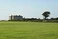
 Ardgillan Castle - geograph.org.uk - 490661.jpg 640 × 480; 91 KB
-
 Arthurstown quay - geograph.org.uk - 202390.jpg 640 × 426; 139 KB
-
 Arthurstown, Co. Wexford - geograph.org.uk - 212155.jpg 640 × 471; 91 KB
-
 Athlone Castle - geograph.org.uk - 412987.jpg 640 × 480; 85 KB
-
 Baginbun Bay, Co. Wexford - geograph.org.uk - 212161.jpg 640 × 480; 93 KB
-
 Ballyheigue village.jpg 1,600 × 1,200; 116 KB
-
 Ballymurphy Church, Co. Carlow - geograph.org.uk - 212819.jpg 640 × 480; 73 KB
-
 Barn at Newmarket, Co. Kilkenny - geograph.org.uk - 206916.jpg 640 × 480; 74 KB
-
 Bay, Gubaranduff, Inishbofin - geograph.org.uk - 199652.jpg 640 × 513; 123 KB
-
 Belvedere gardens.jpg 1,600 × 1,200; 350 KB
-
 Belvedere House.jpg 2,816 × 2,112; 1.25 MB
-
 Benbaun crags over Kylemore Lough - geograph.org.uk - 200801.jpg 541 × 640; 151 KB
-

-
 Blacks, Cavan - geograph.org.uk - 309381.jpg 640 × 480; 73 KB
-
 Blennerville.JPG 2,048 × 1,536; 704 KB
-
 Boulders in the Owengin River - geograph.org.uk - 200367.jpg 640 × 496; 133 KB
-
 Bracken and boulders, Killary Harbour - geograph.org.uk - 201137.jpg 480 × 640; 144 KB
-

-
 BRONZE HARE.jpg 1,361 × 2,048; 645 KB
-

-
 Bullock grazing at Lettergesh beach - geograph.org.uk - 199967.jpg 640 × 477; 152 KB
-
 Cannon of King John's Castle in Limerick.jpg 2,592 × 1,944; 1.64 MB
-
 Cannons of King John's Castle in Limerick.jpg 2,592 × 1,944; 1.44 MB
-
 Castle, Tinnahinch, Co. Carlow - geograph.org.uk - 212867.jpg 471 × 640; 88 KB
-
 Castletown Bearhaven - geograph.org.uk - 263706.jpg 640 × 480; 78 KB
-

-
 Churches, Inistioge, Co. Kilkenny - geograph.org.uk - 205261.jpg 640 × 480; 66 KB
-
 Cladaghgarriff - geograph.org.uk - 286148.jpg 640 × 480; 71 KB
-
 Clashduv - geograph.org.uk - 262658.jpg 640 × 480; 80 KB
-
 Clerestory, Dunbrody Abbey, Co. Wexford - geograph.org.uk - 212177.jpg 480 × 640; 139 KB
-
 Cliff face from Dun Aengus.JPG 2,048 × 1,536; 1.07 MB
-
 Clones - geograph.org.uk - 310022.jpg 640 × 480; 62 KB
-
 Clones - geograph.org.uk - 310025.jpg 640 × 480; 80 KB
-
 Clougherane - geograph.org.uk - 263398.jpg 640 × 480; 103 KB
-
 Cnoc Daod - Hungry Hill - geograph.org.uk - 274657.jpg 640 × 480; 106 KB
-
 Cnoc Daod - Hungry Hill - geograph.org.uk - 275337.jpg 640 × 480; 78 KB
-
 Cnoc Daod - Hungry Hill - geograph.org.uk - 275339.jpg 640 × 480; 93 KB
-
 Cnoc Daod - Hungry Hill - geograph.org.uk - 275340.jpg 640 × 480; 71 KB
-
 Cnoc na Gréine - geograph.org.uk - 308892.jpg 640 × 480; 64 KB
-

-
 Comnagapple Glen - geograph.org.uk - 279328.jpg 640 × 480; 86 KB
-
 Conor Pass - Brandon Bay.JPG 2,048 × 1,536; 663 KB
-
 Conor Pass Bull's Head.JPG 2,048 × 1,536; 781 KB
-
 Conors Pass An Ghoill Mhorr.JPG 2,048 × 1,536; 609 KB
-
 Contorted rocks on Hungry Hill - geograph.org.uk - 274683.jpg 640 × 480; 120 KB
-
 Coolcreen - geograph.org.uk - 286143.jpg 640 × 480; 76 KB
-
 Coomgira - geograph.org.uk - 263805.jpg 640 × 480; 100 KB
-
 Coomgira - geograph.org.uk - 263806.jpg 640 × 480; 117 KB
-
 CorkSignsInPolish.jpg 1,280 × 960; 570 KB
-
 Costcutter's Cloghore, County Donegal - geograph.org.uk - 204200.jpg 640 × 479; 54 KB
-

-
 Cows and islands, Lettergesh beach - geograph.org.uk - 199974.jpg 640 × 360; 72 KB
-
 Cows grazing by Lettergesh beach - geograph.org.uk - 199973.jpg 640 × 408; 117 KB
-
 Curraduff - geograph.org.uk - 279325.jpg 640 × 480; 97 KB
-
 Damp woodland, Adrigole - geograph.org.uk - 263747.jpg 640 × 480; 138 KB
-
 Derrylea - geograph.org.uk - 200376.jpg 640 × 430; 127 KB
-
 Doolough Pass, the Gem of Mayo - geograph.org.uk - 447610.jpg 640 × 85; 20 KB
-
 Downings Harbour - geograph.org.uk - 307052.jpg 640 × 422; 76 KB
-
 Drumsna Harbour - geograph.org.uk - 209505.jpg 640 × 480; 102 KB
-
 DublinStPatricksCathedral adjusted.JPG 1,280 × 960; 1.01 MB
-
 DublinStPatricksCathedral.jpg 1,280 × 960; 517 KB
-
 Dunbrody Abbey, Co. Wexford - geograph.org.uk - 212180.jpg 640 × 472; 99 KB
-
 Dunbrody ship, New Ross, Co. Wexford - geograph.org.uk - 210895.jpg 480 × 640; 73 KB
-
 Duncannon Harbour, Co. Wexford - geograph.org.uk - 212189.jpg 640 × 473; 96 KB
-
 Duncannon Harbour, Co. Wexford - geograph.org.uk - 212190.jpg 640 × 480; 99 KB
-
 Dunmore East harbour - geograph.org.uk - 202368.jpg 640 × 426; 151 KB
-
 Eadargóil - geograph.org.uk - 263811.jpg 640 × 480; 63 KB
-
 Eas Mor falls on the Owengin River - geograph.org.uk - 200409.jpg 640 × 480; 134 KB
-
 Eglyse St Fechin Fore.JPG 1,600 × 1,200; 414 KB
-
-
 Erriff River and Aasleagh Bridge - geograph.org.uk - 199912.jpg 640 × 476; 153 KB
-
 Erriff River and Killary Harbour - geograph.org.uk - 199914.jpg 640 × 463; 162 KB
-
 Farm on Turkenagh Mountain. - geograph.org.uk - 295795.jpg 640 × 480; 91 KB
-
 Farm with belfry, Co. Wexford - geograph.org.uk - 212206.jpg 640 × 480; 121 KB
-
 Feakle - An Fhiacail - geograph.org.uk - 293810.jpg 640 × 480; 54 KB
-
 Fethard Quay, Co. Wexford - geograph.org.uk - 212212.jpg 640 × 480; 89 KB
-
 Fethard Quay.jpg 640 × 426; 158 KB
-
 Fishermen on Hook Head, Co. Wexford - geograph.org.uk - 212218.jpg 640 × 480; 129 KB
-
 Fishing dinghies by Lough Muck - geograph.org.uk - 200035.jpg 640 × 470; 126 KB
-
 Flowering alpine on rock spike - geograph.org.uk - 200432.jpg 635 × 640; 182 KB
-

-
 Footbridge over stream by Lough Fee - geograph.org.uk - 200007.jpg 640 × 480; 134 KB
-

-

-

-
 Former lifting bridge, River Barrow - geograph.org.uk - 202307.jpg 640 × 426; 156 KB
-
 Fountain at Bantry House.jpg 1,944 × 2,592; 2.05 MB
-
 Gap between the benches - Hungry Hill - geograph.org.uk - 274694.jpg 480 × 640; 112 KB
-
 Gap of Dunloe Auger Lake depuis le col.JPG 2,048 × 1,536; 930 KB
-
 Gap of Dunloe Wishing bridge aval.JPG 2,048 × 1,536; 542 KB
-
 Gap of Dunloe Wishing Bridge.JPG 2,048 × 1,536; 890 KB
-
 Ging's Cellar Bar, Carrick-on-Shannon - geograph.org.uk - 209500.jpg 640 × 480; 104 KB
-
 Glengarriff River - geograph.org.uk - 262613.jpg 640 × 480; 166 KB
-
 Glengesh Pass ouest.JPG 2,048 × 1,536; 695 KB
-
 Goats and crags - geograph.org.uk - 263382.jpg 637 × 439; 55 KB
-
 Gorge on the Owengin - geograph.org.uk - 200426.jpg 640 × 488; 157 KB
-

-
 Grianan Castle, Thomastown, Co. Kilkenny - geograph.org.uk - 205286.jpg 640 × 478; 122 KB
-
 Gunnera tinctoria - geograph.org.uk - 201431.jpg 534 × 640; 152 KB
-
 HARE IN O'CONNELL STREET (pun intended).jpg 333 × 500; 173 KB
-
 HARE IN O'CONNELL STREET.jpg 1,361 × 2,048; 683 KB
-
 Headland at Lettergesh beach - geograph.org.uk - 199957.jpg 640 × 428; 234 KB
-
 Healy Pass - geograph.org.uk - 262660.jpg 640 × 480; 104 KB
-
 Healy Pass - geograph.org.uk - 263389.jpg 640 × 480; 110 KB
-
 Healy Pass - geograph.org.uk - 263391.jpg 640 × 480; 111 KB
-
 Healy Pass - geograph.org.uk - 263392.jpg 640 × 480; 89 KB
-
 Healy Pass - geograph.org.uk - 286136.jpg 640 × 480; 103 KB
-
 Hillside below the Healy Pass - geograph.org.uk - 263393.jpg 640 × 480; 87 KB
-
 Holiday Cottage South Of Stradbally - geograph.org.uk - 425614.jpg 640 × 480; 88 KB
-
 Holy Trinity Church, Westport July 2006.jpg 2,592 × 1,944; 1.15 MB
-
 Hook Head lighthouse (1) - geograph.org.uk - 202252.jpg 640 × 426; 110 KB
-
 Hook Head lighthouse (2) - geograph.org.uk - 202253.jpg 640 × 426; 98 KB
-

-
 Hungry Hill - geograph.org.uk - 274637.jpg 620 × 404; 79 KB
-
 Hungry Hill - geograph.org.uk - 274676.jpg 480 × 640; 111 KB
-

-
 Inchbofin, Lough Ree - geograph.org.uk - 412925.jpg 640 × 480; 57 KB
-
 Inistioge Bridge, Co. Kilkenny - geograph.org.uk - 205258.jpg 640 × 480; 97 KB
-
 Inistioge from Sandford Castle - geograph.org.uk - 488492.jpg 640 × 512; 118 KB
-
 Inlet at Culfin - geograph.org.uk - 199944.jpg 640 × 504; 118 KB
-
 IRA Memorial, Athlone - geograph.org.uk - 412998.jpg 480 × 640; 111 KB
-
 Irl BallycottonLifeboat.jpg 640 × 426; 148 KB
-
 Irl-Enniskerry-StPatsCoI.jpg 495 × 612; 70 KB
-
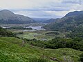
 Killary Harbour in evening sunlight - geograph.org.uk - 201352.jpg 640 × 436; 116 KB
-
 Kilmalkedar Ogham Stone.JPG 1,536 × 2,048; 1,002 KB
-
 King John's Castle in Limerick (1).jpg 2,592 × 1,944; 1.86 MB
-
 King John's Castle in Limerick (2).jpg 2,592 × 1,944; 1.89 MB
-
 King John's Castle in Limerick (3).jpg 1,944 × 2,592; 1.84 MB
-
 King John's Castle in Limerick (4).jpg 1,944 × 2,592; 1.41 MB
-
 King John's Castle in Limerick (5).jpg 2,592 × 1,944; 1.3 MB
-
 King John's Castle in Limerick (6).jpg 2,592 × 1,944; 1.44 MB
-
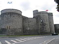 King John's Castle in Limerick (7).jpg 2,592 × 1,944; 1.25 MB
-
 King John's Castle in Limerick (8).jpg 2,082 × 1,582; 500 KB
-
 Kite at Lettergesh beach - geograph.org.uk - 199951.jpg 640 × 491; 134 KB
-
 Kittiwake, kittiwake - geograph.org.uk - 202353.jpg 640 × 426; 183 KB
-
 Knockastumpa - geograph.org.uk - 263399.jpg 640 × 480; 125 KB
-
 Knocknasallagh - geograph.org.uk - 289929.jpg 640 × 480; 83 KB
-

-
 Laidies View.JPG 2,048 × 1,536; 796 KB
-
 Leveret Island, Lough Ree - geograph.org.uk - 412880.jpg 640 × 480; 61 KB
-
 Leveret Island, Lough Ree - geograph.org.uk - 412934.jpg 640 × 480; 86 KB
-
 Lighthouse, Wicklow harbour - geograph.org.uk - 202250.jpg 640 × 426; 105 KB
-
 Lime kiln viewed down slit quarry - geograph.org.uk - 200673.jpg 640 × 475; 133 KB
-
 Limestone flowers - geograph.org.uk - 308866.jpg 640 × 480; 109 KB
-
 Lock, Tinnahinch, Co. Carlow - geograph.org.uk - 212871.jpg 640 × 480; 92 KB
-
-
 Lone fishing boat - geograph.org.uk - 201318.jpg 640 × 492; 106 KB
-
 Lone yacht moored at Glassilaun - geograph.org.uk - 199924.jpg 640 × 469; 91 KB
-
 Loughnagrooaun, Gubaranduff, Inishbofin - geograph.org.uk - 199677.jpg 640 × 430; 103 KB
-
 Low hill by the Owengin River - geograph.org.uk - 200359.jpg 552 × 640; 132 KB
-
 Maghera Strand - geograph.org.uk - 305471.jpg 634 × 414; 59 KB
-
 Main street, Tinnahinch, Co. Carlow - geograph.org.uk - 212860.jpg 640 × 474; 78 KB
-
 McCaffrey's Bar, Cavan - geograph.org.uk - 309358.jpg 640 × 480; 66 KB
-
 McMahon's - geograph.org.uk - 309387.jpg 480 × 640; 73 KB
-
 Mill at Foulksmill, Co. Wexford - geograph.org.uk - 212213.jpg 640 × 480; 123 KB
-
 Minor road to Barnanoraun - geograph.org.uk - 200438.jpg 640 × 480; 124 KB
-

-
 Moorland north of Lough Muck - geograph.org.uk - 200049.jpg 640 × 419; 142 KB
-
 Mount Leinster.JPG 640 × 480; 36 KB
-
 Mouth of the Culfin River - geograph.org.uk - 199938.jpg 640 × 452; 145 KB
-
 Mt Leinster.JPG 1,024 × 400; 64 KB
-

-
 Mullinavat main street, Co.Kilkenny - geograph.org.uk - 213484.jpg 640 × 409; 72 KB
-

-

-
 New Ross Post Office Co. Wexford - geograph.org.uk - 212220.jpg 640 × 485; 123 KB
-
 North side of Maghera Strand - geograph.org.uk - 305476.jpg 640 × 421; 68 KB
-
 North-west head of Lough Muck - geograph.org.uk - 199986.jpg 640 × 475; 126 KB
-
 Northeast ridge of Hungry Hill - geograph.org.uk - 275920.jpg 640 × 480; 105 KB
-

-
 Notice Board - geograph.org.uk - 209504.jpg 640 × 480; 114 KB
-
 O'connell st3.jpg 620 × 852; 186 KB
-

-
 Old Church, Knocktopher, Co. Kilkenny - geograph.org.uk - 206346.jpg 469 × 640; 107 KB
-
 Old corn mill, Foulksmills - geograph.org.uk - 204476.jpg 640 × 426; 150 KB
-

-
 Omey Island, southern extremity - geograph.org.uk - 378590.jpg 640 × 427; 114 KB
-
 On Hungry Hill - geograph.org.uk - 275924.jpg 640 × 480; 72 KB
-
 Owengin Bridge - geograph.org.uk - 200155.jpg 640 × 459; 125 KB
-
 Owengin River looking towards Cregg Hill - geograph.org.uk - 200218.jpg 640 × 495; 145 KB
-
 Painting at Wicklow harbour - geograph.org.uk - 205330.jpg 640 × 426; 194 KB


.jpg)


_-_geograph.org.uk_-_202252.jpg)
_-_geograph.org.uk_-_202253.jpg)


.jpg)
.jpg)
.jpg)
.jpg)
.jpg)
.jpg)
.jpg)
.jpg)


