Category:Jamestown, West Dunbartonshire
Jump to navigation
Jump to search

village in West Dunbartonshire, Scotland, UK | |||||
| Upload media | |||||
| Instance of | |||||
|---|---|---|---|---|---|
| Location |
| ||||
| Different from | |||||
 | |||||
Subcategories
This category has the following 4 subcategories, out of 4 total.
A
J
- Jamestown footbridge (2 F)
Media in category "Jamestown, West Dunbartonshire"
The following 18 files are in this category, out of 18 total.
-
 Arthurston House Jamestown - geograph.org.uk - 441757.jpg 640 × 457; 136 KB
-
 BP filling station Jamestown - geograph.org.uk - 438217.jpg 640 × 480; 122 KB
-
-
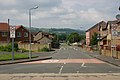 Dalvait Road Junction. Jamestown. - geograph.org.uk - 461780.jpg 640 × 426; 124 KB
-
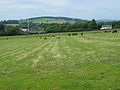
 Deep bog area - geograph.org.uk - 365481.jpg 640 × 480; 106 KB
-
 Disused railway line by the trees. - geograph.org.uk - 206548.jpg 640 × 480; 104 KB
-
 Entering Jamestown - geograph.org.uk - 3341466.jpg 640 × 480; 63 KB
-
 Entering Jamestown on the A813 - geograph.org.uk - 3464328.jpg 4,439 × 3,084; 5.1 MB
-
 Heatherdale - geograph.org.uk - 433804.jpg 640 × 427; 76 KB
-
 Jamestown Industrial Estate - geograph.org.uk - 3363527.jpg 1,024 × 576; 304 KB
-
 Jamestown Industrial Estate - geograph.org.uk - 3363534.jpg 1,024 × 576; 399 KB
-
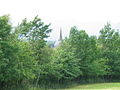
 Jamestown Parish Church - geograph.org.uk - 2530734.jpg 2,000 × 1,508; 564 KB
-
 Jamestown Parish Church - geograph.org.uk - 2666952.jpg 837 × 1,024; 192 KB
-
 Jamestown Parish Church - geograph.org.uk - 3464339.jpg 4,608 × 3,456; 5.59 MB
-
 Jamestown Primary School - geograph.org.uk - 3464335.jpg 4,608 × 3,456; 6.18 MB
-
 Jamestown Primary School - geograph.org.uk - 434343.jpg 640 × 427; 83 KB
-
 One end of the Horseshoe - geograph.org.uk - 1713072.jpg 640 × 480; 65 KB
-
 Village Store - geograph.org.uk - 461773.jpg 640 × 426; 170 KB


