Category:Ixworth Thorpe
Jump to navigation
Jump to search
English: Ixworth Thorpe is a small village and civil parish in the St Edmundsbury district of Suffolk in eastern England. Located on the A1088 around a mile north-west of sister village Ixworth and five miles north-east of Bury St Edmunds, in 2005 its population was 60.[1]
village in the United Kingdom  | |||||
| Upload media | |||||
| Instance of | |||||
|---|---|---|---|---|---|
| Location | St Edmundsbury, Suffolk, East of England, England | ||||
 | |||||
- ↑ Cite error: Invalid
<ref>tag; no text was provided for refs namedpopulation
Subcategories
This category has the following 3 subcategories, out of 3 total.
Media in category "Ixworth Thorpe"
The following 33 files are in this category, out of 33 total.
-
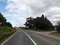
 A1088 Thetford Road, Ixworth Thorpe - geograph.org.uk - 5113726.jpg 3,072 × 2,228; 2.2 MB
-
 A1088 Thetford Road, Ixworth Thorpe - geograph.org.uk - 5113741.jpg 3,072 × 2,304; 4.09 MB
-
 A1088 Thetford Road, Ixworth Thorpe - geograph.org.uk - 5113824.jpg 2,990 × 2,186; 2.87 MB
-
 A1088 Thetford Road, Ixworth Thorpe - geograph.org.uk - 5114030.jpg 3,072 × 2,304; 1.79 MB
-
 A1088 Thetford Road, Ixworth Thorpe - geograph.org.uk - 5114102.jpg 3,072 × 2,304; 1.83 MB
-
 A1088 Thetford Road, Ixworth Thorpe - geograph.org.uk - 5121189.jpg 3,072 × 2,304; 2.51 MB
-
 Bardwell Road, Ixworth Thorpe - geograph.org.uk - 4494006.jpg 1,024 × 768; 416 KB
-
 Bardwell Road, Ixworth Thorpe - geograph.org.uk - 4494009.jpg 1,024 × 768; 467 KB
-
 Bardwell Road, Ixworth Thorpe - geograph.org.uk - 5114111.jpg 3,072 × 2,304; 1.89 MB
-
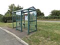 Bus Shelter on Thetford Road - geograph.org.uk - 5113833.jpg 3,072 × 2,304; 1.99 MB
-
 Concrete Hardstanding off the A1088 Thetford Road - geograph.org.uk - 5121181.jpg 3,072 × 2,304; 2.86 MB
-
 Entering Ixworth Thorpe on the A1088 Thetford Road - geograph.org.uk - 5113746.jpg 3,072 × 2,304; 3.99 MB
-
 Entrance of All Saints Church - geograph.org.uk - 5113770.jpg 3,072 × 2,304; 1.96 MB
-
 Entrance to All Saints Church - geograph.org.uk - 5113740.jpg 3,072 × 2,188; 3.46 MB
-
 Entrance to Manor Farm - geograph.org.uk - 5113899.jpg 3,072 × 2,304; 1.79 MB
-
 Farm track at Ixworth Thorpe - geograph.org.uk - 209363.jpg 640 × 427; 72 KB
-
 Farmer's Track To Thorpe Carr - geograph.org.uk - 5784649.jpg 1,184 × 2,104; 451 KB
-
 Farmers Track - geograph.org.uk - 2262217.jpg 1,600 × 1,200; 538 KB
-
 Green Lane Postbox - geograph.org.uk - 5113962.jpg 2,283 × 3,044; 5.51 MB
-
 Green Lane Postbox - geograph.org.uk - 5113965.jpg 2,253 × 3,004; 4.15 MB
-
 Green Lane Postbox ^ Telephone Box - geograph.org.uk - 5113922.jpg 3,072 × 2,304; 1.85 MB
-
 Green Lane Postbox ^ Telephone Box - geograph.org.uk - 5113968.jpg 2,169 × 2,992; 4.11 MB
-
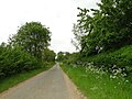
 Green Lane, Ixworth Thorpe - geograph.org.uk - 5113915.jpg 3,072 × 2,304; 2 MB
-
 Green Lane, Ixworth Thorpe - geograph.org.uk - 5114041.jpg 3,072 × 2,304; 1.92 MB
-
 Ixworth Thorpe Village Name sign - geograph.org.uk - 5113749.jpg 2,304 × 3,072; 4.5 MB
-
 Ixworth Thorpe Village Name sign - geograph.org.uk - 5114161.jpg 2,990 × 2,242; 4.73 MB
-
 Nursery on Heath Road - geograph.org.uk - 208969.jpg 640 × 427; 62 KB
-
 Private No Admittance - geograph.org.uk - 2262271.jpg 1,600 × 1,200; 508 KB
-
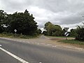
 The A.1088 - geograph.org.uk - 2262257.jpg 1,600 × 1,200; 441 KB
-
 The War Memorial at Ixworth Thorpe - geograph.org.uk - 4913917.jpg 3,456 × 2,592; 2.83 MB
-
 Thetford Road approaching Ixworth Thorpe - geograph.org.uk - 5760400.jpg 3,024 × 2,268; 2.32 MB
-
 Thetford Road, Ixworth Thorpe - geograph.org.uk - 5113828.jpg 3,072 × 2,304; 1.91 MB
-
 Thetford Road, Ixworth Thorpe - geograph.org.uk - 5114020.jpg 3,072 × 2,304; 1.71 MB


