Category:Iwerne Minster
Jump to navigation
Jump to search
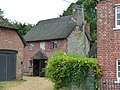
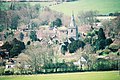
English: Iwerne Minster is a village in North Dorset, England, situated under Cranborne Chase in the Blackmore Vale just off the A350. The village has a population of 889 (2001 census). A cheese shop employs 57 persons. The village shop doubles as a Post Office.
village and civil parish in Dorset, United Kingdom  | |||||
| Upload media | |||||
| Instance of | |||||
|---|---|---|---|---|---|
| Location | Dorset, South West England, England | ||||
| Said to be the same as | Iwerne Minster (Wikimedia duplicated page, civil parish) | ||||
 | |||||
Subcategories
This category has the following 3 subcategories, out of 3 total.
Media in category "Iwerne Minster"
The following 126 files are in this category, out of 126 total.
-
 Abingdon Memorial Hall, Iwerne Minster.jpg 4,000 × 3,000; 1.02 MB
-
 Across Brookman's Valley - geograph.org.uk - 372637.jpg 640 × 480; 86 KB
-
 Across Presont Hill - geograph.org.uk - 588798.jpg 640 × 430; 201 KB
-
 An apple a day ... - geograph.org.uk - 907642.jpg 640 × 480; 106 KB
-
 Applegarth and Tymps Cottage, Iwerne Minster.jpg 4,000 × 3,000; 4.84 MB
-
 Ashmore Lodge Bridleway - geograph.org.uk - 530201.jpg 640 × 480; 105 KB
-
 Back to "The Talbot" - geograph.org.uk - 4053108.jpg 3,888 × 2,592; 3.12 MB
-
 Brewer's sign, restaurant sign and pub weather vane - geograph.org.uk - 3812490.jpg 3,888 × 2,592; 2.57 MB
-
 Brook Cottage, Iwerne Minster.jpg 1,800 × 1,350; 2.38 MB
-
 Brookman's Farmhouse (geograph 6767859).jpg 4,320 × 3,240; 2.48 MB
-
 Butcher's Shop, Iwerne Minster - geograph.org.uk - 906974.jpg 640 × 480; 95 KB
-
 Dwell Deep and Dip Well, Iwerne Minster.jpg 4,000 × 3,000; 1.02 MB
-
 Fallen tree near Sutton Waldron - geograph.org.uk - 1717900.jpg 640 × 480; 130 KB
-
 Finger post, Pegg's Lane - geograph.org.uk - 1717948.jpg 640 × 480; 168 KB
-
 Fingerpost at the Bottom of Heth Woods - geograph.org.uk - 6392111.jpg 5,184 × 3,456; 5.42 MB
-
 Former primary school, Iwerne Minster.jpg 4,000 × 3,000; 5.02 MB
-
 Heddle House, Iwerne Minster 01.jpg 3,070 × 4,052; 1.14 MB
-
 Heddle House, Iwerne Minster 02.jpg 4,000 × 3,000; 1.41 MB
-
 Iwerne Minster buildings (2) (geograph 6767846).jpg 4,320 × 3,240; 2.71 MB
-
 Iwerne Minster buildings (3) (geograph 6767854).jpg 4,320 × 3,240; 2.94 MB
-
 Iwerne Minster Church and the Moon - geograph.org.uk - 118304.jpg 640 × 479; 77 KB
-
 Iwerne Minster features (2) (geograph 6767841).jpg 3,167 × 4,223; 3.09 MB
-
 Iwerne Minster houses (10) (geograph 6768710).jpg 4,069 × 3,051; 2.98 MB
-
 Iwerne Minster houses (11) (geograph 6768726).jpg 4,320 × 3,240; 2.69 MB
-
 Iwerne Minster houses (3) (geograph 6767851).jpg 4,320 × 3,240; 2.43 MB
-
 Iwerne Minster houses (geograph 6768706).jpg 4,320 × 3,240; 2.39 MB
-
 Iwerne Minster houses (geograph 6768727).jpg 3,982 × 2,986; 2.38 MB
-

-
 Iwerne Minster, A350 looking North - geograph.org.uk - 3812446.jpg 3,888 × 2,592; 3.98 MB
-
 Iwerne Minster, Clayesmore School - geograph.org.uk - 4393802.jpg 640 × 480; 54 KB
-

-

-

-

-
 Iwerne Minster, Peggs Lane finger-post - geograph.org.uk - 1406242.jpg 640 × 480; 105 KB
-
-
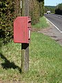
 Iwerne Minster, postbox No. DT11 143 - geograph.org.uk - 1405776.jpg 640 × 480; 107 KB
-

-
 Iwerne Minster, postbox No. DT11 66 - geograph.org.uk - 1405779.jpg 480 × 640; 64 KB
-
-

-
 Iwerne Minster, solar panels - geograph.org.uk - 4393794.jpg 640 × 480; 75 KB
-
 Iwerne Minster, the post office - geograph.org.uk - 475205.jpg 640 × 429; 102 KB
-
 Iwerne Minster, the telephone box - geograph.org.uk - 3349446.jpg 640 × 480; 93 KB
-

-
 K6 Telephone Kiosk, Iwerne Minster.jpg 4,000 × 3,000; 1.93 MB
-
 Looking along the Southern Edge of Hanging Coppice - geograph.org.uk - 6392127.jpg 5,184 × 3,456; 7.15 MB
-
 Medieval coin, gold half noble of Edward III (FindID 466256).jpg 2,625 × 1,592; 1.02 MB
-
 Noel Cottage, Iwerne Minster.jpg 4,078 × 3,104; 1.5 MB
-
 Oakwood Drive, Iwerne Minster, Dorset, England.jpg 1,024 × 768; 149 KB
-

-

-
 Oyles Mill House.jpg 4,000 × 3,000; 4.99 MB
-
 River Cottage, Iwerne Minster.jpg 3,000 × 4,000; 1.18 MB
-
 Roadside stream, Iwerne Minster - geograph.org.uk - 906930.jpg 480 × 640; 151 KB
-
 Shaftesbury Road goes past Hill Farm - geograph.org.uk - 301539.jpg 480 × 640; 95 KB
-
 Spring Cottage, Iwerne Minster 01.jpg 4,000 × 3,000; 1.35 MB
-
 Spring Cottage, Iwerne Minster 02.jpg 4,103 × 3,138; 1.61 MB
-
 Sunnyside and attached shop, Iwerne Minster.jpg 4,000 × 3,000; 4.69 MB
-
 Sunnyside Cottage, Iwerne Minster.jpg 4,000 × 3,000; 1.5 MB
-
 The Chantry - Iwerne Minster - geograph.org.uk - 618633.jpg 640 × 427; 195 KB
-
 The Co-op, Iwerne Minster - geograph.org.uk - 908298.jpg 640 × 480; 78 KB
-
 The Talbot at Iwerne Minster.jpg 4,000 × 3,000; 1.11 MB
-
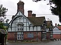
 The Talbot Inn, Iwerne Minster - geograph.org.uk - 907004.jpg 640 × 480; 83 KB
-
 The Wild Garlic at the Talbot Inn, Iwerne Minster - geograph.org.uk - 3812477.jpg 3,888 × 2,592; 2.77 MB
-
 Tillhays, Iwerne Minster.jpg 4,000 × 3,000; 1.52 MB
-
 Top edge of Beech Clump - geograph.org.uk - 588803.jpg 640 × 430; 377 KB
-
 Track in Beech Clump on Preston Hill - geograph.org.uk - 6391644.jpg 5,184 × 3,456; 4.91 MB
-

-
 View over Iwerne Minster - geograph.org.uk - 513849.jpg 640 × 429; 102 KB
-
 View up Preston Hill - geograph.org.uk - 588812.jpg 640 × 430; 290 KB
-
 Village pump, Iwerne Minster.jpg 3,000 × 4,000; 1.46 MB
-
 Village sign and shelter, Iwerne Minster - geograph.org.uk - 906989.jpg 640 × 480; 133 KB
-
 War memorial in Iwerne Minster - geograph.org.uk - 3124109.jpg 480 × 640; 64 KB
-
 Weather vane, Iwerne Minster - geograph.org.uk - 907026.jpg 640 × 480; 46 KB
-
 Wessex Ridgeway beside Heth Woods - geograph.org.uk - 6392107.jpg 5,184 × 3,456; 6.54 MB
-
 Wessex Ridgeway climbing Preston Hill - geograph.org.uk - 588808.jpg 430 × 640; 212 KB
-
 Wessex Ridgeway in Heth Woods - geograph.org.uk - 6392115.jpg 5,184 × 3,456; 4.81 MB
-
 Wooded driveway near Freak's Coppice - geograph.org.uk - 5433703.jpg 640 × 427; 84 KB
-
 Wooded driveway to Ashmore Wood - geograph.org.uk - 5433707.jpg 640 × 427; 89 KB
-
 Ye Old Village Shoppe, Iwerne Minster - geograph.org.uk - 906992.jpg 480 × 640; 102 KB
-
 Beside Great Peaky Coppice - geograph.org.uk - 301583.jpg 640 × 480; 87 KB
-
 Beside Heron Grove Coppice - geograph.org.uk - 301579.jpg 480 × 640; 91 KB
-
 Beside Lime Pit Coppice - geograph.org.uk - 301570.jpg 640 × 480; 108 KB
-

-
 Bull Pit Coppice - geograph.org.uk - 301259.jpg 480 × 640; 146 KB
-
 Fancy signpost - geograph.org.uk - 310885.jpg 480 × 640; 100 KB
-
 Field on Hill Farm - geograph.org.uk - 301434.jpg 640 × 480; 73 KB
-
 Foot of Preston Hill - geograph.org.uk - 588814.jpg 640 × 430; 196 KB
-
 Footpath to Iwerne Minster - geograph.org.uk - 516549.jpg 480 × 640; 136 KB
-
 Great Peaky Coppice - Private - geograph.org.uk - 301584.jpg 480 × 640; 151 KB
-

-
 Highland Cattle near Sutton Waldron - geograph.org.uk - 375941.jpg 640 × 480; 123 KB
-
 Hilltop Barns - geograph.org.uk - 301557.jpg 640 × 480; 134 KB
-
 Into Brookman's Valley - geograph.org.uk - 372631.jpg 640 × 480; 101 KB
-
 Iwerne Minster from Iwerne Hill - geograph.org.uk - 372640.jpg 640 × 480; 59 KB
-
 Junction on Shaftesbury Road - geograph.org.uk - 301545.jpg 640 × 480; 74 KB
-
 Lime Pit Coppice - geograph.org.uk - 301567.jpg 480 × 640; 152 KB
-
 Pits (dis) - geograph.org.uk - 301565.jpg 640 × 480; 95 KB
-

-
 Preston Hill Farm - geograph.org.uk - 588788.jpg 640 × 430; 289 KB
-
 Preston Hill, Iwerne Minster - geograph.org.uk - 372627.jpg 640 × 480; 50 KB
-
 Preston Wood - geograph.org.uk - 301257.jpg 640 × 480; 82 KB
-
 Preston Wood - geograph.org.uk - 588790.jpg 640 × 430; 281 KB
-
 Private Road - Ranston Estate - geograph.org.uk - 588789.jpg 430 × 640; 96 KB
-
 Private Woods by Hill Farm - geograph.org.uk - 301532.jpg 480 × 640; 161 KB
-
 Ranston Hill Buildings - geograph.org.uk - 588783.jpg 640 × 430; 264 KB
-
 Reservoir at Hill Farm - geograph.org.uk - 301446.jpg 640 × 480; 110 KB
-
 Sensitive 30 sign - geograph.org.uk - 372645.jpg 640 × 480; 121 KB
-
 Signpost on Trail by Boyne's Lane - geograph.org.uk - 301247.jpg 480 × 640; 152 KB
-
 Stile by Boyne's Lane - geograph.org.uk - 301240.jpg 480 × 640; 109 KB
-
 Sunset from Ranston Hill - geograph.org.uk - 589651.jpg 640 × 430; 214 KB
-
 The entrance to Bull Pit - geograph.org.uk - 301238.jpg 640 × 480; 187 KB
-

-
 The Pit in Bull Pit Coppice - geograph.org.uk - 301235.jpg 640 × 480; 160 KB
-
 The road from the Tarrants - geograph.org.uk - 301588.jpg 480 × 640; 111 KB
-
 The road to the Tarrants - geograph.org.uk - 301551.jpg 480 × 640; 60 KB
-
 Track by Bull Pit Coppice - geograph.org.uk - 301255.jpg 480 × 640; 109 KB
-
 Track into Preston Wood - geograph.org.uk - 588786.jpg 640 × 430; 370 KB
-
 View from Hill Farm - geograph.org.uk - 301435.jpg 640 × 480; 63 KB
-
 View of Heron Grove Coppice - geograph.org.uk - 301574.jpg 640 × 480; 91 KB
-
 View of Heth and Boyne's Coppice - geograph.org.uk - 301245.jpg 640 × 480; 60 KB
-

-
 View towards Common Bushes - geograph.org.uk - 301549.jpg 640 × 480; 97 KB
-
 View towards Great Peaky Coppice - geograph.org.uk - 301541.jpg 640 × 480; 89 KB
-
 Walking through Heth woods - geograph.org.uk - 310850.jpg 480 × 640; 105 KB


.jpg)


_(geograph_6767846).jpg)
_(geograph_6767854).jpg)

_(geograph_6767841).jpg)
_(geograph_6768710).jpg)
_(geograph_6768726).jpg)
_(geograph_6767851).jpg)
.jpg)
.jpg)


.jpg)


.jpg)


_-_geograph.org.uk_-_301565.jpg)


