Category:Iver
Jump to navigation
Jump to search
English: Iver is in the south-east corner of the English county of Buckinghamshire and it forms one of the largest civil parishes in the South Bucks district.
village and civil parish in Buckinghamshire, England  | |||||
| Upload media | |||||
| Instance of | |||||
|---|---|---|---|---|---|
| Location | Buckinghamshire, South East England, England | ||||
| Area |
| ||||
| Said to be the same as | Iver (Wikimedia duplicated page, civil parish) | ||||
 | |||||
Subcategories
This category has the following 8 subcategories, out of 8 total.
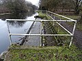
- Canals in Iver (9 F)
I
- Iver War Memorial (1 F)
R
S
- The Swan, Iver (2 F)
T
- Thorney Interchange (30 F)
Media in category "Iver"
The following 200 files are in this category, out of 731 total.
(previous page) (next page)-
 5k-9 Working dogs - geograph.org.uk - 5437566.jpg 4,381 × 2,589; 2.91 MB
-
 A fire damaged Blue Sapphire - geograph.org.uk - 3301583.jpg 640 × 480; 75 KB
-
-
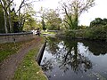
 A narrow boat on the Slough Arm of the Grand Union Canal - geograph.org.uk - 5958761.jpg 4,000 × 3,000; 4.5 MB
-
 A new road along the footpath - geograph.org.uk - 5594609.jpg 3,539 × 2,036; 1.31 MB
-
 A teazle west of the River Colne - geograph.org.uk - 5522400.jpg 480 × 640; 50 KB
-

-
 A weedy field - geograph.org.uk - 4325748.jpg 640 × 480; 165 KB
-
 A4007 (Slough Road) bridge over M25 - geograph.org.uk - 5431496.jpg 1,600 × 1,201; 607 KB
-
 A412 - Denham Road, Iver - geograph.org.uk - 854316.jpg 640 × 480; 86 KB
-
 A412 - geograph.org.uk - 3207738.jpg 640 × 430; 50 KB
-
 A412 near Iver Heath - geograph.org.uk - 3501057.jpg 640 × 480; 91 KB
-
 A412, Church Rd - geograph.org.uk - 3207745.jpg 640 × 430; 68 KB
-
 A412, Denham Rd - geograph.org.uk - 3207763.jpg 640 × 393; 72 KB
-
 Abandoned Land across the Colne - geograph.org.uk - 2663027.jpg 3,512 × 2,232; 1.13 MB
-
 Above ground goes under ground - geograph.org.uk - 5425565.jpg 640 × 480; 118 KB
-
 Alder Road, Iver Heath - geograph.org.uk - 4179040.jpg 640 × 480; 89 KB
-
 Alderbourne Farm near Fulmer - geograph.org.uk - 20386.jpg 640 × 480; 110 KB
-
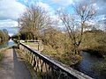
 An aqueduct on the Slough Arm of the Grand Union Canal - geograph.org.uk - 5958766.jpg 4,000 × 3,000; 4.97 MB
-
 Anslow Gardens looking west - geograph.org.uk - 3470681.jpg 800 × 600; 145 KB
-
 Anslow Gardens, Iver Heath - geograph.org.uk - 3501098.jpg 640 × 480; 78 KB
-
 Anti-clockwise M25 - geograph.org.uk - 3725664.jpg 640 × 480; 255 KB
-

-

-

-
 Aqueduct No 2 - Slough Arm, Grand Union Canal - geograph.org.uk - 5266305.jpg 3,648 × 2,056; 4.94 MB
-

-

-
-
 Aqueduct on the Slough Arm of the Grand Union Canal - geograph.org.uk - 5958774.jpg 4,000 × 3,000; 4.96 MB
-
 Aqueduct over the Colne - geograph.org.uk - 2085082.jpg 640 × 460; 124 KB
-
 Army ambulance near Iver village - geograph.org.uk - 5437832.jpg 4,272 × 2,578; 2.32 MB
-
-
 Attractive bridleway - geograph.org.uk - 3470663.jpg 600 × 800; 242 KB
-
 B470 (Iver Lane) bridge over M25 - geograph.org.uk - 5431480.jpg 1,600 × 1,277; 705 KB
-
 Back-lot in Pinewood Studios - geograph.org.uk - 3195288.jpg 640 × 480; 141 KB
-
 Back-lot in Pinewood Studios - geograph.org.uk - 3195290.jpg 640 × 480; 115 KB
-
 Bangor Road South - geograph.org.uk - 3192181.jpg 640 × 480; 169 KB
-
 Bangors Road North, Iver Heath - geograph.org.uk - 3501084.jpg 640 × 480; 84 KB
-
 Bangors Road North, Iver Heath - geograph.org.uk - 3501089.jpg 640 × 480; 110 KB
-
 Bangors Road North, Iver Heath - geograph.org.uk - 3501093.jpg 640 × 480; 94 KB
-
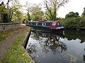
 Barge, Grand Union Canal - geograph.org.uk - 2085108.jpg 640 × 480; 109 KB
-
 Barge, Grand Union Canal - geograph.org.uk - 2085112.jpg 640 × 480; 115 KB
-
 Barrier on drive to Cherry Orchard Farm - geograph.org.uk - 4320138.jpg 640 × 480; 160 KB
-
 Bathurst Walk and Wellesley Ave junction, Iver - geograph.org.uk - 5437549.jpg 5,202 × 3,465; 3.49 MB
-
 Bathurst Walk, Richings Park - geograph.org.uk - 3381845.jpg 1,600 × 1,204; 538 KB
-
 Bee Orchid by path - geograph.org.uk - 5423194.jpg 480 × 640; 139 KB
-
 Beeches Way (78) - geograph.org.uk - 3474799.jpg 800 × 600; 190 KB
-
 Beeches Way (79) - geograph.org.uk - 3474800.jpg 800 × 600; 122 KB
-
 Beeches Way (80) - geograph.org.uk - 3474802.jpg 800 × 600; 103 KB
-
 Beeches Way (81) - geograph.org.uk - 3474807.jpg 800 × 600; 236 KB
-
 Beeches Way (82) - geograph.org.uk - 3474808.jpg 800 × 600; 212 KB
-
 Beeches Way (83) - geograph.org.uk - 3474811.jpg 800 × 600; 153 KB
-
 Beeches Way (84) - geograph.org.uk - 3474816.jpg 600 × 800; 180 KB
-
 Beeches Way (85) - geograph.org.uk - 3474821.jpg 800 × 600; 101 KB
-
 Beeches Way (86) - geograph.org.uk - 3474850.jpg 800 × 600; 100 KB
-
 Beeches Way (87) - geograph.org.uk - 3474852.jpg 800 × 600; 107 KB
-
 Beeches Way (88) - geograph.org.uk - 3474854.jpg 800 × 600; 124 KB
-
 Beeches Way (89) - geograph.org.uk - 3474857.jpg 800 × 600; 107 KB
-
 Beeches Way (90) - geograph.org.uk - 3474859.jpg 600 × 800; 91 KB
-
 Beeches Way (91) - geograph.org.uk - 3474868.jpg 600 × 800; 152 KB
-
 Beeches Way (92) - geograph.org.uk - 3474871.jpg 600 × 800; 129 KB
-
 Beeches Way - geograph.org.uk - 3176903.jpg 2,012 × 1,510; 2.44 MB
-
 Beeches Way - geograph.org.uk - 3176949.jpg 2,048 × 1,536; 3.26 MB
-
 Beeches Way - geograph.org.uk - 3301595.jpg 640 × 480; 161 KB
-
 Beeches Way - geograph.org.uk - 3301608.jpg 640 × 480; 133 KB
-
 Beeches Way Bridge - geograph.org.uk - 3445322.jpg 2,560 × 1,920; 1.78 MB
-

-

-
 Bellswood Lane, Iver - geograph.org.uk - 3176946.jpg 2,048 × 1,536; 3.33 MB
-
 Bend on bridleway - geograph.org.uk - 3470664.jpg 800 × 600; 192 KB
-
 Big house behind big wall - geograph.org.uk - 5272932.jpg 3,648 × 2,736; 5.07 MB
-
 Black Park Link Path - geograph.org.uk - 4325089.jpg 640 × 480; 163 KB
-
 Black Park Link Path - geograph.org.uk - 4325093.jpg 640 × 480; 192 KB
-
 BMX track - geograph.org.uk - 5213344.jpg 3,648 × 2,056; 3.75 MB
-
 Boatyard on the Canal - geograph.org.uk - 3378636.jpg 2,463 × 1,626; 1.02 MB
-
 Bodley House with clock tower - geograph.org.uk - 3470683.jpg 800 × 527; 81 KB
-
 Bridal path, Iver - geograph.org.uk - 4178973.jpg 640 × 480; 113 KB
-
 Bridge 3, Slough Arm, Grand Union Canal - geograph.org.uk - 4319363.jpg 640 × 480; 157 KB
-
 Bridge 4, Slough Arm, Grand Union Canal - geograph.org.uk - 4319200.jpg 640 × 480; 133 KB
-
 Bridge 5, Slough Arm, Grand Union Canal - geograph.org.uk - 4491972.jpg 2,832 × 2,128; 2.43 MB
-

-
 Bridge on the River Colne - geograph.org.uk - 5239429.jpg 3,648 × 2,056; 5.36 MB
-
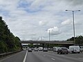
 Bridge over M25 north of junction 4A - geograph.org.uk - 5431454.jpg 1,600 × 1,066; 667 KB
-
 Bridge over stream near Denham - geograph.org.uk - 3501010.jpg 640 × 480; 124 KB
-
 Bridge over the M25 - geograph.org.uk - 4480339.jpg 640 × 432; 62 KB
-
 Bridge over the River Colne - geograph.org.uk - 5520248.jpg 640 × 480; 139 KB
-
 Bridge over the River Colne on Iver Lane - geograph.org.uk - 3470650.jpg 800 × 600; 154 KB
-
 Bridge remains over canal - geograph.org.uk - 5270248.jpg 3,648 × 2,056; 4.45 MB
-

-
 Bridges over the Grand Union Canal - geograph.org.uk - 2085125.jpg 640 × 480; 102 KB
-
 Bridlebridge over Colne Brook - geograph.org.uk - 3470668.jpg 800 × 600; 190 KB
-
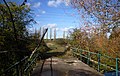
 Bridleway beside the M25 - geograph.org.uk - 4325609.jpg 640 × 480; 128 KB
-
 Bridleway crosses the M25 north of Iver - geograph.org.uk - 3470657.jpg 800 × 600; 132 KB
-
 Bridleway passing Palmers Moor Farm - geograph.org.uk - 3470655.jpg 800 × 600; 111 KB
-
 Bridleway view south of the M25 - geograph.org.uk - 3470659.jpg 800 × 600; 106 KB
-
 Broken Down Bridge - geograph.org.uk - 3448476.jpg 2,433 × 1,722; 1.53 MB
-

-
 Buckinghamshire County Sign - geograph.org.uk - 5594626.jpg 1,600 × 1,179; 584 KB
-
 Bucolic scene in Huntsmoor Park - geograph.org.uk - 5513541.jpg 640 × 480; 117 KB
-
 Bungalows on Love Lane - geograph.org.uk - 6021059.jpg 5,120 × 3,840; 5.18 MB
-
 By the Main Line - geograph.org.uk - 3967403.jpg 640 × 430; 52 KB
-
 Cafe in Richings Park - geograph.org.uk - 3381841.jpg 1,600 × 1,200; 557 KB
-
 Cafe O, Iver - geograph.org.uk - 5437553.jpg 5,202 × 3,465; 3.72 MB
-
 Canal Bridge near Iver - geograph.org.uk - 3448489.jpg 2,478 × 1,839; 1.76 MB
-
 Canal in winter - geograph.org.uk - 5270228.jpg 3,648 × 2,056; 5.12 MB
-
 Canal Weir - geograph.org.uk - 5270256.jpg 3,648 × 2,736; 5.56 MB
-
 Canal wharf, over grown remains - geograph.org.uk - 5581696.jpg 2,832 × 2,128; 1.5 MB
-
 Canal ^ Colne Brook - geograph.org.uk - 3381922.jpg 2,560 × 1,920; 2 MB
-
 Canal's aqueduct for River Colne - geograph.org.uk - 5270274.jpg 3,648 × 2,056; 4.12 MB
-
 Car Dealership, by the B470, Iver - geograph.org.uk - 5213367.jpg 3,648 × 2,056; 3.11 MB
-
 Car park near Iver - geograph.org.uk - 3908764.jpg 640 × 377; 36 KB
-
 Carriage for one awaits - geograph.org.uk - 3470725.jpg 800 × 518; 115 KB
-
 Cattle at Huntsmoor Park Farm - geograph.org.uk - 2159597.jpg 3,521 × 2,640; 1.87 MB
-
 Charter train pauses on the Colnbrook Branch - geograph.org.uk - 2786414.jpg 683 × 1,024; 237 KB
-
 Christmas lights on Iver High Street - geograph.org.uk - 5626663.jpg 2,304 × 1,728; 868 KB
-
 Christmas tree on Iver High Street - geograph.org.uk - 5626664.jpg 2,250 × 1,654; 1.06 MB
-
 Church of Saint Margaret of Antioch - geograph.org.uk - 4071987.jpg 4,320 × 3,240; 3.9 MB
-
 Church Road, Iver Heath - geograph.org.uk - 2824916.jpg 640 × 426; 193 KB
-
 Church Road, Iver Heath - geograph.org.uk - 3195063.jpg 640 × 480; 149 KB
-
 Clockwise M25, Mansfield Farm Bridge - geograph.org.uk - 3725614.jpg 640 × 480; 242 KB
-
 Clockwise M25, Thorney Mill Road Bridge - geograph.org.uk - 3725665.jpg 640 × 427; 232 KB
-

-
-

-

-
 Colne Brook - geograph.org.uk - 5423184.jpg 640 × 480; 179 KB
-
 Colne Brook Flows Under the M25 - geograph.org.uk - 6020431.jpg 5,120 × 3,840; 7.45 MB
-
 Colne Brook seen from Thorney Mill Road - geograph.org.uk - 3638950.jpg 800 × 600; 172 KB
-
 Colne Brook, Iver - geograph.org.uk - 3192174.jpg 480 × 640; 141 KB
-
 Colne Valley Trail near Thorney - geograph.org.uk - 5323954.jpg 4,608 × 3,456; 6.81 MB
-
 Colne Valley Trail next to Old Slade Road - geograph.org.uk - 5324837.jpg 4,608 × 3,456; 6.16 MB
-
 Colne Valley Way near Richings Park - geograph.org.uk - 5594535.jpg 3,782 × 2,438; 3.78 MB
-
 Communications antenna on Seven Hills Road - geograph.org.uk - 5624462.jpg 1,650 × 2,246; 1.31 MB
-
 Concrete thingy and digital billboard - geograph.org.uk - 5265040.jpg 3,648 × 2,736; 5.68 MB
-
 Coot family by nest on Farlows Lake - geograph.org.uk - 3470624.jpg 800 × 600; 161 KB
-
 Copas Farms pick-your-own parking space - geograph.org.uk - 4063795.jpg 2,272 × 1,704; 2.28 MB
-
 Coppins Farm - geograph.org.uk - 3176907.jpg 2,048 × 1,536; 2.78 MB
-
 Coppins Lane, Iver - geograph.org.uk - 3176880.jpg 1,988 × 1,490; 2.42 MB
-
 Copse near the Colne Brook - geograph.org.uk - 5522406.jpg 640 × 480; 124 KB
-

-
 Court Lane, Iver - geograph.org.uk - 5437562.jpg 4,770 × 2,852; 2.42 MB
-
 Cowley, Clisby's Bridge - geograph.org.uk - 4123049.jpg 1,024 × 768; 275 KB
-

-
 Crop fields, Iver - geograph.org.uk - 5064950.jpg 2,832 × 2,128; 1.91 MB
-
 Cut Bench Mark, St Peter's Church, Iver - geograph.org.uk - 2724595.jpg 2,304 × 1,728; 770 KB
-
 Cutting near Iver - geograph.org.uk - 5377807.jpg 640 × 426; 80 KB
-
 Dead tree close to Iver Lane - geograph.org.uk - 5221756.jpg 3,648 × 2,056; 5.94 MB
-
 Delaford Manor - geograph.org.uk - 3301600.jpg 640 × 480; 87 KB
-
 Denham Rd - geograph.org.uk - 3207755.jpg 640 × 400; 70 KB
-
 Denham Road - geograph.org.uk - 3192200.jpg 480 × 640; 73 KB
-
 Denham Road Bridge, M25 - geograph.org.uk - 2698772.jpg 640 × 430; 54 KB
-
 Denham Road, Iver Heath - geograph.org.uk - 3501076.jpg 640 × 480; 108 KB
-
 Derelict building off Pinewood Road - geograph.org.uk - 4325076.jpg 640 × 480; 176 KB
-
 Derelict phone box in Thorn Road, Iver - geograph.org.uk - 5437914.jpg 5,202 × 3,465; 3.5 MB
-
 Digging up the field - geograph.org.uk - 5594595.jpg 3,466 × 2,126; 1.67 MB
-
 Distant Uxbridge - geograph.org.uk - 5541345.jpg 2,832 × 2,128; 1.47 MB
-
 Disused bridge over canal - geograph.org.uk - 4491189.jpg 2,832 × 2,128; 2.34 MB
-

-

-
 Don't even bother trying - geograph.org.uk - 5522419.jpg 640 × 480; 148 KB
-

-

-

-

-
 Dromenagh Farm House - geograph.org.uk - 6227743.jpg 3,648 × 2,736; 3.13 MB
-
 Electricity Pylon at Thorney - geograph.org.uk - 4454762.jpg 1,683 × 2,873; 2.42 MB
-
 Electricity Pylons - geograph.org.uk - 5212145.jpg 3,648 × 2,056; 3.55 MB
-
 Emergency access to M25 near Uxbridge - geograph.org.uk - 5431487.jpg 1,600 × 1,066; 783 KB
-
 Empty Depot near Iver - geograph.org.uk - 3381853.jpg 2,118 × 1,422; 655 KB
-
 Entering Buckinghamshire on the M25 - geograph.org.uk - 3003368.jpg 800 × 600; 76 KB
-

-
 Entrance and notice at Iver Heath Fields - geograph.org.uk - 3470549.jpg 800 × 600; 149 KB
-

-

-
 Entrance to Pinewood Studios - geograph.org.uk - 3195294.jpg 640 × 480; 118 KB
-
 Entrance to Pinewood Studios - geograph.org.uk - 3470583.jpg 800 × 492; 63 KB
-
 Entrance to Richings Park Golf Club - geograph.org.uk - 3639032.jpg 800 × 601; 154 KB
-
 Evreham Road, Iver - geograph.org.uk - 3176940.jpg 2,048 × 1,536; 2.71 MB
-
 Exit road for the M40, off the M25 - geograph.org.uk - 2866380.jpg 640 × 480; 63 KB
-
 Farlows Lake - geograph.org.uk - 4325772.jpg 640 × 480; 115 KB
-
 Farlows Lake - geograph.org.uk - 4326017.jpg 640 × 480; 103 KB
-
 Farm Access Bridge over the M25 - geograph.org.uk - 3725672.jpg 640 × 480; 231 KB
-
 Farm Buildings by the Colne - geograph.org.uk - 2667898.jpg 3,288 × 2,232; 1.94 MB
-
 Farm Land near Palmer's Moor Farm - geograph.org.uk - 6227579.jpg 3,648 × 2,736; 2.85 MB
-
 Farmer's bridge - geograph.org.uk - 3192196.jpg 480 × 640; 76 KB
-
 Farmland - geograph.org.uk - 5377779.jpg 640 × 337; 40 KB
-
 Farmland east of Old Slade Lane - geograph.org.uk - 5910119.jpg 1,024 × 768; 245 KB
-

-

-
 Farmland, Langley - geograph.org.uk - 5587942.jpg 640 × 426; 54 KB
-
 Farmland, langley - geograph.org.uk - 5787048.jpg 640 × 425; 39 KB
-
 Field by the Colne Valley Way - geograph.org.uk - 5594432.jpg 1,600 × 1,067; 599 KB
-
 Field for grazing - geograph.org.uk - 5239406.jpg 3,648 × 2,056; 3.76 MB
-
 Field Next to the Colne Valley Trail - geograph.org.uk - 6227119.jpg 5,120 × 3,840; 4.09 MB
-
 Field of Barley - geograph.org.uk - 5423223.jpg 640 × 480; 106 KB
-
 Field of barley - geograph.org.uk - 5423256.jpg 640 × 480; 114 KB
-
 Field path to Iver Heath - geograph.org.uk - 3470678.jpg 800 × 493; 101 KB
-
 Field South of the Seven Hills Road - geograph.org.uk - 6227369.jpg 2,262 × 1,694; 1.36 MB
-
 Field, off Thorn Road, south of Iver village - geograph.org.uk - 5437830.jpg 5,202 × 3,465; 3.54 MB


_bridge_over_M25_-_geograph.org.uk_-_5431496.jpg)


_over_the_River_Colne_(2)_-_geograph.org.uk_-_5516272.jpg)
_over_the_River_Colne_(3)_-_geograph.org.uk_-_5516283.jpg)
_over_the_River_Colne_-_geograph.org.uk_-_5516220.jpg)


_bridge_over_M25_-_geograph.org.uk_-_5431480.jpg)


_-_geograph.org.uk_-_3474799.jpg)
_-_geograph.org.uk_-_3474800.jpg)
_-_geograph.org.uk_-_3474802.jpg)
_-_geograph.org.uk_-_3474807.jpg)
_-_geograph.org.uk_-_3474808.jpg)
_-_geograph.org.uk_-_3474811.jpg)
_-_geograph.org.uk_-_3474816.jpg)
_-_geograph.org.uk_-_3474821.jpg)
_-_geograph.org.uk_-_3474850.jpg)
_-_geograph.org.uk_-_3474852.jpg)
_-_geograph.org.uk_-_3474854.jpg)
_-_geograph.org.uk_-_3474857.jpg)
_-_geograph.org.uk_-_3474859.jpg)
_-_geograph.org.uk_-_3474868.jpg)
_-_geograph.org.uk_-_3474871.jpg)


