Category:Itchingfield
Jump to navigation
Jump to search

village in the United Kingdom  | |||||
| Upload media | |||||
| Instance of | |||||
|---|---|---|---|---|---|
| Location | Horsham, West Sussex, South East England, England | ||||
| Area |
| ||||
| official website | |||||
 | |||||
Subcategories
This category has only the following subcategory.
I
Media in category "Itchingfield"
The following 200 files are in this category, out of 393 total.
(previous page) (next page)-
 A fallow field near Itchingfield - geograph.org.uk - 2960141.jpg 640 × 430; 63 KB
-
 A field of wheat by the old railway line - geograph.org.uk - 1869170.jpg 640 × 430; 114 KB
-

-

-

-
 A wet day on the old Cranleigh line - geograph.org.uk - 1869200.jpg 640 × 430; 171 KB
-
 A264 - geograph.org.uk - 2955671.jpg 640 × 458; 86 KB
-
 A264 crosses the Downs Link - geograph.org.uk - 1869268.jpg 640 × 430; 138 KB
-
 A264 in Rookery Wood - geograph.org.uk - 2971661.jpg 640 × 430; 133 KB
-
 A264, Five Oaks Rd - geograph.org.uk - 2971657.jpg 640 × 430; 120 KB
-
 A264, Rookery Wood - geograph.org.uk - 2971659.jpg 640 × 430; 125 KB
-
 Across the Field - geograph.org.uk - 5570747.jpg 3,780 × 2,520; 7.68 MB
-
 An empty manger - geograph.org.uk - 2352538.jpg 640 × 428; 117 KB
-
 An interesting Fingerpost - geograph.org.uk - 3392159.jpg 1,600 × 1,126; 653 KB
-

-
 Approach to Itchingfield from the east - geograph.org.uk - 1591927.jpg 640 × 480; 100 KB
-

-
 Arun Valley line - geograph.org.uk - 2670136.jpg 640 × 430; 123 KB
-
 Arun Valley Line - geograph.org.uk - 2672649.jpg 640 × 430; 101 KB
-
 Barn by the old railway line - geograph.org.uk - 1869211.jpg 640 × 430; 158 KB
-
 Barns at Possessionhouse Farm - geograph.org.uk - 530046.jpg 640 × 482; 73 KB
-
 Barns Green - geograph.org.uk - 5569211.jpg 3,720 × 2,480; 7.69 MB
-
 Barns Green - geograph.org.uk - 5569366.jpg 3,960 × 2,640; 7.68 MB
-
 Barns Green - geograph.org.uk - 5569370.jpg 3,420 × 2,280; 7.62 MB
-
 Barns Green - geograph.org.uk - 5569548.jpg 6,000 × 4,000; 7.25 MB
-
 Barns Green - geograph.org.uk - 5569552.jpg 6,000 × 4,000; 7.28 MB
-
 Barns Green Sun Clock - geograph.org.uk - 5569562.jpg 3,360 × 2,240; 7.73 MB
-
 Bashurst Copse - geograph.org.uk - 2963564.jpg 640 × 430; 151 KB
-
 Bashurst Copse - geograph.org.uk - 2963584.jpg 640 × 430; 154 KB
-
 Bashurst Hill - geograph.org.uk - 1282584.jpg 640 × 480; 119 KB
-
 Bashurst Hill - geograph.org.uk - 2955673.jpg 640 × 430; 70 KB
-
 Bashurst Hill - geograph.org.uk - 2968716.jpg 640 × 430; 140 KB
-
 Bashurst Hill - geograph.org.uk - 2968717.jpg 640 × 430; 131 KB
-
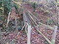
 Baystone Bridge - geograph.org.uk - 3363877.jpg 1,600 × 1,200; 603 KB
-
 Baystone Bridge - geograph.org.uk - 5381017.jpg 800 × 549; 137 KB
-
 Baystone Farm land-fill site - geograph.org.uk - 411305.jpg 640 × 480; 51 KB
-
 Bishop's Wood near Five Oaks - geograph.org.uk - 1594257.jpg 640 × 480; 135 KB
-

-
 Bluebells on the railway embankment - geograph.org.uk - 1869134.jpg 640 × 430; 207 KB
-
 Breached pond bay, Bashurst Copse - geograph.org.uk - 2124270.jpg 640 × 428; 174 KB
-
 Bridge over Five Oaks Road - geograph.org.uk - 3363869.jpg 1,600 × 1,200; 572 KB
-
 Bridge over the old Cranleigh line - geograph.org.uk - 1869140.jpg 640 × 430; 186 KB
-
 Bridge over the old Cranleigh line - geograph.org.uk - 1869222.jpg 640 × 430; 164 KB
-
 Bridleway - geograph.org.uk - 530032.jpg 640 × 482; 89 KB
-

-
 Bridleway between oak trees - geograph.org.uk - 5858615.jpg 4,608 × 3,456; 5.79 MB
-
 Bridleway crosses Rye Farm Gill - geograph.org.uk - 5227488.jpg 800 × 600; 223 KB
-
 Bridleway entrance into Bishop's Wood - geograph.org.uk - 1594244.jpg 640 × 480; 126 KB
-

-
 Bridleway to A264 - geograph.org.uk - 2968779.jpg 640 × 430; 85 KB
-
 Bridleway to Elmhurst Farm - geograph.org.uk - 2968757.jpg 640 × 430; 134 KB
-
 Bridleway to the A264 - geograph.org.uk - 2971654.jpg 640 × 430; 77 KB
-
 Bridleway, Elmhurst Farm - geograph.org.uk - 2968765.jpg 640 × 430; 129 KB
-
 Bridleway, Rookery Wood - geograph.org.uk - 2971665.jpg 640 × 430; 139 KB
-
 Buildings at Weston's Farm - geograph.org.uk - 4862988.jpg 800 × 600; 78 KB
-
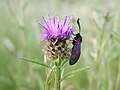 Burnet moth on Knapweed - geograph.org.uk - 395638.jpg 640 × 480; 44 KB
-
 Cattle with plenty of grass - geograph.org.uk - 2124312.jpg 640 × 428; 142 KB
-
 Christ's Hospital rail station - geograph.org.uk - 4849998.jpg 800 × 600; 161 KB
-
 Christ's Hospital Railway Station - geograph.org.uk - 3856403.jpg 1,600 × 876; 403 KB
-
 Christ's Hospital Railway Station - geograph.org.uk - 3856415.jpg 1,600 × 1,196; 439 KB
-
 Christ's Hospital Railway Station - geograph.org.uk - 3856417.jpg 1,600 × 1,183; 349 KB
-
 Christ's Hospital Railway Station - geograph.org.uk - 5570877.jpg 3,480 × 2,320; 7.61 MB
-
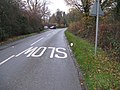
 Christ's Hospital Rd - geograph.org.uk - 1296402.jpg 640 × 321; 39 KB
-
 Christ's Hospital Rd - geograph.org.uk - 2956980.jpg 640 × 430; 60 KB
-
 Christ's Hospital Rd - geograph.org.uk - 2957007.jpg 640 × 430; 83 KB
-
 Christ's Hospital Rd - geograph.org.uk - 2957011.jpg 640 × 430; 77 KB
-
 Christ's Hospital Rd - geograph.org.uk - 2957014.jpg 640 × 430; 74 KB
-
 Christ's Hospital Rd - geograph.org.uk - 2957024.jpg 640 × 430; 58 KB
-
 Church behind a Yew tree - geograph.org.uk - 2963541.jpg 430 × 640; 81 KB
-
 Church Corner Cottage - geograph.org.uk - 2960189.jpg 640 × 430; 92 KB
-
 Church Farmhouse - geograph.org.uk - 2960210.jpg 640 × 430; 79 KB
-
 Church Farmhouse - geograph.org.uk - 2963548.jpg 640 × 430; 80 KB
-

-

-
 Communications centre on Bashurst Hill - geograph.org.uk - 4813711.jpg 800 × 600; 188 KB
-

-
 Coppiced trees by the old Cranleigh line - geograph.org.uk - 1869190.jpg 640 × 430; 193 KB
-
 Coppiced trees by the old Cranleigh line - geograph.org.uk - 1869207.jpg 640 × 430; 198 KB
-
 Coppicing, Bashurst Copse - geograph.org.uk - 2963582.jpg 640 × 430; 136 KB
-
 Cottage by Batchelors - geograph.org.uk - 2124321.jpg 640 × 428; 94 KB
-
 Crop field, Fulford Farm - geograph.org.uk - 1869232.jpg 640 × 430; 124 KB
-
 Crops by the Downs Link - geograph.org.uk - 1869245.jpg 640 × 430; 122 KB
-
 Culvert under old railway embankment - geograph.org.uk - 2154700.jpg 640 × 480; 213 KB
-

-
 Do Not loiter on Footpath^ - geograph.org.uk - 3363881.jpg 1,600 × 1,200; 268 KB
-
 Downs Link (2) - geograph.org.uk - 1869240.jpg 640 × 430; 145 KB
-
 Downs Link (3) - geograph.org.uk - 1869258.jpg 640 × 430; 127 KB
-
 Downs Link - geograph.org.uk - 1869238.jpg 640 × 430; 148 KB
-
 Downs Link - geograph.org.uk - 1869264.jpg 640 × 430; 129 KB
-
 Dwelling at Lower Toat Farm - geograph.org.uk - 4813703.jpg 800 × 600; 173 KB
-
 Dwelling by bridleway on Bashurst Hill - geograph.org.uk - 4813727.jpg 800 × 600; 115 KB
-
 East of Five Oaks from the air - geograph.org.uk - 5151089.jpg 1,875 × 1,256; 610 KB
-
 Elmhurst Farm - geograph.org.uk - 2968747.jpg 640 × 430; 66 KB
-
 Elmhurst Farm - geograph.org.uk - 2968780.jpg 640 × 430; 64 KB
-
 Emms Lane, Barns Green - geograph.org.uk - 3665779.jpg 4,320 × 3,240; 4.28 MB
-
 End of Bridleway BW1911 - geograph.org.uk - 3247771.jpg 3,745 × 2,400; 1.81 MB
-
 Entering Lower Toat Farm - geograph.org.uk - 2968721.jpg 640 × 430; 133 KB
-
 Entrance to Sidings Cottages - geograph.org.uk - 3346100.jpg 1,600 × 1,200; 368 KB
-
 Entrance to St Nicholas Church - geograph.org.uk - 3366850.jpg 1,600 × 1,200; 383 KB
-
 Entrance to Weston's Farm Shop - geograph.org.uk - 3346068.jpg 1,600 × 1,200; 250 KB
-
 Entrance to Westons Farmshop - geograph.org.uk - 1650074.jpg 640 × 480; 86 KB
-
 Evening - Bashurst Hill - geograph.org.uk - 3694935.jpg 2,778 × 1,891; 322 KB
-
 Fallow field by the Downs Link - geograph.org.uk - 1869235.jpg 640 × 430; 122 KB
-
 Farm entrance - geograph.org.uk - 3329299.jpg 1,600 × 1,162; 652 KB
-
 Farm entrance - geograph.org.uk - 3366865.jpg 1,600 × 1,200; 396 KB
-
 Farm gates by the A264 - geograph.org.uk - 2957848.jpg 640 × 430; 59 KB
-
 Farmland near Weston's Farm - geograph.org.uk - 2955665.jpg 640 × 430; 46 KB
-
 Farmland, Sharpenhurst Farm - geograph.org.uk - 2596515.jpg 640 × 331; 24 KB
-
 Fence, Lower Toat Farm - geograph.org.uk - 2968741.jpg 640 × 430; 113 KB
-
 Field near Bashurst Copse - geograph.org.uk - 2963601.jpg 640 × 430; 61 KB
-

-
 Fingerpost for Public Bridleway BW1466-1 - geograph.org.uk - 3329302.jpg 1,600 × 1,192; 626 KB
-
 Firwood House - geograph.org.uk - 2963609.jpg 640 × 430; 80 KB
-
 Firwood House - geograph.org.uk - 2968705.jpg 640 × 430; 78 KB
-

-
 Footbridge over North Gill - geograph.org.uk - 2963589.jpg 640 × 430; 149 KB
-
 Footpath - geograph.org.uk - 530028.jpg 640 × 482; 108 KB
-

-
 Footpath Across the Field - geograph.org.uk - 5569623.jpg 3,540 × 2,360; 7.8 MB
-

-
 Footpath goes east from Bashurst Hill - geograph.org.uk - 4813732.jpg 800 × 600; 176 KB
-
 Footpath goes east to Lower Toat Farm - geograph.org.uk - 4813695.jpg 800 × 600; 189 KB
-

-
 Footpath junction - geograph.org.uk - 2968719.jpg 640 × 430; 136 KB
-
 Footpath junction at Lower Toat Farm - geograph.org.uk - 4813705.jpg 800 × 600; 178 KB
-
 Footpath junction, Bashurst Copse - geograph.org.uk - 2963568.jpg 640 × 430; 139 KB
-

-
 Footpath lined with flowers - geograph.org.uk - 5380394.jpg 570 × 640; 168 KB
-
 Footpath notice at Muntham House School - geograph.org.uk - 4813773.jpg 800 × 600; 167 KB
-
 Footpath to Itchingfield - geograph.org.uk - 2960146.jpg 640 × 430; 66 KB
-
 Footpath to Itchingfield - geograph.org.uk - 2960155.jpg 640 × 430; 74 KB
-
 Footpath to Plumtree Cross Lane - geograph.org.uk - 2124291.jpg 640 × 428; 174 KB
-
 Footpath towards the River Arun - geograph.org.uk - 1869129.jpg 640 × 430; 210 KB
-
 Footpath west of St Nicholas church - geograph.org.uk - 1591956.jpg 640 × 480; 142 KB
-
 Footpath, Elmhurst Farm - geograph.org.uk - 2968739.jpg 640 × 399; 100 KB
-
 Fulford Farm - geograph.org.uk - 1869231.jpg 640 × 430; 114 KB
-
 Fulford Farm - geograph.org.uk - 1869243.jpg 640 × 430; 110 KB
-
 Fulford Farm - geograph.org.uk - 1869247.jpg 640 × 381; 62 KB
-

-
 Fulfords Hill - geograph.org.uk - 2955666.jpg 640 × 430; 53 KB
-
 Fulfords Hill NW towards the A 264 - geograph.org.uk - 1710437.jpg 1,600 × 1,200; 498 KB
-

-
 Gated service entrance - geograph.org.uk - 3399755.jpg 1,600 × 1,200; 782 KB
-
 Geese by pond on Eastlands Estate - geograph.org.uk - 1282060.jpg 640 × 480; 77 KB
-
 Grass verge by Weston Hill - geograph.org.uk - 2955663.jpg 640 × 430; 44 KB
-

-
 Grassland, Lower Toat Farm - geograph.org.uk - 2968732.jpg 640 × 430; 62 KB
-
 Guildings beside the lane (geograph 6820084).jpg 1,600 × 1,048; 561 KB
-
 Hang Man Barn - geograph.org.uk - 530008.jpg 640 × 482; 108 KB
-
 Horses in a field near Grassy Copse - geograph.org.uk - 2596525.jpg 640 × 430; 57 KB
-
 House near Lower Toat Farm - geograph.org.uk - 2968718.jpg 640 × 430; 85 KB
-
 House on Fulfords Hill - geograph.org.uk - 2960178.jpg 640 × 430; 76 KB
-
 Houses in Itchingfield - geograph.org.uk - 2960148.jpg 640 × 430; 59 KB
-
 Housing on Weston's Hill - geograph.org.uk - 4862992.jpg 800 × 600; 125 KB
-
 In Eastland Copse - geograph.org.uk - 2123652.jpg 640 × 428; 174 KB
-
 Inside St Nicholas Itchingfield (b) - geograph.org.uk - 3800205.jpg 640 × 480; 44 KB
-
 Inside St Nicholas Itchingfield (c) - geograph.org.uk - 3800209.jpg 640 × 480; 94 KB
-
 Inside St Nicholas Itchingfield (d) - geograph.org.uk - 3800214.jpg 640 × 480; 50 KB
-
 Inside St Nicholas Itchingfield (e) - geograph.org.uk - 3800222.jpg 480 × 640; 85 KB
-
 Inside St Nicholas Itchingfield (f) - geograph.org.uk - 3800227.jpg 640 × 480; 82 KB
-
 Inside St Nicholas, Itchingfield (a) - geograph.org.uk - 3800198.jpg 480 × 640; 44 KB
-
 Itchingfield - geograph.org.uk - 5569903.jpg 4,140 × 2,328; 7.77 MB
-
 Itchingfield - geograph.org.uk - 5570744.jpg 4,080 × 2,295; 7.76 MB
-
 Itchingfield Church - geograph.org.uk - 5380352.jpg 640 × 480; 68 KB
-

-
 Itchingfield foot crossing - geograph.org.uk - 4361507.jpg 428 × 640; 160 KB
-
 Itchingfield foot crossing - geograph.org.uk - 4361512.jpg 640 × 428; 124 KB
-
 Itchingfield foot crossing - geograph.org.uk - 4361516.jpg 640 × 428; 143 KB
-
 Itchingfield foot crossing - geograph.org.uk - 4361521.jpg 640 × 428; 136 KB
-
 Itchingfield foot crossing - geograph.org.uk - 4361536.jpg 428 × 640; 141 KB
-
 Itchingfield Junior School - geograph.org.uk - 5569923.jpg 3,120 × 2,080; 7.73 MB
-
 Itchingfield Primary school - geograph.org.uk - 1591935.jpg 640 × 480; 69 KB
-
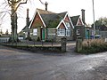 Itchingfield School - geograph.org.uk - 1071438.jpg 640 × 480; 89 KB
-
 Itchingfield School - geograph.org.uk - 2960182.jpg 640 × 430; 73 KB
-
 Junction of paths - geograph.org.uk - 3399854.jpg 1,600 × 1,200; 807 KB
-

-
 Junction on Bashurst Hill - geograph.org.uk - 4813738.jpg 800 × 600; 186 KB
-
 Lambs near Barns Green - geograph.org.uk - 2596517.jpg 640 × 430; 106 KB
-
 Landing Strip by the Downs Link - geograph.org.uk - 1869254.jpg 640 × 430; 100 KB
-
 Landing strip, Wellcross Grange - geograph.org.uk - 2211322.jpg 3,072 × 2,304; 1.81 MB
-
 Lay- by on Plumtree Cross Lane - geograph.org.uk - 1594316.jpg 640 × 480; 104 KB
-
 Level Crossing at Barns Green - geograph.org.uk - 5569200.jpg 3,240 × 2,160; 7.62 MB
-
 Level Crossing at Barns Green - geograph.org.uk - 5569417.jpg 3,780 × 2,520; 7.7 MB
-
 Level crossing, Emms Lane - geograph.org.uk - 2596518.jpg 640 × 353; 72 KB
-
-

-

-
 Looking north on Bashurst Hill - geograph.org.uk - 4813718.jpg 800 × 600; 150 KB
-

-
 Looking up the line to railway buildings - geograph.org.uk - 5227497.jpg 800 × 600; 136 KB
-

-
 Lower Barn - geograph.org.uk - 2672648.jpg 640 × 430; 106 KB
-
 Lower Toat Farm - geograph.org.uk - 2968723.jpg 640 × 430; 71 KB
-
 Lower Toat Farm - geograph.org.uk - 2968746.jpg 640 × 430; 61 KB
-
 MAN Resting - geograph.org.uk - 5569629.jpg 3,240 × 2,160; 7.7 MB
-
 Marlands Halt - geograph.org.uk - 2124298.jpg 640 × 428; 147 KB
-
 Mill Lane - geograph.org.uk - 411191.jpg 640 × 480; 113 KB
-
 Motorline Toyota, Lyons Corner, Five Oaks Road, Horsham - geograph.org.uk - 2930912.jpg 4,320 × 3,240; 3.74 MB
-
 Muntham Lodge - geograph.org.uk - 2124284.jpg 640 × 428; 137 KB
-
 Narrow footpath between fences - geograph.org.uk - 1282933.jpg 640 × 480; 107 KB


_-_geograph.org.uk_-_1869240.jpg)
_-_geograph.org.uk_-_1869258.jpg)


.jpg)


_-_geograph.org.uk_-_3800205.jpg)
_-_geograph.org.uk_-_3800209.jpg)
_-_geograph.org.uk_-_3800214.jpg)
_-_geograph.org.uk_-_3800222.jpg)
_-_geograph.org.uk_-_3800227.jpg)
_-_geograph.org.uk_-_3800198.jpg)


