Category:Irving Dam, taken by Lar
Jump to navigation
Jump to search
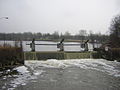
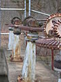
Images of, or related to, the Irving Dam, in Irving, Michigan on the Thornapple River, taken by User:Lar |
 Powerhouse:P Old control structure: O New control structure: S |
Media in category "Irving Dam, taken by Lar"
The following 7 files are in this category, out of 7 total.
-
 Irving Dam Thornapple River DSCN0162.JPG 1,600 × 1,200; 408 KB
-
 Irving Dam Thornapple River DSCN0164.JPG 1,600 × 1,200; 340 KB
-
 Irving Dam Thornapple River DSCN0166.JPG 1,600 × 1,200; 434 KB
-
 Irving Dam Thornapple River DSCN0169.JPG 1,600 × 1,200; 420 KB
-
 Irving Dam Thornapple River DSCN0176.JPG 1,600 × 1,200; 367 KB
-
 Irving Dam Thornapple River DSCN0177.JPG 1,200 × 1,600; 359 KB
-
 Irving Dam Thornapple River DSCN0179.JPG 1,600 × 1,200; 432 KB


