Category:Ironville
Jump to navigation
Jump to search
village and civil parish in Amber Valley district, Derbyshire, England  | |||||
| Upload media | |||||
| Instance of | |||||
|---|---|---|---|---|---|
| Location | Amber Valley, Derbyshire, East Midlands, England | ||||
 | |||||
Subcategories
This category has the following 4 subcategories, out of 4 total.
C
J
- The Jessop Monument (9 F)
Media in category "Ironville"
The following 139 files are in this category, out of 139 total.
-
 Access Point Information - geograph.org.uk - 5993232.jpg 824 × 1,280; 661 KB
-
 Bed of the Pinxton Canal - geograph.org.uk - 5991690.jpg 1,280 × 849; 574 KB
-
 Bed of the Pinxton Canal - geograph.org.uk - 5991770.jpg 1,280 × 960; 485 KB
-
 Bed of the Pinxton Canal - geograph.org.uk - 5991775.jpg 1,280 × 960; 496 KB
-
 Bench mark, Christ Church, Ironville - geograph.org.uk - 5991771.jpg 1,280 × 1,280; 750 KB
-
 Bench mark, former canal bridge, Ironville - geograph.org.uk - 5991776.jpg 1,280 × 1,280; 955 KB
-
 Bench mark, Station Lane, Codnor Park - geograph.org.uk - 5992465.jpg 1,280 × 1,280; 398 KB
-
 Bluebells in Foxhole Plantation - geograph.org.uk - 4947380.jpg 800 × 600; 232 KB
-
 Boat Dock Lock, Cromford Canal - geograph.org.uk - 3276369.jpg 1,280 × 856; 505 KB
-
 Boat Dock Lock, No.2, Cromford Canal - geograph.org.uk - 5992435.jpg 1,280 × 960; 537 KB
-
 Bottom of Flight Lock, Cromford Canal.jpg 1,280 × 960; 642 KB
-
 Bridge over disused Cromford Canal - geograph.org.uk - 4993741.jpg 3,072 × 1,728; 4.71 MB
-
 Bridge over the Cromford Canal in Ironville - geograph.org.uk - 2888154.jpg 3,206 × 2,346; 1.76 MB
-
 Bridge over the Cromford Canal, Ironville (2).jpg 1,280 × 960; 1.61 MB
-
 Bridge over the Cromford Canal, Ironville.jpg 800 × 600; 129 KB
-
 Bridge over the entrance to the basin at Jacksdale - geograph.org.uk - 5309272.jpg 1,600 × 1,200; 929 KB
-
 Bridge over the Pinxton Canal - geograph.org.uk - 2972308.jpg 1,024 × 768; 180 KB
-
 Bridge remains by the Cromford Canal - geograph.org.uk - 3274556.jpg 1,280 × 856; 360 KB
-

-
 Bulrushes in the Cromford Canal - geograph.org.uk - 3276312.jpg 1,280 × 856; 247 KB
-
 Canal bridge, Adelaide Walk, Ironville - geograph.org.uk - 5991781.jpg 1,280 × 965; 586 KB
-
 Christ church in Ironville. - geograph.org.uk - 5941372.jpg 1,024 × 684; 209 KB
-
 Christ Church, Ironville - geograph.org.uk - 1833589.jpg 640 × 480; 61 KB
-
 Christ Church, Ironville - geograph.org.uk - 4963770.jpg 5,097 × 3,712; 4.62 MB
-
 Christ Church, Ironville - geograph.org.uk - 5991778.jpg 1,020 × 1,280; 299 KB
-
 Church hall, Ironville - geograph.org.uk - 1833590.jpg 640 × 377; 67 KB
-
 Coal train at Codnor Park - 1995 - geograph.org.uk - 4132611.jpg 1,024 × 768; 525 KB
-
 Codnor Park Reservoir - geograph.org.uk - 1463248.jpg 640 × 480; 78 KB
-
 Codnor Park Reservoir - geograph.org.uk - 3274523.jpg 1,280 × 856; 114 KB
-
 Codnor park reservoir. - geograph.org.uk - 5941383.jpg 1,024 × 768; 242 KB
-
 Codnorpark Reservoir - geograph.org.uk - 4946833.jpg 3,072 × 1,728; 1.93 MB
-
 Codnorpark Reservoir - geograph.org.uk - 4961878.jpg 800 × 600; 79 KB
-
 Cromford canal (disused) near Jacksdale - geograph.org.uk - 1833620.jpg 640 × 480; 106 KB
-
 Cromford Canal at Codnor Park - geograph.org.uk - 5991631.jpg 1,280 × 960; 669 KB
-
 Cromford Canal near Jacksdale - geograph.org.uk - 5992512.jpg 1,280 × 960; 612 KB
-
 Cromford Canal, near Jacksdale - geograph.org.uk - 3276372.jpg 1,280 × 856; 392 KB
-
 Crossing the Cromford Canal - geograph.org.uk - 3275731.jpg 1,280 × 856; 415 KB
-
 Crossing the remains of the Cromford Canal - geograph.org.uk - 4993751.jpg 2,982 × 1,548; 4.64 MB
-
 Crossings Club, Ironville - geograph.org.uk - 4965071.jpg 5,047 × 3,748; 4.03 MB
-
 Derbyshire UK parish map highlighting Ironville.svg 888 × 1,308; 2.34 MB
-
 Disused canal, Ironville - geograph.org.uk - 1833598.jpg 640 × 480; 110 KB
-
 Erewash Meadows Local Nature Reserve - geograph.org.uk - 5992484.jpg 1,280 × 860; 299 KB
-
 Erewash Meadows Local Nature Reserve - geograph.org.uk - 5992485.jpg 1,280 × 867; 294 KB
-
 Erewash Meadows Local Nature Reserve - geograph.org.uk - 5992487.jpg 1,280 × 829; 254 KB
-
 Erewash Meadows Local Nature Reserve - geograph.org.uk - 5992490.jpg 1,280 × 814; 176 KB
-
 Erewash Valley Line - geograph.org.uk - 4290634.jpg 640 × 350; 70 KB
-
 Erewash Valley railway line, Codnor Park - geograph.org.uk - 5992476.jpg 1,280 × 832; 322 KB
-
 Farmland near Codnor Park - geograph.org.uk - 1833607.jpg 640 × 480; 60 KB
-
 Farmland on the west bank of the River Erewash - geograph.org.uk - 5505140.jpg 1,024 × 768; 262 KB
-
 Fishing platform at Codnorpark Reservoir - geograph.org.uk - 5991636.jpg 1,280 × 960; 604 KB
-
 Footbridge at Codnorpark Reservoir - geograph.org.uk - 5991639.jpg 960 × 1,280; 451 KB
-
 Footbridge in the Erewash Valley - geograph.org.uk - 4963991.jpg 3,888 × 5,184; 6.08 MB
-
 Footbridge over the railway south of Codnor Park - geograph.org.uk - 5309276.jpg 1,600 × 1,200; 672 KB
-
 Footpath Bridge, Stoneyford (aka Monkey Bridge) - geograph.org.uk - 2994970.jpg 1,600 × 1,200; 424 KB
-
 Footpath by the Cromford Canal near Jacksdale - geograph.org.uk - 2888132.jpg 3,226 × 2,376; 1.97 MB
-
 Footpath to Jacksdale - geograph.org.uk - 5992433.jpg 1,280 × 960; 464 KB
-
 Former canal bridge at Ironville - geograph.org.uk - 5991671.jpg 1,280 × 856; 445 KB
-
 Former canal bridge at Ironville - geograph.org.uk - 5991674.jpg 1,280 × 960; 432 KB
-
 Former canal bridge at Ironville - geograph.org.uk - 5991678.jpg 1,280 × 960; 472 KB
-

-
 Former Mechanics Institute, Ironville - geograph.org.uk - 5992434.jpg 1,280 × 866; 836 KB
-
 Gas House Lock, Cromford Canal.jpg 1,280 × 960; 1.32 MB
-
 Gas House Lock, No.5, Cromford Canal - geograph.org.uk - 5992382.jpg 1,280 × 960; 455 KB
-

-

-
 Golden valley cottages.jpg 600 × 400; 118 KB
-
 Ironville - Adelaide Walk - geograph.org.uk - 953818.jpg 415 × 640; 91 KB
-
 Ironville - Codnor Park Lock (view west) - geograph.org.uk - 1044900.jpg 640 × 480; 113 KB
-
 Ironville - Primary School - geograph.org.uk - 1044892.jpg 640 × 467; 72 KB
-
 Ironville 227337 88c39afd.jpg 640 × 421; 106 KB
-
 Ironville House - geograph.org.uk - 5991721.jpg 1,280 × 920; 482 KB
-
 Ironville House.jpg 1,280 × 960; 368 KB
-
 Ironville Market Place - geograph.org.uk - 5991695.jpg 1,280 × 810; 451 KB
-
 Ironville Market Place - geograph.org.uk - 5991710.jpg 1,280 × 784; 552 KB
-
 Ironville2.JPG 577 × 385; 42 KB
-

-
 King William Square - geograph.org.uk - 2441241.jpg 2,973 × 2,230; 2.65 MB
-
 Marshall's Lock, Cromford Canal.jpg 1,280 × 946; 563 KB
-
 Marshall's Lock, No.6, Cromford Canal - geograph.org.uk - 5992521.jpg 1,280 × 886; 675 KB
-
 Marshall's Lock, No.6, Cromford Canal - geograph.org.uk - 5992527.jpg 1,280 × 960; 565 KB
-

-
 Monument Lane towards Codnor Park - geograph.org.uk - 1833554.jpg 640 × 480; 111 KB
-
 Monument Lane, Codnor Park - geograph.org.uk - 5992438.jpg 1,280 × 845; 397 KB
-
 Monument Lane, Codnor Park - geograph.org.uk - 5992462.jpg 1,280 × 883; 389 KB
-
 New Road, Codnor Park - geograph.org.uk - 5992463.jpg 1,280 × 862; 231 KB
-
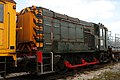 NS 9 Midland Railway Centre.jpg 3,456 × 2,304; 5.97 MB
-
 Parking area near King William Square - geograph.org.uk - 2441267.jpg 3,397 × 1,911; 3.46 MB
-
 Parson's Cottage, Ironville - geograph.org.uk - 5991772.jpg 1,280 × 960; 379 KB
-
 Passenger train at Codnor Park - 1995 - geograph.org.uk - 4132647.jpg 1,006 × 744; 557 KB
-
 Path alongside the Disused Cromford Canal - geograph.org.uk - 2888026.jpg 3,296 × 2,472; 1.67 MB
-
 Path towards Jacksdale - geograph.org.uk - 4993747.jpg 3,040 × 1,670; 3.93 MB
-
 Paths next to Codnor Park Reservoir - geograph.org.uk - 1463257.jpg 640 × 480; 124 KB
-
 Pink purslane flowering in Foxhole Plantation - geograph.org.uk - 4963996.jpg 3,614 × 5,059; 5.55 MB
-
 Pinxton Arm bridge, Codnor Park - geograph.org.uk - 3275013.jpg 1,280 × 856; 383 KB
-
 Pinxton Arm bridge, Codnor Park - geograph.org.uk - 3275138.jpg 1,280 × 856; 308 KB
-
 Pond in the woods near Codnor Park - geograph.org.uk - 3275663.jpg 1,280 × 856; 389 KB
-
 Pottery Lock, Cromford Canal - geograph.org.uk - 3276357.jpg 1,280 × 856; 300 KB
-
 Pottery Lock, Cromford Canal - geograph.org.uk - 3276364.jpg 1,280 × 856; 271 KB
-
 Pottery Lock, Cromford Canal - geograph.org.uk - 5309266.jpg 1,600 × 1,200; 735 KB
-

-
 Pottery Lock, No.3, Cromford Canal - geograph.org.uk - 5991782.jpg 1,280 × 915; 509 KB
-
 Pound above Marshall's Lock, Cromford Canal - geograph.org.uk - 5992528.jpg 1,280 × 955; 455 KB
-
 Pye Bridge - geograph.org.uk - 1468642.jpg 640 × 480; 102 KB
-
 Railway bridge, Nottingham Road, Ironville - geograph.org.uk - 4963772.jpg 4,960 × 3,628; 5.65 MB
-
 Railway bridges near Ironville (2) - geograph.org.uk - 2972189.jpg 1,024 × 768; 181 KB
-
 Railway bridges near Ironville (3) - geograph.org.uk - 2972197.jpg 1,024 × 768; 217 KB
-
 Railway bridges near Ironville (4) - geograph.org.uk - 2972208.jpg 1,024 × 768; 224 KB
-
 Railway line - geograph.org.uk - 4349689.jpg 640 × 480; 107 KB
-
 Railway lines towards Nottingham - geograph.org.uk - 1833615.jpg 640 × 480; 72 KB
-

-
 Remains of bridge over the Cromford Canal - geograph.org.uk - 5992508.jpg 1,280 × 960; 523 KB
-
 Remnants of a bridge - geograph.org.uk - 4290629.jpg 640 × 430; 78 KB
-

-

-

-

-

-
 Site of Codnor Park ^ Ironville Station - geograph.org.uk - 5993233.jpg 1,280 × 960; 609 KB
-

-
 Site of Portland Wharf - geograph.org.uk - 5992517.jpg 1,280 × 875; 409 KB
-
 Small lake within Foxhole Plantation - geograph.org.uk - 4993778.jpg 3,072 × 1,728; 5.48 MB
-
 Smith's Lock, Cromford Canal - geograph.org.uk - 3276366.jpg 1,280 × 856; 351 KB
-
 Smith's Lock, Cromford Canal - geograph.org.uk - 3276367.jpg 1,280 × 856; 437 KB
-
 Smith's Lock, No.4, Cromford Canal - geograph.org.uk - 5992375.jpg 1,280 × 816; 1.47 MB
-
 Stagnant Pond - geograph.org.uk - 2994980.jpg 1,600 × 1,200; 931 KB
-
 Station Lane Bridge, Codnor Park - geograph.org.uk - 5993234.jpg 1,280 × 960; 476 KB
-
 Station Lane Bridge, Codnor Park, notice - geograph.org.uk - 5993235.jpg 1,280 × 960; 391 KB
-
 Station Lane, Codnor Park - geograph.org.uk - 5992471.jpg 1,280 × 960; 535 KB
-
 Swan on the Cromford Canal - geograph.org.uk - 3275830.jpg 1,280 × 856; 284 KB
-
 Terrace on Casson Street - geograph.org.uk - 5991719.jpg 1,280 × 833; 384 KB
-
 The dam at Codnorpark Reservoir - geograph.org.uk - 5992436.jpg 1,280 × 852; 454 KB
-
 The former Pinxton Arm, the Cromford Canal - geograph.org.uk - 4236504.jpg 1,024 × 768; 179 KB
-
 Track towards Kennels Farm (footpath) - geograph.org.uk - 1833608.jpg 640 × 480; 112 KB
-
 View at the end of Codnor Park Reservoir - geograph.org.uk - 1463279.jpg 640 × 480; 151 KB
-
 Warehouse or barn, Ironville - geograph.org.uk - 5991780.jpg 1,280 × 960; 284 KB
-
 Water tank, Monument Lane - geograph.org.uk - 1833551.jpg 640 × 480; 121 KB
-
 Waterside, Ironville - geograph.org.uk - 5991779.jpg 1,280 × 960; 405 KB
-
 Welcome to Ironville - geograph.org.uk - 2441253.jpg 3,460 × 1,946; 3.66 MB
-


.jpg)


_near_Jacksdale_-_geograph.org.uk_-_1833620.jpg)


_-_geograph.org.uk_-_2994970.jpg)


_-_geograph.org.uk_-_1044900.jpg)


_-_geograph.org.uk_-_2972189.jpg)
_-_geograph.org.uk_-_2972197.jpg)
_-_geograph.org.uk_-_2972208.jpg)


_-_geograph.org.uk_-_1833608.jpg)


