Category:Ingleborough
Jump to navigation
Jump to search
Deutsch: Der Ingleborough ist mit der zweithöchste Berg in den Yorkshire Dales in Nordengland und mit einer Schartenhöhe von 427 m ein Marilyn.
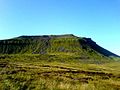
English: Ingleborough is the second highest mountain in the Yorkshire Dales, at . Ingleborough is frequently climbed as part of the Yorkshire Three Peaks Challenge, a 24-mile (38-km) circular challenge walk starting and finishing in Horton in Ribblesdale. If done anti-clockwise Ingleborough is the last mountain climbed, and ascent is from Chapel-le-Dale.
Français : L'Ingleborough est un sommet montagneux des Pennines, dans le Nord de l'Angleterre, qui culmine à d'altitude. Il est situé dans la région des Yorkshire Dales, dans le comté du Yorkshire du Nord.

mountain in the United Kingdom  | |||||
| Upload media | |||||
| Instance of | |||||
|---|---|---|---|---|---|
| Located in protected area | |||||
| Location |
| ||||
| Mountain range | |||||
| Elevation above sea level |
| ||||
| Parent peak | |||||
 | |||||
Subcategories
This category has the following 9 subcategories, out of 9 total.
+
- Ingleborough - maps (6 F)
F
- Fell Lane, North Yorkshire (33 F)
G
- Gaping Gill (46 F)
- Great Douk Cave (10 F)
I
- Ingleborough trig point (12 F)
J
- Juniper Gulf (4 F)
L
V
- Views of Ingleborough (68 F)
Media in category "Ingleborough"
The following 200 files are in this category, out of 296 total.
(previous page) (next page)-
 3 peaks Race - geograph.org.uk - 161362.jpg 640 × 480; 92 KB
-
 A varied diet - geograph.org.uk - 866539.jpg 427 × 640; 123 KB
-
 A Wish Tree on a yew stump, Ingleborough Nature Trail, Clapham, Yorkshire.jpg 4,896 × 2,752; 4.36 MB
-
 A Wish Tree on a yew, Ingleborough Nature Trail, Clapham, Yorkshire.jpg 4,896 × 2,752; 4.93 MB
-
 Almost at the Summit of Ingleborough - geograph.org.uk - 1386237.jpg 640 × 480; 122 KB
-
 Ascending Ingleborough - geograph.org.uk - 766276.jpg 640 × 480; 60 KB
-
 Bar Pot - geograph.org.uk - 546909.jpg 640 × 480; 126 KB
-
 Barn Winder Farm - geograph.org.uk - 99022.jpg 640 × 480; 101 KB
-
 Birds over Ingleborough (7744).jpg 4,288 × 2,848; 3.41 MB
-
 Birds over Simon Fell (7745).jpg 4,288 × 2,848; 3.67 MB
-
 Boulder on Ingleborough Common - geograph.org.uk - 157297.jpg 640 × 480; 137 KB
-
 Bridge at Ingleborough Cave - geograph.org.uk - 1431293.jpg 400 × 592; 176 KB
-
 Cairn below Little Ingleborough - geograph.org.uk - 958263.jpg 640 × 429; 85 KB
-
 Cairn east of Ingleborough (7605).jpg 4,288 × 2,848; 6.48 MB
-
 Cairn east of Ingleborough (7808).jpg 4,288 × 2,848; 6.34 MB
-
 Cairn east of Ingleborough (7811).jpg 4,288 × 2,848; 6.16 MB
-

-
 Cairn on Ingleborough summit (7687).jpg 4,288 × 2,848; 6.29 MB
-
 Cairn on Ingleborough summit (7690).jpg 4,288 × 2,848; 6.32 MB
-
 Cairn on Ingleborough summit (7691).jpg 4,288 × 2,848; 5.22 MB
-
 Cairn on Ingleborough summit (7694).jpg 4,288 × 2,848; 6.34 MB
-
 Cairn on Ingleborough summit (7695).jpg 4,288 × 2,848; 6.38 MB
-
 Cairn on Ingleborough summit (7710).jpg 4,288 × 2,848; 5.76 MB
-
 Cairn on Ingleborough summit (7716).jpg 4,288 × 2,848; 5.99 MB
-
 Cairn on Thwaite Scar above Norber - geograph.org.uk - 958456.jpg 640 × 427; 102 KB
-
 Cairn on Thwaite Scar above Norber - geograph.org.uk - 958461.jpg 640 × 412; 79 KB
-
 Cairns on Ingleborough summit (7711).jpg 4,288 × 2,848; 6.39 MB
-
 Cars for restoration ^ - geograph.org.uk - 397236.jpg 640 × 480; 122 KB
-
 Cattle east of Ingleborough (7802).jpg 4,288 × 2,848; 6.8 MB
-
 Cattle east of Ingleborough (7803).jpg 4,288 × 2,848; 5.76 MB
-
 Cattle east of Ingleborough (7813).jpg 4,288 × 2,848; 5.43 MB
-
 Cattle east of Ingleborough (7814).jpg 4,288 × 2,848; 6.51 MB
-

-
 Clapham Bents (7644).jpg 4,288 × 2,848; 6.99 MB
-
 Clapham Bents (7645).jpg 4,288 × 2,848; 6.57 MB
-
 Clapham Bents (7648).jpg 4,288 × 2,848; 5.51 MB
-
 Clapham Bents (7655).jpg 4,288 × 2,848; 6.21 MB
-
 Clapham Bents (7657).jpg 4,288 × 2,848; 4.99 MB
-
 Clapham Bents (7658).jpg 4,288 × 2,848; 5.01 MB
-
 Clapham Bents (7663).jpg 4,288 × 2,848; 5.17 MB
-
 Clapham Bents (7742).jpg 4,288 × 2,848; 6.96 MB
-
 Clapham Bents (7750).jpg 4,288 × 2,848; 6.32 MB
-
 Clapham Bents (7751).jpg 4,288 × 2,848; 4.92 MB
-
 Clapham Bents (7755).jpg 4,288 × 2,848; 5.12 MB
-
 Clapham Bents (7756).jpg 4,288 × 2,848; 4.79 MB
-
 Clapham Bents from Ingleborough (7739).jpg 4,288 × 2,848; 6 MB
-
 Cloud inversion from Pen-y-Ghent - geograph.org.uk - 290130.jpg 640 × 482; 51 KB
-
 Clouds - Ingleborough summit.jpg 2,592 × 1,620; 1.13 MB
-
 Crina Bottom - geograph.org.uk - 840174.jpg 640 × 480; 141 KB
-
 Crina Bottom Farm - geograph.org.uk - 283133.jpg 640 × 480; 163 KB
-
 Dales High Way east of Ingleborough (7610).jpg 4,288 × 2,848; 6.66 MB
-
 Dales High Way east of Ingleborough (7616).jpg 4,288 × 2,848; 6.31 MB
-
 Dales High Way east of Ingleborough (7636).jpg 4,288 × 2,848; 6.48 MB
-
 Dales High Way east of Ingleborough (7767).jpg 4,288 × 2,848; 6.39 MB
-
 Dales High Way east of Ingleborough (7806).jpg 4,288 × 2,848; 6.32 MB
-
 Dales High Way on Ingleborough (7647).jpg 4,288 × 2,848; 6.09 MB
-
 Dales High Way on Ingleborough (7653).jpg 4,288 × 2,848; 6.19 MB
-
 Dales High Way on Ingleborough (7654).jpg 4,288 × 2,848; 6.12 MB
-
 Dales High Way on Ingleborough (7660).jpg 4,288 × 2,848; 6.42 MB
-
 Dales High Way on Ingleborough (7746).jpg 4,288 × 2,848; 6.82 MB
-
 Dales High Way on Ingleborough (7749).jpg 4,288 × 2,848; 6.28 MB
-
 Dry Stone Wall on Brunt Riggs - geograph.org.uk - 701298.jpg 427 × 640; 296 KB
-
 Eastern profile of Ingleborough (5547771973).jpg 1,536 × 1,152; 2.05 MB
-
 Falls Foot Ingleborough - geograph.org.uk - 21176.jpg 640 × 480; 129 KB
-
 Farm near Horton in Ribblesdale (7567).jpg 4,288 × 2,848; 6.52 MB
-
 Flat top and trig point (5548347280).jpg 2,048 × 1,152; 1.85 MB
-
 Flood Entrance Pot.jpg 1,504 × 1,128; 1,014 KB
-
-
 Gaping Gill with Ingleborough summit behind (5547762485).jpg 1,152 × 1,536; 1.65 MB
-
 Great Coun from Ingleborough (7680).jpg 4,288 × 2,848; 4.39 MB
-
 Hawthorn and snow, Twisleton Scar End (geograph 5626640).jpg 960 × 720; 203 KB
-
 Heart on Ingleborough summit (7717).jpg 4,288 × 2,848; 6.34 MB
-
 Heavy Showers over Ingleborough - geograph.org.uk - 802998.jpg 640 × 427; 161 KB
-
 Humphrey Bottom (7678).jpg 4,288 × 2,848; 5.34 MB
-
 Humphrey Bottom (7738).jpg 4,288 × 2,848; 5.14 MB
-
 Humphrey Bottom from Ingleborough (7684).jpg 4,288 × 2,848; 5.79 MB
-
 Humphrey Bottom from Ingleborough (7728).jpg 4,288 × 2,848; 5.52 MB
-
 Humphrey Bottom from Ingleborough (7732).jpg 4,288 × 2,848; 5.89 MB
-
 Humphrey Bottom from Ingleborough (7734).jpg 4,288 × 2,848; 5.91 MB
-
 Humphrey Bottom from Ingleborough (7736).jpg 4,288 × 2,848; 6.39 MB
-
 Hydraulic ram houses, Clapham Beck, Ingleborough, North Yorkshire, England.jpg 4,896 × 2,752; 4.8 MB
-
 In a hurry - geograph.org.uk - 866521.jpg 460 × 640; 119 KB
-
 Ingleborough (272477289).jpg 3,456 × 2,304; 4.38 MB
-
 Ingleborough (51234251661).jpg 3,648 × 2,736; 2.61 MB
-
 Ingleborough (51234462308).jpg 3,648 × 2,736; 3.33 MB
-
 Ingleborough (51235317500).jpg 3,648 × 2,736; 2.98 MB
-
 Ingleborough (51235318355).jpg 3,648 × 2,736; 2.97 MB
-
 Ingleborough (7671).jpg 4,288 × 2,848; 4.69 MB
-
 Ingleborough - geograph.org.uk - 2454001.jpg 1,024 × 700; 157 KB
-
 Ingleborough - geograph.org.uk - 3398957.jpg 640 × 480; 121 KB
-
 Ingleborough - geograph.org.uk - 631729.jpg 640 × 429; 71 KB
-
 Ingleborough - geograph.org.uk - 631731.jpg 640 × 429; 86 KB
-
 Ingleborough - geograph.org.uk - 636379.jpg 597 × 400; 90 KB
-
 Ingleborough - geograph.org.uk - 798975.jpg 640 × 480; 56 KB
-

-
 Ingleborough from Little Ingleborough - geograph.org.uk - 548604.jpg 640 × 480; 90 KB
-
 Ingleborough from near Crina Bottom - geograph.org.uk - 631719.jpg 640 × 429; 76 KB
-
 Ingleborough from Runscar Scar - geograph.org.uk - 1303776.jpg 640 × 480; 93 KB
-
 Ingleborough from the north (5548352046).jpg 2,048 × 1,152; 2.51 MB
-

-
 Ingleborough Grotto, Clapham Beck, Ingleborough, North Yorkshire, England.jpg 4,896 × 2,752; 5.46 MB
-
 Ingleborough Hill Fort - geograph.org.uk - 180366.jpg 640 × 480; 127 KB
-
 Ingleborough on a spring morning (5548342376).jpg 2,048 × 1,152; 2.29 MB
-

-
 Ingleborough Sept2015.jpg 1,016 × 672; 296 KB
-
 Ingleborough summit (7685).jpg 4,288 × 2,848; 6.28 MB
-
 Ingleborough summit (7688).jpg 4,288 × 2,848; 5.62 MB
-
 Ingleborough summit (7696).jpg 4,288 × 2,848; 5.75 MB
-
 Ingleborough summit (7697).jpg 4,288 × 2,848; 5.16 MB
-
 Ingleborough summit (7698).jpg 4,288 × 2,848; 5.25 MB
-
 Ingleborough summit (7701).jpg 4,288 × 2,848; 6.26 MB
-
 Ingleborough summit (7702).jpg 4,288 × 2,848; 6.52 MB
-
 Ingleborough summit (7703).jpg 4,288 × 2,848; 6.4 MB
-
 Ingleborough summit (7705).jpg 4,288 × 2,848; 5.84 MB
-
 Ingleborough summit (7706).jpg 4,288 × 2,848; 5.91 MB
-
 Ingleborough summit (7718).jpg 4,288 × 2,848; 5.9 MB
-
 Ingleborough summit (7719).jpg 4,288 × 2,848; 5.73 MB
-
 Ingleborough summit (7720).jpg 4,288 × 2,848; 5.81 MB
-
 Ingleborough summit (7721).jpg 4,288 × 2,848; 5.78 MB
-
 Ingleborough summit (7729).jpg 4,288 × 2,848; 6.88 MB
-
 Ingleborough Summit - geograph.org.uk - 920935.jpg 640 × 480; 90 KB
-

-
 Ingleborough Summit Shelter - geograph.org.uk - 1116942.jpg 640 × 427; 304 KB
-

-
 Ingleborough viewed from Blue Clay Ridge - geograph.org.uk - 1152859.jpg 640 × 480; 197 KB
-
 Ingleborough whole.JPG 640 × 480; 90 KB
-
 Ingleborough Yorkshire dales - panoramio.jpg 600 × 450; 63 KB
-
 Ingleborough, north face.jpg 3,000 × 1,875; 5.29 MB
-
 Ingleborough, West Riding of Yorkshire.jpg 1,843 × 1,382; 314 KB
-
 Ingleborough.jpg 640 × 480; 77 KB
-
 Ingleborough.JPG 640 × 480; 38 KB
-
 Ingleton from Ingleborough (7708).jpg 4,288 × 2,848; 5.02 MB
-
 Ingleton, UK - panoramio (10).jpg 1,087 × 815; 346 KB
-
 Ingleton, UK - panoramio (12).jpg 1,087 × 815; 430 KB
-
 Ingleton, UK - panoramio (13).jpg 1,087 × 815; 384 KB
-
 Ingleton, UK - panoramio (14).jpg 1,087 × 815; 291 KB
-
 Ingleton, UK - panoramio (15).jpg 1,087 × 815; 358 KB
-
 Ingleton, UK - panoramio (16).jpg 1,087 × 815; 402 KB
-
 Ingleton, UK - panoramio (5).jpg 1,087 × 815; 393 KB
-
 Ingleton, UK - panoramio (6).jpg 1,087 × 815; 317 KB
-
 Ingleton, UK - panoramio (7).jpg 1,087 × 815; 365 KB
-
 Ingleton, UK - panoramio (8).jpg 1,087 × 815; 429 KB
-
 Ingleton, UK - panoramio (9).jpg 1,087 × 815; 340 KB
-
 Ingleton, UK - panoramio - jim walton (1).jpg 3,264 × 2,448; 2.29 MB
-
 Ingleton, UK - panoramio - jim walton (10).jpg 3,264 × 2,448; 2.23 MB
-
 Ingleton, UK - panoramio - jim walton (11).jpg 3,264 × 2,448; 2.16 MB
-
 Ingleton, UK - panoramio - jim walton (12).jpg 3,264 × 2,448; 2.31 MB
-
 Ingleton, UK - panoramio - jim walton (13).jpg 3,264 × 2,448; 2.16 MB
-
 Ingleton, UK - panoramio - jim walton (14).jpg 3,264 × 2,448; 2.14 MB
-
 Ingleton, UK - panoramio - jim walton (15).jpg 3,264 × 2,448; 2.26 MB
-
 Ingleton, UK - panoramio - jim walton (16).jpg 3,264 × 2,448; 2.29 MB
-
 Ingleton, UK - panoramio - jim walton (17).jpg 3,264 × 2,448; 2.3 MB
-
 Ingleton, UK - panoramio - jim walton (18).jpg 3,264 × 2,448; 2.3 MB
-
 Ingleton, UK - panoramio - jim walton (19).jpg 3,264 × 2,448; 2.22 MB
-
 Ingleton, UK - panoramio - jim walton (2).jpg 3,264 × 2,448; 2.14 MB
-
 Ingleton, UK - panoramio - jim walton (3).jpg 3,264 × 2,448; 2.2 MB
-
 Ingleton, UK - panoramio - jim walton (4).jpg 3,264 × 2,448; 2.15 MB
-
 Ingleton, UK - panoramio - jim walton (5).jpg 3,264 × 2,448; 2.26 MB
-
 Ingleton, UK - panoramio - jim walton (6).jpg 3,264 × 2,448; 2.2 MB
-
 Ingleton, UK - panoramio - jim walton (7).jpg 3,264 × 2,448; 2.15 MB
-
 Ingleton, UK - panoramio - jim walton (8).jpg 3,264 × 2,448; 2.17 MB
-
 Ingleton, UK - panoramio - jim walton (9).jpg 3,264 × 2,448; 2.18 MB
-
 Ingleton, UK - panoramio - jim walton.jpg 3,264 × 2,448; 2.24 MB
-
 Ingleton, UK - panoramio.jpg 3,264 × 2,448; 2.31 MB
-
 Limestone pavement - Ingleborough.jpg 2,102 × 1,577; 966 KB
-
 Limestone pavement and Ingleborough from Whernside.jpg 2,592 × 1,944; 1.2 MB
-
 Limestone pavement east of Ingleborough (7781).jpg 4,288 × 2,848; 6.05 MB
-
 Limestone rock in the Yorkshire Dales (5547775135).jpg 1,536 × 1,152; 1.91 MB
-
 Little Ingleborough (7747).jpg 4,288 × 2,848; 5.12 MB
-
 Little Ingleborough (7752).jpg 4,288 × 2,848; 6.39 MB
-
 Little Ingleborough - geograph.org.uk - 121555.jpg 640 × 480; 128 KB
-
 Little Ingleborough and Ingleborough and blue sky (5547761491).jpg 2,048 × 1,152; 2.05 MB
-
 Looking back to Little Ingleborough - geograph.org.uk - 1386232.jpg 640 × 480; 107 KB
-
 Majestic Ingleboro... - geograph.org.uk - 859850.jpg 640 × 480; 68 KB
-
 Moorland east of Ingleborough (7794).jpg 4,288 × 2,848; 6.54 MB
-
 Moughton Scars (7650).jpg 4,288 × 2,848; 4.84 MB
-
 Moughton Scars (7731).jpg 4,288 × 2,848; 4.72 MB
-
 Moughton Scars (7762).jpg 4,288 × 2,848; 5.96 MB
-
 Moughton Scars (7763).jpg 4,288 × 2,848; 5.26 MB
-
 Moughton Scars (7769).jpg 4,288 × 2,848; 5.46 MB
-
 Moughton Scars from Ingleborough (7646).jpg 4,288 × 2,848; 5.37 MB
-
 New Close Lane - geograph.org.uk - 264050.jpg 640 × 480; 126 KB
-
 Newt in Ingleborough NNR (7795).jpg 4,288 × 2,848; 4.91 MB
-
 Newt in Ingleborough NNR (7797).jpg 4,288 × 2,848; 4.95 MB
-
 Newt in Ingleborough NNR (7799).jpg 4,288 × 2,848; 4.42 MB
-
 Old Waggon - geograph.org.uk - 283146.jpg 640 × 480; 340 KB
-
 On Blea Moor - geograph.org.uk - 758483.jpg 640 × 480; 68 KB
-

-

-
 Orange on white - geograph.org.uk - 1152775.jpg 640 × 480; 210 KB
-
 Orchid east of Ingleborough (7588).jpg 4,288 × 2,848; 4.32 MB
-
 OS old series 1 63360 97sw.jpg 3,792 × 2,695; 3.38 MB
-

-
 Path to the Summit of Ingleborough - geograph.org.uk - 1386230.jpg 640 × 480; 99 KB
-
 Paths from Ingleborough - geograph.org.uk - 1386264.jpg 640 × 480; 99 KB
-
 Pennine Way on Pen-y-Ghent (7791).jpg 4,288 × 2,848; 4.16 MB
-
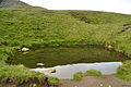 Pond on Ingleborough (7672).jpg 4,288 × 2,848; 6.72 MB
-
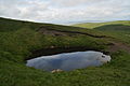 Pond on Ingleborough (7741).jpg 4,288 × 2,848; 5.41 MB
-
 Pothole - Ingleborough.jpg 2,592 × 1,944; 2.48 MB
-
 Raven Scar - geograph.org.uk - 2508497.jpg 960 × 573; 111 KB


.jpg)
.jpg)


.jpg)
.jpg)
.jpg)

.jpg)
.jpg)
.jpg)
.jpg)
.jpg)
.jpg)
.jpg)


.jpg)

.jpg)
.jpg)
.jpg)
.jpg)

.jpg)
.jpg)
.jpg)
.jpg)
.jpg)
.jpg)
.jpg)
.jpg)
.jpg)
.jpg)
.jpg)
.jpg)
.jpg)


.jpg)
.jpg)
.jpg)
.jpg)
.jpg)
.jpg)
.jpg)
.jpg)
.jpg)
.jpg)
.jpg)

.jpg)

.jpg)
.jpg)


.jpg)
.jpg)
.jpg)
.jpg)

.jpg)
.jpg)
.jpg)
.jpg)
.jpg)
.jpg)
.jpg)


.jpg)
.jpg)
.jpg)
.jpg)
.jpg)
.jpg)


.jpg)


.jpg)


.jpg)
.jpg)
.jpg)
.jpg)
.jpg)
.jpg)
.jpg)
.jpg)
.jpg)
.jpg)
.jpg)
.jpg)
.jpg)
.jpg)
.jpg)


.jpg)
.jpg)
.jpg)
.jpg)
.jpg)
.jpg)
.jpg)
.jpg)
.jpg)
.jpg)
.jpg)
.jpg)
.jpg)
.jpg)
.jpg)
.jpg)
.jpg)
.jpg)
.jpg)
.jpg)
.jpg)
.jpg)
.jpg)
.jpg)
.jpg)
.jpg)
.jpg)
.jpg)
.jpg)
.jpg)
.jpg)


.jpg)
.jpg)
.jpg)
.jpg)

.jpg)


.jpg)
.jpg)
.jpg)
.jpg)
.jpg)
.jpg)
.jpg)

.jpg)
.jpg)
.jpg)


.jpg)


.jpg)
.jpg)
.jpg)

