Category:Images from "Tracing the Social and Environmental History of the Don River"
Jump to navigation
Jump to search
Media in category "Images from "Tracing the Social and Environmental History of the Don River""
The following 21 files are in this category, out of 21 total.
-
 Ashbridge’s Bay Marsh, 1909.png 955 × 764; 515 KB
-
 Boys swimming in the Don River.png 972 × 766; 544 KB
-
 Cave & Shack Dwellers, in Toronto, 1930s -a.png 544 × 762; 326 KB
-
 Cave & Shack Dwellers, in Toronto, 1930s -b.png 557 × 760; 316 KB
-
 Cave & Shack Dwellers, in Toronto, 1930s -c.png 523 × 749; 254 KB
-

-
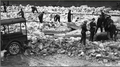 Clearing ice from railroad tracks, Don Valley, ca.1910.png 1,366 × 768; 841 KB
-

-
 Don Brewery, 1877.png 1,178 × 720; 645 KB
-
 Don Improvement Plan, 1880s.png 1,366 × 446; 377 KB
-
 Don River embankment parallel to Pape Avenue - 1931-12-30.png 1,103 × 714; 522 KB
-
 Don River flood north of Bloor Street, 1918.png 1,068 × 756; 357 KB
-
 Don River flood south of Wilton Avenue. March 12, 1920.png 1,174 × 763; 568 KB
-
 Don Valley Bridge and teamster, early 1900s.png 1,147 × 768; 417 KB
-
 Dredging Toronto's Portlands, circa 1900.png 1,025 × 768; 417 KB
-
 Elizabeth Simcoe's painting of a log bridge over the Don River.png 931 × 768; 492 KB
-

-
 Map of waterfront of York, Upper Canada, by Alexander Aitkin, 1793.png 1,366 × 680; 517 KB
-
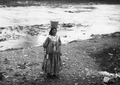 Roma woman carrying water, Humber River, September 1918.png 1,059 × 752; 475 KB
-
 Todmorden POW Camp, 1940s.png 949 × 759; 126 KB
-
 Toronto's House of Refuge, in the Don Valley.png 525 × 752; 256 KB


.png)


