Category:Images by Trevor Littlewood
Jump to navigation
Jump to search

Subcategories
This category has only the following subcategory.
N
Media in category "Images by Trevor Littlewood"
The following 62 files are in this category, out of 62 total.
-
 Access road for Designer Outlet - geograph.org.uk - 5560793.jpg 1,500 × 1,125; 1.39 MB
-
 Askham Lane - geograph.org.uk - 5691628.jpg 1,500 × 1,125; 1.36 MB
-
 Bandstand in West Park (geograph 3025223).jpg 1,500 × 843; 1.12 MB
-
 Cairn at Lang Hurst (geograph 3318398).jpg 1,500 × 1,125; 1.38 MB
-
 Church and village hall, Rufforth - geograph.org.uk - 3789438.jpg 1,500 × 946; 1.47 MB
-
 Convoy of vehicles on byway on Birkett Fell (geograph 6565775).jpg 1,999 × 1,257; 2.42 MB
-
 Derelict machinery at Erwood Craft Centre (geograph 3835259).jpg 1,500 × 1,125; 2.31 MB
-
 Detached houses, Bradley Lane, Rufforth - geograph.org.uk - 3789429.jpg 1,500 × 846; 1.38 MB
-
 Dew pond Oxteddle.jpg 1,500 × 1,125; 1.85 MB
-
 Disused railway platform at Marston Moor (geograph 3789765).jpg 1,500 × 1,000; 1.26 MB
-
 Electric bus recharging at Poppleton Bar (geograph 6344934).jpg 1,999 × 1,027; 1.36 MB
-
 Estate road on York Cross Rigg - geograph.org.uk - 2654920.jpg 1,500 × 1,125; 1.43 MB
-
 Fasnakyle Power Station - geograph.org.uk - 3463990.jpg 1,500 × 1,125; 1.87 MB
-
 Field at Burnham Ings - geograph.org.uk - 3789456.jpg 1,500 × 1,000; 1.27 MB
-
 Field near to Askham Bryan - geograph.org.uk - 3788934.jpg 1,500 × 888; 1.01 MB
-
 Field with Grange Farm beyond - geograph.org.uk - 3790926.jpg 1,500 × 1,000; 1.36 MB
-
 Field with gulls above - geograph.org.uk - 3790917.jpg 1,500 × 1,000; 1,000 KB
-
 Field with tractor wheel ruts - geograph.org.uk - 3789557.jpg 1,500 × 913; 1.29 MB
-
 Field with trig point - geograph.org.uk - 5626192.jpg 1,500 × 1,125; 1.75 MB
-

-
 Gateshead East railway station in 1977 (geograph 6738110).jpg 2,000 × 1,331; 1.97 MB
-
 Glenorchy church and graveyard.jpg 1,125 × 1,500; 1.95 MB
-
 Gulls above field - geograph.org.uk - 3789421.jpg 1,500 × 737; 886 KB
-
 Hedge with lone tree - geograph.org.uk - 3790906.jpg 1,500 × 868; 1.14 MB
-
 Helix-form Car Park in Newcastle City Centre - geograph.org.uk - 1942522.jpg 1,500 × 1,125; 1.65 MB
-
 High Spital Cottages - geograph.org.uk - 1777460.jpg 640 × 480; 570 KB
-

-
 Houses west of Ambrose Street and Frances Street - geograph.org.uk - 5564924.jpg 1,500 × 1,211; 1.98 MB
-
 Land on east side of River Ouse - geograph.org.uk - 5563395.jpg 1,500 × 876; 1.31 MB
-
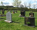 Langley Park Cemetery - geograph.org.uk - 1840540.jpg 603 × 480; 474 KB
-
 Low Fields Farm - geograph.org.uk - 3788946.jpg 1,500 × 886; 1.27 MB
-
 Low walling beside Haswell to Hart route (geograph 5761023).jpg 2,000 × 1,333; 3.63 MB
-
 Newlands Lane heading north - geograph.org.uk - 4993480.jpg 1,500 × 1,000; 1.41 MB
-
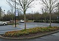 Park and ride at York's 'Designer Outlet' - geograph.org.uk - 4283138.jpg 1,500 × 1,045; 1.8 MB
-
 Pele Tower, Inner Farne Island - geograph.org.uk - 2010838.jpg 1,500 × 1,125; 2.05 MB
-
 Pennine Way alongside Black Band - geograph.org.uk - 3003150.jpg 1,500 × 843; 938 KB
-
 Pillar and abutment of Lands Viaduct - geograph.org.uk - 2937102.jpg 1,500 × 1,125; 2.04 MB
-
 Platform at Harperley Station (geograph 6472027).jpg 2,000 × 1,335; 3.53 MB
-
 Ploughed field with lone tree - geograph.org.uk - 5561137.jpg 1,500 × 1,125; 1.83 MB
-
 Railway at Dalnaspidal (geograph 2785542).jpg 1,500 × 957; 1.31 MB
-
 Railway platforms at Great Longstone (geograph 4766036).jpg 1,500 × 1,125; 2.06 MB
-
 Railway route north from Riccarton Junction (geograph 3329318).jpg 1,500 × 1,125; 1.87 MB
-
 River Ouse in York - geograph.org.uk - 3271424.jpg 1,500 × 1,125; 1.33 MB
-
 Root crop heap (geograph 6386148).jpg 2,500 × 1,541; 2.96 MB
-
 Shore of Loch Sunart near to Strontian.jpg 1,500 × 1,125; 1.33 MB
-
 Sleightholme Beck meandering NE - geograph.org.uk - 1780465.jpg 640 × 480; 554 KB
-
 Standing stone at Tarbert - geograph.org.uk - 2772582.jpg 1,500 × 1,125; 1.4 MB
-
 Stream between fields - geograph.org.uk - 3789739.jpg 1,500 × 1,000; 1.44 MB
-
 Stubble field with tree - geograph.org.uk - 3790953.jpg 1,500 × 1,000; 1.28 MB
-
 Stubble fields with deciduous trees (geograph 6386177).jpg 2,500 × 1,875; 4.71 MB
-
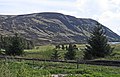
 Summit cairn of Burach 607m - geograph.org.uk - 1580993.jpg 640 × 480; 252 KB
-
 The Mound railway station (geograph 2502847).jpg 1,500 × 1,125; 1.6 MB
-
 Trees alongside Trout Beck (geograph 3759901).jpg 1,500 × 1,000; 1.53 MB
-
 Trickle of water entering Loch Leven (geograph 6844034).jpg 1,600 × 1,200; 958 KB
-
 Trig point at Poppleton - geograph.org.uk - 4181931.jpg 1,500 × 1,125; 2.15 MB
-
 Trig point on Kimberlow Hill - geograph.org.uk - 5538641.jpg 1,500 × 913; 1.54 MB
-
 War Memorial Garden, Birtley - geograph.org.uk - 1925600.jpg 1,500 × 972; 1.99 MB
-
 War memorial in garden with surrounding trees - geograph.org.uk - 3806896.jpg 1,500 × 1,125; 2.4 MB
-
 War Memorial, Upper Poppleton - geograph.org.uk - 4993737.jpg 1,500 × 942; 1.38 MB
-
 Western end of Wolverhampton Low Level station (geograph 3381641).jpg 1,500 × 899; 1.43 MB
-
 York ^ Selby Path on south side of River Ouse - geograph.org.uk - 2837446.jpg 1,500 × 1,125; 1.47 MB
-
 York, city wall adjacent to Station Road - geograph.org.uk - 3865595.jpg 1,500 × 1,125; 1.84 MB


.jpg)
.jpg)

.jpg)
.jpg)


.jpg)
.jpg)


.jpg)


.jpg)


.jpg)

.jpg)
.jpg)
.jpg)

.jpg)


.jpg)

.jpg)
.jpg)
.jpg)


.jpg)

