Category:Images by Rob Noble
Jump to navigation
Jump to search

Media in category "Images by Rob Noble"
The following 88 files are in this category, out of 88 total.
-
 Anglesey Abbey Formal Garden in Spring - geograph.org.uk - 1734722.jpg 640 × 427; 149 KB
-
 Anna Crag - geograph.org.uk - 1766019.jpg 640 × 427; 137 KB
-
 Bleamoss Beck - geograph.org.uk - 1750128.jpg 640 × 427; 138 KB
-
 Blind Tarn - geograph.org.uk - 1763205.jpg 640 × 427; 133 KB
-
 Boats for Hire beside Coniston Pier - geograph.org.uk - 1737319.jpg 640 × 427; 129 KB
-
 Brantwood - geograph.org.uk - 1735430.jpg 640 × 433; 147 KB
-
 Brantwood Jetty on Coniston Water - geograph.org.uk - 1735406.jpg 427 × 640; 125 KB
-
 Brickpit Pond, Wicken Fen - geograph.org.uk - 1760158.jpg 640 × 427; 144 KB
-
 Bridleway to Black Combe - geograph.org.uk - 1764038.jpg 640 × 427; 141 KB
-
 Broughton-in-Furness - geograph.org.uk - 1867282.jpg 640 × 427; 144 KB
-
 Cairn on Seaness - geograph.org.uk - 1764406.jpg 640 × 427; 108 KB
-

-
 Castle Point from Pencannow Point - geograph.org.uk - 1735979.jpg 640 × 427; 123 KB
-

-
 Chronophage on Corpus Christi Clock - geograph.org.uk - 1738126.jpg 640 × 427; 83 KB
-
 Cliff Path at Pencannow Point - geograph.org.uk - 1773414.jpg 640 × 427; 111 KB
-
 Cliff Path Erosion, St. Bees - geograph.org.uk - 1752673.jpg 427 × 640; 118 KB
-
 Clifton Suspension Bridge - geograph.org.uk - 1732074.jpg 427 × 640; 126 KB
-
 Crackington Haven Beach - geograph.org.uk - 1734301.jpg 640 × 427; 146 KB
-
 Dam at Seathwaite Tarn - geograph.org.uk - 1732945.jpg 640 × 427; 103 KB
-
 Derelict Stone Barn, Lickle Valley - geograph.org.uk - 1751179.jpg 640 × 427; 117 KB
-
 Duckpool Cottage, Coombe Valley - geograph.org.uk - 1748669.jpg 640 × 427; 140 KB
-
 Dunnerdale Forest Track - geograph.org.uk - 1741583.jpg 640 × 427; 134 KB
-
 Entrance to Ingleby Greenhow Churchyard - geograph.org.uk - 1738231.jpg 640 × 427; 162 KB
-
 Fields and Walls, Duddon Valley - geograph.org.uk - 1762759.jpg 640 × 427; 148 KB
-
 Fields below Ayton Banks Wood - geograph.org.uk - 1754139.jpg 640 × 427; 91 KB
-
 Fields in Little Langdale.jpg 640 × 427; 136 KB
-
 Fishing Boats in St Ives Harbour - geograph.org.uk - 1736136.jpg 640 × 427; 131 KB
-
 Footbridge at the Foot of Tom Gill - geograph.org.uk - 1735513.jpg 640 × 480; 184 KB
-
 Footbridge over Grassguards Gill - geograph.org.uk - 1737828.jpg 640 × 427; 188 KB
-
 Footbridge Over Wicken Lode - geograph.org.uk - 1733177.jpg 640 × 427; 126 KB
-
 Gate at High Wallabarrow Farm - geograph.org.uk - 1736281.jpg 640 × 427; 167 KB
-
 Great Carrs - geograph.org.uk - 1733071.jpg 640 × 427; 103 KB
-
 Great Stickle Trig Pillar - geograph.org.uk - 1735364.jpg 640 × 427; 128 KB
-
 Grey Friar Summit Cairn - geograph.org.uk - 1732992.jpg 640 × 427; 94 KB
-
 Helicopter landing site, Lundy - geograph.org.uk - 3014375.jpg 640 × 432; 186 KB
-
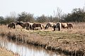 Herd of Konik Ponies, Wicken Fen - geograph.org.uk - 1760619.jpg 640 × 427; 124 KB
-
 Houseboats in Bristol Harbour - geograph.org.uk - 1751297.jpg 640 × 427; 122 KB
-
 Houses on Main St. Ravenglass - geograph.org.uk - 1733625.jpg 640 × 427; 111 KB
-
 Ingleby Manor - geograph.org.uk - 1739830.jpg 640 × 427; 94 KB
-
 Isolated Barn Below Hovel Knott - geograph.org.uk - 1735792.jpg 640 × 427; 137 KB
-
 Keldy Holiday Cabin - geograph.org.uk - 1737853.jpg 640 × 427; 157 KB
-
 Lambs Cross - geograph.org.uk - 1802282.jpg 640 × 427; 124 KB
-
 Levers Water - geograph.org.uk - 1738319.jpg 640 × 427; 92 KB
-
 Lode Mill - geograph.org.uk - 1735909.jpg 640 × 427; 133 KB
-
 Long Stanton - geograph-1817276-by-Rob-Noble.jpg 640 × 427; 111 KB
-

-
 Newquay Harbour - geograph.org.uk - 1772393.jpg 640 × 427; 129 KB
-
 North East Face of Scafell Pike - geograph.org.uk - 1733957.jpg 640 × 427; 145 KB
-
 Old Hunstanton Lighthouse at Dusk - geograph.org.uk - 1750055.jpg 427 × 640; 54 KB
-
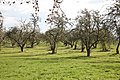 Old Orchard, South of Reynolds' Drove - geograph.org.uk - 1803172.jpg 640 × 427; 157 KB
-
 Outflow from the Tarn at Tarn Hows - geograph.org.uk - 1735693.jpg 640 × 480; 187 KB
-
 Peel Island on Coniston Water - geograph.org.uk - 1737812.jpg 640 × 427; 91 KB
-
 Pike of Blisco Summit Cairn - geograph.org.uk - 1750156.jpg 640 × 427; 110 KB
-

-
 Pollarded Willows, Wicken Fen - geograph.org.uk - 1760467.jpg 440 × 640; 174 KB
-
 Port Isaac Seafront and Lifeboat Station - geograph.org.uk - 1734237.jpg 640 × 427; 146 KB
-
 Pur Fleet (geograph 3044982).jpg 640 × 427; 174 KB
-
 Ravenglass Station - geograph.org.uk - 1738270.jpg 640 × 427; 154 KB
-
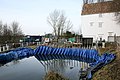 Repairs to Lode Mill - geograph.org.uk - 1749098.jpg 640 × 427; 121 KB
-
 Revetment Steps and Promenade, Cleveleys - geograph.org.uk - 1872708.jpg 640 × 427; 109 KB
-
-
 Rocks, Fistral Beach - geograph.org.uk - 1772347.jpg 640 × 427; 84 KB
-

-
 Rydal Head - geograph.org.uk - 1752339.jpg 640 × 427; 105 KB
-
 Seafront Restaurant in Port Isaac - geograph.org.uk - 1734271.jpg 640 × 427; 115 KB
-
 Sedge Fen Drove, Wicken Fen - geograph.org.uk - 1760046.jpg 640 × 427; 165 KB
-

-
 St. Andrew's Church, Cleveleys - geograph.org.uk - 1872919.jpg 640 × 427; 139 KB
-
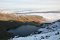
 Stickle Tarn, Dunnerdale Fells - geograph.org.uk - 1754631.jpg 640 × 427; 82 KB
-
-
 Surfing School, Fistral Beach - geograph.org.uk - 1772330.jpg 640 × 427; 134 KB
-
 Tarn Beck - geograph.org.uk - 1755062.jpg 427 × 640; 154 KB
-
 The Three Horseshoes, Batcombe - geograph.org.uk - 1734410.jpg 640 × 427; 162 KB
-

-
 Tidal Sands at Hammerside Point - geograph.org.uk - 1739474.jpg 640 × 427; 88 KB
-
 Townend Gill - geograph.org.uk - 1765039.jpg 640 × 427; 86 KB
-
-
 Turnoff for Tilberthwaite - geograph.org.uk - 1742006.jpg 640 × 427; 128 KB
-
-
-
 Warning Sign on Carr Ridge - geograph.org.uk - 1739738.jpg 640 × 427; 89 KB
-

-
 Waterfalls on Tarn Beck - geograph.org.uk - 1755171.jpg 427 × 640; 134 KB
-

-
 Whorlton Old Church and Castle - geograph.org.uk - 1754389.jpg 640 × 427; 115 KB
-
 Wicken Lode and Wicken Fen - geograph.org.uk - 1731773.jpg 640 × 427; 58 KB
-
 Widemouth Sand - geograph.org.uk - 1737611.jpg 640 × 427; 101 KB


.jpg)


