Category:Images by John Holmes
Jump to navigation
Jump to search

Media in category "Images by John Holmes"
The following 200 files are in this category, out of 1,194 total.
(previous page) (next page)-
 "Newby East" - geograph.org.uk - 128109.jpg 640 × 338; 52 KB
-
 "Sunny Corner" Pardshaw. - geograph.org.uk - 80434.jpg 640 × 480; 86 KB
-
 "The How" entrance. - geograph.org.uk - 80588.jpg 640 × 480; 105 KB
-
-
 2 exits from Bridekirk. - geograph.org.uk - 80882.jpg 640 × 480; 119 KB
-
 2nd in series left to right. - geograph.org.uk - 98329.jpg 640 × 443; 59 KB
-
 4th in the series here. - geograph.org.uk - 98339.jpg 640 × 418; 84 KB
-

-
 A Covered Reservoir. - geograph.org.uk - 96713.jpg 640 × 480; 45 KB
-
 A feedr for Rannerdale beck. - geograph.org.uk - 116108.jpg 640 × 480; 47 KB
-
 A Frosty Sale Fell Track. - geograph.org.uk - 95439.jpg 640 × 439; 46 KB
-
 A gloomy Hannah Hall. - geograph.org.uk - 101486.jpg 640 × 422; 52 KB
-
 A granite wall. - geograph.org.uk - 92249.jpg 640 × 480; 101 KB
-
 A high motorway junction. - geograph.org.uk - 88767.jpg 640 × 445; 71 KB
-
 A Lodge or Toll at Cardew. - geograph.org.uk - 95536.jpg 640 × 448; 81 KB
-
 A mixture of farming. - geograph.org.uk - 98706.jpg 640 × 446; 70 KB
-
 A pair of motorway bridges - geograph.org.uk - 92604.jpg 640 × 360; 52 KB
-
 A path to the top of Sale Fell. - geograph.org.uk - 95442.jpg 640 × 480; 73 KB
-

-
 A recently flooded roadway. - geograph.org.uk - 79496.jpg 640 × 480; 80 KB
-
 A road maze. - geograph.org.uk - 88732.jpg 640 × 344; 45 KB
-
 A seven barred gate. - geograph.org.uk - 97786.jpg 640 × 454; 62 KB
-
 A Shap Granite Limekiln. - geograph.org.uk - 92618.jpg 640 × 337; 53 KB
-
 A Sheep breeding centre. - geograph.org.uk - 101073.jpg 640 × 379; 54 KB
-
 A Sign of the times. - geograph.org.uk - 124603.jpg 640 × 543; 109 KB
-
 A Stone built sheep pen. - geograph.org.uk - 105996.jpg 640 × 480; 80 KB
-
 A Straight Road. - geograph.org.uk - 88689.jpg 640 × 480; 79 KB
-
 A tall sign. - geograph.org.uk - 88697.jpg 640 × 515; 85 KB
-
-
 A429 - A3400 Roundabout. - geograph.org.uk - 88721.jpg 640 × 442; 62 KB
-
 A429 Sub Station. - geograph.org.uk - 88712.jpg 640 × 480; 74 KB
-
 A594 to Dearham junction. - geograph.org.uk - 81995.jpg 640 × 480; 55 KB
-
 A6 into Penrith. - geograph.org.uk - 101093.jpg 640 × 304; 33 KB
-
 A6 to Cliburn Junction. - geograph.org.uk - 88877.jpg 640 × 417; 60 KB
-
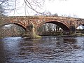 A6071 river bridge. - geograph.org.uk - 128086.jpg 640 × 480; 109 KB
-
 A66 over Lorton Road - geograph.org.uk - 78476.jpg 640 × 480; 53 KB
-
 A66 Road Bridge over the river Marron - geograph.org.uk - 78415.jpg 640 × 480; 67 KB
-
 A66 Trunk road looking north west - geograph.org.uk - 79958.jpg 640 × 480; 98 KB
-
 A66T crossover point. - geograph.org.uk - 101063.jpg 640 × 480; 52 KB
-
 Acre Walls Farmland - geograph.org.uk - 79424.jpg 640 × 480; 92 KB
-
 Across the estuary to Eskmeals - geograph.org.uk - 156835.jpg 640 × 480; 21 KB
-
 Across the estuary towards Saltcoats - geograph.org.uk - 156839.jpg 640 × 480; 28 KB
-
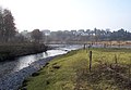 Across the rivers to Kentrigg. - geograph.org.uk - 143159.jpg 640 × 444; 65 KB
-
 Activity centre Broats Moss. - geograph.org.uk - 143071.jpg 640 × 480; 97 KB
-
 Aikbank Mill - geograph.org.uk - 80601.jpg 640 × 480; 78 KB
-
 Aikton Church. - geograph.org.uk - 119914.jpg 640 × 471; 64 KB
-
 Airport Building. - geograph.org.uk - 142990.jpg 640 × 480; 41 KB
-
 Allerdale Ramble. - geograph.org.uk - 86904.jpg 640 × 480; 116 KB
-
 An old ford. - geograph.org.uk - 92591.jpg 640 × 480; 110 KB
-
 An unnamed farm - geograph.org.uk - 89991.jpg 640 × 480; 85 KB
-
 Ancient Woodland Strip. - geograph.org.uk - 114563.jpg 640 × 435; 49 KB
-
 Anns Hill Farm - geograph.org.uk - 78513.jpg 640 × 480; 68 KB
-
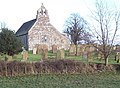
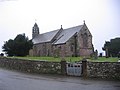
 Arlecdon Church - geograph.org.uk - 79460.jpg 640 × 480; 81 KB
-
 Armaside - geograph.org.uk - 80555 B.jpg 614 × 424; 85 KB
-
 Armaside. - geograph.org.uk - 80555.jpg 640 × 480; 103 KB
-
 Armathwaite Hall entrance. - geograph.org.uk - 81004.jpg 640 × 480; 109 KB
-
 Around the corner please. - geograph.org.uk - 80925.jpg 640 × 480; 95 KB
-
 Asby Moor Farmhouse. - geograph.org.uk - 84577.jpg 640 × 480; 69 KB
-
 Bankhouse Farm. - geograph.org.uk - 97821.jpg 640 × 408; 55 KB
-
 Barred gate. - geograph.org.uk - 138977.jpg 640 × 480; 92 KB
-
 Barrow from Catbells - geograph.org.uk - 77311.jpg 600 × 407; 49 KB
-
 Bass Beck Bridge. - geograph.org.uk - 86666.jpg 640 × 480; 126 KB
-
 Bassenthwaite 1.jpg 640 × 372; 37 KB
-
 Bassenthwaite from Sale Fell - geograph.org.uk - 95450.jpg 640 × 400; 58 KB
-
 Bassenthwaite Lake in Winter - geograph.org.uk - 79588.jpg 500 × 332; 35 KB
-
 Beach and sandunes at Drigg. - geograph.org.uk - 156829.jpg 640 × 409; 30 KB
-
 Beach at Drigg Point. - geograph.org.uk - 156831.jpg 640 × 430; 22 KB
-
 Bell House Farm. - geograph.org.uk - 96262.jpg 640 × 352; 47 KB
-
 Berrier End Farmhouse. - geograph.org.uk - 114387.jpg 640 × 480; 66 KB
-
 Berrier. - geograph.org.uk - 101035.jpg 640 × 480; 37 KB
-
 Bewaldeth. - geograph.org.uk - 80975.jpg 640 × 480; 84 KB
-
 Birks Farm. - geograph.org.uk - 89915.jpg 640 × 480; 62 KB
-
 Blea Tarn. - geograph.org.uk - 145573.jpg 640 × 480; 57 KB
-
 Blue Roller. - geograph.org.uk - 118803.jpg 640 × 480; 68 KB
-
 Bootle Fire Station. - geograph.org.uk - 160390.jpg 640 × 480; 50 KB
-
 Branthwaite Hall. - geograph.org.uk - 80423.jpg 640 × 480; 123 KB
-
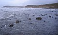
 Braystones beach. - geograph.org.uk - 97378.jpg 640 × 337; 53 KB
-
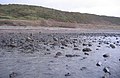
 Braystones wet beach. - geograph.org.uk - 97390.jpg 640 × 480; 30 KB
-
 Bridge over clearway. - geograph.org.uk - 97342.jpg 640 × 480; 73 KB
-
 Bridge over the river keekle - geograph.org.uk - 79416.jpg 640 × 480; 144 KB
-
 Bridge over Windergill Beck. - geograph.org.uk - 89856.jpg 640 × 480; 129 KB
-
 Brockleymoor. - geograph.org.uk - 146570.jpg 640 × 480; 52 KB
-
 Bullgill from the railway bridge. - geograph.org.uk - 98652.jpg 640 × 402; 64 KB
-
 Bullgill houses. - geograph.org.uk - 98669.jpg 640 × 480; 63 KB
-
 Bullgill. - geograph.org.uk - 88951.jpg 640 × 480; 79 KB
-
 Calder Abbey Ice House. - geograph.org.uk - 84174.jpg 640 × 472; 112 KB
-
 Cardew House Farm. - geograph.org.uk - 145020.jpg 640 × 386; 54 KB
-
 Carleton Hall. - geograph.org.uk - 146542.jpg 640 × 407; 44 KB
-
 Catterlen with pennines background. - geograph.org.uk - 143772.jpg 640 × 381; 70 KB
-
 Chapel Wood. - geograph.org.uk - 95451.jpg 640 × 480; 122 KB
-
 Civic Trust Award. - geograph.org.uk - 92564.jpg 640 × 480; 67 KB
-
 Cleator Moor with Backdrop. - geograph.org.uk - 96724 (cropped).jpg 640 × 141; 22 KB
-
 Cleator Moor with Backdrop. - geograph.org.uk - 96724.jpg 640 × 360; 49 KB
-
 Coming in to land. - geograph.org.uk - 128066.jpg 640 × 422; 50 KB
-
 Crofton Grain Store. - geograph.org.uk - 119485.jpg 640 × 417; 42 KB
-
 Crookdake Hall. - geograph.org.uk - 138988.jpg 640 × 457; 69 KB
-
 Crookdake. - geograph.org.uk - 138978.jpg 640 × 373; 67 KB
-

-
 Cycle track bridge. - geograph.org.uk - 88976.jpg 640 × 480; 121 KB
-
 D and G Aviation Museum. - geograph.org.uk - 142994.jpg 640 × 370; 48 KB
-
 Dalston Railway Station.jpg 640 × 480; 80 KB
-
 Daw Bank. - geograph.org.uk - 92584.jpg 640 × 480; 115 KB
-
 Dead Muck spreader. - geograph.org.uk - 138990.jpg 640 × 480; 95 KB
-
 Dearham Church. - geograph.org.uk - 88889.jpg 640 × 480; 103 KB
-
 Derwent View. - geograph.org.uk - 81010.jpg 640 × 480; 50 KB
-
 Distington Church. - geograph.org.uk - 88993.jpg 640 × 480; 50 KB
-
 Distington Crematorium. - geograph.org.uk - 88994.jpg 640 × 480; 59 KB
-
 Dovenby Craggs Farm - geograph.org.uk - 78514.jpg 640 × 480; 72 KB
-
 Dower House Scarness. - geograph.org.uk - 86642.jpg 640 × 480; 117 KB
-
 Down the line at sunset. - geograph.org.uk - 98697.jpg 640 × 417; 61 KB
-
 Drigg beach. - geograph.org.uk - 156852.jpg 640 × 456; 16 KB
-
 Dry stone wall in the winter sunlight. - geograph.org.uk - 95443.jpg 640 × 377; 62 KB
-
 Dub Bridge. - geograph.org.uk - 89881.jpg 640 × 480; 114 KB
-
 Dubwath - geograph.org.uk - 79952.jpg 640 × 480; 116 KB
-
 Dukes Meadow Caravan Park. - geograph.org.uk - 114483.jpg 640 × 475; 47 KB
-
 East House Farm. - geograph.org.uk - 80534.jpg 640 × 480; 109 KB
-
 East Town End Wind Farm. - geograph.org.uk - 96733.jpg 640 × 408; 35 KB
-
 Elva Plain Farmstead. - geograph.org.uk - 79947.jpg 640 × 480; 79 KB
-
 Entrance lodge houses at Orton Park, Cumbria, England.jpg 640 × 480; 63 KB
-
 Entrance to Broughton Moor. - geograph.org.uk - 81751.jpg 640 × 388; 39 KB
-
 Entrance to Irton House Farm. - geograph.org.uk - 80931.jpg 640 × 480; 60 KB
-
 Estuary at Ravenglass. - geograph.org.uk - 156836.jpg 640 × 480; 27 KB
-
 Ettington Church. - geograph.org.uk - 86752.jpg 640 × 480; 79 KB
-
 Farm track and footpath. - geograph.org.uk - 118804.jpg 640 × 383; 61 KB
-
 Farmers ford near Scout Green - geograph.org.uk - 92596.jpg 640 × 480; 103 KB
-
 Field fenced off area - geograph.org.uk - 105545.jpg 640 × 303; 53 KB
-
 Field slope to wood and on. - geograph.org.uk - 95445.jpg 640 × 480; 53 KB
-
 Flag Pole Base. - geograph.org.uk - 96286.jpg 640 × 415; 48 KB
-
 Folly Bridge. - geograph.org.uk - 81792.jpg 640 × 480; 83 KB
-
 Folly. - geograph.org.uk - 119496.jpg 640 × 530; 71 KB
-
 Footbridge and Sheep pens. - geograph.org.uk - 116115.jpg 640 × 480; 62 KB
-
 Footpath and field gate. - geograph.org.uk - 144707.jpg 640 × 480; 73 KB
-
 Footpath goes either way. - geograph.org.uk - 119892.jpg 640 × 480; 72 KB
-
 Footpath to Black How. - geograph.org.uk - 156218.jpg 640 × 344; 23 KB
-
 Footpath to Micklethwaite. - geograph.org.uk - 119420.jpg 640 × 480; 95 KB
-
 Footpath to Newtown. - geograph.org.uk - 128075.jpg 640 × 399; 67 KB
-
 Forestry at Clargillheadon A686 - geograph.org.uk - 80120.jpg 600 × 401; 90 KB
-
 Four Shire Stone. - geograph.org.uk - 88659.jpg 640 × 480; 108 KB
-
 Fox House Farm. - geograph.org.uk - 81821.jpg 640 × 480; 96 KB
-
 From the Mid Tarn Farm Turnoff. - geograph.org.uk - 98363.jpg 640 × 390; 33 KB
-
 Gated track to Orton Moss. - geograph.org.uk - 144697.jpg 640 × 480; 67 KB
-
 Gilgarran farm. - geograph.org.uk - 88997.jpg 640 × 480; 58 KB
-
 Goat Craggs and Reecastle Cragg - geograph.org.uk - 80016.jpg 640 × 480; 80 KB
-
 Great Clifton - Old School.jpg 640 × 480; 85 KB
-
 Great Wolford Church. - geograph.org.uk - 88684.jpg 625 × 640; 66 KB
-
 Greyrigg shooting range. - geograph.org.uk - 92558.jpg 640 × 480; 91 KB
-
 Greystoke Roman Road. - geograph.org.uk - 101053.jpg 640 × 480; 56 KB
-
 Hackthorpe Hall. - geograph.org.uk - 88870.jpg 640 × 480; 69 KB
-
 St Mary's Church Halford. - geograph.org.uk - 88723.jpg 640 × 480; 108 KB
-
 Harker Marsh. - geograph.org.uk - 81832.jpg 640 × 480; 72 KB
-
 Harrot. - geograph.org.uk - 98723.jpg 640 × 426; 46 KB
-
 Harthopeburn Cottages. - geograph.org.uk - 84332.jpg 600 × 428; 88 KB
-
 Hewthwaite Hall. - geograph.org.uk - 80908.jpg 640 × 480; 79 KB
-
 High Ireby. - geograph.org.uk - 86919.jpg 640 × 480; 65 KB
-
 Higham Hall - geograph.org.uk - 79950.jpg 640 × 480; 90 KB
-
 Hursthole Point Car Park - geograph.org.uk - 79970.jpg 640 × 480; 163 KB
-
 Hutton End Crossroads. - geograph.org.uk - 143793.jpg 640 × 480; 44 KB
-
 Hutton in the Forest Parkland - geograph.org.uk - 143789.jpg 640 × 480; 87 KB
-
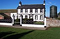
 Inn "The Fox and Hounds" - geograph.org.uk - 88682.jpg 640 × 480; 66 KB
-
 The church at Irthington. - geograph.org.uk - 128070.jpg 640 × 480; 71 KB
-
 Isel Bridge over the river Derwent. - geograph.org.uk - 80919.jpg 640 × 480; 113 KB
-
 Isel Old Park Crossroads. - geograph.org.uk - 80929.jpg 640 × 480; 99 KB
-
 Jenkin's Cross Farm. - geograph.org.uk - 95507.jpg 640 × 312; 38 KB
-
 Johnby Hall. - geograph.org.uk - 114445.jpg 640 × 480; 50 KB
-
 Kale crop. - geograph.org.uk - 119435.jpg 640 × 541; 66 KB
-
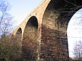 Keekle Viaduct. - geograph.org.uk - 96236.jpg 640 × 480; 95 KB
-
 Keekle Viaduct. - geograph.org.uk - 96239.jpg 640 × 480; 121 KB
-
 Keekle Viaduct. - geograph.org.uk - 96246.jpg 640 × 319; 52 KB
-
 Keekle Viaduct. - geograph.org.uk - 96249.jpg 640 × 361; 35 KB
-
 Church at Kells Whitehaven. - geograph.org.uk - 89978.jpg 640 × 480; 70 KB
-
 Kirkland Hall Farm. - geograph.org.uk - 119403.jpg 640 × 424; 49 KB
-
 Kirkstone Pass. - geograph.org.uk - 105609.jpg 640 × 387; 68 KB
-
 Lake District National Park Sign. - geograph.org.uk - 101130.jpg 640 × 480; 75 KB
-
 Lamplugh Church. - geograph.org.uk - 89335.jpg 640 × 480; 61 KB
-
 Lane beside rugby clubhouse - geograph.org.uk - 79413.jpg 640 × 480; 64 KB
-
 Latter Barrow Beck. - geograph.org.uk - 124573.jpg 640 × 350; 67 KB
-
 Limekilns at the old quarries. - geograph.org.uk - 113447.jpg 640 × 384; 42 KB
-
 Little Building at Flusco Pike - geograph.org.uk - 80047.jpg 640 × 480; 42 KB
-
 Looking towards Beckermet. - geograph.org.uk - 97352.jpg 640 × 480; 65 KB
-
 Lower flanks of Maiden Moor and Black Crag - geograph.org.uk - 79997.jpg 640 × 480; 104 KB
-
 Lowther Farm. - geograph.org.uk - 124642.jpg 640 × 343; 84 KB
-
 Lowthwaite and Longlands. - geograph.org.uk - 106023.jpg 640 × 480; 37 KB
-
 Lowthwaite Fell from the footpath. - geograph.org.uk - 105991.jpg 640 × 429; 42 KB
-
 Lowthwaite Fell. - geograph.org.uk - 106019.jpg 640 × 480; 40 KB
-
 M6 Northbound Congestion. - geograph.org.uk - 86786.jpg 640 × 480; 62 KB
-
 M6 under the A6. - geograph.org.uk - 88873.jpg 640 × 498; 74 KB
-

-
 Marsh Channel to the estuary. - geograph.org.uk - 146170.jpg 640 × 480; 62 KB
-
 Maryport Cottage Hospital. - geograph.org.uk - 82027.jpg 640 × 480; 86 KB
-
 Midtown Farm Great Orton. - geograph.org.uk - 144693.jpg 640 × 480; 48 KB
-
 Midtown Farm, Aughertree - geograph.org.uk - 86684.jpg 640 × 480; 69 KB
-
 Milestone House. - geograph.org.uk - 146547.jpg 640 × 480; 46 KB
-
 Modern road through old village. - geograph.org.uk - 78430.jpg 640 × 480; 57 KB
-
 Moorland Powerlines. - geograph.org.uk - 88986.jpg 640 × 480; 50 KB
-
 Moota Inn and the old road. - geograph.org.uk - 80893.jpg 640 × 480; 85 KB
-
 Mosser Mains. - geograph.org.uk - 80599.jpg 640 × 480; 83 KB
-
 Mouth of the river Calder. - geograph.org.uk - 98376.jpg 640 × 402; 59 KB
-
 Mouth of the rivers Calder and Ehen. - geograph.org.uk - 98378.jpg 640 × 480; 43 KB
-
 Mowbray Farm. - geograph.org.uk - 96461.jpg 640 × 422; 53 KB
-
 Nature sign. - geograph.org.uk - 146223.jpg 640 × 480; 75 KB


.jpg)