Category:Images by Ian Paterson
Jump to navigation
Jump to search

Subcategories
This category has only the following subcategory.
N
Media in category "Images by Ian Paterson"
The following 200 files are in this category, out of 431 total.
(previous page) (next page)-
 "Slow Down, Me Duck" - geograph.org.uk - 521198.jpg 640 × 480; 126 KB
-
 "Wath House" - geograph.org.uk - 426400.jpg 640 × 480; 106 KB
-
 32A Float, Winterton and Wind Farm - geograph.org.uk - 1392909.jpg 640 × 480; 115 KB
-
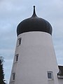
 6-Sailed Windmill - geograph.org.uk - 669932.jpg 480 × 640; 50 KB
-
 7 St Valentine's Way, Skegness - geograph.org.uk - 426456.jpg 640 × 480; 112 KB
-
 A touch of greenery - geograph.org.uk - 1251922.jpg 453 × 604; 106 KB
-
 Access No Longer Required - geograph.org.uk - 548586.jpg 640 × 480; 112 KB
-
 Across Branston Fen Towards Bardney - geograph.org.uk - 662330.jpg 640 × 480; 84 KB
-

-
 Across the Field to Westfield Farm - geograph.org.uk - 1106812.jpg 640 × 480; 63 KB
-
-
 Aiming high - geograph.org.uk - 1320244.jpg 480 × 640; 70 KB
-
 All at Sea Today - geograph.org.uk - 640691.jpg 640 × 480; 42 KB
-
 Almost there - geograph.org.uk - 1279695.jpg 640 × 480; 99 KB
-
 Almost there^ - geograph.org.uk - 1123798.jpg 640 × 480; 44 KB
-
 An everlasting barrier - geograph.org.uk - 1251823.jpg 640 × 480; 109 KB
-
 Ancient Road Sign - geograph.org.uk - 521207.jpg 640 × 480; 131 KB
-
 Approaching Dragonby - geograph.org.uk - 1287057.jpg 640 × 480; 69 KB
-
 Approaching Skellingthorpe - geograph.org.uk - 1174845.jpg 640 × 480; 91 KB
-
 Approaching Withern - geograph.org.uk - 1003499.jpg 640 × 480; 96 KB
-
 Arched Brick Wall - geograph.org.uk - 693809.jpg 640 × 427; 81 KB
-
 Ash Holt from the public footpath - geograph.org.uk - 462285.jpg 640 × 480; 136 KB
-
 At the sign of The Steaming Kettle - geograph.org.uk - 1226813.jpg 480 × 640; 72 KB
-
 Autumn Road Near Abbey Farm - geograph.org.uk - 1039375.jpg 640 × 480; 150 KB
-
 Bank at Catchwater Drain - geograph.org.uk - 1104924.jpg 640 × 480; 74 KB
-
 Barlings Hall and horses two - geograph.org.uk - 476305.jpg 640 × 455; 145 KB
-
 Barn at Manor Farm - geograph.org.uk - 596239.jpg 480 × 640; 58 KB
-
 Barn in the Distance - geograph.org.uk - 1105458.jpg 640 × 480; 90 KB
-
 Baywatch - geograph.org.uk - 1252317.jpg 640 × 480; 26 KB
-
 Beach Near Gibraltar Point - geograph.org.uk - 668423.jpg 640 × 480; 36 KB
-
 Beams of light (geograph 4202622).jpg 3,456 × 4,608; 3.25 MB
-
 Bear Behind - geograph.org.uk - 663595.jpg 640 × 480; 89 KB
-
 Beauty in Nature - geograph.org.uk - 643908.jpg 640 × 480; 60 KB
-
 Beech barrier - geograph.org.uk - 1283640.jpg 640 × 480; 104 KB
-
 Belmont Mast at Dusk - geograph.org.uk - 1105539.jpg 640 × 480; 37 KB
-
 Bird Feeder and Observation Point - geograph.org.uk - 662214.jpg 640 × 480; 116 KB
-
 Bird Hide at Delph Farm - geograph.org.uk - 662130.jpg 640 × 480; 76 KB
-
 Bird's-Eye View - geograph.org.uk - 645130.jpg 480 × 640; 117 KB
-
 Birds on Hatfield Moors - geograph.org.uk - 1172615.jpg 640 × 480; 55 KB
-
 Black Horse Farmhouse - geograph.org.uk - 771574.jpg 640 × 480; 55 KB
-
 Blankney Village - geograph.org.uk - 462445.jpg 640 × 480; 72 KB
-
 Bombing guides at RAF Donna Nook - geograph.org.uk - 1249582.jpg 640 × 480; 44 KB
-
 Bombing guides at RAF Donna Nook - geograph.org.uk - 1249697.jpg 640 × 480; 35 KB
-
 Bonby Carrs - geograph.org.uk - 1392559.jpg 640 × 480; 68 KB
-
-
 Branston Delph Sluice - geograph.org.uk - 662299.jpg 640 × 480; 104 KB
-
 Branstonbooths.jpg 640 × 480; 75 KB
-
 Brick tunnel leading to Head Dike - geograph.org.uk - 492044.jpg 640 × 480; 140 KB
-
 Bridge Farm House - geograph.org.uk - 491946.jpg 640 × 480; 105 KB
-

-
 Bridge over Kyme Eau - geograph.org.uk - 492176.jpg 640 × 480; 103 KB
-

-
 Bridge over the A46 near Main Drain - geograph.org.uk - 1174627.jpg 640 × 480; 76 KB
-
 Bridge Reconstruction - geograph.org.uk - 462427.jpg 640 × 480; 164 KB
-
 Bring it on^ - geograph.org.uk - 1320286.jpg 640 × 480; 51 KB
-
 Brocklesby Hunt at Riby Grove Farm - geograph.org.uk - 1123694.jpg 640 × 480; 68 KB
-
 Building in the Nature Reserve - geograph.org.uk - 643983.jpg 640 × 480; 107 KB
-
 Building near Will Pitts - geograph.org.uk - 645109.jpg 640 × 480; 81 KB
-
 Bull Sand Fort from Cleethorpes - geograph.org.uk - 1123574.jpg 640 × 480; 34 KB
-
 Bull Sand Fort from Passing Yacht - geograph.org.uk - 1116534.jpg 480 × 640; 40 KB
-

-
-
 Casualty - geograph.org.uk - 1251984.jpg 480 × 640; 71 KB
-
 Catchwater Drain - geograph.org.uk - 1104936.jpg 640 × 480; 85 KB
-
 Catchwater Drain towards the A46 - geograph.org.uk - 1174785.jpg 640 × 480; 152 KB
-
 Chambers Crossing Halt Railway Station.jpg 640 × 480; 145 KB
-
 Channel markers on Sand Haile Flats - geograph.org.uk - 1249440.jpg 640 × 480; 30 KB
-
 Channel on the sands - geograph.org.uk - 1249545.jpg 640 × 480; 132 KB
-
 Church Street Waddingham - geograph.org.uk - 1104969.jpg 640 × 480; 70 KB
-
 Clearing in the Woods - geograph.org.uk - 645768.jpg 640 × 480; 106 KB
-
 Cliff of Peat - geograph.org.uk - 645269.jpg 480 × 640; 83 KB
-
 Close to the edge - geograph.org.uk - 1283629.jpg 640 × 480; 95 KB
-
 Closed for the Season - geograph.org.uk - 644192.jpg 461 × 640; 115 KB
-
 Cock-a-doodle-doo^ - geograph.org.uk - 743535.jpg 640 × 480; 33 KB
-
 Cold Harbour farm from the railway - geograph.org.uk - 1229044.jpg 640 × 480; 70 KB
-
 Comfy Seat - geograph.org.uk - 645399.jpg 480 × 640; 140 KB
-
 Coming Into View - geograph.org.uk - 743484.jpg 640 × 480; 61 KB
-
 Converted Wesleyan Chapel, Welby - geograph.org.uk - 467657.jpg 640 × 480; 103 KB
-
 Corner Cottage - geograph.org.uk - 693635.jpg 640 × 427; 84 KB
-
 Cuckoo in the Nest - geograph.org.uk - 644269.jpg 640 × 480; 44 KB
-
 Cuckoo Lane and Mystery Building - geograph.org.uk - 489938.jpg 640 × 480; 74 KB
-
 Culvert Over Norton New Beck Drain - geograph.org.uk - 1104795.jpg 640 × 480; 73 KB
-
 Damon's Motel - geograph.org.uk - 663623.jpg 640 × 480; 68 KB
-
 Day mooring-Southrey-Geograph-1279646-by-Ian-Paterson.jpg 640 × 480; 67 KB
-
 Day's End - geograph.org.uk - 1391405.jpg 480 × 640; 62 KB
-
 Deeping-StJames-Lockup-geograph-693417-by-Ian-Paterson.jpg 640 × 480; 57 KB
-
 Demolished Transmission Mast and Old Road - geograph.org.uk - 521228.jpg 640 × 480; 104 KB
-
 Deserted landscape - geograph.org.uk - 1255027.jpg 640 × 480; 154 KB
-

-
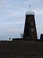
 Detail of Roof of Sibsey Trader Mill - geograph.org.uk - 669946.jpg 640 × 480; 60 KB
-
 Dorrington Sewage Treatment Works - geograph.org.uk - 490042.jpg 640 × 480; 106 KB
-
 Dorrington Sewage Treatment Works - geograph.org.uk - 490051.jpg 640 × 480; 131 KB
-
 DoubleTree by Hilton - geograph.org.uk - 6011402.jpg 4,608 × 3,456; 3.28 MB
-
 Down the ramp - geograph.org.uk - 1174602.jpg 640 × 480; 75 KB
-
 Downhill Stretch - geograph.org.uk - 596251.jpg 640 × 480; 60 KB
-
 Downhill to Riby Grove Farm - geograph.org.uk - 1123824.jpg 640 × 480; 63 KB
-
 Drain and Field near Gayton le Marsh - geograph.org.uk - 1003383.jpg 480 × 640; 56 KB
-
 Drain near Gayton le Marsh - geograph.org.uk - 1003773.jpg 640 × 480; 84 KB
-
 Drain Near Whisby Nature Park - geograph.org.uk - 684238.jpg 640 × 480; 155 KB
-
 Drainage at Bonby Carrs - geograph.org.uk - 1392586.jpg 640 × 480; 84 KB
-
 Drainage work - geograph.org.uk - 1172874.jpg 640 × 480; 105 KB
-
 Dusky Miller - geograph.org.uk - 682936.jpg 480 × 640; 87 KB
-
 Each little flower that opens - geograph.org.uk - 1259188.jpg 640 × 480; 119 KB
-
 East Drain and New River Ancholme - geograph.org.uk - 789157.jpg 640 × 480; 78 KB
-
 East Meets West - geograph.org.uk - 645091.jpg 640 × 480; 117 KB
-
 Edge of the range - geograph.org.uk - 1249765.jpg 640 × 480; 152 KB
-
 Empty shell - geograph.org.uk - 1287033.jpg 640 × 480; 84 KB
-
 Enchanted Road - geograph.org.uk - 753033.jpg 640 × 480; 104 KB
-
 Entering Grimsby Fish Dock - geograph.org.uk - 1138889.jpg 429 × 640; 38 KB
-
 Entrance and exit - geograph.org.uk - 1172879.jpg 640 × 480; 131 KB
-
-
 Epworth, Brooks Mill.jpg 480 × 640; 26 KB
-
 Epworth, Maws Mill.jpg 480 × 640; 42 KB
-
 Fairway and sand trap - geograph.org.uk - 1249607.jpg 640 × 480; 46 KB
-
 Farm Buildings - geograph.org.uk - 753326.jpg 640 × 480; 100 KB
-
 Fen Farm - geograph.org.uk - 589188.jpg 640 × 480; 112 KB
-

-
 Field and private road off B1211 - geograph.org.uk - 1204396.jpg 640 × 480; 72 KB
-
 Field at Grove Wold Farm - geograph.org.uk - 1123289.jpg 640 × 480; 105 KB
-
 Fields from Moor Road - geograph.org.uk - 1102568.jpg 640 × 480; 84 KB
-

-
 Fields Near Moor Road - geograph.org.uk - 1102554.jpg 640 × 480; 71 KB
-
 Fiskerton Post Office - geograph.org.uk - 476368.jpg 480 × 640; 127 KB
-
 Flood Prevention - geograph.org.uk - 644112.jpg 640 × 480; 150 KB
-
 Footbridge at Head Dike - geograph.org.uk - 491979.jpg 640 × 480; 94 KB
-
 Footbridge beside The Splash - geograph.org.uk - 537057.jpg 640 × 480; 130 KB
-

-
 Footbridge Over Great Eau - geograph.org.uk - 1003477.jpg 640 × 480; 82 KB
-
-
 Footpath in the snow - geograph.org.uk - 1624366.jpg 640 × 480; 67 KB
-
 Footpath leading to Irby Dales Wood - geograph.org.uk - 1123815.jpg 640 × 480; 76 KB
-
 Footpath through the fields - geograph.org.uk - 1123811.jpg 640 × 480; 73 KB
-

-
 Ford at Kirkby Green - geograph.org.uk - 897627.jpg 640 × 480; 65 KB
-
 Ford at Little Cawthorpe - geograph.org.uk - 535487.jpg 640 × 480; 151 KB
-
 Former Railway Line - geograph.org.uk - 644166.jpg 640 × 480; 83 KB
-
 Gate and track on Risby Warren - geograph.org.uk - 1285601.jpg 640 × 480; 130 KB
-
 Gate on the Bank - geograph.org.uk - 1003784.jpg 640 × 480; 85 KB
-
 Gate on the Decoy Trail - geograph.org.uk - 643893.jpg 640 × 480; 125 KB
-
 Gate opening at Ludborough Station - geograph.org.uk - 1228954.jpg 640 × 424; 69 KB
-
 Gate to north of Green Man Wood - geograph.org.uk - 462320.jpg 640 × 480; 106 KB
-
 Gateway to Building - geograph.org.uk - 645117.jpg 640 × 480; 82 KB
-
 Glorious Grass - geograph.org.uk - 643992.jpg 640 × 480; 112 KB
-
 Going, Going.. - geograph.org.uk - 643844.jpg 640 × 480; 98 KB
-
 Golden glow - geograph.org.uk - 1401855.jpg 640 × 480; 64 KB
-
 Goldener Oktober - geograph.org.uk - 1003470.jpg 640 × 480; 48 KB
-
 Goole Moors - geograph.org.uk - 645185.jpg 640 × 480; 95 KB
-
 Grazing on Frampton Marsh - geograph.org.uk - 1432540.jpg 640 × 480; 56 KB
-
-
 Great Eau Footbridge - geograph.org.uk - 1003508.jpg 640 × 480; 88 KB
-
 Great Yarmouth beach in the summer (geograph 4582664).jpg 4,608 × 3,456; 3 MB
-
 Green fields near Roxby Hall - geograph.org.uk - 1283550.jpg 640 × 480; 87 KB
-
 Green Man Wood - geograph.org.uk - 462299.jpg 640 × 480; 117 KB
-
 Green Man Wood across the field - geograph.org.uk - 462292.jpg 640 × 480; 77 KB
-
 Greenhouses Near Sutton Corner - geograph.org.uk - 602707.jpg 640 × 495; 93 KB
-
 Haile Sand Fort and Spurn Head - geograph.org.uk - 1205143.jpg 640 × 480; 39 KB
-
 Happy bunny - geograph.org.uk - 1255041.jpg 640 × 480; 157 KB
-
 Hard Standing at Lemon Wong Lane - geograph.org.uk - 512472.jpg 640 × 480; 96 KB
-
 Hatfield Moors - geograph.org.uk - 1172139.jpg 640 × 480; 108 KB
-
 Hatfield Moors - geograph.org.uk - 1172385.jpg 640 × 480; 64 KB
-
 Hazelhatch and Celbridge Station - geograph.ie - 2436383.jpg 2,048 × 1,536; 1.48 MB
-
 Head Dike from footbridge - geograph.org.uk - 492072.jpg 640 × 480; 111 KB
-
 Heading south on Hatfield Moors - geograph.org.uk - 1172858.jpg 640 × 480; 100 KB
-
 High Water at Bardney - geograph.org.uk - 662347.jpg 640 × 480; 59 KB
-
 Hill Ahead with Daffodils - geograph.org.uk - 753427.jpg 640 × 480; 77 KB
-
 Holiday Inn Express - geograph.org.uk - 1320085.jpg 640 × 480; 55 KB
-
 Houses at Almery Terrace - geograph.org.uk - 6011445.jpg 4,608 × 3,456; 5.3 MB
-
 Humber Bridge from North Ferriby - geograph.org.uk - 1395644.jpg 640 × 480; 51 KB
-
 Humber Bridge from the green field - geograph.org.uk - 1287080.jpg 640 × 480; 84 KB
-
-
 I slip, I slide, I gloom, I glance - geograph.org.uk - 827401.jpg 640 × 480; 114 KB
-
 I wander'd lonely as a cloud - geograph.org.uk - 1259157.jpg 480 × 640; 102 KB
-
 In case you missed the other signs - geograph.org.uk - 1249506.jpg 640 × 480; 87 KB
-
 In flight entertainment - geograph.org.uk - 1252307.jpg 640 × 480; 29 KB
-
 In the Shadow of the Tower - geograph.org.uk - 644155.jpg 640 × 480; 85 KB
-
-
 Invasion of the four-legged freaks - geograph.org.uk - 1249566.jpg 640 × 480; 27 KB
-
 Keep Shut - geograph.org.uk - 753345.jpg 640 × 480; 109 KB
-
 Keeping the Fields Bird-Free - geograph.org.uk - 806841.jpg 640 × 480; 79 KB
-
 Kingfisher - geograph.org.uk - 492631.jpg 480 × 640; 124 KB
-
 Knowle's Wood - geograph.org.uk - 662156.jpg 480 × 640; 143 KB
-
 Kyme Eau from Heckington Tunnel - geograph.org.uk - 492133.jpg 640 × 480; 121 KB
-
 Kyme Eau from the Bridge - geograph.org.uk - 491921.jpg 640 × 480; 107 KB
-
 Lagoon at Howden's Pullover - geograph.org.uk - 1255255.jpg 640 × 480; 147 KB
-
 Lambing Time - geograph.org.uk - 771627.jpg 640 × 480; 65 KB
-
 Landing light - geograph.org.uk - 1279725.jpg 640 × 480; 42 KB
-
-
 Laughton milepost-Geograph-2258050-by-Ian-Paterson.jpg 1,536 × 2,048; 1.42 MB
-
 Leg It^ - geograph.org.uk - 645149.jpg 640 × 480; 140 KB
-
 Leixlip (Louisa Bridge) Railway Station - geograph.ie - 1007942.jpg 640 × 480; 57 KB
-
 Lemon Wong Lane - geograph.org.uk - 512475.jpg 640 × 480; 130 KB
-

-
 Lines at Hull Marina - geograph.org.uk - 1392673.jpg 640 × 427; 55 KB
-
 Long beach - geograph.org.uk - 1249517.jpg 640 × 480; 117 KB
-
 Look North - geograph.org.uk - 548587.jpg 640 × 480; 106 KB
-
 Looking down the lines - geograph.org.uk - 6011436.jpg 4,608 × 3,456; 6 MB
-
 Looking north from the footpath - geograph.org.uk - 462454.jpg 640 × 480; 101 KB
-

-

-
 Looking Towards New River Ancholme - geograph.org.uk - 1104905.jpg 640 × 480; 79 KB


.jpg)


.jpg)


_Railway_Station_-_geograph.ie_-_1007942.jpg)


