Category:Images by Helen Steed
Jump to navigation
Jump to search

Subcategories
This category has only the following subcategory.
N
- Norfolk images by Helen Steed (22 F)
Media in category "Images by Helen Steed"
The following 39 files are in this category, out of 39 total.
-
 Bench on what was once Walberswick station (geograph 2500974).jpg 1,024 × 768; 313 KB
-
-
-
 Footpath to Likely Wood - geograph.org.uk - 559147.jpg 640 × 480; 106 KB
-
 Geldeston Rail Station & goods shed (geograph 2525799).jpg 1,024 × 842; 212 KB
-

-
 Haddiscoe Railway Station.jpg 640 × 480; 88 KB
-

-

-
-

-
 Why is this marker stone here^ - geograph.org.uk - 559156.jpg 640 × 480; 81 KB
-
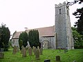 All Saints Parish Church, Worlingham - geograph.org.uk - 550559.jpg 640 × 480; 73 KB
-
-

-
 WW2 Pillbox at Level Crossing. - geograph.org.uk - 549334.jpg 640 × 480; 103 KB
-
 WW2 Pillbox near Hulver - geograph.org.uk - 554045.jpg 640 × 480; 98 KB
-

-

-
 Beccles Common and Boney's Island - geograph.org.uk - 551402.jpg 640 × 480; 76 KB
-
 Beccles Road near to Grove Farm - geograph.org.uk - 555610.jpg 640 × 480; 93 KB
-

-
-
 Entrance to Raveningham Craft Centre - geograph.org.uk - 555619.jpg 640 × 480; 86 KB
-

-
 Footpath behind Industrial Park, Loddon - geograph.org.uk - 550780.jpg 480 × 640; 124 KB
-
 Footpath leading off The Spinney - geograph.org.uk - 555626.jpg 640 × 480; 76 KB
-
 Footpath off Sotterley Road - geograph.org.uk - 559148.jpg 640 × 480; 101 KB
-
 Footpath to Crowfoot's Farm - geograph.org.uk - 559150.jpg 640 × 480; 76 KB
-

-
 Junction of Thorpe Road and The Loke - geograph.org.uk - 577019.jpg 640 × 480; 75 KB
-
 Junction of Thorpe Road and The Loke - geograph.org.uk - 577023.jpg 640 × 480; 75 KB
-
 Level Crossing at Barnby Broad - geograph.org.uk - 550590.jpg 640 × 480; 106 KB
-

-

-

-

-

-

.jpg)


.jpg)


.jpg)


