Category:Images by Gareth James
Jump to navigation
Jump to search

Subcategories
This category has only the following subcategory.
N
Media in category "Images by Gareth James"
The following 96 files are in this category, out of 96 total.
-
 Abandoned quarry - geograph.org.uk - 1777069.jpg 640 × 201; 51 KB
-
 Abandoned quarry and cave - geograph.org.uk - 1777064.jpg 640 × 480; 93 KB
-
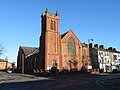 Alexandra Presbyterian Church, York Road, Belfast - geograph.org.uk - 5728993.jpg 5,184 × 3,888; 4.57 MB
-
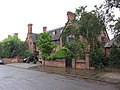 Bishopsbarns, York Geograph-2993569-by-Gareth-James.jpg 4,000 × 3,000; 3.26 MB
-
 Blackwater, IoW NCN route 23 by Gareth James 1967745 af177182.jpg 480 × 640; 113 KB
-
 Boat yard, York - geograph.org.uk - 2993577.jpg 4,000 × 3,000; 3.94 MB
-
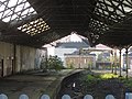
 Carriage wash, York Road Depot - geograph.org.uk - 5728988.jpg 5,184 × 3,888; 5.87 MB
-
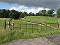
 Chiseldon- site of the old station (geograph 3842148).jpg 4,000 × 3,000; 3.12 MB
-
 Christ Church, Swindon - geograph.org.uk - 3198670.jpg 3,000 × 4,000; 2.37 MB
-
 Clun Castle at Cardiff Central (geograph 6979842).jpg 3,679 × 3,679; 4.96 MB
-
 Coal train near Lisvane & Thornhill (geograph 6785943).jpg 5,182 × 3,887; 7.7 MB
-

-
 Dark Hedges (geograph 3677892).jpg 4,000 × 3,000; 3.02 MB
-
 Deltic gala; Bluebell Railway (geograph 5566407).jpg 3,473 × 2,605; 4.78 MB
-
 Deltic locomotives at the NRM - geograph.org.uk - 4993550.jpg 3,603 × 2,702; 3.12 MB
-
 Derelict Bute Road railway station building (geograph 4112064).jpg 4,000 × 3,000; 2.82 MB
-
 Disused platform at Castlebar station (geograph 6124896).jpg 5,184 × 3,888; 5.02 MB
-
 Disused platform at Woodhead Station (geograph 3230588).jpg 4,000 × 3,000; 3.63 MB
-
 Disused platforms on Tondu station (geograph 4136973).jpg 3,000 × 4,000; 4.64 MB
-
 Disused sections of platform at Crawley station (geograph 3575219).jpg 4,000 × 3,000; 4.24 MB
-
 Disused signalbox at Castlebar station (geograph 6124897).jpg 5,184 × 3,888; 4.43 MB
-
 Disused station building at Llandaff (geograph 5487536).jpg 4,000 × 3,000; 5.18 MB
-
 Disused station platforms at Heathfield (geograph 3145172).jpg 4,000 × 3,000; 4.41 MB
-
 Dublin docklands quayside - geograph.org.uk - 1754681.jpg 640 × 480; 70 KB
-
 Excursion train at Morris Hill level crossing - geograph.org.uk - 3480661.jpg 3,470 × 2,601; 2.77 MB
-
 Excursion train leaves York - geograph.org.uk - 2993537.jpg 4,000 × 3,000; 3.34 MB
-
 Fan Hir and the old station at Penwyllt (geograph 3210436).jpg 4,000 × 3,000; 2.8 MB
-
 Fields near Malham - geograph.org.uk - 1251071.jpg 640 × 480; 87 KB
-
 Flying Scotsman at Railfest 2012 - geograph.org.uk - 2993542.jpg 3,183 × 2,643; 2.79 MB
-
 Footpath through trees near York Racecourse - geograph.org.uk - 2993567.jpg 4,000 × 3,000; 5.13 MB
-
 Former Engine Shed, Malmesbury (geograph 4018050).jpg 4,000 × 3,000; 2.99 MB
-
 Former railway station, Richmond (geograph 3858554).jpg 4,000 × 3,000; 2.77 MB
-
 Former railway station, Richmond (geograph 3858558).jpg 4,000 × 3,000; 2.9 MB
-
 Former station at Clydach (geograph 2648915).jpg 4,000 × 3,000; 2.82 MB
-
 Former station at North Woolwich (geograph 3224841).jpg 4,000 × 3,000; 3.16 MB
-
 Former station at Penwyllt (geograph 3210430).jpg 4,000 × 3,000; 3.25 MB
-
 Former well on the banks of the River Ouse - geograph.org.uk - 2993588.jpg 4,000 × 3,000; 3.4 MB
-
 Freightliner's York depot - geograph.org.uk - 2993553.jpg 4,000 × 3,000; 2.5 MB
-
 Ha'penny bridge, Dublin - geograph.org.uk - 1754718.jpg 480 × 640; 60 KB
-
 Kilkennys old station building (geograph 5349574).jpg 4,000 × 3,000; 3.38 MB
-
 Kilkennys old station building (geograph 5349577).jpg 4,000 × 3,000; 3.12 MB
-
 Kite-flying on Ogmore-by-Sea beach (geograph 3260676).jpg 4,000 × 3,000; 2.06 MB
-
 Llyn Peris and the Pass of Llanberis from Dinorwic Quarry (geograph 4170222).jpg 3,857 × 2,893; 1.7 MB
-
 Looking south from Cefn Onn Halt - geograph-3278072-by-Gareth-James.jpg 4,000 × 3,000; 3.45 MB
-
 Mallard at Railfest 2012 - geograph.org.uk - 2993547.jpg 4,000 × 3,000; 2.8 MB
-
 Monsal Trail- disused platforms at Millers Dale station (geograph 5834652).jpg 4,709 × 3,532; 6.91 MB
-
 Monsal Trail- overbridge at Bakewell station site (geograph 5834902).jpg 5,184 × 3,888; 6.86 MB
-
 Monsal Trail- remains of Bakewell station (geograph 5834897).jpg 5,104 × 2,871; 4.45 MB
-
 Monsal Trail- remains of Great Longstone station (geograph 5834867).jpg 5,184 × 3,888; 6.49 MB
-
 Monsal Trail- site of Great Longstone station (geograph 5834859).jpg 5,184 × 3,888; 5.91 MB
-
 Monsal Trail- site of Hassop station (geograph 5834888).jpg 5,182 × 2,915; 5.07 MB
-
 Monsal Trail- site of Monsaldale Station (geograph 5834728).jpg 5,184 × 3,888; 7.31 MB
-
 Monsal Trail- station buildings at Millers Dale (geograph 5834658).jpg 5,184 × 3,888; 6.29 MB
-
 New convention centre, Dublin - geograph.org.uk - 1756125.jpg 640 × 480; 70 KB
-
 NIR class 111 at York Road Depot - geograph.org.uk - 5728969.jpg 4,145 × 3,107; 4.54 MB
-
 Old crane at Ballinasloe station (geograph 5345575).jpg 3,899 × 2,924; 4.42 MB
-
 Pant Station - geograph.org.uk - 1451270.jpg 640 × 480; 98 KB
-
 Railfest 2012 - geograph.org.uk - 2993538.jpg 3,151 × 2,527; 3.62 MB
-
 Railfest 2012 - geograph.org.uk - 2993552.jpg 4,000 × 3,000; 3 MB
-
 Railtour at York - geograph.org.uk - 4993552.jpg 3,331 × 2,498; 3.23 MB
-
 Railtour at York - geograph.org.uk - 4993555.jpg 3,944 × 2,958; 3.71 MB
-
 Railway line near Cultra Station - geograph.org.uk - 3680264.jpg 4,000 × 3,000; 5.68 MB
-
 Remains of a former fishing railway track at Dungeness - geograph.org.uk - 5779726.jpg 3,807 × 5,076; 7.49 MB
-
 Remains of Crowden station (geograph 3230648).jpg 4,000 × 3,000; 3.2 MB
-
 Royal Salute in York - geograph.org.uk - 2993575.jpg 3,961 × 2,952; 4.25 MB
-
 Scherzer bridges, Dublin - geograph.org.uk - 1754753.jpg 640 × 480; 58 KB
-
 Shed at the former Athlone Midland station (geograph 5349174).jpg 3,587 × 2,689; 2.66 MB
-
 Sidings at York - geograph.org.uk - 2993556.jpg 4,000 × 3,000; 3.61 MB
-
 Site of Ashton Gate station (geograph 4112162).jpg 4,000 × 3,000; 4.54 MB
-
 Site of Bedlinog station (geograph 5717511).jpg 4,925 × 3,552; 7.81 MB
-
 Site of Crowden station from the B6105 (geograph 3230678).jpg 4,000 × 3,000; 2.73 MB
-
 Site of Dunford Bridge stations (geograph 3230515).jpg 4,000 × 3,000; 3.19 MB
-
 Site of Waunafon station (geograph 4657734).jpg 4,000 × 3,000; 3.16 MB
-
 St Paul and St Barnabas church, York Road, Belfast - geograph.org.uk - 5728999.jpg 5,184 × 3,888; 5.11 MB
-
 The closed station at Avoca (geograph 5574135).jpg 4,000 × 3,000; 3.94 MB
-
 The disused Cefn Onn Halt (looking north) - geograph-3278063-by-Gareth-James.jpg 4,000 × 3,000; 4.13 MB
-
 The former Athlone Midland station (geograph 5345513).jpg 3,705 × 2,778; 2.66 MB
-
 The former Athlone Midland station (geograph 5345516).jpg 4,000 × 3,000; 2.8 MB
-
 The former Athlone Midland station (geograph 5349176).jpg 4,000 × 3,000; 3.09 MB
-
 The former Cirencester Town station (geograph 4017870).jpg 4,000 × 3,000; 2.72 MB
-
 The former Govilon station (geograph 2177389).jpg 2,816 × 2,112; 1.37 MB
-
 The York Wheel - geograph.org.uk - 2993558.jpg 4,000 × 3,000; 2.98 MB
-
 The York Wheel - geograph.org.uk - 2993561.jpg 4,000 × 3,000; 2.73 MB
-
 Torpantau - geograph-1488383-by-Gareth-James.jpg 640 × 480; 71 KB
-
 Torpantau - geograph-1488541-by-Gareth-James.jpg 640 × 480; 84 KB
-
 Torpantau - geograph-1488551-by-Gareth-James.jpg 640 × 480; 110 KB
-
 Trans Pennine Trail at Crowden (geograph 3230629).jpg 4,000 × 3,000; 2.99 MB
-
 Trans Pennine Trail at Crowden (geograph 3230658).jpg 4,000 × 3,000; 2.97 MB
-
 Trans Pennine Trail at Dunford Bridge (geograph 3230505).jpg 4,000 × 3,000; 3.23 MB
-
 Trans Pennine Trail at Woodhead (geograph 3230578).jpg 4,000 × 3,000; 3.03 MB
-
 York Road Depot, Belfast - geograph.org.uk - 5728977.jpg 4,633 × 3,473; 7.8 MB
-
 York Road Depot, Belfast - geograph.org.uk - 6289730.jpg 4,438 × 3,327; 4.27 MB
-
 York station - geograph.org.uk - 2993529.jpg 4,000 × 3,000; 3.03 MB
-
 York, city wall and minster - geograph.org.uk - 2993564.jpg 3,922 × 2,831; 4.96 MB
-
 Youghals former railway station (geograph 6121120).jpg 5,184 × 3,888; 6.27 MB
-
 Youghals former railway station (geograph 6121122).jpg 5,184 × 3,888; 5.81 MB


.jpg)

.jpg)
.jpg)

.jpg)
.jpg)

.jpg)
.jpg)
.jpg)
.jpg)
.jpg)
.jpg)
.jpg)
.jpg)


.jpg)


.jpg)
.jpg)
.jpg)
.jpg)
.jpg)
.jpg)


.jpg)
.jpg)
.jpg)
.jpg)


.jpg)
.jpg)
.jpg)
.jpg)
.jpg)
.jpg)
.jpg)
.jpg)


.jpg)


.jpg)


.jpg)

.jpg)
.jpg)
.jpg)
.jpg)
.jpg)

.jpg)
_-_geograph-3278063-by-Gareth-James.jpg)
.jpg)
.jpg)
.jpg)
.jpg)
.jpg)


.jpg)
.jpg)
.jpg)
.jpg)
.jpg)
.jpg)