Category:Images by Dominic Dawn Harry and Jacob Paterson
Jump to navigation
Jump to search

Media in category "Images by Dominic Dawn Harry and Jacob Paterson"
The following 200 files are in this category, out of 923 total.
(previous page) (next page)-
 "Alien Scene" - geograph.org.uk - 1253243.jpg 640 × 481; 88 KB
-
-
 "Geordie's Pond" at Kinaldie Fisheries - geograph.org.uk - 94443.jpg 640 × 475; 79 KB
-
 "Misty Corner" - geograph.org.uk - 91779.jpg 640 × 475; 56 KB
-
 4 Cows and a Field - geograph.org.uk - 141575.jpg 640 × 475; 58 KB
-
 A Gully in Corrie Fee - geograph.org.uk - 746895.jpg 481 × 640; 82 KB
-
 A house on the road to Hillside - geograph.org.uk - 62445.jpg 640 × 475; 90 KB
-
 A Lone Scots Pine - geograph.org.uk - 123289.jpg 475 × 640; 108 KB
-
 A Mobile Phone Mast - geograph.org.uk - 80497.jpg 475 × 640; 48 KB
-
 A Quiet A90 Dual Carriageway - geograph.org.uk - 115830.jpg 640 × 475; 61 KB
-
 A Rather Attractive Sheep - geograph.org.uk - 114898.jpg 640 × 475; 123 KB
-
 A River Valley - geograph.org.uk - 90287.jpg 640 × 475; 59 KB
-
 A small Fishing pond and Bothy - geograph.org.uk - 78750.jpg 640 × 475; 110 KB
-

-
 A367 Peasedown Bypass - geograph.org.uk - 127021.jpg 640 × 430; 98 KB
-
-

-
 A90 from Laurencekirk Junction - geograph.org.uk - 90239.jpg 640 × 475; 56 KB
-
 A90 Near Careston - geograph.org.uk - 1226399.jpg 640 × 481; 90 KB
-
 A90 Near Muchalls - geograph.org.uk - 141570.jpg 640 × 475; 52 KB
-
 A90 over Bervie Water - geograph.org.uk - 168584.jpg 640 × 475; 127 KB
-

-
 A92 Near Gourdon - geograph.org.uk - 109904.jpg 640 × 475; 69 KB
-
 A935 and Disused Petrol Station - geograph.org.uk - 112092.jpg 640 × 475; 86 KB
-
 Abbeythune Farm - geograph.org.uk - 94445.jpg 640 × 475; 74 KB
-
 Addicate Farmhouse - geograph.org.uk - 80464.jpg 640 × 475; 61 KB
-
 Airy Muir - geograph.org.uk - 1253226.jpg 640 × 481; 82 KB
-
 Allan Water - geograph.org.uk - 179800.jpg 481 × 640; 68 KB
-
 Allan Water - geograph.org.uk - 179805.jpg 481 × 640; 138 KB
-
 Allt Slugach - geograph.org.uk - 76483.jpg 640 × 418; 64 KB
-
 Ardverikie House - geograph.org.uk - 57171.jpg 640 × 475; 46 KB
-
 Arrat's Mill - geograph.org.uk - 122402.jpg 640 × 475; 118 KB
-
 B966 running through Edzell Wood - geograph.org.uk - 77573.jpg 640 × 475; 106 KB
-
 B979 Stonehaven to Peterculter Road - geograph.org.uk - 168614.jpg 640 × 475; 92 KB
-
 Backboath Farm - geograph.org.uk - 148578.jpg 640 × 475; 72 KB
-
 Balbinny Farmhouse and Fields - geograph.org.uk - 151705.jpg 640 × 475; 83 KB
-
 Balbirnie Mill - geograph.org.uk - 122401.jpg 640 × 475; 71 KB
-
 Balconnel Farmhouse - geograph.org.uk - 126015.jpg 640 × 475; 113 KB
-
 Barn Conversion - geograph.org.uk - 94446.jpg 640 × 475; 135 KB
-
 Beach near Arbroath Golf Course - geograph.org.uk - 127302.jpg 640 × 475; 88 KB
-
 Ben Gulabin Plateau - geograph.org.uk - 78807.jpg 640 × 418; 56 KB
-
 Bervie Water from Bridge of Kair - geograph.org.uk - 156092.jpg 475 × 640; 130 KB
-
 Bervie Water Looking West - geograph.org.uk - 153636.jpg 475 × 640; 135 KB
-
 Black Rock - geograph.org.uk - 57182.jpg 640 × 475; 93 KB
-
 Black Watch Memorial - geograph.org.uk - 174783.jpg 640 × 475; 65 KB
-
 Boy Scout Huts - geograph.org.uk - 1223057.jpg 640 × 481; 80 KB
-
 Braco to Dunblane from A9 - geograph.org.uk - 179783.jpg 640 × 481; 104 KB
-
 Braemar and The Dee - geograph.org.uk - 273302.jpg 640 × 475; 82 KB
-
 Brechin Castle Centre and Pictavia - geograph.org.uk - 115826.jpg 640 × 475; 97 KB
-
-
 Brechin Round Tower 2.jpg 475 × 640; 68 KB
-
 Brechin Round Tower.jpg 475 × 640; 84 KB
-
 Bridge across North Esk - geograph.org.uk - 1223069.jpg 640 × 481; 92 KB
-
 Bridge on Dismantled Railway - geograph.org.uk - 151696.jpg 640 × 475; 124 KB
-
 Bridge over Allan Water - geograph.org.uk - 179809.jpg 640 × 481; 116 KB
-
 Bridge over Gallery Burn - geograph.org.uk - 62438.jpg 640 × 475; 101 KB
-
 Bridge over the Burn of Oldtown - geograph.org.uk - 78735.jpg 640 × 475; 122 KB
-
 Bridgend of Lintrathen from the Bridge - geograph.org.uk - 158309.jpg 640 × 475; 109 KB
-
 Broomfield Playing Fields - geograph.org.uk - 92073.jpg 640 × 475; 57 KB
-
 Brown Caterthun from Car Park - geograph.org.uk - 267901.jpg 640 × 481; 77 KB
-
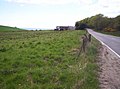
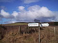
 Bryans Gate (I Think) - geograph.org.uk - 182880.jpg 640 × 481; 134 KB
-
 Building in the former RAF Edzell - geograph.org.uk - 77582.jpg 640 × 475; 86 KB
-
 Burn of Freoch and Hill of Wirren - geograph.org.uk - 119273.jpg 640 × 475; 97 KB
-
 Burnfoot Cottage - geograph.org.uk - 78745.jpg 640 × 475; 100 KB
-

-
 Cable and Wireless Mast and Dishes - geograph.org.uk - 125612.jpg 640 × 475; 68 KB
-

-
 Cairncortie Farm Road - geograph.org.uk - 127333.jpg 640 × 475; 82 KB
-

-
 Caledonian Railway Bridge - geograph.org.uk - 112091.jpg 640 × 475; 137 KB
-
 Capo Long Barrow - geograph.org.uk - 77577.jpg 640 × 475; 80 KB
-
 Car Park and Recycling Bins - geograph.org.uk - 167206.jpg 640 × 475; 73 KB
-
 Car Park at Paulton Hospital - geograph.org.uk - 126710.jpg 640 × 430; 95 KB
-
 Carmyllie Community Hall - geograph.org.uk - 155099.jpg 640 × 475; 62 KB
-
 Church Converted into a House - geograph.org.uk - 110789.jpg 640 × 475; 67 KB
-
 Church just outside Tarfside - geograph.org.uk - 83571.jpg 640 × 475; 155 KB
-
 Church near Mains of Logie - geograph.org.uk - 92078.jpg 640 × 475; 129 KB
-
 Clachnaben Path - geograph.org.uk - 56746.jpg 640 × 475; 78 KB
-
 Clapton Village - geograph.org.uk - 126749.jpg 640 × 430; 134 KB
-
 Cloch-na Hill near Temple of Fiddes - geograph.org.uk - 141568.jpg 640 × 475; 50 KB
-
-
 Coldstream Farm - geograph.org.uk - 114947.jpg 640 × 475; 62 KB
-
 Colliston Castle.jpg 640 × 481; 129 KB
-
 Communication Centre - geograph.org.uk - 126018.jpg 475 × 640; 149 KB
-
 Corbie End of Lunan Bay - geograph.org.uk - 111397.jpg 640 × 475; 68 KB
-

-
 Cornescorn Farm - geograph.org.uk - 1222956.jpg 640 × 481; 74 KB
-
 Cornescorn Farm - geograph.org.uk - 1222968.jpg 640 × 481; 67 KB
-
 Cottage beside A90 - geograph.org.uk - 90297.jpg 640 × 475; 63 KB
-
 Cottages Near Ethie Woods - geograph.org.uk - 94438.jpg 640 × 475; 61 KB
-
 Covesea Lighthouse - geograph.org.uk - 218469.jpg 640 × 481; 80 KB
-
 Craig Soales - geograph.org.uk - 1223025.jpg 640 × 481; 109 KB
-
 Craig Soales and Craigangower - geograph.org.uk - 1223006.jpg 640 × 481; 75 KB
-
 Craigangower - geograph.org.uk - 1223009.jpg 481 × 640; 112 KB
-

-
 Criggie Farm and Fields - geograph.org.uk - 99589.jpg 640 × 475; 56 KB
-
-
 Denside Farm - geograph.org.uk - 111600.jpg 640 × 475; 51 KB
-
 Derelict Cottage - geograph.org.uk - 62429.jpg 640 × 475; 84 KB
-
 Disused Railway Bridge at Hillside - geograph.org.uk - 116496.jpg 640 × 475; 80 KB
-
 Doolie Ness at Gourdon - geograph.org.uk - 109906.jpg 640 × 475; 57 KB
-
 Door to Brechin Round Tower.jpg 475 × 640; 111 KB
-
 Dowrieburn Pig Farm - geograph.org.uk - 90214.jpg 640 × 475; 84 KB
-
 Dowrieburn Pig Farm and Fields - geograph.org.uk - 90213.jpg 640 × 475; 66 KB
-
 Droop Hill ddhjp.jpg 640 × 475; 84 KB
-
 Dryplaid Farmhouse - geograph.org.uk - 167191.jpg 640 × 475; 93 KB
-
 Dubton Farm - geograph.org.uk - 80276.jpg 640 × 475; 70 KB
-
 Duff's Hill Forest - geograph.org.uk - 141584.jpg 640 × 475; 88 KB
-

-
 Dundee from Black Watch Memorial - geograph.org.uk - 174801.jpg 640 × 475; 67 KB
-

-
-
 East Coast Main Line near Scotston - geograph.org.uk - 153567.jpg 640 × 475; 102 KB
-
 East Coast Mainline Near Abbeyton - geograph.org.uk - 153596.jpg 475 × 640; 90 KB
-
 East Coast Rail Line and Boddin Farm - geograph.org.uk - 122038.jpg 640 × 475; 84 KB
-
 East Coast Railway Near Ferryden - geograph.org.uk - 122028.jpg 475 × 640; 120 KB
-
 East Wirren - geograph.org.uk - 1223032.jpg 640 × 481; 115 KB
-
 Edzell Church - geograph.org.uk - 58043.jpg 640 × 475; 120 KB
-
 Edzell Church - geograph.org.uk - 78708.jpg 640 × 475; 74 KB
-
 Edzell Woods and Daffodils - geograph.org.uk - 163596.jpg 640 × 475; 128 KB
-
 Egypt and Field of Daffodils - geograph.org.uk - 122417.jpg 640 × 475; 90 KB
-
 Electricity Sub Station - geograph.org.uk - 71495.jpg 640 × 475; 45 KB
-
 Entrance to Gardens at Guthrie Castle - geograph.org.uk - 288083.jpg 640 × 475; 119 KB
-
 Farm Buildings - geograph.org.uk - 99615.jpg 640 × 475; 98 KB
-
 Farm Track to Templewood - geograph.org.uk - 80437.jpg 640 × 475; 94 KB
-
 Fence line - geograph.org.uk - 1222996.jpg 481 × 640; 87 KB
-
 Ferryden Church of Scotland Church - geograph.org.uk - 122026.jpg 475 × 640; 47 KB
-
 Field and Bridge over Disused Railway - geograph.org.uk - 112086.jpg 640 × 475; 68 KB
-
 Field and Hill of Wirren - geograph.org.uk - 112058.jpg 640 × 427; 43 KB
-
 Field near Idvies - geograph.org.uk - 148553.jpg 640 × 475; 138 KB
-
 Field of Daffodils - geograph.org.uk - 156074.jpg 640 × 475; 100 KB
-
 Field with Sauchieburn in the distance - geograph.org.uk - 77591.jpg 640 × 475; 56 KB
-
 Fields - geograph.org.uk - 111296.jpg 640 × 475; 57 KB
-
 Fields and Burn - geograph.org.uk - 111364.jpg 640 × 475; 70 KB
-
 Fields and Muck from Dumbarrow Mains - geograph.org.uk - 148576.jpg 640 × 475; 68 KB
-
 Fields and Shed - geograph.org.uk - 148600.jpg 640 × 475; 72 KB
-
 Fields and Track - geograph.org.uk - 119311.jpg 640 × 475; 80 KB
-
 Fields From A90 Southbound - geograph.org.uk - 153650.jpg 640 × 475; 54 KB
-
 Fields Getting Fertilized, I Think. - geograph.org.uk - 151704.jpg 640 × 475; 91 KB
-
 Fields Looking Towards Farrington Gurney - geograph.org.uk - 126753.jpg 640 × 430; 100 KB
-

-
 Fields, Woodland and Track to Dunes - geograph.org.uk - 110767.jpg 640 × 475; 55 KB
-
 Finavon Doocot - geograph.org.uk - 151702.jpg 640 × 475; 100 KB
-
 Finavon Hotel next to A90 - geograph.org.uk - 151699.jpg 640 × 475; 57 KB
-
 Forester's Croft and B979 - geograph.org.uk - 168592.jpg 640 × 475; 86 KB
-
 Forestry Road Junction During Heavy Rain - geograph.org.uk - 125152.jpg 640 × 475; 105 KB
-
 Forgie Farm - geograph.org.uk - 109917.jpg 640 × 475; 63 KB
-
 Friockheim High Street.jpg 640 × 427; 63 KB
-
 Gatehouse for Glassingall - geograph.org.uk - 179792.jpg 640 × 481; 122 KB
-
 Gateway to Arbuthnott House - geograph.org.uk - 156081.jpg 640 × 475; 81 KB
-
 Gilrivie Farm and Disused Railway - geograph.org.uk - 110775.jpg 640 × 475; 54 KB
-
 Gleann Beag - geograph.org.uk - 78808.jpg 640 × 423; 43 KB
-
 Glen Esk and Mount Keen - geograph.org.uk - 108452.jpg 640 × 475; 72 KB
-

-
 Glensaugh Lodge - geograph.org.uk - 100215.jpg 640 × 475; 66 KB
-
 Grassy field - geograph.org.uk - 151723.jpg 640 × 475; 77 KB
-
 Guthriecastle1.jpg 640 × 475; 75 KB
-
-
 Halsey School, Edzell Woods - geograph.org.uk - 167202.jpg 640 × 475; 77 KB
-
 Haremuir Farm - geograph.org.uk - 109890.jpg 640 × 475; 54 KB
-
 Heathery hillside - geograph.org.uk - 1107549.jpg 640 × 481; 88 KB
-
 Heathery Hillside - geograph.org.uk - 1107563.jpg 640 × 481; 86 KB
-
 Hill of Wirren on Xmas Day - geograph.org.uk - 54623.jpg 640 × 475; 71 KB
-
 House of Dun - geograph.org.uk - 110777.jpg 640 × 475; 88 KB
-
 Ice Feature - geograph.org.uk - 1107546.jpg 481 × 640; 111 KB
-
 Inchbare village hall - geograph.org.uk - 58045.jpg 640 × 475; 132 KB
-
 Junction on Noranside to Brechin Road - geograph.org.uk - 126035.jpg 640 × 475; 96 KB
-
-
 Kirkton Hill Tower - geograph.org.uk - 109090.jpg 475 × 640; 109 KB
-
 Kirktower House, Private Residence - geograph.org.uk - 122044.jpg 475 × 640; 136 KB
-
 Leightonhill Farm - geograph.org.uk - 112069.jpg 640 × 475; 74 KB
-
 Letham Grange Hotel - geograph.org.uk - 111597.jpg 640 × 475; 147 KB
-
 Letham Village Square - geograph.org.uk - 148538.jpg 640 × 475; 86 KB
-
 Leysmill Village Green - geograph.org.uk - 182863.jpg 640 × 481; 127 KB
-
 Loch of Lintrathen Nature Reserve - geograph.org.uk - 158301.jpg 640 × 475; 89 KB
-
 Lochans and Brandshill Woods - geograph.org.uk - 90283.jpg 640 × 475; 54 KB
-
 Lochside Bar - geograph.org.uk - 62447.jpg 640 × 475; 87 KB
-
 Lochside of Turin - geograph.org.uk - 125700.jpg 640 × 475; 85 KB
-
 Looking across the A90 at Careston - geograph.org.uk - 1226408.jpg 640 × 481; 94 KB
-
 Looking Along the Lake - geograph.org.uk - 288097.jpg 640 × 475; 98 KB
-
 Looking South Across Montrose Basin - geograph.org.uk - 116491.jpg 640 × 475; 45 KB
-

-
 Looking towards Craig Soales - geograph.org.uk - 1223000.jpg 640 × 481; 87 KB
-
 Looking towards Fern - geograph.org.uk - 1226415.jpg 640 × 481; 79 KB
-

-
 Lundie Castle from a distance - geograph.org.uk - 78791.jpg 640 × 475; 45 KB
-
 Luthermuir Primary School - geograph.org.uk - 71532.jpg 640 × 475; 76 KB
-
 Mains of Balgavies and Ploughed Field - geograph.org.uk - 125673.jpg 640 × 475; 97 KB
-
 Mains of Balnakettle - geograph.org.uk - 114882.jpg 640 × 475; 85 KB
-
 Mains of Gallery Farm - geograph.org.uk - 79811.jpg 640 × 475; 90 KB
-
 Maisondieu Farm - geograph.org.uk - 115800.jpg 640 × 475; 73 KB
-
 Maltings near Hillside - geograph.org.uk - 79800.jpg 640 × 475; 80 KB
-
 Memorial Near Temple of Fiddes - geograph.org.uk - 141563.jpg 475 × 640; 92 KB
-
 Mill of Aucheen - geograph.org.uk - 83541.jpg 640 × 475; 116 KB
-
 Mill of Cruick - geograph.org.uk - 112673.jpg 640 × 475; 67 KB
-
 Mill of Kincardine - geograph.org.uk - 114913.jpg 640 × 475; 89 KB
-
 Montrose Basin - geograph.org.uk - 110770.jpg 640 × 475; 45 KB
-
 Montrose Basin - geograph.org.uk - 111639.jpg 640 × 475; 57 KB
-
 Montrose Basin - geograph.org.uk - 111641.jpg 640 × 475; 58 KB
-
 Montrose Basin and Farm Machinery - geograph.org.uk - 116494.jpg 640 × 475; 57 KB


_-_geograph.org.uk_-_182880.jpg)


