Category:Images by Christopher Hilton
Jump to navigation
Jump to search

Subcategories
This category has only the following subcategory.
N
Media in category "Images by Christopher Hilton"
The following 98 files are in this category, out of 98 total.
-
 -2021-04-04 A field next to Sandlings Walk, Snape, Suffolk.jpg 1,600 × 1,064; 310 KB
-
 -2021-04-04 Ploughed field next to Sandlings Walk, Friston, Suffolk.jpg 1,600 × 1,064; 325 KB
-
 Aldeburgh Beach on a day of sun and showers (geograph 6501394).jpg 1,600 × 1,064; 375 KB
-
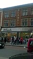 Blands, High Road, Wembley (geograph 5121821).jpg 899 × 1,600; 243 KB
-

-
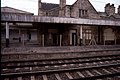 Carnforth station- disused main line platforms (geograph 3055951).jpg 1,024 × 682; 186 KB
-
 Castle Lane, Little Fryup Dale - geograph.org.uk - 4792855.jpg 1,600 × 1,064; 342 KB
-
-
 Cottrell Cottages, The Broadway, Stanmore - geograph.org.uk - 5129580.jpg 1,600 × 1,064; 264 KB
-
 Crossbarry battle monument - geograph.org.uk - 1969057.jpg 640 × 480; 61 KB
-

-

-
 Croydon Airport former terminal building - geograph 3044446.jpg 1,600 × 1,064; 397 KB
-

-
 East Moors, Brown Hill - geograph.org.uk - 4775747.jpg 1,600 × 1,064; 232 KB
-
 East Moors, view across Bonfield Gill to Pockley Moor - geograph.org.uk - 4775750.jpg 1,600 × 1,064; 254 KB
-

-
 East Moors, view along the lane northwards - geograph.org.uk - 4775743.jpg 1,600 × 1,064; 265 KB
-
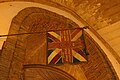
 Edinburgh - golden postbox, Hunter Square - geograph.org.uk - 3148153.jpg 768 × 1,024; 247 KB
-
 Esk Dale from the side of Little Fryup Dale - geograph.org.uk - 4792012.jpg 1,600 × 1,064; 314 KB
-
 Footpath off A158 along the edge of Gunby Hall parkland (geograph 3610063).jpg 1,064 × 1,600; 585 KB
-
 Former Highgate Road station, Kentish Town (geograph 5265441).jpg 1,600 × 1,064; 349 KB
-
 Gordon Place - cycle hire station - geograph.org.uk - 1972016.jpg 480 × 640; 65 KB
-
 Gordon Place - cycle hire station - geograph.org.uk - 1972025.jpg 480 × 640; 76 KB
-

-
 Grosmont, North Yorkshire Moors Railway, engine shed - geograph.org.uk - 2798397.jpg 1,066 × 1,600; 310 KB
-
 Gunby Hall gardens and dovecot (geograph 3614433).jpg 1,600 × 1,064; 452 KB
-
 Lane above Bransdale - geograph.org.uk - 4775768.jpg 1,600 × 1,064; 232 KB
-
 Lane along Shaw Ridge - geograph.org.uk - 4775956.jpg 1,600 × 1,064; 232 KB
-
 Lane down into Bransdale, from Shaw Ridge - geograph.org.uk - 4775945.jpg 1,600 × 1,064; 279 KB
-
 Looking into the head of Great Fryup Dale, from New Way - geograph.org.uk - 4814612.jpg 1,600 × 1,064; 309 KB
-
 Looking up Little Fryup Dale - geograph.org.uk - 4792010.jpg 1,600 × 1,064; 316 KB
-
 Looking up York Rise from Chetwynd Road, Kentish Town - geograph.org.uk - 5259191.jpg 1,600 × 1,064; 373 KB
-

-
 March - the local bus arrives from Wisbech - geograph.org.uk - 2538885.jpg 1,600 × 1,064; 371 KB
-
-
 Masonic Hall, Grove Road, Sutton.jpg 373 × 398; 229 KB
-

-
 New Way, lane at the head of Little Fryup Dale - geograph.org.uk - 4793804.jpg 1,600 × 1,064; 284 KB
-
 North entrance to Alexandra Palace, and former station building (geograph 5279308).jpg 1,600 × 1,064; 411 KB
-
 Osmotherley village from Big Wood - geograph.org.uk - 3321803.jpg 1,600 × 1,066; 392 KB
-
 Osmotherley, Oak Dale from Big Wood - geograph.org.uk - 3321801.jpg 1,600 × 1,067; 318 KB
-
 Parade of shops, High Road, Wembley - geograph.org.uk - 5121815.jpg 1,600 × 854; 251 KB
-
 Path down Dargate Slack, Dalby Forest - geograph.org.uk - 4784307.jpg 1,600 × 1,064; 516 KB
-
 Penge West station- disused entrance, Down side (geograph 2391941).jpg 681 × 1,024; 247 KB
-
 Penge West station- disused entrance, Up side (geograph 2391956).jpg 681 × 1,024; 249 KB
-

-
 Premier Inn, Wolverhampton - geograph.org.uk - 3849215.jpg 1,600 × 886; 214 KB
-
 Railway bridge, Highgate Road (geograph 5265482).jpg 1,600 × 1,064; 284 KB
-
 Road dropping into Westerdale from the Ralph Crosses - geograph.org.uk - 4789252.jpg 1,600 × 1,064; 279 KB
-
 Rocks beside London Road, Royal Tunbridge Wells - geograph.org.uk - 3987151.jpg 1,024 × 768; 204 KB
-
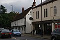
 Shops at the south end of Wembley Hill Road - geograph.org.uk - 5121088.jpg 1,600 × 899; 266 KB
-
 South aisle of Holy Trinity, Privett, from the chancel.jpg 480 × 640; 36 KB
-
 South end of Rudland Rigg - geograph.org.uk - 4779253.jpg 1,600 × 1,064; 462 KB
-
 St Cyprian's church, Clarence Gate - geograph.org.uk - 2415240.jpg 1,024 × 768; 172 KB
-
 St Giles' church, Bletchingdon - geograph.org.uk - 4276316.jpg 1,600 × 1,064; 435 KB
-
 St James, Bermondsey, from a London-bound train (geograph 2745017).jpg 768 × 1,024; 155 KB
-
 Stubble field south of Moreby Far Wood - geograph.org.uk - 4629564.jpg 1,600 × 1,064; 318 KB
-
 Swiss restaurant, Wardour St, Soho W1 (geograph 3064490).jpg 768 × 1,024; 212 KB
-

-
 Thornton Heath - Strand House, Zion Road - geograph.org.uk - 2659336.jpg 768 × 1,024; 162 KB
-
 Track onto Shaw Ridge - geograph.org.uk - 4775950.jpg 1,600 × 1,064; 404 KB
-
 Track over Lambfold Hill - geograph.org.uk - 4775765.jpg 1,600 × 1,064; 300 KB
-
 Track to the Lidmoor farms - geograph.org.uk - 4776155.jpg 1,600 × 1,064; 278 KB
-
 Track to the Lidmoor farms - geograph.org.uk - 4783214.jpg 1,600 × 1,064; 317 KB
-
 Track up Bransdale below Lidmoor - geograph.org.uk - 4786352.jpg 1,600 × 1,064; 431 KB
-
 Transport interchange, Elmers End Station - geograph.org.uk - 2419748.jpg 1,024 × 768; 156 KB
-
 University of York, J.B. Morrell Library - geograph.org.uk - 3814070.jpg 899 × 1,600; 275 KB
-

-
-
 View across Farndale from Blakey Ridge - geograph.org.uk - 4789246.jpg 1,600 × 1,064; 443 KB
-
 View across Ouse Gill - geograph.org.uk - 4776164.jpg 1,600 × 1,064; 302 KB
-
 View into Bransdale from Shaw Ridge - geograph.org.uk - 4775967.jpg 1,600 × 1,064; 282 KB
-
 View south along Blakey Road towards Stepin Turn - geograph.org.uk - 4789244.jpg 1,600 × 1,064; 316 KB
-
 View up Bransdale from below Lidmoor - geograph.org.uk - 4786379.jpg 1,600 × 1,064; 484 KB
-
 View up Bransdale from north of Lambfold Hill - geograph.org.uk - 4775769.jpg 1,600 × 1,064; 261 KB
-
 Wallington - golden postbox, Woodcote Road - geograph.org.uk - 3152996.jpg 768 × 1,024; 148 KB
-
 Westerdale Head, from the Ralph Crosses - geograph.org.uk - 4789415.jpg 1,600 × 1,064; 277 KB
-
 Whitby, looking up the valley from the abbey car park - geograph.org.uk - 3133755.jpg 1,600 × 1,064; 259 KB
-
 Willesden Junction bus station - geograph.org.uk - 2829629.jpg 1,024 × 768; 122 KB
-
 York Mansions, tenements, St Giles High Street - geograph.org.uk - 2215039.jpg 1,024 × 768; 171 KB
-
 York Mansions, tenements, St Giles High Street - geograph.org.uk - 2215040.jpg 1,024 × 643; 133 KB
-
 York Way and east side of Kings Cross Station - geograph.org.uk - 4335561.jpg 1,600 × 899; 307 KB
-
 York, alley entrance - geograph.org.uk - 2204198.jpg 1,024 × 681; 87 KB
-
 York, Bootham Bar - geograph.org.uk - 2204158.jpg 681 × 1,024; 169 KB
-

-
 York, Micklegate Bar - geograph.org.uk - 3465258.jpg 1,066 × 1,600; 287 KB
-
 York, Monkgate Bar - geograph.org.uk - 2204190.jpg 681 × 1,024; 165 KB
-
 York, ornamental ironwork at Monkgate Bar - geograph.org.uk - 2204194.jpg 1,024 × 681; 140 KB
-
 York, peeping between buildings off the walls - geograph.org.uk - 2204188.jpg 1,024 × 681; 139 KB
-
 York, peeping past Bootham Bar to the Minster - geograph.org.uk - 2204165.jpg 681 × 1,024; 225 KB
-
 York, peeping past Bootham Bar to the Minster - geograph.org.uk - 2204168.jpg 681 × 1,024; 144 KB
-
 York, ruins of St Mary's Abbey - geograph.org.uk - 2986453.jpg 1,600 × 1,064; 340 KB
-
 York, Southlands Methodist Church and surroundings - geograph.org.uk - 3465246.jpg 1,600 × 1,066; 307 KB
-
 York, St Mary's Abbey buildings - geograph.org.uk - 2204153.jpg 1,024 × 681; 231 KB
-
 York, the Minster from the walls - geograph.org.uk - 2204171.jpg 1,024 × 681; 132 KB
-

-
 York, winter view downstream from Ouse Bridge - geograph.org.uk - 2986270.jpg 1,600 × 1,067; 275 KB


.jpg)
.jpg)

.jpg)


.jpg)


.jpg)
.jpg)


.jpg)


.jpg)


.jpg)

.jpg)


.jpg)
.jpg)


.jpg)


.jpg)

.jpg)


