Category:Images by Christine Johnstone
Jump to navigation
Jump to search

Media in category "Images by Christine Johnstone"
The following 200 files are in this category, out of 1,878 total.
(previous page) (next page)-
 "A route heading diagonally uphill" (geograph 6837422).jpg 1,600 × 1,200; 555 KB
-
 "A wildlife area has been established" (geograph 6835815).jpg 1,600 × 1,201; 722 KB
-
 "Another waymarked track bears uphill" (geograph 6835804).jpg 1,600 × 1,200; 319 KB
-
 "At the bottom corner of the field, turn right" (geograph 6827936).jpg 1,600 × 1,200; 566 KB
-
 "Continue ... east ... along the bottom edge of the field" (geograph 6835824).jpg 1,600 × 1,200; 581 KB
-
 "Continue along the edge of the next field" (geograph 6835826).jpg 1,600 × 1,200; 619 KB
-
 "Follow the wide grassy track" (geograph 6836545).jpg 1,600 × 1,200; 587 KB
-
 "It never snows much in the Mendips" - geograph.org.uk - 1555134.jpg 640 × 480; 59 KB
-
 "Meet a chalky track ... heading up towards the woods" (geograph 6835842).jpg 1,600 × 1,200; 454 KB
-

-
 "Reach a stile about 100 yards from the far corner" (geograph 6837432).jpg 1,600 × 1,200; 575 KB
-
 "Reach the main road. Turn left along the verge" (geograph 6837421).jpg 1,600 × 1,200; 216 KB
-

-
 "Take the path which passes through a children's play area" (geograph 6827925).jpg 1,600 × 1,200; 531 KB
-
-
 "The waymarked bridleway which skirts the farm" (geograph 6835794).jpg 1,600 × 1,200; 520 KB
-
 "Turn left along the field edge" (geograph 6827932).jpg 1,600 × 1,200; 614 KB
-

-
-
 'The Thatch', Rake End - geograph.org.uk - 1769885.jpg 518 × 389; 197 KB
-

-

-
 A covered platform at Leamington Spa station - geograph.org.uk - 1715243.jpg 1,024 × 768; 125 KB
-
 A crop of houses - geograph.org.uk - 1570533.jpg 640 × 480; 86 KB
-
 A cutting on the former Rosedale Railway - geograph.org.uk - 3195913.jpg 1,024 × 768; 181 KB
-

-
 A field of green - geograph.org.uk - 1749088.jpg 518 × 389; 148 KB
-
 A field within a field, near Satron - geograph.org.uk - 1727876.jpg 518 × 389; 142 KB
-
 A hedge full of yellowhammers (geograph 6837433).jpg 1,294 × 971; 473 KB
-
 A herd of satellites, North Woolwich - geograph.org.uk - 1736815.jpg 553 × 415; 162 KB
-
-
 A large clump of teasels - geograph.org.uk - 1592340.jpg 640 × 480; 99 KB
-

-
 A minor boggy patch on the Esk Valley Way - geograph.org.uk - 3195490.jpg 1,024 × 768; 202 KB
-
 A muddy footpath alongside the A5033 - geograph.org.uk - 1613191.jpg 640 × 480; 76 KB
-
 A private tree, on the edge of Byram - geograph.org.uk - 1620829.jpg 640 × 480; 112 KB
-

-
 A row of trees in a Glaisdale field - geograph.org.uk - 6187858.jpg 1,703 × 1,277; 967 KB
-
 A shelf cut into the valley side, Rosedale - geograph.org.uk - 3196319.jpg 1,024 × 768; 134 KB
-

-
 A snow family, Saville Street - geograph.org.uk - 1650638.jpg 640 × 480; 72 KB
-

-
 A snowy hillside - geograph.org.uk - 1579390.jpg 640 × 480; 57 KB
-
-
 A snowy morning on Dutch River Side - geograph.org.uk - 1701586.jpg 1,024 × 768; 145 KB
-
-

-
 A tiny path into Hargate Forest - geograph.org.uk - 5865237.jpg 1,024 × 768; 374 KB
-
 A warning to dog-walkers - geograph.org.uk - 1592343.jpg 480 × 640; 100 KB
-
 A well-used rabbit hole - geograph.org.uk - 1727856.jpg 518 × 389; 175 KB
-
 A whole field of cabbages - geograph.org.uk - 1749085.jpg 518 × 389; 150 KB
-
 A166 at Garton Slack (geograph 3524898).jpg 1,024 × 614; 123 KB
-
 A63, on a winter's afternoon - geograph.org.uk - 1620422.jpg 640 × 480; 63 KB
-
 A64 crossing the River Ouse - geograph.org.uk - 5149376.jpg 1,024 × 768; 169 KB
-
 Abandoned canal, Upper Framilode - geograph.org.uk - 1555161.jpg 640 × 480; 69 KB
-

-
 Above Castle Crag, upper Rosedale - geograph.org.uk - 3195909.jpg 1,024 × 768; 166 KB
-
 Acaster Reach, River Ouse - geograph.org.uk - 5149194.jpg 1,024 × 615; 145 KB
-
 Acaster Reach, River Ouse - geograph.org.uk - 5149202.jpg 1,024 × 768; 141 KB
-
 Access track to Burton Fleming Grange (geograph 2723672).jpg 1,024 × 768; 140 KB
-
 Ackton Lane, Ackton - geograph.org.uk - 1691473.jpg 1,024 × 768; 133 KB
-
 Across the fields stands a windmill - geograph.org.uk - 1549452.jpg 640 × 480; 58 KB
-

-
 Afon Gwyrfai, upstream from Pont Faen - geograph.org.uk - 1602046.jpg 640 × 480; 100 KB
-
 Agricultural sheds, Wetwang (geograph 6837477).jpg 1,600 × 1,199; 417 KB
-
 Albion Street - geograph.org.uk - 1650647.jpg 640 × 480; 56 KB
-

-
 All Saints Church, Wold Newton (geograph 2724637).jpg 1,024 × 768; 146 KB
-
 All Saints Church, York - geograph.org.uk - 4179418.jpg 1,024 × 615; 107 KB
-
 All's quiet at 9am on London Road - geograph.org.uk - 1715337.jpg 1,024 × 768; 125 KB
-
-
 Almshouses off Westfield Road - geograph.org.uk - 1651025.jpg 640 × 480; 73 KB
-

-

-

-

-

-
-
 Approaching Wetwang Grange from the west (geograph 6835778).jpg 1,600 × 1,200; 480 KB
-
 Arable field between Back Lane and York Street - geograph.org.uk - 4416044.jpg 1,024 × 768; 141 KB
-

-
 Arliss Road, off Romsey Road - geograph.org.uk - 1715522.jpg 553 × 415; 197 KB
-

-
 Arundel Street - geograph.org.uk - 1650644.jpg 640 × 480; 65 KB
-
 Ashfield Villas, Hillam Lane - geograph.org.uk - 1620455.jpg 640 × 480; 54 KB
-
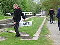 At work at Hopper Lock -40E- - geograph.org.uk - 1883639.jpg 1,024 × 768; 123 KB
-
 ATL Construction Training Centre, Boothroyds Way - geograph.org.uk - 1692360.jpg 1,025 × 768; 408 KB
-
 Autumn colours in Rosedale - geograph.org.uk - 3198991.jpg 1,024 × 768; 145 KB
-
 Autumn colours, upper Rosedale - geograph.org.uk - 3195911.jpg 1,024 × 768; 185 KB
-
 Autumn trees - geograph.org.uk - 1564024.jpg 640 × 480; 81 KB
-
 Avenue leading up to Teversal Manor - geograph.org.uk - 1564286.jpg 640 × 480; 103 KB
-
 Avondale Street - geograph.org.uk - 1570521.jpg 640 × 480; 63 KB
-

-
 Back Hatfeild Street - geograph.org.uk - 1650649.jpg 640 × 480; 60 KB
-

-
 Bad Bargain Lane, near Willow Grove - geograph.org.uk - 5771101.jpg 1,024 × 768; 264 KB
-
 Bagged roadside rubbish, Glaisdale Moor - geograph.org.uk - 6196969.jpg 1,703 × 1,277; 833 KB
-
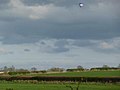 Balloon over the valley - geograph.org.uk - 1555187.jpg 640 × 480; 31 KB
-
 Bank of woodland, off Jerry Clay Lane - geograph.org.uk - 1760591.jpg 518 × 389; 160 KB
-
 Banked and hedged field boundary, Eskdale - geograph.org.uk - 4453559.jpg 1,024 × 615; 102 KB
-
 Banked field boundary, off Hessle Lane - geograph.org.uk - 1749055.jpg 518 × 389; 169 KB
-
 Bare field, north of Bad Bargain Lane - geograph.org.uk - 5771108.jpg 1,024 × 768; 234 KB
-
 Barley in Vicarage Closes (geograph 3021823).jpg 1,024 × 768; 154 KB
-
 Barn at Prospect Farm, Murton - geograph.org.uk - 5757371.jpg 1,024 × 768; 138 KB
-

-
 Batley Road, Kirkhamgate - geograph.org.uk - 1760509.jpg 518 × 389; 147 KB
-
 Beacon at the end of Town Quay - geograph.org.uk - 1715612.jpg 553 × 415; 114 KB
-
 Beam engine, this end down - geograph.org.uk - 1586937.jpg 480 × 640; 68 KB
-
 Beam engine, this end up - geograph.org.uk - 1586933.jpg 480 × 640; 65 KB
-
 Beautiful garden in Roundhay Park - geograph.org.uk - 1581078.jpg 640 × 480; 111 KB
-
 Beautiful tree on top of a low hill - geograph.org.uk - 1570428.jpg 640 × 480; 64 KB
-

-
 Bend in the River Ouse, near Moreby Hall - geograph.org.uk - 5148416.jpg 1,024 × 615; 75 KB
-

-
 Beware sheep^ - geograph.org.uk - 1728990.jpg 518 × 389; 161 KB
-
 Beware, obstruction^ - geograph.org.uk - 1748972.jpg 518 × 389; 136 KB
-

-
 Bexton Lane, Knutsford - geograph.org.uk - 1613269.jpg 640 × 480; 77 KB
-
-

-

-
 Birds are nesting on Glaisdale Moor - geograph.org.uk - 6196911.jpg 1,622 × 1,216; 673 KB
-
 Birkin Lane on a winter's afternoon - geograph.org.uk - 1620952.jpg 640 × 480; 60 KB
-
 Birkin Lane, looking south-west - geograph.org.uk - 1621627.jpg 640 × 480; 37 KB
-

-
 Black plastic on barbed wire - geograph.org.uk - 1564243.jpg 640 × 480; 94 KB
-
 Blansby Park Wood - geograph.org.uk - 4450947.jpg 1,024 × 768; 196 KB
-
 Blind Lane, off Woodhouse Lane - geograph.org.uk - 1760495.jpg 518 × 389; 123 KB
-

-

-
-
 Blithbury Road, looking towards Colton - geograph.org.uk - 1768594.jpg 518 × 389; 145 KB
-

-
 Blocked field entrance - geograph.org.uk - 1568125.jpg 640 × 480; 105 KB
-
 Blocked up railway bridge - geograph.org.uk - 1576090.jpg 640 × 480; 105 KB
-
 Blue Scar (north end), Eskdale - geograph.org.uk - 4453549.jpg 1,024 × 768; 150 KB
-
 Blue Scar, south bank of the Esk - geograph.org.uk - 4453546.jpg 1,024 × 768; 177 KB
-
 Bluebells in Round Wood - geograph.org.uk - 1579583.jpg 640 × 480; 116 KB
-
 Boarded-up church, Old Goole (geograph 2018191).jpg 1,024 × 768; 191 KB
-

-

-

-
 Boat on the River Ouse - geograph.org.uk - 5149363.jpg 1,024 × 768; 164 KB
-
 Boat on the River Ouse, near Fulford Ings - geograph.org.uk - 5149372.jpg 1,024 × 615; 182 KB
-

-
 Boats moored on the east bank of the River Ouse - geograph.org.uk - 5149393.jpg 1,024 × 615; 133 KB
-
 Boats moored on the east bank of the River Ouse - geograph.org.uk - 5149400.jpg 1,024 × 615; 204 KB
-

-

-

-
 Boundary between field and Newstead Lane - geograph.org.uk - 1748995.jpg 518 × 389; 141 KB
-
 Boundary between fields and woodland - geograph.org.uk - 1768616.jpg 518 × 389; 170 KB
-
 Boundary stone on Howdale Hill - geograph.org.uk - 3194722.jpg 1,024 × 768; 199 KB
-
 Bow Creek, looping down to the Thames - geograph.org.uk - 1736902.jpg 553 × 415; 165 KB
-
 Bracken and heather at the roadside, Shaw End - geograph.org.uk - 6194595.jpg 1,600 × 1,200; 605 KB
-
 Bracken on Mount Nod, Hargate Forest - geograph.org.uk - 5865253.jpg 1,024 × 768; 285 KB
-
 Bracken-covered east side of the Esk valley - geograph.org.uk - 3195501.jpg 1,024 × 768; 228 KB
-
 Braithwaite Hall, Coverdale - geograph.org.uk - 1579405.jpg 640 × 480; 63 KB
-
 Brandy Carr Road, Kirkhamgate - geograph.org.uk - 1760501.jpg 518 × 389; 141 KB
-
 Bridge 41, the Chesterfield Canal - geograph.org.uk - 1802860.jpg 518 × 389; 176 KB
-
 Bridge 41a, the Chesterfield Canal - geograph.org.uk - 1802864.jpg 518 × 389; 127 KB
-
 Bridge 42a, the Chesterfield Canal - geograph.org.uk - 1802906.jpg 518 × 389; 155 KB
-
 Bridge across the Gypsey Race (geograph 3021806).jpg 1,024 × 768; 200 KB
-

-
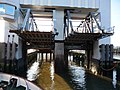
 Bridge on the move (1-10) - geograph.org.uk - 1738484.jpg 415 × 553; 195 KB
-
 Bridge on the move (10-10) - geograph.org.uk - 1738522.jpg 415 × 553; 178 KB
-
 Bridge on the move (2-10) - geograph.org.uk - 1738488.jpg 415 × 553; 173 KB
-
 Bridge on the move (3-10) - geograph.org.uk - 1738495.jpg 415 × 553; 168 KB
-
 Bridge on the move (4-10) - geograph.org.uk - 1738500.jpg 415 × 553; 167 KB
-
 Bridge on the move (5-10) - geograph.org.uk - 1738503.jpg 415 × 553; 173 KB
-
 Bridge on the move (6-10) - geograph.org.uk - 1738507.jpg 415 × 553; 178 KB
-
 Bridge on the move (7-10) - geograph.org.uk - 1738511.jpg 415 × 553; 177 KB
-
 Bridge on the move (8-10) - geograph.org.uk - 1738514.jpg 415 × 553; 178 KB
-
 Bridge on the move (9-10) - geograph.org.uk - 1738519.jpg 415 × 553; 176 KB
-

-

-
 Bridge over disused railway line - geograph.org.uk - 1568111.jpg 640 × 480; 57 KB
-
 Bridge over Eller Beck, near Moorgates - geograph.org.uk - 4474654.jpg 1,024 × 768; 124 KB
-
 Bridge over Gunnerside Ghyll - geograph.org.uk - 1726710.jpg 518 × 389; 141 KB
-

-
 Bridge over small stream, Stonyford Lane - geograph.org.uk - 1769853.jpg 518 × 389; 150 KB
-

-
 Bridleway above disused quarries, Glaisdale Low Moor - geograph.org.uk - 6190415.jpg 1,600 × 1,200; 476 KB
-
 Bridleway and track to the Stamford Bridge road - geograph.org.uk - 5759970.jpg 1,024 × 768; 199 KB
-
 Bridleway below Bank House Brow Plantation, Glaisdale - geograph.org.uk - 6187814.jpg 1,703 × 1,277; 1.1 MB
-
 Bridleway below Bank House Brow, Glaisdale - geograph.org.uk - 6187795.jpg 1,600 × 1,200; 615 KB
-
 Bridleway bridge, Glaisdale Beck - geograph.org.uk - 6189121.jpg 1,600 × 1,200; 731 KB
-
 Bridleway crossing Glaisdale valley floor - geograph.org.uk - 6187868.jpg 1,646 × 1,234; 628 KB
-
 Bridleway descending Glaisdale Side - geograph.org.uk - 6189143.jpg 1,703 × 1,277; 1.02 MB
-
 Bridleway entering Bank House Brow Plantation - geograph.org.uk - 6187820.jpg 1,600 × 1,200; 784 KB
-
 Bridleway heading north-west to Plum Tree Farm - geograph.org.uk - 6189123.jpg 1,600 × 1,200; 504 KB
-
 Bridleway heading towards Blithbury Road - geograph.org.uk - 1768687.jpg 518 × 389; 165 KB
-
 Bridleway heading west to Bank House Farm - geograph.org.uk - 6187840.jpg 1,703 × 1,277; 1.09 MB
-
 Bridleway nearing Red House, Glaisdale - geograph.org.uk - 6187649.jpg 1,600 × 1,200; 622 KB
-
 Bridleway sign, Newlands Lane - geograph.org.uk - 1768672.jpg 389 × 518; 160 KB
-
 Bridleway signpost, near Glaisdale Beck - geograph.org.uk - 6187655.jpg 1,600 × 1,200; 669 KB
-
 Bridleway to Bank House Farm, Glaisdale - geograph.org.uk - 6187789.jpg 1,600 × 1,200; 603 KB
-
 Bridleway to Bank House Farm, Glaisdale - geograph.org.uk - 6187801.jpg 1,703 × 1,277; 1.04 MB
-
 Bridleway to Fryup Lodge, Great Fryup Dale - geograph.org.uk - 6197032.jpg 1,703 × 1,277; 964 KB
-
 Bridleway, off Newlands Lane - geograph.org.uk - 1768690.jpg 518 × 389; 169 KB
.jpg)
.jpg)
.jpg)
.jpg)
.jpg)
.jpg)
.jpg)

.jpg)

.jpg)
.jpg)

.jpg)

.jpg)
.jpg)
.jpg)


.jpg)


.jpg)


.jpg)


.jpg)


.jpg)


.jpg)


_1999_DAF_DB250_Optare_Spectra,_Pontefract,_24_June_2011.jpg)


.jpg)


,_Eskdale_-_geograph.org.uk_-_4453549.jpg)


.jpg)


_on_the_west_side_of_Newtondale_-_geograph.org.uk_-_4451332.jpg)


.jpg)

_-_geograph.org.uk_-_1738484.jpg)
_-_geograph.org.uk_-_1738522.jpg)
_-_geograph.org.uk_-_1738488.jpg)
_-_geograph.org.uk_-_1738495.jpg)
_-_geograph.org.uk_-_1738500.jpg)
_-_geograph.org.uk_-_1738503.jpg)
_-_geograph.org.uk_-_1738507.jpg)
_-_geograph.org.uk_-_1738511.jpg)
_-_geograph.org.uk_-_1738514.jpg)
_-_geograph.org.uk_-_1738519.jpg)


