Category:Images by Alan Murray-Rust
Jump to navigation
Jump to search

Subcategories
This category has only the following subcategory.
N
Media in category "Images by Alan Murray-Rust"
The following 200 files are in this category, out of 533 total.
(previous page) (next page)-
 'Pepper and Salt' at Goole - geograph.org.uk - 579215.jpg 427 × 640; 79 KB
-
 . . . now you don't (at least nearly not) - geograph.org.uk - 6014239.jpg 1,280 × 1,280; 294 KB
-
 1-4 Bramcote Lane, Wollaton.jpg 1,280 × 960; 296 KB
-
 107 to 125 Mansfield Road, Nottingham.jpg 1,280 × 960; 319 KB
-
 110 to 138 Mansfield Road, Nottingham.jpg 1,280 × 960; 433 KB
-
 118, 116, 114 Micklegate - geograph.org.uk - 6014262.jpg 1,280 × 922; 321 KB
-
 12 Shakespeare Street, Nottingham.jpg 1,280 × 1,280; 402 KB
-
 14 to 11 Tower Street - geograph.org.uk - 6013884.jpg 1,280 × 897; 260 KB
-
 16 Blossom Street, York - geograph.org.uk - 6014265.jpg 1,280 × 1,280; 396 KB
-
 19 – 25 Blossom Street - geograph.org.uk - 6014681.jpg 1,280 × 937; 418 KB
-
 19th century York - geograph.org.uk - 6014708.jpg 1,280 × 960; 376 KB
-
 2 Monkgate, York - geograph.org.uk - 5625791.jpg 1,280 × 960; 424 KB
-
 2017 York Ice Trail – Crab Apple Tree, Davygate - geograph.org.uk - 5625815.jpg 960 × 1,280; 298 KB
-
 2017 York Ice Trail – Cross Keys close-up, Pavement - geograph.org.uk - 5625829.jpg 1,280 × 1,280; 357 KB
-
 2017 York Ice Trail – Cross Keys, Pavement - geograph.org.uk - 5625825.jpg 960 × 1,280; 326 KB
-
 2017 York Ice Trail – Green house, Stonegate - geograph.org.uk - 5625820.jpg 960 × 1,280; 271 KB
-

-
-

-
 29 Blossom Street, York - geograph.org.uk - 6014665.jpg 960 × 1,280; 302 KB
-
 31-35 Blossom Street, York - geograph.org.uk - 6014675.jpg 1,280 × 942; 298 KB
-
 38 and 40 Market Place, Long Eaton.jpg 960 × 1,280; 306 KB
-
 39 Blossom Street, York - geograph.org.uk - 6014667.jpg 1,280 × 1,280; 355 KB
-
 4 ^ 3 Tower Street - geograph.org.uk - 6013888.jpg 1,280 × 816; 284 KB
-
 47 Aldwark - geograph.org.uk - 5999408.jpg 1,280 × 1,280; 482 KB
-
 49 Aldwark - geograph.org.uk - 5999403.jpg 1,042 × 1,280; 433 KB
-
 5 King's Staith, York - geograph.org.uk - 6000305.jpg 1,280 × 1,280; 555 KB
-
 52 Skeldergate, York - geograph.org.uk - 6000284.jpg 1,280 × 1,280; 456 KB
-
 54, 56 ^ 58 The Mount, York - geograph.org.uk - 6014643.jpg 1,280 × 1,088; 356 KB
-
 55 Skeldergate, York - geograph.org.uk - 6000287.jpg 1,280 × 1,280; 392 KB
-
 69 to 71 Mansfield Road, Nottingham.jpg 1,280 × 1,280; 477 KB
-
 7 ^ 6 Tower Street - geograph.org.uk - 6013885.jpg 1,280 × 876; 305 KB
-
 96 to 108 Mansfield Road, Nottingham.jpg 1,280 × 960; 353 KB
-
 A ride in Newball Wood - geograph.org.uk - 329927.jpg 427 × 640; 118 KB
-
 A rook on every pinnacle - geograph.org.uk - 4237058.jpg 1,280 × 996; 191 KB
-
 A59 York Road on the outskirts of Knaresborough (geograph 5538337).jpg 1,280 × 960; 439 KB
-

-
 Aire Street Swing Bridge Goole.jpg 640 × 427; 83 KB
-
 Aire Street swing bridge, Goole - geograph.org.uk - 579268.jpg 427 × 640; 100 KB
-
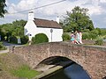
 Aldwark Bridge - geograph.org.uk - 1586694.jpg 640 × 479; 125 KB
-
 Alexandra Dock - Geograph-6497692-by-Alan-Murray-Rust.jpg 1,280 × 862; 259 KB
-
 All Saints, North Street - geograph.org.uk - 5625803.jpg 960 × 1,280; 299 KB
-
 All Saints, Pavement, York - geograph.org.uk - 6000815.jpg 1,093 × 1,280; 348 KB
-
 All Saints, Pavement, York - geograph.org.uk - 6000817.jpg 966 × 1,280; 407 KB
-

-
 Approaching The Mound station (geograph 6158361).jpg 842 × 1,280; 312 KB
-
 Archbishop's Palace - geograph.org.uk - 839072.jpg 640 × 426; 89 KB
-
 Art Deco shop front, 66 Blossom Street - geograph.org.uk - 6014280.jpg 1,280 × 1,280; 375 KB
-

-
 Baile Hill Tower, York - geograph.org.uk - 6014718.jpg 960 × 1,280; 381 KB
-
 Banana Warehouse, Piccadilly - geograph.org.uk - 6000225.jpg 1,280 × 960; 310 KB
-
 Banff Bridge (geograph 7190958).jpg 1,280 × 819; 291 KB
-
 Barclays Bank, Parliament Street, York, detail - geograph.org.uk - 6013891.jpg 1,280 × 960; 498 KB
-
 Barn on Nacton Fen - geograph.org.uk - 434026.jpg 640 × 480; 130 KB
-
 Barn on Nocton Fen - geograph.org.uk - 434013.jpg 640 × 480; 93 KB
-
 Barnwell Junction Station buildings (geograph 7104120).jpg 1,280 × 960; 497 KB
-
 Bartle Garth - geograph.org.uk - 5625798.jpg 1,280 × 860; 260 KB
-
 Bartle Garth with Bedern Hall - geograph.org.uk - 5625795.jpg 960 × 1,280; 335 KB
-
 Bay Horse Inn, Blossom Street - geograph.org.uk - 6014645.jpg 1,280 × 987; 320 KB
-
 Bedern Hall, interior - geograph.org.uk - 5626018.jpg 1,280 × 960; 334 KB
-
 Bedern Hall, the interior - geograph.org.uk - 5625796.jpg 1,280 × 988; 341 KB
-
 Beeston Castle and Tarporley - geograph.org.uk - 1350595.jpg 640 × 479; 108 KB
-
 Bellwater Junction signal box (geograph 4257482).jpg 960 × 1,280; 285 KB
-
 Bench mark, Station Road bridge, East Leake (geograph 4000966).jpg 899 × 1,280; 365 KB
-
 Between Potterhanworth and Bardney - geograph.org.uk - 434023.jpg 480 × 640; 159 KB
-
 Bilton-in-Ainsty St Helen chancel to south chapel GeoUK 7362897.jpg 1,280 × 960; 351 KB
-
 Bilton-in-Ainsty St Helen chancel to vestry & north aisle GeoUK 7362896.jpg 1,280 × 960; 335 KB
-
 Bilton-in-Ainsty St Helen from NE GeoUK 7362792.jpg 1,280 × 985; 324 KB
-
 Bilton-in-Ainsty St Helen from S GeoUK 7362785.jpg 1,280 × 960; 278 KB
-
 Bilton-in-Ainsty St Helen travers GeoUK7362807.jpg 1,280 × 1,013; 364 KB
-
 Black Horse, Caythorpe - geograph.org.uk - 1551415.jpg 640 × 479; 169 KB
-
 Black Horse, Caythorpe - geograph.org.uk - 1551425.jpg 640 × 479; 89 KB
-
 Blossom Street at Micklegate Bar - geograph.org.uk - 6014269.jpg 1,280 × 920; 315 KB
-
 Bonding Warehouse - geograph.org.uk - 6000271.jpg 1,280 × 960; 390 KB
-
 Bonding Warehouse - geograph.org.uk - 6000273.jpg 1,280 × 960; 382 KB
-
 Bonding Warehouse - geograph.org.uk - 6000283.jpg 1,280 × 822; 333 KB
-
 Borrobol Platform (geograph 6158429).jpg 841 × 1,280; 334 KB
-
 Breaking the soil - geograph.org.uk - 1551520.jpg 640 × 479; 162 KB
-
 Breaking the soil - geograph.org.uk - 1551523.jpg 640 × 426; 167 KB
-
 Bridge and canalside cottage at Shipley Gate - geograph.org.uk - 3556757.jpg 1,280 × 960; 411 KB
-
 Bridge at Tattershall. - geograph.org.uk - 1630163.jpg 640 × 479; 99 KB
-
 Bridge on the footpath - geograph.org.uk - 1551521.jpg 480 × 640; 287 KB
-
 Bridge over the A180 - geograph.org.uk - 883277.jpg 640 × 480; 73 KB
-
 Bridge over the Dover Beck - geograph.org.uk - 1536327.jpg 640 × 479; 152 KB
-
 Bridge over the River Foss, Layerthorpe - geograph.org.uk - 5999419.jpg 1,280 × 833; 339 KB
-
 Bridge over the River Foss, Layerthorpe - geograph.org.uk - 5999426.jpg 960 × 1,280; 388 KB
-

-
 Bridleway at Southrey - geograph.org.uk - 434201.jpg 477 × 640; 159 KB
-
 Bridleway to Hoveringham Mill - geograph.org.uk - 1551310.jpg 640 × 479; 128 KB
-
 Bridleway to Hoveringham Mill - geograph.org.uk - 1551313.jpg 640 × 479; 117 KB
-
 Bridleways near Southrey - geograph.org.uk - 434041.jpg 640 × 480; 80 KB
-
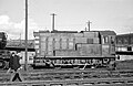 British Rail Class D3 10 No. 15100.jpg 1,280 × 837; 324 KB
-
 Broad Beans and Southrey Wood - geograph.org.uk - 434046.jpg 640 × 480; 167 KB
-
 Buckingham Street, York - geograph.org.uk - 6000308.jpg 1,280 × 1,001; 336 KB
-

-
 Campney Lane at Poplar Grove - geograph.org.uk - 434265.jpg 640 × 480; 180 KB
-
 Campney Lane near Horsington Holmes - geograph.org.uk - 434243.jpg 640 × 480; 149 KB
-
 Car Dyke - geograph.org.uk - 1551516.jpg 479 × 640; 232 KB
-
 Castle Mills Lock, York - geograph.org.uk - 6014722.jpg 1,073 × 1,280; 335 KB
-
 Cattal Station - geograph.org.uk - 1586774.jpg 640 × 479; 123 KB
-
 Caythorpe from the footpath - geograph.org.uk - 1551517.jpg 640 × 479; 127 KB
-
 Caythorpe Mill - geograph.org.uk - 1551412.jpg 640 × 479; 182 KB
-
 Caythorpe Mill - geograph.org.uk - 1551419.jpg 640 × 476; 243 KB
-
 Caythorpe Mill waterwheel - geograph.org.uk - 1551421.jpg 640 × 479; 176 KB
-
 Chapel Lane - geograph.org.uk - 1586667.jpg 640 × 479; 113 KB
-
 Chestnut Avenue Poplar Road - geograph.org.uk - 434275.jpg 640 × 473; 132 KB
-
 Church of St Denys, east end - geograph.org.uk - 6000238.jpg 1,280 × 928; 444 KB
-
 Church of St Denys, south doorway - geograph.org.uk - 6000233.jpg 918 × 1,280; 388 KB
-
 Church of St Denys, south side - geograph.org.uk - 6000235.jpg 1,280 × 964; 376 KB
-
 Church of St Denys, west end - geograph.org.uk - 6000232.jpg 1,209 × 1,280; 311 KB
-
 Church of St Giles, Darlton - geograph.org.uk - 4140493.jpg 1,280 × 960; 341 KB
-
 Church of St Helens, Bilton-in-Ainsty (geograph 7362801).jpg 1,280 × 973; 333 KB
-
 Church of St John the Baptist, Treswell - geograph.org.uk - 4154746.jpg 1,280 × 978; 332 KB
-
 Church of St Laurence, Gonalston (geograph 6508469).jpg 960 × 1,280; 391 KB
-
 Church of St Mary, Chalgrove - the nave - geograph.org.uk - 4075620.jpg 1,280 × 964; 157 KB
-
 Church of St Mary, Greasley (geograph 5967241).jpg 1,280 × 1,280; 594 KB
-
 Church of St Nicholas, Islip, North aisle arcade - geograph.org.uk - 4066237.jpg 1,280 × 960; 165 KB
-
 Church of St Peter, Thurgarton (geograph 6844592).jpg 960 × 1,280; 529 KB
-
 Church of the Holy Trinity, Goodramgate - geograph.org.uk - 5626011.jpg 1,280 × 1,280; 390 KB
-
 Church of the Holy Trinity, Goodramgate - geograph.org.uk - 5626012.jpg 1,280 × 960; 378 KB
-
 Church of the Holy Trinity, Goodramgate - geograph.org.uk - 5626014.jpg 1,280 × 960; 380 KB
-
 Church of the Holy Trinity, Goodramgate - geograph.org.uk - 5626016.jpg 1,280 × 927; 371 KB
-
 Church of the Holy Trinity, Goodramgate - geograph.org.uk - 5626017.jpg 1,280 × 960; 348 KB
-
 Church Street, Market Deeping - geograph.org.uk - 672654.jpg 628 × 460; 89 KB
-
 City Walls alongside Jewbury - geograph.org.uk - 5999379.jpg 1,280 × 876; 515 KB
-
 City Walls near Lendal Tower - geograph.org.uk - 6014251.jpg 1,280 × 960; 823 KB
-
 Class 222 at East Midlands Parkway railway station in 2009.jpg 640 × 442; 98 KB
-
 Clifford's Tower, York Castle - geograph.org.uk - 6000265.jpg 1,280 × 869; 336 KB
-
 Clifton Road Bridge, Ruddington (geograph 7123635).jpg 1,280 × 960; 525 KB
-
 Colwick Hall - geograph.org.uk - 652744.jpg 640 × 480; 95 KB
-
 Colwick Hall across the Hall Lake - geograph.org.uk - 652740.jpg 623 × 442; 135 KB
-

-
 Commemorative plaque, Skeldergate Bridge - geograph.org.uk - 6000269.jpg 1,280 × 960; 407 KB
-
 Cow Parsley and Rape on Nocton Fen - geograph.org.uk - 434031.jpg 640 × 470; 140 KB
-

-

-
 Cumberland House, York - geograph.org.uk - 6000302.jpg 1,280 × 1,280; 480 KB
-
 Dallas York Road, Beeston - geograph.org.uk - 680851.jpg 640 × 480; 103 KB
-
 Damford Grounds - geograph.org.uk - 418308.jpg 640 × 427; 144 KB
-
 Datestone and inscription, Bonding Warehouse - geograph.org.uk - 6000274.jpg 1,280 × 960; 296 KB
-
 Datestone, Gaddesby School - geograph.org.uk - 5298621.jpg 960 × 1,280; 555 KB
-
 December late afternoon sun on the Minster - geograph.org.uk - 5999386.jpg 1,280 × 1,280; 381 KB
-
 December sunset over the River Ouse - geograph.org.uk - 6000275.jpg 1,280 × 960; 341 KB
-
 Denton Village Hall.jpg 1,280 × 960; 300 KB
-
 Der Oderturm - geo-en.hlipp.de - 13393.jpg 426 × 640; 91 KB
-
 Derelict car park - geograph.org.uk - 882803.jpg 640 × 480; 104 KB
-
 Desolate field - geograph.org.uk - 882138.jpg 640 × 480; 113 KB
-
 Dover Beck bridge, Caythorpe - geograph.org.uk - 1551328.jpg 479 × 640; 193 KB
-
 Dover Beck near Caythorpe - geograph.org.uk - 1551319.jpg 640 × 479; 193 KB
-
 Drainage ditch on Damford Grounds - geograph.org.uk - 422686.jpg 640 × 427; 148 KB
-
 Dukedog class 9004 at Wellington station, 1960 (geograph 6430860).jpg 1,280 × 840; 474 KB
-
 Dyl's cafe bar - geograph.org.uk - 6000268.jpg 1,067 × 1,280; 442 KB
-
 Earthwork in Newball Wood - geograph.org.uk - 329921.jpg 640 × 427; 114 KB
-
 Easingwold Market Cross - geograph.org.uk - 1586642.jpg 640 × 479; 93 KB
-
 Easingwold Market Place - geograph.org.uk - 1586639.jpg 640 × 479; 98 KB
-
 Easingwold Town Hall - geograph.org.uk - 1586631.jpg 640 × 479; 82 KB
-
 Edmondthorpe and Wymondham station - geograph.org.uk - 4815959.jpg 1,280 × 960; 530 KB
-
 Embsay bus at Skipton - geograph.org.uk - 2668022.jpg 1,280 × 846; 228 KB
-
 End of the City walls at Layerthorpe - geograph.org.uk - 5999388.jpg 1,280 × 960; 366 KB
-
 Entrance to former Heck Station goods yard (geograph 6008073).jpg 1,280 × 960; 630 KB
-
 Entrance to Grangetown Station - geograph.org.uk - 1730564.jpg 1,280 × 959; 292 KB
-
 Entrance to the goods yard (geograph 4809953).jpg 1,280 × 960; 394 KB
-
 Entry to Newball Wood - geograph.org.uk - 330370.jpg 640 × 427; 111 KB
-
 Exhibition Square and York Minster - geograph.org.uk - 6014237.jpg 1,280 × 1,280; 344 KB
-
 Fairfax Street, York - geograph.org.uk - 6014712.jpg 1,280 × 960; 356 KB
-
 Farm bridge over the Dover Beck - geograph.org.uk - 1551325.jpg 640 × 479; 211 KB
-
 Farm bridge over the River Eau - geograph.org.uk - 544609.jpg 640 × 480; 105 KB
-
 Farm track and ditch on Digby Fen - geograph.org.uk - 420924.jpg 640 × 427; 195 KB
-
 Farm track near Misson - geograph.org.uk - 516964.jpg 640 × 425; 89 KB
-
 Farm track near Southrey. - geograph.org.uk - 434038.jpg 640 × 462; 148 KB
-
 Farmland and pipeline at Marsh Lane - geograph.org.uk - 883523.jpg 640 × 480; 102 KB
-
 Farmland near Redbourne - geograph.org.uk - 545018.jpg 640 × 480; 111 KB
-
 Farmland near Southrey - geograph.org.uk - 434035.jpg 640 × 475; 132 KB
-
 Fast Wil creeps round the corner - geograph.org.uk - 579242.jpg 640 × 427; 88 KB
-
 Field boundary near Kirton - geograph.org.uk - 545006.jpg 640 × 480; 113 KB
-
 Fields near Northorpe - geograph.org.uk - 544608.jpg 640 × 480; 107 KB
-
 Finningley Station - geograph.org.uk - 503647.jpg 640 × 480; 103 KB
-
 Fishergate Tower - geograph.org.uk - 6000247.jpg 1,280 × 857; 268 KB
-
 Fishing on a reservoir - geograph.org.uk - 544616.jpg 640 × 480; 92 KB
-
 Flush Bracket Bench Mark 2423, High Petergate - geograph.org.uk - 6000800.jpg 1,280 × 1,280; 559 KB
-
 Footbridge near Gonalston - geograph.org.uk - 1508215.jpg 479 × 640; 146 KB
-
-
 Footpath along the Dover Beck - geograph.org.uk - 1551314.jpg 640 × 479; 182 KB
-
 Footpath near Northorpe - geograph.org.uk - 544606.jpg 640 × 480; 69 KB
-

-
 Former Church of St John the Evangelist - geograph.org.uk - 6000313.jpg 1,280 × 856; 331 KB
-
 Former Church of St John the Evangelist - geograph.org.uk - 6000314.jpg 960 × 1,280; 339 KB
-
 Former Debtors' Prison, York Castle - geograph.org.uk - 6000245.jpg 1,280 × 848; 292 KB
-
 Former Debtors' Prison, York Castle, clock tower - geograph.org.uk - 6000251.jpg 960 × 1,280; 252 KB
-
 Former Engineers' Office, Chesterfield (2).jpg 1,280 × 868; 388 KB
-
 Former Engineers' Office, Chesterfield.jpg 1,280 × 1,280; 430 KB
-
 Former footbridge location - geograph.org.uk - 779977.jpg 476 × 640; 78 KB
-
 Former Home Farm Barn, Wollaton House.jpg 1,280 × 960; 445 KB
-
 Former Judge's Bakery, Nottingham.jpg 1,280 × 960; 277 KB
-
 Former Lace Factory, Mansfield Road, Nottingham.jpg 1,280 × 948; 352 KB
-
 Former Maxwell's Hotel, Walmgate - geograph.org.uk - 6000242.jpg 1,280 × 868; 403 KB
-
 Former railway goods yard (geograph 4809954).jpg 1,280 × 960; 333 KB
-
 Former Stamford East Station building (geograph 6393616).jpg 1,280 × 960; 309 KB
-
 Former Stamford East Station building - main entrance (geograph 6393620).jpg 920 × 1,280; 333 KB
-
 Former Stamford East Station building, south side (geograph 6393617).jpg 1,280 × 939; 352 KB

_-_geograph.org.uk_-_6014239.jpg)


.jpg)


.jpg)


_-_geograph.org.uk_-_545654.jpg)


.jpg)


.jpg)


.jpg)
.jpg)


.jpg)


.jpg)

.jpg)

.jpg)

.jpg)


.jpg)


.jpg)


.jpg)

.jpg)


.jpg)


.jpg)


.jpg)
.jpg)
.jpg)
.jpg)