Category:Igreja dos Lóios
Jump to navigation
Jump to search
| Object location | | View all coordinates using: OpenStreetMap |
|---|
church building in Évora, Évora District, Portugal  | |||||
| Upload media | |||||
| Instance of | |||||
|---|---|---|---|---|---|
| Part of | |||||
| Location | Sé e São Pedro, União das Freguesias de Évora (São Mamede, Sé, São Pedro e Santo Antão), Évora, Portugal | ||||
| Architectural style | |||||
| Diocese | |||||
| Heritage designation | |||||
| Religion or worldview | |||||
 | |||||
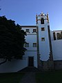
Português: Igreja dos Lóios, compreendendo as campas de bronze / Convento dos Lóios em Évora. Portugal, Évora, Évora, União das freguesias de Évora (São Mamede, Sé, São Pedro e Santo Antão)
|
This monument is classified as
Monumento Nacional .It is indexed in the IGESPAR database ( Instituto de Gestão do Património Arquitectónico e Arqueológico ), under the reference 69784.It is indexed in the SIPA database (Sistema de Informação para o Património Arquitectónico) under the reference 1167. |
Subcategories
This category has only the following subcategory.
I
- Interior of Igreja dos Lóios (15 F)
Media in category "Igreja dos Lóios"
The following 32 files are in this category, out of 32 total.
-
 Aerial view of the Cathedral of Évora.jpg 3,016 × 4,024; 9.29 MB
-
 Evora (10242656033).jpg 2,448 × 3,264; 2.15 MB
-
 Evora (34578807975).jpg 4,272 × 2,848; 3.46 MB
-
 Evora (34968475401).jpg 2,848 × 4,272; 2.35 MB
-
 Evora (35059313456).jpg 4,272 × 2,848; 2.91 MB
-
 Evora, Portugal (40066023750).jpg 4,896 × 2,752; 5.2 MB
-
 Evora, Portugal (41156490084).jpg 2,752 × 4,896; 5.38 MB
-
 Evora, Portugal (52958931439).jpg 6,960 × 4,640; 13.78 MB
-
 Evora-LoiosChurch.jpg 2,736 × 3,648; 2.43 MB
-
 Igreja de São João Evangelista - Igreja dos Lóios (50861127226).jpg 5,184 × 3,888; 12.96 MB
-
 Igreja de São João Evangelista - Igreja dos Lóios (50862537542).jpg 3,421 × 3,024; 7.02 MB
-
 Igreja dos Loios - Évora - Portugal (2318754280).jpg 959 × 1,280; 288 KB
-
 Portogallo2007 (1668823276).jpg 3,648 × 2,736; 2.63 MB
-
 Portugal-Evora-P1250288 (25893556815).jpg 1,618 × 1,080; 1.27 MB
-
 Pousad Convent Lóios - panoramio.jpg 1,952 × 2,592; 979 KB
-
 Pousada dos Lóios - Convento dos Lóios ou Convento de São João Evangelista.jpg 2,362 × 3,543; 1.5 MB
-
 Évora (6097685378).jpg 1,000 × 669; 244 KB
-
 Évora - Portugal (314346043).jpg 1,280 × 936; 292 KB
-
 Évora - Portugal (8278904896).jpg 5,115 × 3,836; 9.98 MB
-
 Évora - Portugal (8607764502).jpg 2,048 × 1,036; 324 KB
-
 Évora -i---i- (24271592207).jpg 3,024 × 4,032; 1.47 MB
-
 Évora 2015 10 16 1022 (23970321445).jpg 7,360 × 4,912; 37.15 MB
-
 Évora IMG 6545 (21101938806).jpg 5,616 × 3,744; 2.68 MB
-
 Évora IMG 6546 (20940262558).jpg 5,616 × 3,744; 2.66 MB
-
 Évora IMG 6572 (21135860461).jpg 5,616 × 3,744; 2.42 MB
-
 Évora IMG 6573 (21128147815).jpg 5,616 × 3,744; 2.86 MB
-
 Évora IMG 6574 (20941322489).jpg 5,616 × 3,744; 2.35 MB
-
 Évora IMG 6580 (20940031410).jpg 5,616 × 3,744; 2.86 MB
-
 Évora IMG 6581 (21128146235).jpg 5,616 × 3,744; 2.68 MB
-
 Évora IMG 6582 (20940030590).jpg 5,616 × 3,744; 2.65 MB
-
 Évora IMG 6584 (21128145325).jpg 5,616 × 3,744; 3.38 MB
-
 Évora IMG 6585 (20507059323).jpg 5,616 × 3,744; 2.8 MB

.jpg)
.jpg)
.jpg)
.jpg)
.jpg)
.jpg)
.jpg)
.jpg)
.jpg)
.jpg)
.jpg)
.jpg)


.jpg)
.jpg)
.jpg)
.jpg)
.jpg)
.jpg)
.jpg)
.jpg)
.jpg)
.jpg)
.jpg)
.jpg)
.jpg)
.jpg)
.jpg)
.jpg)