Category:Igreja de Nossa Senhora da Conceição (Ferreira do Alentejo)
Jump to navigation
Jump to search
| Object location | | View all coordinates using: OpenStreetMap |
|---|
| This building is classified as Sem proteção legal .It is indexed in the SIPA database (Sistema de Informação para o Património Arquitetónico) under the reference 10154. |
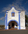
church in Ferreira do Alentejo  | |||||
| Upload media | |||||
| Instance of | |||||
|---|---|---|---|---|---|
| Location | Ferreira do Alentejo, Ferreira do Alentejo e Canhestros, Ferreira do Alentejo, Beja, Portugal | ||||
| Diocese | |||||
| Heritage designation | |||||
 | |||||
Media in category "Igreja de Nossa Senhora da Conceição (Ferreira do Alentejo)"
This category contains only the following file.
-
 Ferreira-alent-01-1-nsra-conceicao.jpg 979 × 1,200; 255 KB