Category:Ide Hill
Jump to navigation
Jump to search
English: Ide Hill is a village within the civil parish of Sundridge with Ide Hill, in the Sevenoaks District of Kent, England. It stands on one of the highest points of the sandstone ridge about five miles south-west of Sevenoaks. Its name first appears on record in 1250 as Edythehelle, meaning 'Edith's hill'

village in United Kingdom  | |||||
| Upload media | |||||
| Instance of | |||||
|---|---|---|---|---|---|
| Location | Sundridge with Ide Hill, Sevenoaks, Kent, South East England, England | ||||
| Different from | |||||
 | |||||
Subcategories
This category has the following 3 subcategories, out of 3 total.
Media in category "Ide Hill"
The following 82 files are in this category, out of 82 total.
-
 Barn at Yorkshill Farm - geograph.org.uk - 1803366.jpg 1,024 × 683; 190 KB
-
 Barrier on the Greensand Way, Toy's Hill - geograph.org.uk - 1499358.jpg 640 × 430; 187 KB
-
 Bough Beech Reservoir Nature Reserve - geograph.org.uk - 153148.jpg 640 × 462; 93 KB
-

-
 Bridleway near Goathurst Common carpark - geograph.org.uk - 1549320.jpg 427 × 640; 102 KB
-
 Bridleway on Boarhill access road - geograph.org.uk - 1549295.jpg 640 × 427; 94 KB
-
-
 Deeply ploughed field east of Chains Farm - geograph.org.uk - 396466.jpg 640 × 466; 111 KB
-
 Emmetts House.jpg 6,016 × 4,016; 12.45 MB
-

-
 Farmland and Houses at Coopers Corner - geograph.org.uk - 151948.jpg 640 × 480; 117 KB
-
 Footpath junction in Stubbs Wood - geograph.org.uk - 1549253.jpg 640 × 427; 100 KB
-
 Goathurst Common crossroads - geograph.org.uk - 1549155.jpg 640 × 427; 87 KB
-

-
 Hanging Bank Carpark - geograph.org.uk - 1549342.jpg 640 × 427; 59 KB
-
 Hanging Bank Information Board - geograph.org.uk - 1549330.jpg 640 × 427; 65 KB
-
 Henden Manor - Ide Hill - geograph.org.uk - 164903.jpg 640 × 480; 150 KB
-
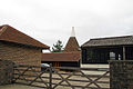
 Henden Manor Oast, Ide Hill, Kent - geograph.org.uk - 2099513.jpg 640 × 427; 96 KB
-
 House by the village green, Ide Hill - geograph.org.uk - 2468148.jpg 640 × 430; 69 KB
-
 House on the Village Green, Ide Hill - geograph.org.uk - 1495646.jpg 640 × 371; 65 KB
-
 Houses by village green, Ide Hill - geograph.org.uk - 2561207.jpg 640 × 480; 78 KB
-
 Houses in Ide Hill - geograph.org.uk - 2470648.jpg 640 × 430; 78 KB
-
 Ide Hill Post Office - geograph.org.uk - 1495641.jpg 640 × 430; 79 KB
-
 Ide Hill Post Office - geograph.org.uk - 2468165.jpg 640 × 430; 85 KB
-
 Ide Hill Primary School - geograph.org.uk - 1499206.jpg 640 × 430; 118 KB
-
 Ide Hill Primary School - geograph.org.uk - 2468117.jpg 640 × 430; 63 KB
-
 Ide Hill Primary School - geograph.org.uk - 2468127.jpg 640 × 430; 82 KB
-
 Ide Hill Viewpoint Information Board - geograph.org.uk - 1947936.jpg 3,072 × 2,304; 1.53 MB
-
 Ide Hill Village Green - geograph.org.uk - 1495644.jpg 640 × 430; 90 KB
-
 Ide Hill Village Green - geograph.org.uk - 2205767.jpg 1,160 × 767; 377 KB
-
 Ide Hill village hall - geograph.org.uk - 2470665.jpg 640 × 430; 52 KB
-
 Ide Hill, Village Hall - geograph.org.uk - 1495629.jpg 640 × 430; 54 KB
-
 Kissing gate and footbridge near Bushes Plantation - geograph.org.uk - 1705013.jpg 1,600 × 1,198; 692 KB
-
 Kissing Gate on the Greensand Way - geograph.org.uk - 1499224.jpg 640 × 430; 153 KB
-
 Lane south of Ide Hill - geograph.org.uk - 2470658.jpg 640 × 430; 94 KB
-
-
 Looking towards Ide Hill - geograph.org.uk - 34582.jpg 640 × 480; 97 KB
-
 Post Office, Ide Hill - geograph.org.uk - 1553313.jpg 640 × 480; 78 KB
-
 Public Toilets, Ide Hill Car Park - geograph.org.uk - 1495622.jpg 640 × 430; 66 KB
-
 Recycling Centre, Ide Hill Car Park - geograph.org.uk - 1495618.jpg 640 × 430; 84 KB
-
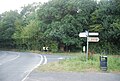 Road junction, Ide Hill - geograph.org.uk - 1495625.jpg 640 × 430; 94 KB
-
 Road through Ide Hill - geograph.org.uk - 1296974.jpg 640 × 427; 59 KB
-
 Roundabout, Ide Hill - geograph.org.uk - 1495649.jpg 640 × 430; 55 KB
-
 Roundabout, Ide Hill - geograph.org.uk - 1553294.jpg 640 × 480; 54 KB
-

-
 Stile and Gate on the Greensand Way - geograph.org.uk - 1499222.jpg 640 × 430; 137 KB
-
 Stile by the side of the Greensand Way - geograph.org.uk - 1499216.jpg 640 × 430; 152 KB
-
 Stile near Cooper's Corner - geograph.org.uk - 1536632.jpg 640 × 427; 134 KB
-
 Stile near Highland copse - geograph.org.uk - 1536603.jpg 640 × 427; 90 KB
-
 Stile near Highland wood - geograph.org.uk - 1536599.jpg 640 × 427; 109 KB
-
 Stile on the Greensand Way, Ide Hill - geograph.org.uk - 1499210.jpg 640 × 430; 162 KB
-

-
 Stubbs Wood - Hanging Bank - geograph.org.uk - 152677.jpg 640 × 427; 83 KB
-
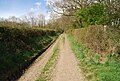
 The Greensand Way west of Ide Hill - geograph.org.uk - 1499212.jpg 640 × 430; 147 KB
-
 The road into Ide Hill - geograph.org.uk - 1495631.jpg 640 × 430; 81 KB
-

-
 Track heading for Bore Place - geograph.org.uk - 1256643.jpg 640 × 430; 141 KB
-
 Track heading for Faulkner Hill Farm - geograph.org.uk - 1256654.jpg 640 × 430; 111 KB
-
 Track into Stubb's Cross - geograph.org.uk - 1549279.jpg 640 × 427; 91 KB
-

-
 View from Stubb's Cross Wood - geograph.org.uk - 1549290.jpg 640 × 427; 56 KB
-

-
 Village Centre, Ide Hill - geograph.org.uk - 1553308.jpg 640 × 480; 54 KB
-
 Woodland by the Greensand Way - geograph.org.uk - 1499223.jpg 640 × 430; 126 KB
-
 Woodland by the Greensand Way, Ide Hill - geograph.org.uk - 1499219.jpg 640 × 430; 153 KB
-
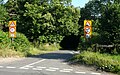 Yorks Hill - Steep Hill 16^ - geograph.org.uk - 1429804.jpg 640 × 400; 129 KB
-
 Barn, Bardogs Farm, Puddledock Lane - geograph.org.uk - 1499778.jpg 640 × 430; 143 KB
-
 Bridleway, Toy's Hill - geograph.org.uk - 1499459.jpg 640 × 430; 191 KB
-
 Cattle by the Greensand Way - geograph.org.uk - 1499228.jpg 640 × 430; 159 KB
-
 Chart Lane - geograph.org.uk - 1499456.jpg 640 × 430; 155 KB
-
 Chartland's Cottage, Toy's Hill - geograph.org.uk - 1499748.jpg 640 × 430; 156 KB
-
 Eastwood Cottages - Yorkshill - geograph.org.uk - 209232.jpg 640 × 480; 105 KB
-
 Farm Barn - Ide Hill - geograph.org.uk - 156901.jpg 640 × 480; 100 KB
-
 Goathurst Common Well - geograph.org.uk - 151800.jpg 640 × 480; 102 KB
-
 Henden Farm - Looking towards Toy's Hill - geograph.org.uk - 164897.jpg 640 × 480; 115 KB
-
 Ide Hill - geograph.org.uk - 543097.jpg 640 × 419; 59 KB
-

-
 Tanhouse Wood and Fields - Toys Hill - geograph.org.uk - 151773.jpg 640 × 480; 81 KB
-
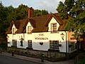 The Woodman - Goathurst Common - geograph.org.uk - 451309.jpg 640 × 480; 108 KB
-
 Toys Hill signs - geograph.org.uk - 34580.jpg 640 × 480; 166 KB
-

-
 Wrapped silage bales - geograph.org.uk - 154646.jpg 640 × 480; 116 KB


