Category:Idbury
Jump to navigation
Jump to search
village and civil parish in West Oxfordshire, Oxfordshire, England  | |||||
| Upload media | |||||
| Instance of | |||||
|---|---|---|---|---|---|
| Location | West Oxfordshire, Oxfordshire, South East England, England | ||||
 | |||||
English: Idbury is a village and civil parish in the Cotswold Hills in Oxfordshire, about 4.5 miles southeast of Stow-on-the-Wold in neighbouring Gloucestershire.
Subcategories
This category has the following 3 subcategories, out of 3 total.
Media in category "Idbury"
The following 115 files are in this category, out of 115 total.
-
 A field of his own - geograph.org.uk - 1931740.jpg 4,000 × 3,000; 2.62 MB
-
 A look back from near to "No Man's Land" - geograph.org.uk - 3301122.jpg 2,048 × 1,536; 472 KB
-
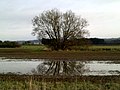 A tree reflected in a pool of water - geograph.org.uk - 3301118.jpg 2,048 × 1,536; 559 KB
-
 A424 at the county boundary - geograph.org.uk - 2651800.jpg 640 × 480; 60 KB
-
 A424 at the junction for Idbury - geograph.org.uk - 2651796.jpg 640 × 480; 55 KB
-
 A424 near Fifield - geograph.org.uk - 2651793.jpg 640 × 480; 49 KB
-
 Barn by the road - geograph.org.uk - 2793073.jpg 4,320 × 3,240; 4.98 MB
-
 Barns and shelter - geograph.org.uk - 2793044.jpg 4,320 × 3,240; 5.09 MB
-
 Bould Cottages - geograph.org.uk - 1931721.jpg 4,000 × 3,000; 2.9 MB
-
 Bould Farm - geograph.org.uk - 1931717.jpg 4,000 × 3,000; 2.38 MB
-
 Bridge on the bend - geograph.org.uk - 1931727.jpg 4,000 × 3,000; 4.32 MB
-
 Bridleway - no through route - geograph.org.uk - 3206653.jpg 640 × 427; 235 KB
-
 Bridleway leaves the road - geograph.org.uk - 2789186.jpg 4,320 × 3,240; 4.69 MB
-
 Bridleway through the rape - geograph.org.uk - 1933324.jpg 4,000 × 3,000; 3.79 MB
-
 Bridleway to Bledington - geograph.org.uk - 1637547.jpg 640 × 480; 83 KB
-
 Bridleway to Bould - geograph.org.uk - 1933675.jpg 4,000 × 3,000; 3.46 MB
-
 Bridleway to nowhere - geograph.org.uk - 3206648.jpg 640 × 462; 242 KB
-
 Bridleway to nowhere - geograph.org.uk - 3206654.jpg 640 × 427; 206 KB
-
 Bridleway to nowhere - geograph.org.uk - 3206658.jpg 640 × 427; 199 KB
-
 Bridleway up the hill - geograph.org.uk - 2789195.jpg 4,320 × 3,240; 4.72 MB
-
 Buildings in the bottom - geograph.org.uk - 2789302.jpg 4,320 × 3,240; 4.9 MB
-
 Bus shelter at the junction - geograph.org.uk - 1933053.jpg 4,000 × 3,000; 3.27 MB
-
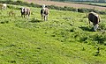 Cattle at Idbury - geograph.org.uk - 3206639.jpg 640 × 391; 178 KB
-
 Change of angle - geograph.org.uk - 1933329.jpg 4,000 × 3,000; 1.88 MB
-
 Church Farm - the farmhouse - geograph.org.uk - 1933087.jpg 4,000 × 3,000; 3.21 MB
-
 Church Farm. Idbury (1) - geograph.org.uk - 1933043.jpg 4,000 × 3,000; 3.04 MB
-
 Church Street - geograph.org.uk - 3206642.jpg 640 × 429; 268 KB
-
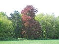 Copper Beech - geograph.org.uk - 2400360.jpg 4,288 × 3,216; 3.89 MB
-
 Country junction - geograph.org.uk - 2789183.jpg 4,320 × 3,240; 5.1 MB
-
 End of footpath - geograph.org.uk - 1933048.jpg 4,000 × 3,000; 3.06 MB
-
 End of path - geograph.org.uk - 1934911.jpg 4,000 × 3,000; 2.58 MB
-
 End of the bridleway - geograph.org.uk - 3206660.jpg 640 × 427; 204 KB
-
 End of the way - geograph.org.uk - 2789312.jpg 4,320 × 3,240; 4.94 MB
-
 Footpath approaching Idbury - geograph.org.uk - 3206637.jpg 640 × 427; 172 KB
-
 Footpath ends - geograph.org.uk - 1931714.jpg 4,000 × 3,000; 3.69 MB
-
 Footpath meets road - geograph.org.uk - 1931697.jpg 4,000 × 3,000; 4.28 MB
-
 Footpath to Bould (3) - geograph.org.uk - 1931695.jpg 4,000 × 3,000; 4.32 MB
-
 Footpath to Bould (4) - geograph.org.uk - 1931710.jpg 4,000 × 3,000; 3.42 MB
-
 Footpath to Bould Wood - geograph.org.uk - 2681328.jpg 640 × 480; 62 KB
-
 Foscot Farm - geograph.org.uk - 1637566.jpg 640 × 480; 79 KB
-
 Foscot Village - geograph.org.uk - 2681319.jpg 640 × 480; 101 KB
-
 Foxcote Farm (1) - geograph.org.uk - 1934924.jpg 4,000 × 3,000; 2.8 MB
-
 Foxcote Farm (2) - geograph.org.uk - 1934926.jpg 4,000 × 3,000; 2.03 MB
-
 From the end of the bridleway - geograph.org.uk - 3206667.jpg 640 × 427; 197 KB
-
 Gates to Idbury House - geograph.org.uk - 1933057.jpg 4,000 × 3,000; 3.42 MB
-
 Green lane - geograph.org.uk - 2789359.jpg 4,320 × 3,240; 4.9 MB
-
 House in Idbury - geograph.org.uk - 1933084.jpg 4,000 × 3,000; 2.03 MB
-
 Idbury Camp hillfort - geograph.org.uk - 2789174.jpg 4,320 × 3,240; 4.21 MB
-
 Idbury Church - geograph.org.uk - 1933040.jpg 4,000 × 3,000; 2.81 MB
-
 Idbury House ha ha (1) - geograph.org.uk - 1933070.jpg 4,000 × 3,000; 3.24 MB
-
 Idbury House ha ha (2) - geograph.org.uk - 2793061.jpg 4,320 × 3,240; 4.81 MB
-
 Idbury Stables - geograph.org.uk - 1933108.jpg 4,000 × 3,000; 2.15 MB
-
 Idbury VRwallbox.jpg 1,800 × 3,000; 2.28 MB
-
 Junction in Idbury - geograph.org.uk - 1226285.jpg 640 × 427; 110 KB
-
 Junction on the edge of Idbury - geograph.org.uk - 1226274.jpg 640 × 427; 64 KB
-
 Long field - geograph.org.uk - 1933039.jpg 4,000 × 3,000; 3.69 MB
-
 Lower Farm, Bould - geograph.org.uk - 1931733.jpg 4,000 × 3,000; 3.26 MB
-
 Missing milestone^ - geograph.org.uk - 2789163.jpg 3,240 × 4,320; 5.83 MB
-
 Near Church Farm - geograph.org.uk - 3206645.jpg 640 × 427; 164 KB
-
 Ordnance Survey Flush Bracket (11048) - geograph.org.uk - 4548940.jpg 480 × 640; 129 KB
-
 Out of the wood - geograph.org.uk - 1934907.jpg 4,000 × 3,000; 3.87 MB
-
 Over Westcote Brook - geograph.org.uk - 1931694.jpg 4,000 × 3,000; 3.92 MB
-
 Oxfordshire and Gloucestershire farmland - geograph.org.uk - 1931706.jpg 4,000 × 3,000; 3.81 MB
-
 Oxfordshire countryside - geograph.org.uk - 1933034.jpg 4,000 × 3,000; 3.29 MB
-
 Oxfordshire countryside - geograph.org.uk - 1933340.jpg 4,000 × 3,000; 2.09 MB
-
 Oxfordshire farmland - geograph.org.uk - 1933035.jpg 4,000 × 3,000; 2.85 MB
-
 Oxfordshire farmland - geograph.org.uk - 1933635.jpg 4,000 × 3,000; 2.71 MB
-
 Oxfordshire Way near Kingham - geograph.org.uk - 3301115.jpg 2,048 × 1,536; 509 KB
-
 Path meets road - geograph.org.uk - 1933037.jpg 4,000 × 3,000; 4.07 MB
-
 Path through the crop - geograph.org.uk - 1934909.jpg 4,000 × 3,000; 3.16 MB
-
 Rickyard Farmhouse - geograph.org.uk - 1934920.jpg 4,000 × 3,000; 3.37 MB
-
 Road from Foscot to Bould - geograph.org.uk - 1216282.jpg 640 × 427; 93 KB
-
 Road through Foscot - geograph.org.uk - 1216270.jpg 640 × 427; 79 KB
-
 Road through Idbury - geograph.org.uk - 1216322.jpg 640 × 427; 77 KB
-
 Seven Shires Way - geograph.org.uk - 2681386.jpg 640 × 480; 82 KB
-
 Seven Shires Way - geograph.org.uk - 2682044.jpg 640 × 480; 69 KB
-
 Sheba's Pool - geograph.org.uk - 2789192.jpg 4,320 × 3,240; 5.09 MB
-
 St Nicholas, Idbury - geograph.org.uk - 1933100.jpg 4,000 × 3,000; 3.33 MB
-
 Start of bridleway - geograph.org.uk - 1933103.jpg 4,000 × 3,000; 3.02 MB
-
 Steps to the ha ha - geograph.org.uk - 1933076.jpg 4,000 × 3,000; 3.84 MB
-
 Stubble fields in the Evenlode valley - geograph.org.uk - 994570.jpg 640 × 426; 106 KB
-
 Sunlight on a ditch next to the Oxfordshire Way - geograph.org.uk - 3301117.jpg 2,048 × 1,536; 862 KB
-
 The A424 near Idbury - geograph.org.uk - 6238452.jpg 1,878 × 1,216; 1.15 MB
-
 The A424, Fifield - geograph.org.uk - 6304530.jpg 1,920 × 1,280; 1.7 MB
-
 The Evenlode valley - geograph.org.uk - 998260.jpg 640 × 426; 112 KB
-
 The Forge, Idbury - geograph.org.uk - 1933093.jpg 4,000 × 3,000; 3.5 MB
-
 The Oxfordshire Way - geograph.org.uk - 994566.jpg 640 × 426; 125 KB
-
 The River Evenlode in Oxfordshire - geograph.org.uk - 3301119.jpg 2,048 × 1,536; 568 KB
-
 The road through Foscot - geograph.org.uk - 5371953.jpg 640 × 480; 74 KB
-

-
 Through the gate - geograph.org.uk - 1933112.jpg 4,000 × 3,000; 2.8 MB
-
 Towards Idbury - geograph.org.uk - 1933060.jpg 4,000 × 3,000; 2.62 MB
-
 Towards Snow Hill - geograph.org.uk - 1933114.jpg 4,000 × 3,000; 4.02 MB
-
 Track to the view - geograph.org.uk - 2793049.jpg 4,320 × 3,240; 4.62 MB
-
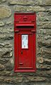
 Victorian Letterbox, Idbury - geograph.org.uk - 1933095.jpg 3,000 × 4,000; 3.01 MB
-

-
 View from the end of the bridleway - geograph.org.uk - 3206663.jpg 640 × 427; 182 KB
-
 View towards Idbury - geograph.org.uk - 1216375.jpg 640 × 427; 38 KB
-
 Workham Bottom - geograph.org.uk - 2792887.jpg 4,320 × 3,240; 4.99 MB
-
 Approaching Idbury - geograph.org.uk - 309087.jpg 640 × 480; 77 KB
-
 Blackheath Clump - geograph.org.uk - 272517.jpg 640 × 480; 196 KB
-

-
 Bruern Grange - geograph.org.uk - 309069.jpg 640 × 480; 149 KB
-
 Burford to Stow road, view over crops - geograph.org.uk - 130793.jpg 640 × 480; 225 KB
-

-
 Fields in light snow, Idbury - geograph.org.uk - 130796.jpg 640 × 480; 166 KB
-
 Footpath to Herbert's Heath - geograph.org.uk - 327220.jpg 640 × 480; 109 KB
-
 Hill Farm and the road to Bruern - geograph.org.uk - 272501.jpg 640 × 480; 97 KB
-
 Kite flying, Milton under Wychwood - geograph.org.uk - 234455.jpg 640 × 480; 49 KB
-
 Lane in the Oxfordshire Cotswolds - geograph.org.uk - 309076.jpg 640 × 480; 75 KB
-
 Ploughed field near Fifield - geograph.org.uk - 131228.jpg 480 × 640; 265 KB
-
 Snowdrops - geograph.org.uk - 327226.jpg 640 × 427; 163 KB
-
 Track over Habber Gallows Hill - geograph.org.uk - 272603.jpg 480 × 640; 135 KB
-
 Trig point in the hedge - geograph.org.uk - 272508.jpg 640 × 427; 140 KB
-
 Trig. point detail - geograph.org.uk - 272511.jpg 480 × 640; 159 KB


_-_geograph.org.uk_-_1933043.jpg)


_-_geograph.org.uk_-_1931695.jpg)
_-_geograph.org.uk_-_1931710.jpg)


_-_geograph.org.uk_-_1934924.jpg)
_-_geograph.org.uk_-_1934926.jpg)


_-_geograph.org.uk_-_1933070.jpg)
_-_geograph.org.uk_-_2793061.jpg)


_-_geograph.org.uk_-_4548940.jpg)


