Category:Hunwick
Jump to navigation
Jump to search
English: Hunwick is a semi-rural village in County Durham, England. There are actually two villages that are often referred to collectively as Hunwick, Hunwick and New Hunwick although it is generally accepted that the two villages are now as one.
village in United Kingdom  | |||||
| Upload media | |||||
| Instance of | |||||
|---|---|---|---|---|---|
| Location | County Durham, North East England, England | ||||
 | |||||
Subcategories
This category has the following 3 subcategories, out of 3 total.
H
- Helmington Hall, Hunwick (5 F)
- Hunwick Hall (5 F)
- Hunwick railway station (2 F)
Media in category "Hunwick"
The following 26 files are in this category, out of 26 total.
-
 Brandon to Bishop Auckland Railway Path - geograph.org.uk - 5064666.jpg 5,312 × 2,988; 7.97 MB
-
 Brandon to Bishop Auckland Railway Walk - geograph.org.uk - 6368221.jpg 2,000 × 1,333; 3.08 MB
-
 Brandon to Bishop Auckland Walk - geograph.org.uk - 2760778.jpg 1,500 × 1,125; 1.83 MB
-
 Course of Roman Road - geograph.org.uk - 2805570.jpg 640 × 427; 250 KB
-
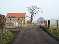 Farm road at Hunwick Station - geograph.org.uk - 4868023.jpg 4,320 × 3,240; 2.83 MB
-
 Farmhouse at New House Farm - geograph.org.uk - 2843519.jpg 1,843 × 1,454; 634 KB
-
 Field adjacent to B6286 - geograph.org.uk - 3740090.jpg 1,500 × 1,125; 1.98 MB
-
 Grazing land east of Hunwick - geograph.org.uk - 2843569.jpg 3,648 × 2,736; 3.12 MB
-
 Grazing land northwest of Toronto - geograph.org.uk - 2843536.jpg 3,648 × 2,736; 2.34 MB
-
 Helmington Terrace, New Hunwick - geograph.org.uk - 124396.jpg 640 × 480; 103 KB
-
 New House Farm - geograph.org.uk - 501989.jpg 640 × 480; 72 KB
-
 Rough Lea Lane, Hunwick - geograph.org.uk - 124394.jpg 480 × 640; 110 KB
-
 Route of Roman Road - geograph.org.uk - 2805556.jpg 640 × 427; 254 KB
-
 St. Paul the Apostle 1844 , Hunwick - geograph.org.uk - 317328.jpg 640 × 479; 128 KB
-
 The Brandon-Bishop Auckland Railway Walk - geograph.org.uk - 3564899.jpg 3,648 × 2,736; 2.8 MB
-
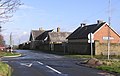
 The Green, Hunwick - geograph.org.uk - 2056644.jpg 640 × 480; 67 KB
-
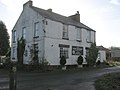
 The Joiners Arms, Hunwick - geograph.org.uk - 2056634.jpg 640 × 480; 83 KB
-
 View from Pixley Hill down B6286 - geograph.org.uk - 2056653.jpg 640 × 480; 45 KB
-
 Village Green in Hunwick - geograph.org.uk - 3740192.jpg 1,500 × 1,125; 1.84 MB
-
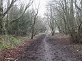 Wooded section of the old railway line - geograph.org.uk - 4868018.jpg 4,320 × 3,240; 4.48 MB
-
 Blakeley Hill Farm, Hunwick - geograph.org.uk - 124397.jpg 640 × 480; 95 KB
-
 Hunwick Gill - geograph.org.uk - 75709.jpg 427 × 640; 144 KB
-
 North Beechburn Reservoir Buildings - geograph.org.uk - 317314.jpg 640 × 404; 74 KB
-
 Pixley Hill , ( A6286) - geograph.org.uk - 317279.jpg 640 × 479; 93 KB
-
 The Haugh, Farnley Farm - geograph.org.uk - 75712.jpg 640 × 427; 65 KB
-
 The New Monkey , Hunwick Station - geograph.org.uk - 317353.jpg 640 × 479; 65 KB


_-_geograph.org.uk_-_317279.jpg)

