Category:Hunger maps of the world
Jump to navigation
Jump to search
Subcategories
This category has only the following subcategory.
O
Media in category "Hunger maps of the world"
The following 18 files are in this category, out of 18 total.
-
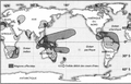 1876-78 el niño Davis.png 888 × 567; 419 KB
-
 Acute food insecurity forecast for 2020 including coronavirus famines.svg 2,754 × 1,398; 1.22 MB
-
 Carte de la faim dans le monde.svg 940 × 415; 1.65 MB
-
 Countries with food scarsity problems.png 1,350 × 625; 60 KB
-
 Depth of the food deficit in kilocalories per person per day, OWID.svg 850 × 600; 144 KB
-
 GHI 2011 Severity Map.jpg 2,207 × 1,550; 679 KB
-
 GHI2010 Severity Map.jpg 2,481 × 1,754; 500 KB
-
 GHI2011.tiff 2,599 × 1,838; 13.67 MB
-
 Global Hidden Hunger Index in pre-school children, OWID.svg 850 × 600; 140 KB
-
 Global Hunger Index, OWID.svg 850 × 600; 140 KB
-
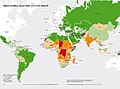
 Global malnutrition.png 1,425 × 625; 41 KB
-
 Mappa dell'indice globale della fame del 2011.jpg 3,280 × 2,161; 1.08 MB
-
 Mappa GHI 2010.jpg 1,216 × 897; 492 KB
-
 Number-of-people-severely-food-insecure (OWID 0726).png 850 × 600; 110 KB
-
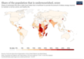 Prevalence-of-undernourishment.png 3,400 × 2,400; 826 KB
-
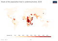 Prevalence-of-undernourishment.svg 850 × 600; 169 KB
-
 Welthunger-Index 2011 Nach Schweregrad.jpg 10,034 × 7,141; 1.45 MB
-
 Welthunger-Index 2012 - Welthunger-Index nach Schweregrad.jpg 4,956 × 3,333; 1,020 KB


.png)


