Category:Hunebed D24 in Bronneger
Jump to navigation
Jump to search
dolmen in the Netherlands  | |||||
| Upload media | |||||
| Instance of | |||||
|---|---|---|---|---|---|
| Part of | |||||
| Location | Bronneger, Borger-Odoorn, Drenthe, Netherlands | ||||
| Street address |
| ||||
 | |||||
|
This is a category about rijksmonument number 467478
|
| Address |
|
Media in category "Hunebed D24 in Bronneger"
The following 13 files are in this category, out of 13 total.
-
 20160428 Hunebedden D25 D24 D23.jpg 4,896 × 3,672; 4.25 MB
-
 20160509 Hunebedden D25 D24 D23 (panoramafoto).jpg 4,912 × 1,080; 1.91 MB
-
 20160509 Hunebedden D25 D24 D23.jpg 3,648 × 2,736; 3.27 MB
-
 20190408 Hunebedden D25 D24 en D23 Bronneger.jpg 5,076 × 3,382; 5.11 MB
-
 20191218 drie hunebedden Bronneger.jpg 5,184 × 3,456; 5.37 MB
-
 D23, D24 en D25.JPG 2,272 × 1,704; 1.01 MB
-
 D23, D24.JPG 1,704 × 2,272; 1.05 MB
-
 De stenen van een hunnebed zijn heel zwaar Drenthe.JPG 5,184 × 3,456; 5.75 MB
-
 Hunebed 003.jpg 1,600 × 1,200; 812 KB
-
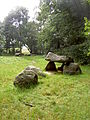
 Hunebed D24 bij Bronneger.jpg 2,332 × 1,749; 800 KB
-
 Hunebed D24 Goedeljee.jpg 2,000 × 1,537; 424 KB
-
 Hunebed graves of the first farmers in Holland.JPG 5,184 × 3,456; 7.59 MB
-
 In het hunnebed begroeven de eerste boeren hun doden Drenthe.JPG 5,184 × 3,456; 8.31 MB


.jpg)