Category:Huncote
Jump to navigation
Jump to search
English: Huncote is a village and civil parish in the district of Blaby in the county of Leicestershire, England. It is just west of Narborough, and is on the Thurlaston Brook.
Main Wikipedia article: Huncote.

a village located in Blaby, United Kingdom  Vue d'un champ, Huncote | |||||
| Upload media | |||||
| Instance of | |||||
|---|---|---|---|---|---|
| Location | Blaby, Leicestershire, East Midlands, England | ||||
| Area |
| ||||
| official website | |||||
 | |||||
Media in category "Huncote"
The following 59 files are in this category, out of 59 total.
-
 167 steps down to Huncote - geograph.org.uk - 681321.jpg 640 × 486; 96 KB
-
 At Holly House Farm - geograph.org.uk - 5793585.jpg 1,600 × 900; 311 KB
-
 Bend in Huncote Road - geograph.org.uk - 5224388.jpg 640 × 480; 64 KB
-
 Bridleway from Forest Road to Narborough - geograph.org.uk - 5045495.jpg 2,000 × 1,500; 616 KB
-
 Brook Street, Huncote - geograph.org.uk - 5224395.jpg 640 × 480; 77 KB
-

-
 Croft Hill Road - geograph.org.uk - 5295168.jpg 640 × 480; 75 KB
-
 Croft Quarry - geograph.org.uk - 2632238.jpg 800 × 530; 103 KB
-
 Croft Quarry - geograph.org.uk - 2632284.jpg 800 × 530; 85 KB
-
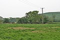
 Crop field and pylon - geograph.org.uk - 5224404.jpg 640 × 480; 46 KB
-
 Differing crops - geograph.org.uk - 5224413.jpg 640 × 480; 61 KB
-

-
 Electricity Pylon by the M69 - geograph.org.uk - 4588002.jpg 2,160 × 1,432; 900 KB
-

-
 Farm track off Huncote Road - geograph.org.uk - 5224385.jpg 640 × 480; 68 KB
-
 Farmland along Thurlaston Lane - geograph.org.uk - 3269093.jpg 2,376 × 2,206; 2.17 MB
-
 Forest Road - geograph.org.uk - 5224406.jpg 640 × 480; 64 KB
-
 Gated track off Croft Hill Road - geograph.org.uk - 5295167.jpg 640 × 480; 122 KB
-

-
 Houses in Huncote - geograph.org.uk - 5793591.jpg 1,600 × 900; 333 KB
-
 Huncote News - geograph.org.uk - 5224399.jpg 640 × 480; 67 KB
-
 Huncote Red Lion - geograph.org.uk - 2890056.jpg 640 × 480; 107 KB
-
 Huncote Road near Tinglebug Farm - geograph.org.uk - 5692593.jpg 800 × 550; 171 KB
-
 Huncote village - geograph.org.uk - 2326385.jpg 3,141 × 1,693; 2.35 MB
-
 Huncote, Leicestershire - geograph.org.uk - 511753.jpg 640 × 476; 124 KB
-
 Huncote-Former Baptist Chapel - geograph.org.uk - 6110283.jpg 1,600 × 1,047; 359 KB
-
 Life in the slow lane - geograph.org.uk - 1962214.jpg 640 × 331; 36 KB
-
 M69 at Forest Road bridge - geograph.org.uk - 3795894.jpg 1,200 × 991; 293 KB
-
 M69 Motorway near Enderby - geograph.org.uk - 5224408.jpg 640 × 480; 46 KB
-
 M69 motorway near Thurlaston - geograph.org.uk - 4588010.jpg 2,036 × 1,247; 754 KB
-

-

-
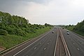 M69, Leicestershire - geograph.org.uk - 169171.jpg 640 × 427; 92 KB
-
 Narborough Road in Huncote - geograph.org.uk - 4191055.jpg 1,600 × 1,104; 384 KB
-
 Narborough Road, Huncote - geograph.org.uk - 5224394.jpg 640 × 480; 79 KB
-
 Post Office and shop, Huncote - geograph.org.uk - 5219643.jpg 640 × 480; 64 KB
-
 Power lines crossing M69 motorway - geograph.org.uk - 1962221.jpg 640 × 409; 38 KB
-
 Pylon and pavement - geograph.org.uk - 5793588.jpg 1,600 × 900; 376 KB
-
 Sign for the Red Lion, Huncote - geograph.org.uk - 5224402.jpg 474 × 640; 69 KB
-
 St James the Greater, Huncote - geograph.org.uk - 511749.jpg 533 × 640; 53 KB
-
 Stubble field off Huncote Road - geograph.org.uk - 5224386.jpg 640 × 480; 65 KB
-
 The Main Street in Huncote - geograph.org.uk - 5478945.jpg 800 × 487; 88 KB
-
 The Red Lion - geograph.org.uk - 5045475.jpg 2,000 × 1,500; 348 KB
-
 The Red Lion, Huncote - geograph.org.uk - 511736.jpg 640 × 435; 88 KB
-
 The Red Lion, Huncote - geograph.org.uk - 5224400.jpg 480 × 640; 44 KB
-
 Thurlaston Lane - geograph.org.uk - 5224454.jpg 640 × 480; 59 KB
-
 Thurlaston Lane heading towards Enderby - geograph.org.uk - 3269096.jpg 3,137 × 1,954; 1.74 MB
-
 View across Croft Quarry - geograph.org.uk - 2326379.jpg 3,184 × 2,002; 2.93 MB
-
 View from Croft Quarry - geograph.org.uk - 2632223.jpg 800 × 530; 79 KB
-
 Welcome to Huncote - geograph.org.uk - 511724.jpg 640 × 480; 132 KB
-
 Welcome to Huncote - geograph.org.uk - 511763.jpg 640 × 489; 105 KB
-
 Forest Road enters Huncote - geograph.org.uk - 681318.jpg 640 × 410; 81 KB
-
 Forest Road near Huncote - geograph.org.uk - 169173.jpg 640 × 427; 153 KB
-
 Forest Road north of Huncote - geograph.org.uk - 681315.jpg 640 × 391; 68 KB
-
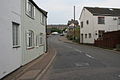
 Main Street, Huncote, Leicestershire - geograph.org.uk - 169041.jpg 640 × 427; 165 KB
-
 Main Street, Huncote, Leicestershire - geograph.org.uk - 169107.jpg 640 × 427; 67 KB
-
-
 Thurlaston Brook at Huncote Mill - geograph.org.uk - 169038.jpg 640 × 427; 131 KB
-
 View towards Croft Hill - geograph.org.uk - 681322.jpg 640 × 503; 76 KB


