Category:Humberside Airport
Jump to navigation
Jump to search
English: Humberside Airport
airport in the United Kingdom  | |||||
| Upload media | |||||
| Instance of |
| ||||
|---|---|---|---|---|---|
| Location | North Lincolnshire, Lincolnshire, Yorkshire and the Humber, England | ||||
| Date of official opening |
| ||||
| Elevation above sea level |
| ||||
| IATA airport code |
| ||||
| ICAO airport code |
| ||||
| official website | |||||
 | |||||
Subcategories
This category has the following 3 subcategories, out of 3 total.
A
R
Media in category "Humberside Airport"
The following 37 files are in this category, out of 37 total.
-
 A view of Humberside Airport - geograph.org.uk - 3093479.jpg 1,024 × 768; 154 KB
-
-
 Approach Lighting - Humberside Airport - geograph.org.uk - 1622946.jpg 637 × 640; 354 KB
-
-

-
 Final approach RW03 EGNJ.JPG 2,048 × 1,536; 862 KB
-
 Flags at Humberside airport - geograph.org.uk - 1053196.jpg 640 × 512; 61 KB
-
 Humberside Airport (1979) - geograph.org.uk - 1069552.jpg 640 × 415; 51 KB
-
 Humberside Airport (cropped).jpg 1,024 × 655; 280 KB
-
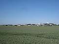
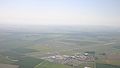
 Humberside Airport - geograph.org.uk - 2075103.jpg 1,280 × 960; 387 KB
-
 Humberside Airport - geograph.org.uk - 3404791.jpg 640 × 427; 36 KB
-
 Humberside Airport 10Jun06.JPG 3,072 × 1,744; 496 KB
-
 Humberside Airport Approach - geograph.org.uk - 1624727.jpg 640 × 480; 278 KB
-
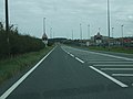
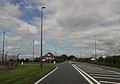 Humberside airport entrance from A18 - geograph.org.uk - 3010713.jpg 640 × 447; 48 KB
-
 Humberside Airport terminal.jpg 640 × 480; 64 KB
-
 Humberside Airport Terminal.jpg 1,600 × 1,200; 323 KB
-
-
 Humberside Airport.jpg 1,024 × 768; 330 KB
-
 Humberside International Airport - geograph.org.uk - 3137694.jpg 2,364 × 1,148; 288 KB
-
 Humberside International Airport - geograph.org.uk - 901116.jpg 476 × 640; 122 KB
-
 Landing Lights - Humberside Airport - geograph.org.uk - 1622897.jpg 427 × 640; 80 KB
-
 Landing Lights - Humberside Airport - geograph.org.uk - 1622910.jpg 640 × 480; 332 KB
-
 Landing Lights for Humberside Airport - geograph.org.uk - 5307226.jpg 1,200 × 799; 312 KB
-
 Landing Lights for Humberside Airport - geograph.org.uk - 5307227.jpg 1,200 × 799; 336 KB
-
 Landing Lights for Humberside Airport - geograph.org.uk - 5307229.jpg 1,200 × 799; 317 KB
-
 Landing Lights, Humberside Airport - geograph.org.uk - 671901.jpg 640 × 480; 95 KB
-
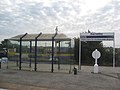
 Long stay car park at Humberside Airport - geograph.org.uk - 2274838.jpg 600 × 800; 338 KB
-

-
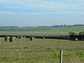
 Near Wold Farm - geograph.org.uk - 737230.jpg 640 × 480; 49 KB
-
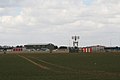
 Radar at Humberside Airport - geograph.org.uk - 282785.jpg 640 × 427; 87 KB
-
 Right down the Runway - geograph.org.uk - 671640.jpg 640 × 522; 55 KB
-
 Runway of Humberside Airport - geograph.org.uk - 70779.jpg 640 × 480; 137 KB
-
 The Start of the Airport - geograph.org.uk - 671780.jpg 640 × 480; 47 KB
-
 Thunderbird 3 - geograph.org.uk - 1204817.jpg 480 × 640; 53 KB
-

-
 View towards airport runway - geograph.org.uk - 312308.jpg 640 × 480; 197 KB
-


_-_geograph.org.uk_-_1069552.jpg)
.jpg)


