Category:Hulme, Greater Manchester
Jump to navigation
Jump to search
area of Manchester  | |||||
| Upload media | |||||
| Instance of | |||||
|---|---|---|---|---|---|
| Location | Manchester, Greater Manchester, North West England, England | ||||
| Area |
| ||||
| Elevation above sea level |
| ||||
| Different from | |||||
 | |||||
English: Hulme is situated in the Manchester City Council ward of Hulme in the City of Manchester
Subcategories
This category has the following 13 subcategories, out of 13 total.
B
D
G
- GUADEC 2017 (75 F)
H
- Hulme Arch Bridge (22 F)
- Hulme Crescents (14 F)
L
- Hulme Lads' Club (6 F)
O
P
Media in category "Hulme, Greater Manchester"
The following 200 files are in this category, out of 266 total.
(previous page) (next page)-
 1992 Hulme Hippodrome and Crescents.jpg 2,049 × 1,389; 554 KB
-
 A Climate Change Experiment for Manchester - geograph.org.uk - 5761077.jpg 3,264 × 2,448; 4.41 MB
-
 A graffiti mural of Karl Marx wearing a bandana on the side of NIAMOS community centre.jpg 4,756 × 3,089; 3.38 MB
-
 A Manchester Lager Factory - geograph.org.uk - 5892944.jpg 1,024 × 678; 129 KB
-
 A park with a view of a church - geograph.org.uk - 4448173.jpg 4,592 × 3,056; 7.63 MB
-
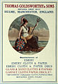 Advertisement for Thomas Goldsworthy and Sons 1920.jpg 800 × 1,163; 310 KB
-
 Airport Tram Arriving at Cornbrook - geograph.org.uk - 6245562.jpg 800 × 600; 641 KB
-
 Apartments on Stretford Road, Hulme - geograph.org.uk - 3365307.jpg 640 × 480; 62 KB
-
 Aquarius Footbridge - geograph.org.uk - 350391.jpg 640 × 442; 99 KB
-
 Arches - geograph.org.uk - 5883800.jpg 4,957 × 3,136; 1.9 MB
-
 Arches, A57 Dawson Street, Manchester - DSC05619.JPG 3,648 × 2,736; 3.63 MB
-
 Archway in Hulme - geograph.org.uk - 330063.jpg 640 × 415; 92 KB
-

-

-
 ASDA, Hulme High Street - geograph.org.uk - 3987348.jpg 640 × 461; 49 KB
-
 Bee Active - geograph.org.uk - 5995096.jpg 1,280 × 1,403; 1.26 MB
-
 Bee in the City ^66 BZZX^^ - geograph.org.uk - 5864235.jpg 800 × 602; 775 KB
-
 Bee in the City, All Saints' Park - geograph.org.uk - 5864339.jpg 800 × 600; 651 KB
-

-
 Bee-autiful - geograph.org.uk - 5995000.jpg 1,280 × 1,280; 1 MB
-
 Beejing - geograph.org.uk - 6004746.jpg 1,280 × 1,020; 1,010 KB
-
 Beejing - geograph.org.uk - 6004749.jpg 1,280 × 895; 918 KB
-
 Bloom, Flourish, Thrive - geograph.org.uk - 5634241.jpg 1,280 × 895; 744 KB
-
 Borrowdale boulder - geograph.org.uk - 5942619.jpg 768 × 1,024; 312 KB
-
 Boundary Lane - Hulme - geograph.org.uk - 2239701.jpg 3,072 × 2,304; 3.53 MB
-
 Bridgewater Canal and apartment block - geograph.org.uk - 5771533.jpg 1,066 × 1,600; 329 KB
-
 Bridgewater Canal at St George's - geograph.org.uk - 5534472.jpg 640 × 480; 440 KB
-
 Bridgewater Canal, Hulme Locks - geograph.org.uk - 5534496.jpg 640 × 481; 600 KB
-
 Bridgewater Canal, St George's Island - geograph.org.uk - 5534478.jpg 640 × 481; 539 KB
-
 Brook Street - geograph.org.uk - 5748872.jpg 1,280 × 960; 1,020 KB
-
 Building work off Grosvenor Street - geograph.org.uk - 5748987.jpg 1,280 × 960; 1.08 MB
-
 BZZX^^ - geograph.org.uk - 6035221.jpg 1,280 × 1,084; 1.04 MB
-
 Captured in Print - geograph.org.uk - 5994998.jpg 1,280 × 990; 841 KB
-
 Chequered Flag, Hulme, Manchester.jpg 1,770 × 1,220; 987 KB
-
 Chester Road - geograph.org.uk - 4712258.jpg 1,000 × 750; 594 KB
-
 Chester Road - geograph.org.uk - 6216418.jpg 6,000 × 4,000; 1.64 MB
-
 Chester Road - geograph.org.uk - 6216420.jpg 6,000 × 4,000; 1.74 MB
-
 Chester Road, St George's - geograph.org.uk - 4712487.jpg 1,000 × 575; 400 KB
-
 Church Inn - geograph.org.uk - 5762555.jpg 1,280 × 1,107; 974 KB
-
 Construction on Boston Street - geograph.org.uk - 350127.jpg 640 × 482; 93 KB
-
 Converting the Unitarian Chapel - geograph.org.uk - 5634248.jpg 1,280 × 1,057; 806 KB
-
 Cornbrook Metrolink stop - geograph.org.uk - 5778739.jpg 1,024 × 768; 127 KB
-
 Corner of Oxford Road and Sidney Street - geograph.org.uk - 5939139.jpg 1,280 × 1,683; 1.44 MB
-

-
-
 Development - geograph.org.uk - 5765432.jpg 5,184 × 2,528; 2.02 MB
-
 End of Greenheys Lane, Hulme - geograph.org.uk - 4698511.jpg 1,600 × 1,054; 398 KB
-
 Engineering Construction - geograph.org.uk - 5892929.jpg 1,024 × 682; 121 KB
-
 Excelsior Mill - geograph.org.uk - 5899067.jpg 4,032 × 3,024; 1.81 MB
-
 Flats off Hulme High Street.jpg 1,280 × 960; 323 KB
-
 Flats on Blantyre Street - geograph.org.uk - 2663587.jpg 640 × 480; 107 KB
-
 Flour and Flagon - geograph.org.uk - 5748229.jpg 1,280 × 960; 852 KB
-
 Foundations of the 'Life Buildings' - geograph.org.uk - 350117.jpg 482 × 640; 101 KB
-
 Front entrance of Hulme Community Garden Centre.jpg 5,213 × 2,558; 12.67 MB
-
 Gemini Takeaway - geograph.org.uk - 6164885.jpg 1,280 × 977; 1.19 MB
-
 Greenheys Lane West from Loreto College - geograph.org.uk - 3188116.jpg 3,204 × 3,456; 2.03 MB
-
 Greenheys, AQA - geograph.org.uk - 6058934.jpg 1,024 × 751; 125 KB
-
 Greenheys, Bright Building - geograph.org.uk - 6058940.jpg 1,024 × 759; 148 KB
-
 Greenheys, Christchurch - geograph.org.uk - 6058909.jpg 1,024 × 743; 140 KB
-
 Greenheys, dental hospital - geograph.org.uk - 6058946.jpg 1,024 × 778; 182 KB
-
 Greenheys, Ducie Arms - geograph.org.uk - 6058930.jpg 1,024 × 769; 203 KB
-
 Greenheys, gurduwara - geograph.org.uk - 6058905.jpg 1,024 × 757; 156 KB
-
 Greenheys, high school - geograph.org.uk - 6058950.jpg 1,024 × 753; 132 KB
-
 Greenheys, Polish RC church - geograph.org.uk - 6058900.jpg 1,024 × 762; 149 KB
-
 Grosvenor Square - geograph.org.uk - 5761018.jpg 1,280 × 960; 1.37 MB
-
 Henry Royce Red Plaque Hulme Park.JPG 4,000 × 3,000; 2.67 MB
-
 Higher Cambridge Street - geograph.org.uk - 5574443.jpg 1,280 × 960; 781 KB
-
 Higher Cambridge Street - geograph.org.uk - 5574468.jpg 1,280 × 960; 890 KB
-
 Holy Name church, Architectural detail (1) - geograph.org.uk - 6164712.jpg 1,280 × 1,436; 1.69 MB
-
 Holy Name church, Architectural detail (2) - geograph.org.uk - 6164704.jpg 1,280 × 1,301; 1.28 MB
-
 Holy Name church, Architectural detail (3) - geograph.org.uk - 6164696.jpg 1,280 × 1,143; 1.46 MB
-
 Holy Name Tower - geograph.org.uk - 6164723.jpg 1,280 × 1,305; 1.36 MB
-

-
 Hornchurch Court, Hulme - panoramio.jpg 1,536 × 2,048; 366 KB
-
 Hulme - Chorlton Road - geograph.org.uk - 1231222.jpg 640 × 480; 162 KB
-
 Hulme - Cornbrook Street - geograph.org.uk - 1231219.jpg 640 × 480; 166 KB
-
 Hulme - geograph.org.uk - 5064401.jpg 5,183 × 2,445; 1.73 MB
-
 Hulme - Three Tower Blocks - geograph.org.uk - 1231218.jpg 640 × 480; 216 KB
-
 Hulme Arch - geograph.org.uk - 1128997.jpg 480 × 640; 44 KB
-
 Hulme Arch Bridge - geograph.org.uk - 5963935.jpg 2,641 × 2,256; 1.85 MB
-
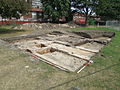 Hulme Barracks findings.jpg 4,608 × 3,456; 5.13 MB
-
 Hulme Bridge - geograph.org.uk - 6059012.jpg 1,024 × 741; 119 KB
-

-
 Hulme Hall, Manchester, England, c.1830.jpg 448 × 276; 153 KB
-
 Hulme indoor market - geograph.org.uk - 954478.jpg 640 × 457; 155 KB
-
 Hulme Library mural detail Carnival.JPG 4,000 × 3,000; 2.66 MB
-
 Hulme Library mural detail demolition and rebuild.JPG 4,000 × 3,000; 2.68 MB
-
 Hulme Library mural detail first panel.JPG 4,000 × 3,000; 2.62 MB
-
 Hulme Library mural detail Library and Car.JPG 4,000 × 3,000; 2.65 MB
-
 Hulme Library mural detail new buildings and Hulme Bridge.JPG 4,000 × 3,000; 2.65 MB
-
 Hulme Library mural detail Windrush.JPG 4,000 × 3,000; 2.66 MB
-
 Hulme Park Temple 2000 by George Wyllie RSA MBE.JPG 3,000 × 4,000; 2.66 MB
-
 Hulme Park Temple 2000 by George Wyllie.JPG 4,000 × 3,000; 2.65 MB
-
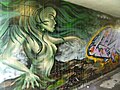
 Hulme subway 01.JPG 1,536 × 2,048; 1.55 MB
-
 Hulme subway 02.JPG 2,048 × 1,536; 1.63 MB
-
 Hulme subway 03.JPG 2,048 × 1,536; 1.62 MB
-
 Hulme subway 04.JPG 2,048 × 1,536; 1.59 MB
-
 Hulme subway 05.JPG 2,048 × 1,536; 1.53 MB
-
 Hulme subway 06.JPG 2,048 × 1,536; 1.55 MB
-
 Hulme subway 07.JPG 2,048 × 1,536; 1.59 MB
-
 Hulme subway 08.JPG 2,048 × 1,536; 1.52 MB
-
 Hulme subway 09.JPG 2,048 × 1,536; 1.6 MB
-
 Hulme subway 10.JPG 2,048 × 1,536; 1.53 MB
-
 Hulme subway 11.JPG 2,048 × 1,536; 1.56 MB
-
 Hulme subway 12.JPG 2,048 × 1,536; 1.52 MB
-
 Hulme subway 13.JPG 2,048 × 1,536; 1.56 MB
-
 Hulme subway 14.JPG 2,048 × 1,536; 1.57 MB
-
 Hulme subway 15.JPG 2,048 × 1,536; 1.57 MB
-
 Hulme Town Hall c.1895.jpg 2,201 × 1,749; 1.36 MB
-
 Hulme View - geograph.org.uk - 329934.jpg 640 × 508; 96 KB
-
 Hulme, Ascension Church - geograph.org.uk - 6059022.jpg 1,024 × 741; 180 KB
-
 Hulme, Brooks Building - geograph.org.uk - 6059017.jpg 1,024 × 768; 184 KB
-
 Hulme, Dale - geograph.org.uk - 6059019.jpg 1,024 × 754; 154 KB
-
 Hulme, first school - geograph.org.uk - 6059023.jpg 1,024 × 754; 273 KB
-
 Hulme, Union Hall - geograph.org.uk - 6059031.jpg 1,024 × 750; 157 KB
-
 Hydrant sign and Blue Plaque (Thomas Wright) - geograph.org.uk - 5939158.jpg 1,280 × 844; 830 KB
-
 I-trees project plot in Grosvenor Square - geograph.org.uk - 5761079.jpg 1,280 × 960; 1.33 MB
-
 Junction Hotel Rolls Crescent Hulme.JPG 4,000 × 3,000; 2.66 MB
-
 Junctions - geograph.org.uk - 350144.jpg 482 × 640; 97 KB
-
 Just inside the entrance of Hulme Community Garden Centre.jpg 4,846 × 2,918; 15.41 MB
-

-
 Life Buildings Tower - geograph.org.uk - 350123.jpg 482 × 640; 104 KB
-
 Loreto 6th Form College - geograph.org.uk - 3245818.jpg 3,872 × 2,592; 5.44 MB
-
 Lovely Day.JPG 2,448 × 3,264; 1.15 MB
-
 Mallow Street, Hulme - geograph.org.uk - 3365308.jpg 640 × 480; 61 KB
-
 Manchester Aquatics Centre - geograph.org.uk - 5995121.jpg 1,280 × 960; 838 KB
-
 Manchester Aquatics Centre - geograph.org.uk - 6059059.jpg 1,024 × 745; 170 KB
-
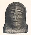
 Manchester Face (3293102811).jpg 2,134 × 1,785; 3.33 MB
-
 Manchester from the air (geograph 6532147).jpg 1,024 × 768; 540 KB
-
 Manchester Metropolitan University Business School - geograph.org.uk - 5762385.jpg 1,280 × 960; 1.02 MB
-
 Manchester Mosque, Greenheys Lane - geograph.org.uk - 6326265.jpg 1,600 × 1,200; 323 KB
-
 Manchester museum - geograph.org.uk - 5808873.jpg 1,944 × 2,592; 712 KB
-
 Manchester Museum 2015 014 - Mithraeum.jpg 5,184 × 3,456; 5.48 MB
-
 Manchester University - geograph.org.uk - 5963946.jpg 4,032 × 2,537; 1.94 MB
-
 Manchester, Grosvenor Picture Palace - geograph.org.uk - 6059056.jpg 1,024 × 758; 165 KB
-
 Manchester, Grosvenor Square - geograph.org.uk - 6059049.jpg 1,024 × 751; 240 KB
-
 Manchester, Holy Name - geograph.org.uk - 6058995.jpg 1,024 × 910; 194 KB
-
 Manchester, Oxford Road - geograph.org.uk - 5864253.jpg 800 × 533; 543 KB
-
 Manchester, RNCM - geograph.org.uk - 6058977.jpg 1,024 × 743; 121 KB
-
 Manchester, Samuel Alexander Building - geograph.org.uk - 6059003.jpg 1,024 × 744; 142 KB
-
 Manchester, Student Living - geograph.org.uk - 6058968.jpg 1,024 × 759; 260 KB
-
 Manchester, Students' Union - geograph.org.uk - 6058987.jpg 1,024 × 768; 151 KB
-
 Manchester, Whitworth Building ^ Hall - geograph.org.uk - 6058984.jpg 1,024 × 768; 187 KB
-
 Mancunian Way over Brook Street - geograph.org.uk - 5938444.jpg 1,280 × 960; 1.12 MB
-
 Mecanoo - The Aaben - Hulme 10.jpg 1,840 × 3,264; 1.66 MB
-
 Mecanoo - The Aaben - Hulme 11.jpg 3,264 × 1,840; 1.91 MB
-
 Mecanoo - The Aaben - Hulme 12.jpg 1,840 × 3,264; 1.82 MB
-
 Mecanoo - The Aaben - Hulme 13.jpg 3,264 × 1,840; 1.62 MB
-
 Mecanoo - The Aaben - Hulme 14.jpg 1,840 × 3,264; 1.96 MB
-
 Mecanoo - The Aaben - Hulme 15.jpg 3,264 × 1,840; 1.63 MB
-
 Mecanoo - The Aaben - Hulme 2.jpg 1,840 × 3,264; 1.8 MB
-
 Mecanoo - The Aaben - Hulme 3.jpg 1,840 × 3,264; 1.48 MB
-
 Mecanoo - The Aaben - Hulme 4.jpg 1,840 × 3,264; 1.79 MB
-
 Mecanoo - The Aaben - Hulme 5.jpg 1,840 × 3,264; 1.88 MB
-
 Mecanoo - The Aaben - Hulme 6.jpg 3,264 × 1,840; 1.71 MB
-
 Mecanoo - The Aaben - Hulme 7.jpg 1,840 × 3,264; 1.57 MB
-
 Mecanoo - The Aaben - Hulme 8.jpg 3,264 × 1,840; 1.86 MB
-
 Mecanoo - The Aaben - Hulme 9.jpg 3,264 × 1,840; 2 MB
-
 Mecanoo - The Aaben - Hulme.jpg 1,840 × 3,264; 1.69 MB
-
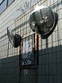
 Metal Swirl.JPG 2,048 × 1,536; 1.09 MB
-

-
 Metrolink tramway north east from Cornbrook - geograph.org.uk - 5778725.jpg 1,024 × 768; 166 KB
-
 Moss Lane West (B5219) - geograph.org.uk - 3365298.jpg 640 × 480; 87 KB
-
 Moss Side Fire Station - geograph.org.uk - 3643098.jpg 1,024 × 683; 134 KB
-
 Moss Side Leisure Centre in Hulme, Manchester, UK.jpg 1,000 × 666; 289 KB
-
 New apartments, Hulme - geograph.org.uk - 954485.jpg 457 × 640; 135 KB
-

-
 New development, Hulme - geograph.org.uk - 954481.jpg 640 × 457; 144 KB
-
 New Engineering Building - geograph.org.uk - 5892908.jpg 678 × 1,024; 133 KB
-
 Nice view of Hulme - March 2007 - panoramio.jpg 2,048 × 1,536; 895 KB
-
 Oddfellows Hall - geograph.org.uk - 5682046.jpg 1,280 × 859; 676 KB
-
 Offices and shrubs on the Bridgewater Canal - geograph.org.uk - 5771536.jpg 1,600 × 1,066; 450 KB
-
 Old Hulme Playhouse - geograph.org.uk - 6082215.jpg 2,000 × 1,331; 2.41 MB
-
 On the Bridgewater Canal (7) - geograph.org.uk - 5688991.jpg 4,896 × 3,264; 4.77 MB
-
 Ormsgill Close, Hulme - geograph.org.uk - 330187.jpg 640 × 447; 101 KB
-
 Ormsgill Street, Hulme - geograph.org.uk - 331024.jpg 640 × 474; 100 KB
-
 Outside St Peter's House - geograph.org.uk - 5995277.jpg 1,280 × 960; 1.02 MB
-
 Owen Street - geograph.org.uk - 5017805.jpg 5,184 × 3,365; 1.71 MB
-
 Oxford Road - geograph.org.uk - 5944245.jpg 1,024 × 734; 199 KB
-
 Panoramic view of Hulme.jpg 3,155 × 758; 480 KB
-
 Pavilion in Hulme Park - geograph.org.uk - 6252961.jpg 1,024 × 678; 191 KB
-
 Phoenix Way, Hulme - geograph.org.uk - 330050.jpg 640 × 421; 97 KB
-
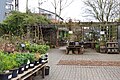 Photo of shade plants area inside Hulme Community Garden Centre.jpg 4,653 × 3,107; 13.41 MB
-
 Powerhouse library and youth centre in Moss Side, Manchester - panoramio.jpg 1,600 × 1,200; 188 KB
-
 Princess Way - geograph.org.uk - 5963933.jpg 4,032 × 2,961; 1.76 MB
-
 Purple Crocus Bee - geograph.org.uk - 5994967.jpg 1,280 × 1,194; 995 KB
-

-

-
 Rain by Lemn Sissay - geograph.org.uk - 6164895.jpg 1,280 × 1,603; 1.39 MB
-
 Righton Building - geograph.org.uk - 5762400.jpg 1,280 × 960; 926 KB
-
 Righton Building - geograph.org.uk - 6004283.jpg 1,280 × 914; 773 KB
-
 Righton Building, Architectural detail - geograph.org.uk - 5762407.jpg 1,280 × 1,027; 737 KB
-
 Roman Catholic Church Of The Holy Name Of Jesus - geograph.org.uk - 6164688.jpg 1,280 × 2,071; 2.13 MB
-
 Roman Manchester by Charles Roeder p51.jpg 585 × 557; 151 KB
-
 Roman Manchester by Charles Roeder p53-2.jpg 349 × 382; 43 KB
-
 Roman Manchester by Charles Roeder p53.jpg 361 × 408; 50 KB
-
 Rusty Screws.JPG 1,536 × 2,048; 1.27 MB
-
 Salisbury Street in Moss Side, Manchester - panoramio (1).jpg 712 × 950; 430 KB
-
 Scaffolding in Hulme.JPG 2,048 × 1,536; 1.54 MB
-
 Sculptures on Oxford Road - geograph.org.uk - 5995284.jpg 1,280 × 960; 1.01 MB


_-_geograph.org.uk_-_6164712.jpg)
_-_geograph.org.uk_-_6164704.jpg)
_-_geograph.org.uk_-_6164696.jpg)


_-_geograph.org.uk_-_5939158.jpg)


.jpg)
.jpg)


_-_geograph.org.uk_-_3365298.jpg)


_-_geograph.org.uk_-_5688991.jpg)


.jpg)

