Category:Hulland Ward
Jump to navigation
Jump to search
English: Hulland Ward is a village and civil parish in the Derbyshire Dales district of Derbyshire roughly 2.5 miles north of Belper, Derbyshire England adjoining the A517 road.
village and civil parish in Derbyshire Dales, Derbyshire, England  | |||||
| Upload media | |||||
| Instance of | |||||
|---|---|---|---|---|---|
| Location | Derbyshire Dales, Derbyshire, East Midlands, England | ||||
 | |||||
Media in category "Hulland Ward"
The following 119 files are in this category, out of 119 total.
-
 A house in the country - geograph.org.uk - 6153855.jpg 2,000 × 1,330; 2.42 MB
-
 A minor road near Cross o' the Hands - geograph.org.uk - 5823006.jpg 2,000 × 1,333; 2.53 MB
-
 A new pond on Spinneyford Brook - geograph.org.uk - 3084926.jpg 2,048 × 1,536; 997 KB
-
 A517 at Cross o' th' hands junction - geograph.org.uk - 5139167.jpg 640 × 481; 41 KB
-

-
 A517 entering Hulland Ward - geograph.org.uk - 3530982.jpg 640 × 466; 111 KB
-
 A517 heading west out of Turnditch - geograph.org.uk - 5139158.jpg 640 × 481; 58 KB
-
 A517 near Hulland Hall - geograph.org.uk - 5139201.jpg 640 × 480; 73 KB
-
 A517 westbound near Massey's Barn - geograph.org.uk - 5139181.jpg 640 × 480; 36 KB
-

-
 Across the fields - geograph.org.uk - 6139009.jpg 2,000 × 1,330; 1.9 MB
-
 An isolated cottage - geograph.org.uk - 6138977.jpg 2,000 × 1,330; 2.46 MB
-
 Approaching Deepdale Farm, Hulland - geograph.org.uk - 4164900.jpg 3,904 × 2,865; 1.96 MB
-
 Approaching Hulland Ward from Moss Lane - geograph.org.uk - 3890479.jpg 3,848 × 2,788; 2.33 MB
-

-
 Approaching Mercaston Sand Quarry - geograph.org.uk - 2469461.jpg 640 × 480; 73 KB
-
 Baling near Hulland Ward - geograph.org.uk - 4164925.jpg 4,000 × 3,000; 2.6 MB
-
 Between Hulland and Hulland Ward - geograph.org.uk - 6138990.jpg 2,000 × 1,330; 1.89 MB
-
 Biggin Lane heading down to Stock-a-Sitch Cottages - geograph.org.uk - 3786960.jpg 3,648 × 2,736; 2.79 MB
-
 Blackbrook Lodge entrance - geograph.org.uk - 6153853.jpg 2,000 × 1,330; 1.94 MB
-
 Bridleway and Common End Farm - geograph.org.uk - 4238653.jpg 3,878 × 2,858; 2.97 MB
-
 Cardinal Rules - geograph.org.uk - 3084943.jpg 4,000 × 3,000; 2.51 MB
-
 Chapel and cottage, Cross O' th' Hands - geograph.org.uk - 2301323.jpg 3,124 × 2,050; 1.01 MB
-
 Cottage on Intakes Lane, Cross O' th' Hands - geograph.org.uk - 2301293.jpg 3,648 × 2,736; 5.1 MB
-
 Cottage with date on the wall - geograph.org.uk - 2408412.jpg 2,509 × 2,005; 780 KB
-
 Cottages and pub at Turnditch - geograph.org.uk - 2301379.jpg 3,648 × 2,736; 5.69 MB
-
 Cottages in Hulland Village - geograph.org.uk - 4164864.jpg 4,000 × 3,000; 2.18 MB
-
 Cottages in Hulland Village - geograph.org.uk - 4164877.jpg 3,900 × 2,865; 3.37 MB
-
 Countryside view - geograph.org.uk - 3039938.jpg 4,320 × 3,240; 2.83 MB
-

-
 Cross roads at Cross O' Th' Hands - geograph.org.uk - 3530956.jpg 640 × 439; 91 KB
-
 Crossways Lane above Crossways Farm - geograph.org.uk - 3786975.jpg 3,648 × 2,736; 2.63 MB
-
 Deepdale Farm - geograph.org.uk - 289804.jpg 640 × 480; 120 KB
-
 Deepdale Farm, Hulland - geograph.org.uk - 2408415.jpg 3,648 × 2,736; 4.46 MB
-
 Derbyshire UK parish map highlighting Hulland (east).svg 888 × 1,308; 2.34 MB
-
 Dog Lane junction at Hulland Ward - geograph.org.uk - 3530991.jpg 640 × 439; 155 KB
-
 Drying farmland - geograph.org.uk - 5822992.jpg 2,000 × 1,333; 2.46 MB
-
 Fallen Tree Branches on Bull Hill - geograph.org.uk - 4308997.jpg 4,000 × 3,000; 3.16 MB
-
 Farmland and buzzard - geograph.org.uk - 2301312.jpg 3,648 × 2,736; 4.82 MB
-
 Farmland hedge boundary above Stock-a-Sitch - geograph.org.uk - 3786966.jpg 3,648 × 2,736; 2.77 MB
-
 Farmland near Hulland Ward - geograph.org.uk - 4164969.jpg 4,000 × 3,000; 2.05 MB
-
 Farmland seen from Intakes Lane - geograph.org.uk - 4165002.jpg 4,000 × 3,000; 2.29 MB
-
 Farmland south of Hulland Ward - geograph.org.uk - 2408417.jpg 3,648 × 2,736; 5.81 MB
-
 Field near Shuckton Manor - geograph.org.uk - 2348283.jpg 640 × 480; 153 KB
-
 Field of Stubble and Pylons near Atlowtop - geograph.org.uk - 3676371.jpg 4,000 × 3,000; 2.84 MB
-
 Fields near Mansell Park Farm - geograph.org.uk - 4238659.jpg 4,000 × 3,000; 2.39 MB
-
 Footpath at Muggintonlane End - geograph.org.uk - 2300165.jpg 3,648 × 2,736; 5.71 MB
-
 Footpath does not go through Aggregate Industries - geograph.org.uk - 3084932.jpg 4,000 × 3,000; 2.49 MB
-
 Footpath near Hulland Ward - geograph.org.uk - 4164909.jpg 4,000 × 3,000; 3.02 MB
-
 Former Chapel on Mercaston Lane - geograph.org.uk - 3084982.jpg 4,000 × 3,000; 2.51 MB
-
 Gorse, buzzard and high-flying plane - geograph.org.uk - 2300195.jpg 3,648 × 2,736; 5.35 MB
-
 Grassy fields - geograph.org.uk - 6139021.jpg 2,000 × 1,330; 2.92 MB
-
 Grazing meadow adjacent to Crossways Farm - geograph.org.uk - 3786971.jpg 3,648 × 2,736; 2.01 MB
-
 Halter Devils Chapel - geograph.org.uk - 11358.jpg 640 × 427; 86 KB
-
 Hanson Aggregates Quarry - geograph.org.uk - 3084953.jpg 4,000 × 3,000; 2.52 MB
-
 Hard to find footpath - geograph.org.uk - 2408413.jpg 3,648 × 2,736; 6.21 MB
-
 Hlater Devil Chapel and Farmhouse.jpg 3,839 × 2,790; 2.21 MB
-
 Hollinghurst - geograph.org.uk - 3039948.jpg 1,600 × 1,200; 445 KB
-
 Hollinghurst and Blue Stoop gates and cattle grids - geograph.org.uk - 3039967.jpg 1,600 × 1,200; 529 KB
-
 House at Redmiregap, roof being re-tiled - geograph.org.uk - 2301260.jpg 3,648 × 2,736; 5.71 MB
-
 House on a lane in Muggintonlane End - geograph.org.uk - 2300175.jpg 3,648 × 2,736; 5.56 MB
-
 Hulland Bourne Chapel - geograph.org.uk - 2408408.jpg 3,648 × 2,736; 5.95 MB
-
 Hulland Bourne Chapel - geograph.org.uk - 6138987.jpg 2,000 × 1,330; 2.14 MB
-
 Hulland Village Ford - geograph.org.uk - 4912499.jpg 6,000 × 4,000; 2.44 MB
-
 Hulland Village, cottages and footpath sign - geograph.org.uk - 2407274.jpg 3,648 × 2,736; 5.63 MB
-
 Hulland Ward Village - geograph.org.uk - 6139081.jpg 2,000 × 1,330; 2.08 MB
-
 Hulland Ward, main road, houses and garage - geograph.org.uk - 2407267.jpg 2,430 × 1,824; 814 KB
-
 Hulland Ward. - geograph.org.uk - 177282.jpg 640 × 480; 133 KB
-
 Intakes Lane - geograph.org.uk - 3039906.jpg 1,600 × 1,200; 582 KB
-
 Junction with Dog Lane near Hulland Ward - geograph.org.uk - 2469659.jpg 640 × 480; 104 KB
-
 Large gravel pile - geograph.org.uk - 3084939.jpg 4,000 × 3,000; 2.47 MB
-
 Late season lamb - geograph.org.uk - 3039638.jpg 4,320 × 3,240; 2.9 MB
-
 Looking along Intake Lane - geograph.org.uk - 5823003.jpg 2,000 × 1,333; 2.91 MB
-
 Lumber Lane heading to Lumber Lane Farm - geograph.org.uk - 3786980.jpg 3,648 × 2,736; 2.65 MB
-
 Mansell Park Wood - geograph.org.uk - 289801.jpg 480 × 640; 121 KB
-
 Mansell Park. - geograph.org.uk - 289799.jpg 640 × 480; 124 KB
-
 Mast, PO Repeater - geograph.org.uk - 3039964.jpg 3,240 × 4,320; 2.81 MB
-
 Mercaston Lane - geograph.org.uk - 3039681.jpg 1,600 × 1,200; 559 KB
-
 Mercaston Sand Quarry - geograph.org.uk - 289795.jpg 640 × 480; 117 KB
-
 Near Mercaston Sand Quarry - geograph.org.uk - 6138966.jpg 2,000 × 1,330; 2.53 MB
-
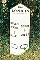 Old Milepost north of Muggintonlane End (geograph 5623800).jpg 1,061 × 1,597; 221 KB
-
 Old tractor, quietly dying - geograph.org.uk - 3084960.jpg 4,000 × 3,000; 2.5 MB
-
 Pond by Hulland Hollow Brook - geograph.org.uk - 3084928.jpg 2,048 × 1,536; 1.04 MB
-
 Pond by Spinneyford Brook - geograph.org.uk - 4238646.jpg 4,000 × 3,000; 2.5 MB
-
 Pylons, Mansellpark - geograph.org.uk - 3039812.jpg 4,320 × 3,240; 3.12 MB
-
 Ratcliffe on Soar Power Station from here - geograph.org.uk - 3039960.jpg 4,320 × 3,240; 2.94 MB
-
 Redmire Gap (new build) - geograph.org.uk - 3039929.jpg 1,600 × 1,200; 658 KB
-
 Redmire Gap Gates - geograph.org.uk - 3039922.jpg 1,600 × 1,200; 454 KB
-
 Road to Hill Top Farm - geograph.org.uk - 2348347.jpg 490 × 640; 104 KB
-
 Road to Houghpark - geograph.org.uk - 3881554.jpg 3,088 × 2,056; 3.69 MB
-
 Rough pasture - geograph.org.uk - 5822997.jpg 2,000 × 1,333; 2.59 MB
-
 Sheep grazing on a hillside - geograph.org.uk - 2300186.jpg 3,464 × 2,246; 1.93 MB
-
 Sherbourne Valley from Bull Hill - geograph.org.uk - 4309004.jpg 4,000 × 3,000; 3.14 MB
-
 Shuckton Manor Farm - geograph.org.uk - 2348348.jpg 640 × 427; 94 KB
-
 Shuckton Manor Farm - geograph.org.uk - 3039651.jpg 1,600 × 1,200; 485 KB
-
 Sign for Muggintonlane End - geograph.org.uk - 2349505.jpg 640 × 427; 113 KB
-
 Signs of old mining - geograph.org.uk - 3039914.jpg 4,320 × 3,240; 2.93 MB
-
 Smiley on a gatepost - geograph.org.uk - 2301271.jpg 2,430 × 1,824; 1.53 MB
-
 Springhill Farm from A517 - geograph.org.uk - 3530975.jpg 640 × 397; 73 KB
-
 Staggered Crossroads at Four Lane Ends - geograph.org.uk - 3676386.jpg 3,990 × 2,986; 2.18 MB
-
 Stand of trees - geograph.org.uk - 2348411.jpg 640 × 418; 84 KB
-
 Stile ^ Footpath to Waterlagg Cottage - geograph.org.uk - 3786983.jpg 3,648 × 2,736; 3.22 MB
-
 The A517 heading North West towards Ashbourne - geograph.org.uk - 3786988.jpg 3,648 × 2,736; 2.61 MB
-
 The Black Horse Inn, Hulland Ward - geograph.org.uk - 4423709.jpg 4,454 × 2,695; 3.67 MB
-
 The Carr. - geograph.org.uk - 291151.jpg 640 × 480; 123 KB
-
 The edge of Hulland Village - geograph.org.uk - 6138981.jpg 2,000 × 1,330; 2.22 MB
-
 The entrance to Stoneycliff Farm - geograph.org.uk - 6138974.jpg 2,000 × 1,330; 1.9 MB
-
 The road to Mercaton - geograph.org.uk - 2348476.jpg 640 × 468; 115 KB
-
 Towards Lower Hough Park - geograph.org.uk - 6138997.jpg 2,000 × 1,330; 3.16 MB
-
 Towards Millington Green from Hulland Ward - geograph.org.uk - 3890487.jpg 3,946 × 2,928; 1.79 MB
-
 Track and Bridleway near Mansellpark - geograph.org.uk - 4238685.jpg 4,000 × 3,000; 2.56 MB
-
 Track and Bridleway near Mansellpark - geograph.org.uk - 4238695.jpg 4,000 × 3,000; 2.05 MB
-
 View Across Waterlagg Brook - geograph.org.uk - 4164989.jpg 4,000 × 3,000; 1.77 MB
-
 View towards Turnditch - geograph.org.uk - 3039972.jpg 4,320 × 3,240; 2.83 MB
-
 Well concealed footbridge - geograph.org.uk - 2301251.jpg 3,648 × 2,736; 6.25 MB
-
 Works entrance - geograph.org.uk - 3039615.jpg 1,600 × 1,200; 469 KB
-
 Y-Junction near Cross o' the Hands - geograph.org.uk - 4165033.jpg 4,000 × 3,000; 2.25 MB
-
 Hulland Ward - geograph.org.uk - 177359.jpg 640 × 480; 122 KB
-
 Near Hulland. - geograph.org.uk - 177847.jpg 640 × 480; 117 KB


.svg)


.jpg)


_-_geograph.org.uk_-_3039929.jpg)


