Category:Howden
Jump to navigation
Jump to search
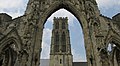
English: Howden is a small market town and civil parish in the East Riding of Yorkshire, England. It lies north of the M62, on the A614 road about 3 miles (4.8 km) north of Goole and 17 miles (27 km) south-west of York. Howden holds a significant historic importance, William the Conqueror giving the town to the Bishops of Durham in 1080.
market town and civil parish in the East Riding of Yorkshire, England  | |||||
| Upload media | |||||
| Instance of | |||||
|---|---|---|---|---|---|
| Location | East Riding of Yorkshire, Yorkshire and the Humber, England | ||||
| Population |
| ||||
| Different from | |||||
| Said to be the same as | Howden (Wikimedia duplicated page, civil parish) | ||||
 | |||||
Subcategories
This category has the following 11 subcategories, out of 11 total.
Media in category "Howden"
The following 200 files are in this category, out of 375 total.
(previous page) (next page)-
 "The Minster View Hotel", Howden - geograph.org.uk - 3260972.jpg 4,497 × 2,699; 2.85 MB
-
 10-11 , Churchside - geograph.org.uk - 4506251.jpg 800 × 533; 142 KB
-
 2, Churchside - geograph.org.uk - 4506254.jpg 533 × 800; 122 KB
-
 A 2nd hand lorry yard - geograph.org.uk - 2017351.jpg 800 × 600; 237 KB
-
 A factory unit on the A614, Howden - geograph.org.uk - 2017329.jpg 800 × 600; 200 KB
-
 A quiet corner of Howden - geograph.org.uk - 6369359.jpg 2,592 × 1,944; 1.06 MB
-
 A seat with a View (geograph 2112206).jpg 800 × 600; 329 KB
-
 A view of Howden Minster from the east - geograph.org.uk - 3260969.jpg 2,924 × 4,386; 2.91 MB
-
 A view of Howden Minster's tower - geograph.org.uk - 3260970.jpg 3,070 × 4,298; 2.83 MB
-
 A wood near Howden Parks (geograph 2112220).jpg 800 × 600; 246 KB
-

-
 A614 at Bellcross Lane, Howden - geograph.org.uk - 5922711.jpg 1,024 × 722; 93 KB
-
 A614 Boothferry Road, Howden - geograph.org.uk - 5922706.jpg 1,024 × 752; 133 KB
-
 A614, Howden - geograph.org.uk - 5435882.jpg 640 × 426; 41 KB
-
 Airship plaque, Ashes Park driveway, Howden - geograph.org.uk - 4398864.jpg 1,024 × 768; 202 KB
-
 Airship plaque, south of Howden's Market Place - geograph.org.uk - 4398868.jpg 768 × 1,024; 538 KB
-
 Allotments on Hailgate, Howden - geograph.org.uk - 5052626.jpg 1,200 × 799; 447 KB
-
 Allotments, Howden - geograph.org.uk - 2023614.jpg 640 × 480; 115 KB
-
 Approaching Howden - geograph.org.uk - 202922.jpg 640 × 479; 58 KB
-
 Artificial pond by the M62 - geograph.org.uk - 3976909.jpg 1,024 × 768; 203 KB
-
 Ashes Field, Howden - geograph.org.uk - 175639.jpg 640 × 480; 88 KB
-

-
 B1228 Looking East to Howden - geograph.org.uk - 235971.jpg 640 × 426; 115 KB
-
 B1228 towards Howden - geograph.org.uk - 2324988.jpg 1,600 × 1,200; 153 KB
-
 Barn Hill Pond - geograph.org.uk - 471940.jpg 480 × 640; 164 KB
-
 Barn off Wood Lane, North Howden - geograph.org.uk - 5486446.jpg 1,600 × 1,065; 600 KB
-
 Barnhill Hall Lane - geograph.org.uk - 471934.jpg 480 × 640; 170 KB
-
 Barnhill Lane, Knedlington heading north (geograph 2023609).jpg 640 × 480; 89 KB
-
 Betfred on Market Place, Howden - geograph.org.uk - 5052776.jpg 1,200 × 799; 375 KB
-
 Between the Cemetery and the Marsh - geograph.org.uk - 3668528.jpg 640 × 427; 146 KB
-
 Big M62 bridge over the Ouse - panoramio.jpg 3,264 × 2,448; 3.4 MB
-
 Blocked footbridge - geograph.org.uk - 3976918.jpg 1,024 × 768; 418 KB
-
 Blue Cedar Gardens - geograph.org.uk - 3568747.jpg 640 × 427; 101 KB
-
 Blue Plaque at the Wellington Hotel - geograph.org.uk - 5052810.jpg 1,200 × 1,166; 483 KB
-
 Boothferry and Airmyn, aerial 2016 - geograph.org.uk - 5085085.jpg 640 × 427; 45 KB
-
 Boothferry bridge - geograph.org.uk - 1978099.jpg 800 × 600; 125 KB
-
 Boothferry, aerial 2016 - geograph.org.uk - 5085106.jpg 640 × 427; 53 KB
-

-
 Bowling Green, Howden - geograph.org.uk - 1326200.jpg 640 × 480; 69 KB
-
 Brenda House Caravan Park - geograph.org.uk - 5486458.jpg 1,600 × 1,165; 537 KB
-
 Brickyard Farm Windmill - geograph.org.uk - 5486467.jpg 1,065 × 1,600; 546 KB
-
 Brickyard pond wind pump - geograph.org.uk - 3669002.jpg 427 × 640; 56 KB
-
 Bridge across dry ditch (geograph 5600828).jpg 5,376 × 3,024; 4.12 MB
-
 Bridge across gully in the woods (geograph 5600831).jpg 5,376 × 3,024; 3.76 MB
-
 Bridgegate blue plaque - geograph.org.uk - 4333862.jpg 1,280 × 960; 876 KB
-
 Bridgegate House, blue plaque - geograph.org.uk - 4333843.jpg 1,280 × 1,204; 1 MB
-
 Bridgegate House, No.15, Bridgegate - geograph.org.uk - 4333838.jpg 1,280 × 960; 806 KB
-
 Bridgegate, Howden - geograph.org.uk - 2477959.jpg 1,024 × 768; 165 KB
-
 Bridgegate, Howden - geograph.org.uk - 5052836.jpg 1,200 × 799; 317 KB
-
 Bridgegate, Howden - geograph.org.uk - 5053554.jpg 1,200 × 799; 332 KB
-
 Built in the style of a Florentine palazzo - geograph.org.uk - 4554282.jpg 3,000 × 4,000; 3.16 MB
-
 Busy layby on the A614 Howden - geograph.org.uk - 4486114.jpg 1,024 × 633; 109 KB
-
 Cemetery, Howden - geograph.org.uk - 2023611.jpg 640 × 480; 78 KB
-
 Central Span Structure - geograph.org.uk - 4392445.jpg 4,512 × 3,456; 1.59 MB
-
 Chestnuts coach house - geograph.org.uk - 4328516.jpg 983 × 1,280; 721 KB
-
 Chestnuts, blue plaque - geograph.org.uk - 4328503.jpg 1,280 × 1,149; 986 KB
-
 Chestnuts, No.16, Pinfold St - geograph.org.uk - 4328495.jpg 1,267 × 952; 692 KB
-
 Churchside - geograph.org.uk - 5458346.jpg 640 × 480; 509 KB
-
 Churchside, Howden - geograph.org.uk - 3668564.jpg 640 × 427; 67 KB
-
 Churchside, Howden - geograph.org.uk - 5268574.jpg 1,024 × 787; 171 KB
-
 Churchside, Howden - geograph.org.uk - 6282563.jpg 851 × 1,280; 356 KB
-

-
 Classic TVR ^1 - geograph.org.uk - 4333882.jpg 1,280 × 960; 750 KB
-
 Classic TVR ^2 - geograph.org.uk - 4333893.jpg 1,261 × 1,280; 622 KB
-
 Coastways Cafe - geograph.org.uk - 2024124.jpg 640 × 393; 50 KB
-
 Covered footbridge, Ashes Park, Howden - geograph.org.uk - 4398857.jpg 1,024 × 768; 181 KB
-
 Crossing Howden Parks (geograph 5600797).jpg 5,350 × 2,976; 2.09 MB
-
 Crows Nest Farm, Station Road, North Howden - geograph.org.uk - 6101821.jpg 4,608 × 3,456; 3.59 MB
-
 Descent from Boothferry Bridge - geograph.org.uk - 6127368.jpg 1,024 × 683; 473 KB
-
 Disused Signal Box, Howden - geograph.org.uk - 5868044.jpg 1,024 × 768; 179 KB
-
 Drain Behind the Co-op At Howden - geograph.org.uk - 5458855.jpg 640 × 480; 545 KB
-
 Drax Power Station - geograph.org.uk - 3683855.jpg 640 × 480; 57 KB
-
 Drax Power Station viewed across polythene fields - geograph.org.uk - 1849780.jpg 1,952 × 2,608; 939 KB
-
 Dry storage - geograph.org.uk - 3976903.jpg 1,024 × 768; 143 KB
-
 Ebuyer.com - geograph.org.uk - 1978190.jpg 800 × 600; 77 KB
-
 Entering Howden on the B1228 - geograph.org.uk - 2290011.jpg 800 × 600; 287 KB
-

-
 Fancy Wrought Ironwork on Howden Minster's Fence - geograph.org.uk - 6174706.jpg 3,456 × 4,608; 2.24 MB
-
 Farmland near Howden - geograph.org.uk - 2024125.jpg 640 × 480; 99 KB
-
 Farmland, North Howden - geograph.org.uk - 2324986.jpg 1,600 × 1,200; 521 KB
-

-

-
 Footbridge over drain north of Howden - geograph.org.uk - 5600824.jpg 5,290 × 2,864; 2.79 MB
-
 Footbridge over Howden Dyke Drain - geograph.org.uk - 4638433.jpg 1,024 × 768; 219 KB
-
 Footpath altered around Wynn Cottage Farm (geograph 6101810).jpg 4,608 × 3,456; 4.15 MB
-
 Former Course of the River Derwent - geograph.org.uk - 175630.jpg 640 × 480; 80 KB
-
 Former Half Moon Inn, blue plaque - geograph.org.uk - 4308841.jpg 1,280 × 1,100; 973 KB
-
 Former Ticket Office - geograph.org.uk - 5486441.jpg 1,600 × 1,065; 445 KB
-
 From one bridge to another - geograph.org.uk - 4280612.jpg 800 × 600; 111 KB
-
 Fruit and flower shop in the centre of Howden - geograph.org.uk - 3260977.jpg 4,160 × 2,972; 2.96 MB
-
 Gatehouse, Ashes Field - geograph.org.uk - 3668579.jpg 640 × 427; 74 KB
-
 Gift shop window in Howden at Christmastime - geograph.org.uk - 3261191.jpg 3,957 × 2,827; 2.31 MB
-
 Hailgate - geograph.org.uk - 3568737.jpg 640 × 427; 88 KB
-
 Hailgate - geograph.org.uk - 4506262.jpg 800 × 533; 130 KB
-
 Hailgate House, blue plaque - geograph.org.uk - 4328664.jpg 1,248 × 1,280; 982 KB
-
 Hailgate House, No.41, Hailgate - geograph.org.uk - 4328660.jpg 1,280 × 1,163; 814 KB
-
 Hailgate, Howden - geograph.org.uk - 5052630.jpg 1,200 × 799; 404 KB
-
 Hailgate, Howden - geograph.org.uk - 5052714.jpg 1,200 × 799; 285 KB
-
 Hailgate, Howden - geograph.org.uk - 5052719.jpg 1,200 × 799; 300 KB
-
 Hailgate, Howden - geograph.org.uk - 5458869.jpg 480 × 640; 405 KB
-
 Hallgate, Howden - geograph.org.uk - 5585359.jpg 5,376 × 3,024; 3.51 MB
-
 HaltempriceHowdenConstituency.svg 200 × 200; 38 KB
-
 Highbridge House, blue plaque - geograph.org.uk - 4328488.jpg 1,280 × 1,110; 933 KB
-
 Highgate House, Howden - geograph.org.uk - 5052758.jpg 1,200 × 799; 315 KB
-
 House backs, Northolmby Street - geograph.org.uk - 3668543.jpg 640 × 427; 75 KB
-
 House fronts, Northolmby Street - geograph.org.uk - 3668551.jpg 640 × 427; 67 KB
-
 House on Barnhill Lane, Howden (geograph 4158298).jpg 1,600 × 1,495; 564 KB
-
 Houses on Hailgate, Howden - geograph.org.uk - 5052643.jpg 1,200 × 799; 376 KB
-
 Houses on Hailgate, Howden - geograph.org.uk - 5052704.jpg 1,200 × 799; 282 KB
-
 Houses on Hailgate, Howden - geograph.org.uk - 5052711.jpg 1,200 × 799; 300 KB
-
 Houses on St John's Street, Howden - geograph.org.uk - 5053546.jpg 1,200 × 799; 394 KB
-
 Howden Arms, Market Place, Howden - geograph.org.uk - 5052798.jpg 1,200 × 799; 310 KB
-
 Howden Brickyard Windpump - geograph.org.uk - 6265729.jpg 640 × 419; 113 KB
-
 Howden Churchyard - geograph.org.uk - 6282903.jpg 1,280 × 851; 535 KB
-
 Howden Dyke Island and the Ouse Bridge - geograph.org.uk - 2930410.jpg 1,024 × 768; 152 KB
-
 Howden Dyke Lee, on a rising tide - geograph.org.uk - 5128841.jpg 1,024 × 768; 123 KB
-
-
 Howden Dyke Road goes over the M62 - geograph.org.uk - 5052547.jpg 1,200 × 799; 371 KB
-
 Howden level crossing - geograph.org.uk - 3568023.jpg 640 × 427; 79 KB
-
 Howden Market Cross - geograph.org.uk - 4328344.jpg 1,197 × 1,280; 815 KB
-
 Howden Market Cross and Minster - geograph.org.uk - 5458834.jpg 480 × 640; 480 KB
-
 Howden Market Cross plaque - geograph.org.uk - 4328362.jpg 1,280 × 725; 630 KB
-
 Howden Market Place - geograph.org.uk - 5948654.jpg 6,692 × 4,462; 6.37 MB
-
 Howden market place, blue plaque - geograph.org.uk - 4328373.jpg 1,280 × 1,133; 759 KB
-
 Howden Market Square - geograph.org.uk - 3668558.jpg 640 × 427; 76 KB
-
 Howden Minster - geograph.org.uk - 2023612.jpg 640 × 480; 78 KB
-
 Howden Minster - geograph.org.uk - 5052772.jpg 1,200 × 799; 272 KB
-
 Howden Minster - geograph.org.uk - 5319722.jpg 1,622 × 2,072; 600 KB
-
 Howden Minster - geograph.org.uk - 5633464.jpg 1,090 × 1,600; 729 KB
-
 Howden Minster - geograph.org.uk - 5633468.jpg 1,106 × 1,600; 828 KB
-
 Howden Minster - geograph.org.uk - 5633472.jpg 1,199 × 1,600; 959 KB
-
 Howden Minster - geograph.org.uk - 5633476.jpg 1,581 × 1,600; 1.09 MB
-
 Howden Minster - geograph.org.uk - 5633525.jpg 1,104 × 1,476; 672 KB
-
 Howden Minster - geograph.org.uk - 5633526.jpg 1,174 × 1,600; 774 KB
-
 Howden Minster - geograph.org.uk - 5633528.jpg 694 × 1,600; 626 KB
-
 Howden Minster - geograph.org.uk - 5633530.jpg 1,074 × 1,600; 822 KB
-
 Howden Minster - geograph.org.uk - 5633532.jpg 791 × 1,600; 648 KB
-
 Howden Minster - geograph.org.uk - 5633534.jpg 797 × 1,600; 616 KB
-
 Howden Minster - geograph.org.uk - 5633536.jpg 896 × 1,600; 787 KB
-
 Howden Minster - geograph.org.uk - 5633537.jpg 931 × 1,600; 680 KB
-
 Howden Minster - geograph.org.uk - 5633541.jpg 746 × 1,600; 755 KB
-
 Howden Minster - geograph.org.uk - 5633633.jpg 1,289 × 1,600; 824 KB
-
 Howden Minster - geograph.org.uk - 5633634.jpg 1,150 × 1,600; 731 KB
-
 Howden Minster - geograph.org.uk - 5633636.jpg 1,151 × 1,600; 696 KB
-
 Howden Minster - geograph.org.uk - 5633638.jpg 922 × 1,600; 601 KB
-
 Howden Minster - geograph.org.uk - 5948644.jpg 4,453 × 2,970; 2.72 MB
-
 Howden Minster - geograph.org.uk - 5948647.jpg 4,455 × 2,970; 2.83 MB
-
 Howden Minster - geograph.org.uk - 5948648.jpg 6,158 × 4,105; 4.77 MB
-
 Howden Minster - geograph.org.uk - 5948673.jpg 6,548 × 4,366; 4.42 MB
-
 Howden Minster - geograph.org.uk - 6281147.jpg 851 × 1,280; 250 KB
-
 Howden Minster - geograph.org.uk - 6282093.jpg 851 × 1,280; 390 KB
-

-
 Howden Minster from the east - geograph.org.uk - 3437455.jpg 2,013 × 1,886; 731 KB
-
 Howden Minster from west - geograph.org.uk - 3437447.jpg 4,000 × 2,248; 1.67 MB
-
 Howden Minster Great West Window (1) - geograph.org.uk - 5458222.jpg 640 × 480; 541 KB
-
 Howden Minster Great West Window (2) - geograph.org.uk - 5458227.jpg 640 × 480; 435 KB
-
 Howden Minster Ruins - geograph.org.uk - 5458204.jpg 481 × 640; 341 KB
-
 Howden Minster tower - geograph.org.uk - 2644043.jpg 1,944 × 2,592; 1.1 MB
-
 Howden Minster, Doorway to the chapel and south transept - geograph.org.uk - 5948677.jpg 6,394 × 4,262; 7.58 MB
-

-

-
 Howden Minster, East End Ruins - geograph.org.uk - 5458268.jpg 480 × 640; 498 KB
-
 Howden Minster, East Window Detail - geograph.org.uk - 5458231.jpg 640 × 480; 603 KB
-
 Howden Minster, Nave and Chancel - geograph.org.uk - 5458210.jpg 486 × 640; 459 KB
-
 Howden Minster, Nave and West Window - geograph.org.uk - 5458217.jpg 482 × 640; 465 KB
-
 Howden Minster, South doorway - geograph.org.uk - 5948679.jpg 4,482 × 6,723; 5.37 MB
-
 Howden Minster, The nave - geograph.org.uk - 5948680.jpg 7,447 × 4,965; 6.7 MB
-
 Howden Minster, The ruined chapter house - geograph.org.uk - 5948675.jpg 6,784 × 4,522; 6 MB
-
 Howden Minster, The ruined choir - geograph.org.uk - 5948659.jpg 7,152 × 4,768; 6.92 MB
-

-
 Howden Minster, Today's Reading - geograph.org.uk - 5458240.jpg 482 × 640; 377 KB
-
 Howden Minster, tower - geograph.org.uk - 6369361.jpg 1,944 × 2,592; 1.48 MB
-
 Howden Minster. - geograph.org.uk - 4570517.jpg 640 × 350; 57 KB
-
 Howden Parks (geograph 3937369).jpg 1,024 × 768; 140 KB
-
 Howden Parks (geograph 4561907).jpg 640 × 426; 42 KB
-
 Howden Parks (geograph 4561909).jpg 640 × 426; 50 KB
-
 Howden Parks (geograph 4561912).jpg 640 × 426; 46 KB
-
 Howden Parks - geograph.org.uk - 593201.jpg 640 × 435; 57 KB
-
 Howden Pet Empawrium - geograph.org.uk - 5052770.jpg 1,200 × 799; 338 KB
-
 Howden Pet Empawrium - geograph.org.uk - 5345259.jpg 2,592 × 1,936; 1.05 MB
-
 Howden sow - geograph.org.uk - 1520464.jpg 640 × 426; 200 KB
-
 Howden Spice Garden Ltd - geograph.org.uk - 5052764.jpg 1,200 × 818; 363 KB
-
 Howden Station - geograph.org.uk - 2324981.jpg 1,600 × 1,200; 266 KB
-
 Howden station - geograph.org.uk - 3568021.jpg 640 × 427; 90 KB
-

-
 Howden Telephone Exchange (1) - geograph.org.uk - 3341232.jpg 3,072 × 2,304; 1.78 MB
-
 Howden Telephone Exchange (2) - geograph.org.uk - 3341243.jpg 3,072 × 2,304; 1.77 MB
-
 Howden UK parish locator map.svg 1,425 × 1,107; 1.68 MB
-
 Howden, aerial 2016 - geograph.org.uk - 5085222.jpg 800 × 533; 86 KB
-
 Howden, Buildings on the north passage by the Minster - geograph.org.uk - 5948664.jpg 5,912 × 3,942; 4.98 MB
-
 Howden, Charles Briggs Avenue - geograph.org.uk - 5458860.jpg 640 × 480; 375 KB
-

-

-
 Howden, Treeton Road - geograph.org.uk - 5458871.jpg 640 × 480; 381 KB
-
 Howden, Vicar Lane - geograph.org.uk - 5458312.jpg 481 × 640; 478 KB
-
 Howden-Hailgate Co-op - geograph.org.uk - 6274927.jpg 1,280 × 851; 410 KB
-

-
 Howdendyke Road towards Howden - geograph.org.uk - 5052553.jpg 1,200 × 799; 342 KB
-
 In Howden - geograph.org.uk - 3260976.jpg 2,881 × 4,321; 2.86 MB
-
 Inside the Gatehouse, Ashes Field - geograph.org.uk - 3668576.jpg 640 × 427; 75 KB


.jpg)


.jpg)


.jpg)


.jpg)
.jpg)


.jpg)


.jpg)


.jpg)


_-_geograph.org.uk_-_5458222.jpg)
_-_geograph.org.uk_-_5458227.jpg)


.jpg)
.jpg)
.jpg)
.jpg)


_-_geograph.org.uk_-_3341232.jpg)
_-_geograph.org.uk_-_3341243.jpg)


