Category:Horspath
Jump to navigation
Jump to search
village and civil parish in South Oxfordshire, England  | |||||
| Upload media | |||||
| Instance of | |||||
|---|---|---|---|---|---|
| Location | South Oxfordshire, Oxfordshire, South East England, England | ||||
| Area |
| ||||
| official website | |||||
 | |||||
Subcategories
This category has the following 4 subcategories, out of 4 total.
Media in category "Horspath"
The following 128 files are in this category, out of 128 total.
-
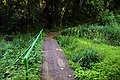
 A muddy track on Horspath Common - geograph.org.uk - 5733083.jpg 2,700 × 2,025; 751 KB
-
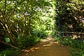
 A path on Horspath Common - geograph.org.uk - 5753158.jpg 2,700 × 2,025; 691 KB
-
 A path on Horspath Common - geograph.org.uk - 5753159.jpg 2,025 × 2,700; 1.06 MB
-
 A path on Horspath Common - geograph.org.uk - 5753160.jpg 2,700 × 2,025; 1.18 MB
-
 Arable field by Wheatley Road - geograph.org.uk - 1835110.jpg 1,500 × 1,000; 191 KB
-
 Arable field from Cuddesdon Road - geograph.org.uk - 1835119.jpg 1,500 × 976; 230 KB
-
 Benchmark on CE Primary School - geograph.org.uk - 3925104.jpg 683 × 1,024; 220 KB
-

-
 Benchmark on tower buttress of St Giles' Church - geograph.org.uk - 3925076.jpg 683 × 1,024; 237 KB
-
 Benchmark on Ways Farm barn conversion - geograph.org.uk - 2248887.jpg 600 × 800; 174 KB
-
 Benchmark on Wesleyan Chapel - geograph.org.uk - 3925812.jpg 689 × 1,024; 225 KB
-
 Benchmark on ^37 Cuddesdon Road - geograph.org.uk - 3925867.jpg 655 × 1,024; 284 KB
-
 Blenheim Road by Horspath Common - geograph.org.uk - 5733079.jpg 2,700 × 2,025; 849 KB
-
 Blenheim Road by Horspath Common - geograph.org.uk - 5733089.jpg 2,025 × 2,700; 914 KB
-
 Blenheim Road by Horspath Common - geograph.org.uk - 5733092.jpg 2,025 × 2,700; 888 KB
-
 Blenheim Road by Horspath Common - geograph.org.uk - 5733093.jpg 2,025 × 2,700; 903 KB
-
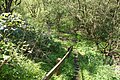
 Boggy wetland in the former railway cutting - geograph.org.uk - 2450726.jpg 1,500 × 1,000; 253 KB
-
 Boggy wetland in the former railway cutting - geograph.org.uk - 2450728.jpg 1,500 × 1,000; 371 KB
-
 Bridleway to Garsington - geograph.org.uk - 2353410.jpg 1,500 × 984; 235 KB
-
 Butts Road crosses the former railway - geograph.org.uk - 2450734.jpg 1,500 × 1,000; 411 KB
-
 Butts Road crosses the former railway - geograph.org.uk - 2450749.jpg 1,500 × 1,000; 278 KB
-
 Car export wagons and a new mini. - geograph.org.uk - 5666646.jpg 5,202 × 3,465; 4.44 MB
-
 Church Road north - geograph.org.uk - 3514459.jpg 800 × 600; 130 KB
-
 Church Road south - geograph.org.uk - 3514468.jpg 600 × 800; 113 KB
-
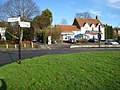
 Cottage, village green and daffodils, Horspath - geograph.org.uk - 3928295.jpg 4,320 × 3,240; 3.67 MB
-
 Cottages on Blenheim Road - geograph.org.uk - 5733069.jpg 2,700 × 2,025; 353 KB
-
 Cricket Pitch at Horspath - geograph.org.uk - 815747.jpg 640 × 480; 45 KB
-
 Cuddesdon Road - geograph.org.uk - 3515570.jpg 800 × 600; 100 KB
-
 Cuddesdon Road - geograph.org.uk - 815753.jpg 640 × 480; 63 KB
-
 Cuddesdon Road entering Horspath - geograph.org.uk - 2353466.jpg 1,500 × 1,000; 180 KB
-
 Cuddesdon Road from the former railway bridge - geograph.org.uk - 2450740.jpg 1,500 × 1,000; 249 KB
-
 Fallow field near Wheatley - geograph.org.uk - 3928131.jpg 4,320 × 3,240; 3.18 MB
-
 Field north of Cuddesdon Road - geograph.org.uk - 2353452.jpg 1,500 × 983; 190 KB
-
 Field south of Cuddesdon Road - geograph.org.uk - 2353458.jpg 1,500 × 1,000; 147 KB
-
 Footbridge over the wetland - geograph.org.uk - 2450732.jpg 1,500 × 1,000; 295 KB
-
 Footpath crossing the old railway track - geograph.org.uk - 3965136.jpg 3,872 × 2,592; 7.54 MB
-
-

-
 Footpath to Cowley - geograph.org.uk - 5753164.jpg 2,700 × 2,025; 540 KB
-
 Footpath to Horspath - geograph.org.uk - 2442976.jpg 1,500 × 1,000; 209 KB
-
 Former railway bridge over Cuddesdon Road - geograph.org.uk - 2353429.jpg 1,500 × 1,000; 370 KB
-
 Fort Box Storage Depot - geograph.org.uk - 1580299.jpg 640 × 427; 69 KB
-
 Gidley Way in Horspath - geograph.org.uk - 2353438.jpg 1,500 × 1,000; 227 KB
-
 Green Bus Stop - geograph.org.uk - 3508768.jpg 800 × 600; 127 KB
-
 High and Low Voltage - geograph.org.uk - 3506823.jpg 2,560 × 1,920; 1.1 MB
-
 Horspath Athletics Ground - geograph.org.uk - 2441466.jpg 2,904 × 2,120; 680 KB
-
 Horspath Bridge - geograph.org.uk - 3515560.jpg 800 × 600; 125 KB
-
 Horspath CE Primary School - geograph.org.uk - 3925111.jpg 1,024 × 683; 209 KB
-
 Horspath CuddesdonRdBridge.JPG 3,000 × 2,000; 2.76 MB
-
 Horspath Garage - geograph.org.uk - 3515576.jpg 800 × 600; 77 KB
-
 Horspath Manor on Church Road - geograph.org.uk - 5733060.jpg 2,700 × 2,025; 418 KB
-
 Horspath pub.jpg 640 × 480; 107 KB
-
 Horspath Service Station on Oxford Road - geograph.org.uk - 5733042.jpg 2,700 × 2,025; 512 KB
-
 Horspath, Butts Road bridge - geograph.org.uk - 662040.jpg 640 × 480; 145 KB
-
 Horspath, Cuddesdon Road bridge - geograph.org.uk - 662137.jpg 640 × 480; 79 KB
-
 Horspath, Disused railway tunnel portal - geograph.org.uk - 661991.jpg 640 × 480; 137 KB
-
 Houses ^ Red Berries, Horspath - geograph.org.uk - 4699572.jpg 3,548 × 2,664; 3.37 MB
-
 Junction of Butts Road and Gidley Way - geograph.org.uk - 3925214.jpg 1,024 × 683; 290 KB
-
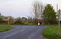 Junction with Wheatley Road - geograph.org.uk - 1835105.jpg 1,500 × 961; 180 KB
-
 Kissing gate on the footpath - geograph.org.uk - 2442980.jpg 1,500 × 1,000; 406 KB
-
 Kissing gate on the footpath to Cowley - geograph.org.uk - 5753165.jpg 2,700 × 2,025; 538 KB
-
 Kissing gate to Gidley Way - geograph.org.uk - 2442964.jpg 1,500 × 1,000; 439 KB
-
 Kissing gate to the footpath - geograph.org.uk - 2442960.jpg 1,000 × 1,500; 305 KB
-

-
 Large house on Spring Lane - geograph.org.uk - 5753162.jpg 2,700 × 2,025; 413 KB
-
 Layby View - geograph.org.uk - 3508742.jpg 800 × 600; 89 KB
-
 Londis store and post office in Horspath - geograph.org.uk - 5733037.jpg 2,700 × 2,025; 325 KB
-
 Manor Cottage on Church Road - geograph.org.uk - 5733067.jpg 2,700 × 2,025; 513 KB
-
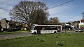
 Mercedes-Benz SprinterCity BU18 YRT Horspath.jpg 1,025 × 684; 566 KB
-
 Methodist Chapel - geograph.org.uk - 3515549.jpg 800 × 600; 103 KB
-
 Methodist Chapel, Horspath - geograph.org.uk - 3928286.jpg 4,320 × 3,240; 3.38 MB
-
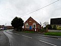
 Methodist Chapel, Oxford Road - geograph.org.uk - 3925842.jpg 1,024 × 683; 190 KB
-
 Old Road - geograph.org.uk - 1113450.jpg 640 × 480; 102 KB
-
 Optare Solo MX08 MYV Horspath cropped.jpg 1,178 × 589; 557 KB
-
 Optare Solo MX08 MYV Horspath.jpg 1,086 × 611; 598 KB
-
 Oxford Road - geograph.org.uk - 3515584.jpg 800 × 600; 94 KB
-
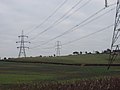 Power lines and pylons at Horspath - geograph.org.uk - 325418.jpg 640 × 480; 65 KB
-
 Road in Brasenose Wood - geograph.org.uk - 3339241.jpg 1,024 × 768; 414 KB
-
 Road passes under bridge carrying disused railway line - geograph.org.uk - 3928204.jpg 4,320 × 3,240; 4.4 MB
-
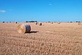 Rolled Up Straw - geograph.org.uk - 3116154.jpg 1,024 × 690; 207 KB
-
 Running track - geograph.org.uk - 815741.jpg 640 × 480; 47 KB
-
 Sandy Lane to Shotover - geograph.org.uk - 2442991.jpg 1,500 × 1,000; 190 KB
-
 Semi-detached houses on Bleheim Road - geograph.org.uk - 3924630.jpg 1,024 × 683; 133 KB
-
 Semis on Cuddesdon Road - geograph.org.uk - 3925879.jpg 1,024 × 683; 179 KB
-
 Shotover Country Park, Oxford - geograph.org.uk - 83398.jpg 480 × 640; 186 KB
-
 Spring Lane - geograph.org.uk - 3515596.jpg 800 × 600; 114 KB
-
 Spring Lane in Horspath - geograph.org.uk - 5753161.jpg 2,700 × 2,025; 418 KB
-
 Spring Lane, Horspath - geograph.org.uk - 3506693.jpg 1,600 × 1,057; 391 KB
-
 St Giles Church - geograph.org.uk - 3515533.jpg 800 × 600; 112 KB
-
 St Giles Church - geograph.org.uk - 3924620.jpg 1,024 × 683; 220 KB
-
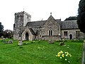
 St Giles church in Horspath - geograph.org.uk - 5733049.jpg 2,700 × 2,007; 427 KB
-
 St Giles Church, Horspath - geograph.org.uk - 2437745.jpg 2,816 × 2,112; 1.48 MB
-
 St Giles' Church, Horspath - geograph.org.uk - 3928225.jpg 4,320 × 3,240; 3.85 MB
-
 Thatched cottage on Blenheim Road - geograph.org.uk - 5733072.jpg 2,700 × 2,025; 525 KB
-
 The bricked up west portal of Horspath Tunnel - geograph.org.uk - 2440854.jpg 1,500 × 1,000; 318 KB
-
 The Butts Road railway bridge - geograph.org.uk - 2450744.jpg 1,500 × 1,000; 271 KB
-
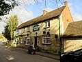
 The Chequers Inn in Horspath - geograph.org.uk - 5733040.jpg 2,700 × 2,025; 511 KB
-
 The Chequers ^ The Taste Of India - geograph.org.uk - 4699566.jpg 2,930 × 2,103; 1.35 MB
-
 The Cricket Ground at Horspath - geograph.org.uk - 31221.jpg 640 × 480; 80 KB
-
 The former railway embankment in Horspath - geograph.org.uk - 2450739.jpg 1,500 × 1,000; 418 KB
-

-
 The Horspath Hub on Oxford Road - geograph.org.uk - 5733046.jpg 2,700 × 2,025; 445 KB
-

-
 The parapet on the former railway bridge - geograph.org.uk - 2450743.jpg 1,500 × 1,000; 396 KB
-
 The Queen's Head - geograph.org.uk - 3515520.jpg 600 × 800; 109 KB
-
 The Queen's Head in Church Road - geograph.org.uk - 5733055.jpg 2,700 × 2,025; 389 KB
-
 The tower of St Giles' Church - geograph.org.uk - 3925085.jpg 675 × 1,024; 234 KB
-
 Trees along Cuddesdon Road - geograph.org.uk - 1835133.jpg 1,500 × 1,000; 156 KB
-
 Trees growing on the former railway bridge - geograph.org.uk - 2450742.jpg 1,500 × 1,000; 302 KB
-
 Tudor Cottage on Manor Farm Road - geograph.org.uk - 5753163.jpg 2,700 × 2,025; 562 KB
-
 Village Hall - geograph.org.uk - 3515588.jpg 800 × 600; 103 KB
-
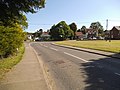 Village View - geograph.org.uk - 3515595.jpg 800 × 600; 116 KB
-
 Wheatley Road at Boundary Farm - geograph.org.uk - 3748858.jpg 1,024 × 683; 186 KB
-
 Wheatley Road junction with Cuddesdon Road - geograph.org.uk - 2829757.jpg 3,518 × 2,338; 1.09 MB
-
 Wheatley windmill from the footpath - geograph.org.uk - 2442990.jpg 1,500 × 1,000; 214 KB
-
 Windmill and Pylon View - geograph.org.uk - 3508758.jpg 800 × 600; 83 KB
-
 Yellow flags in the former railway cutting - geograph.org.uk - 2450723.jpg 1,500 × 1,000; 287 KB
-
 Autumn in Shotover park - geograph.org.uk - 604902.jpg 640 × 505; 210 KB
-
 Field at Horspath - geograph.org.uk - 324886.jpg 640 × 480; 274 KB
-
 Field at Horspath, motor works beyond - geograph.org.uk - 325427.jpg 640 × 480; 202 KB
-
 Gate on Shotover Plain - geograph.org.uk - 574346.jpg 640 × 480; 119 KB
-
 Hill Farm, Horspath - geograph.org.uk - 324881.jpg 640 × 480; 174 KB
-
 Horspath, Queen's Head Public House - geograph.org.uk - 662202.jpg 640 × 480; 98 KB
-
 Houses and field by Brookside, Horspath - geograph.org.uk - 325420.jpg 640 × 480; 200 KB
-
 The Chequers Inn, Horspath - geograph.org.uk - 427562.jpg 640 × 480; 79 KB
-
 Track at Horspath - geograph.org.uk - 325430.jpg 480 × 640; 277 KB
-
 Unusual path in Shotover Country Park - geograph.org.uk - 414286.jpg 640 × 427; 148 KB
-
 ^12 Gidley Way - geograph.org.uk - 3925252.jpg 1,024 × 683; 215 KB


