Category:Horam
Jump to navigation
Jump to search
village in East Sussex, England, UK  | |||||
| Upload media | |||||
| Instance of | |||||
|---|---|---|---|---|---|
| Location | Wealden, East Sussex, South East England, England | ||||
| Area |
| ||||
| Said to be the same as | Horam (Wikimedia duplicated page, civil parish) | ||||
| official website | |||||
 | |||||
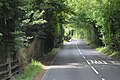
English: Horam is a village and civil parish in the Wealden District of East Sussex, about three miles (5 km) south of Heathfield. The parish includes the settlements of Vines Cross and Burlow.
Subcategories
This category has the following 8 subcategories, out of 8 total.
C
G
- Gamelands Methodist Church (13 F)
H
- Horam Chapel (10 F)
- Horam railway station (13 F)
M
O
- Oasts in Horam (15 F)
V
Media in category "Horam"
The following 200 files are in this category, out of 243 total.
(previous page) (next page)-

-
 A house called "Solitude" - geograph.org.uk - 5211058.jpg 2,714 × 1,916; 1.94 MB
-
 A straight section of the A267 - geograph.org.uk - 2387254.jpg 640 × 406; 80 KB
-
 A267 - Chiddingly Rd junction - geograph.org.uk - 4764060.jpg 640 × 426; 81 KB
-
 A267 - geograph.org.uk - 4764062.jpg 640 × 426; 73 KB
-
 A267 - geograph.org.uk - 4783317.jpg 640 × 426; 90 KB
-
 A267 - Horbeech Lane junction - geograph.org.uk - 4764056.jpg 640 × 426; 70 KB
-
 A267 at Horam - geograph.org.uk - 6075284.jpg 1,024 × 768; 199 KB
-
 A267, Cinderghyll - geograph.org.uk - 4764064.jpg 640 × 426; 95 KB
-
 A267, northbound - geograph.org.uk - 4783271.jpg 640 × 451; 84 KB
-
 A267, northbound - geograph.org.uk - 4783295.jpg 640 × 426; 87 KB
-
 A267, northbound - geograph.org.uk - 4783315.jpg 640 × 426; 96 KB
-
 A267, northbound at Horam - geograph.org.uk - 4783291.jpg 640 × 426; 75 KB
-
 A267, southbound - geograph.org.uk - 4764058.jpg 640 × 426; 92 KB
-
 Activity area at Hidden Spring Vineyard - geograph.org.uk - 2700250.jpg 4,000 × 3,000; 3.62 MB
-

-
 Afternoon feed near Grantleys Farm - geograph.org.uk - 2700200.jpg 4,000 × 3,000; 3.64 MB
-
 Approaching Coggers Farm - geograph.org.uk - 6077364.jpg 1,024 × 768; 235 KB
-
 Approaching Horam - geograph.org.uk - 6075276.jpg 1,600 × 1,200; 754 KB
-
 At the junction - geograph.org.uk - 2909690.jpg 640 × 480; 157 KB
-
 Atcost barn at Tubwell Nurseries - geograph.org.uk - 5283879.jpg 1,235 × 903; 646 KB
-
 Australian heron - geograph.org.uk - 2175406.jpg 3,264 × 2,448; 5.8 MB
-
 B2203 at Maynard's Green, East Sussex - geograph.org.uk - 2423788.jpg 1,600 × 1,118; 615 KB
-
 B2203 off the A267, Horam - geograph.org.uk - 2387181.jpg 640 × 368; 50 KB
-
 B2203, Horam - geograph.org.uk - 4760060.jpg 640 × 426; 83 KB
-
 B2203, Maynard's Green - geograph.org.uk - 4760051.jpg 640 × 426; 89 KB
-
 B2203, southbound - geograph.org.uk - 4760054.jpg 640 × 426; 96 KB
-
 Balcony at Fenton - geograph.org.uk - 6075271.jpg 1,024 × 768; 201 KB
-
 Barn off Furnace Lane - geograph.org.uk - 2418332.jpg 640 × 480; 125 KB
-
 Barns, Lewhurst Farm - geograph.org.uk - 393208.jpg 640 × 397; 265 KB
-
 Bend in the A267 north of Horam - geograph.org.uk - 2387258.jpg 640 × 503; 73 KB
-
 Bike jumps by the Cuckoo Trail - geograph.org.uk - 1948935.jpg 640 × 428; 159 KB
-
 Brewers Arms, Vine Cross - geograph.org.uk - 2115291.jpg 480 × 640; 67 KB
-
 Brewers Arms, Vine Cross - geograph.org.uk - 2115294.jpg 640 × 480; 110 KB
-
 Brick shed at Tubwell Nurseries - geograph.org.uk - 5297264.jpg 2,816 × 2,112; 2.62 MB
-
 Bridge carrying Horebeech Lane over the Cuckoo Trail - geograph.org.uk - 2693567.jpg 4,000 × 3,000; 3.28 MB
-
 Bridge over Tubwell Lane - geograph.org.uk - 2382580.jpg 1,024 × 768; 440 KB
-
 Bridges over Waldron Gill - geograph.org.uk - 2700271.jpg 4,000 × 3,000; 3.62 MB
-
 Bridleway to North Corner - geograph.org.uk - 2450348.jpg 640 × 480; 125 KB
-
 Bulrushes in disused pit by path to Cogger's Cross - geograph.org.uk - 2175552.jpg 3,264 × 2,448; 5.95 MB
-
 Chiddingly Road - geograph.org.uk - 2419261.jpg 640 × 480; 106 KB
-
 Chiddingly Road - geograph.org.uk - 2419286.jpg 640 × 480; 111 KB
-
 Chiddingly Road, Burlow - geograph.org.uk - 2639691.jpg 2,256 × 1,496; 883 KB
-
 Christ Church Horam - geograph.org.uk - 2700294.jpg 4,000 × 3,000; 3.56 MB
-

-
 Christ Church, Horam, East Sussex - geograph.org.uk - 2300503.jpg 1,600 × 1,200; 310 KB
-
 Clock Tower, Horam - geograph.org.uk - 3018932.jpg 1,600 × 1,200; 481 KB
-
 Coggers Farm - geograph.org.uk - 6077368.jpg 1,024 × 768; 337 KB
-
 Cogger’s Lane - geograph.org.uk - 6077405.jpg 1,024 × 768; 303 KB
-
 Cottages at Horam - geograph.org.uk - 3018914.jpg 1,600 × 1,200; 513 KB
-
 Cottages in Vines Cross - geograph.org.uk - 1880702.jpg 1,600 × 1,565; 690 KB
-
 Cowden Hall Lane - geograph.org.uk - 2909073.jpg 640 × 428; 172 KB
-
 Cowden Hall Lane near Marle Green - geograph.org.uk - 2175383.jpg 3,264 × 2,448; 5.47 MB
-
 Cuckoo Trail - geograph.org.uk - 1881235.jpg 1,600 × 1,200; 732 KB
-
 Cuckoo Trail - geograph.org.uk - 1881251.jpg 1,600 × 1,200; 781 KB
-
 Cuckoo Trail - geograph.org.uk - 3893499.jpg 640 × 427; 123 KB
-
 Cuckoo Trail - typical wooded section - geograph.org.uk - 1948866.jpg 640 × 428; 154 KB
-
 Cuckoo Trail - West Street Lane Bridge - geograph.org.uk - 1948814.jpg 640 × 428; 171 KB
-
 Cuckoo Trail at Downline Close, Horam - geograph.org.uk - 5797723.jpg 3,817 × 3,987; 6.65 MB
-
 Cuckoo Trail at Junction with Horebeach Lane - geograph.org.uk - 5797731.jpg 4,764 × 2,992; 6.04 MB
-
 Cuckoo Trail entering Horam - geograph.org.uk - 2693601.jpg 4,000 × 3,000; 3.47 MB
-
 Cuckoo Trail near Horam - geograph.org.uk - 3018901.jpg 1,600 × 1,200; 752 KB
-
 Cycling and running on the Cuckoo Trail - geograph.org.uk - 6075328.jpg 1,600 × 1,200; 836 KB
-
 Dead tree stands out from the autumn colours of small wood. - geograph.org.uk - 2175542.jpg 3,264 × 2,448; 3.37 MB
-
 Derelict building by bridleway to North Corner - geograph.org.uk - 2171331.jpg 3,264 × 2,448; 5.18 MB
-
 Derelict greenhouse - geograph.org.uk - 5211865.jpg 2,108 × 1,468; 575 KB
-
 Dewpond - Horam - geograph.org.uk - 1880680.jpg 1,600 × 1,200; 650 KB
-

-
 Downline Close - geograph.org.uk - 6075320.jpg 1,024 × 768; 317 KB
-
 Drainage or culvert pipes near Riverside Farm - geograph.org.uk - 2175413.jpg 3,264 × 2,448; 4.68 MB
-
 Eastern end of Sicklehatch Lane Maynard's Green - geograph.org.uk - 2700128.jpg 4,000 × 3,000; 3.28 MB
-
 Electricity Pylon - geograph.org.uk - 2419256.jpg 480 × 640; 87 KB
-
 Electricity Pylon - geograph.org.uk - 2419258.jpg 480 × 640; 89 KB
-
 Electricity Pylon near Horeham Flat Farm - geograph.org.uk - 3384283.jpg 1,632 × 2,464; 1,017 KB
-
 Entering Horam on the A267 - geograph.org.uk - 2387174.jpg 640 × 430; 47 KB
-
 Entering Horam, B2203 - geograph.org.uk - 4760056.jpg 640 × 426; 109 KB
-
 Entering Horam, B2203 - geograph.org.uk - 4760058.jpg 640 × 426; 99 KB
-
 Entrance to Brickyard Farm - geograph.org.uk - 6075260.jpg 1,024 × 768; 325 KB
-
 Entrance to Golf Club - geograph.org.uk - 6075270.jpg 1,600 × 1,200; 916 KB
-
 Entrance to Hidden Springs Vineyard - geograph.org.uk - 267724.jpg 640 × 479; 178 KB
-
 Farm near Vines Cross - geograph.org.uk - 1880768.jpg 1,600 × 1,200; 403 KB
-
 Farmland near Horam - geograph.org.uk - 1880694.jpg 1,600 × 1,200; 441 KB
-
 Finger post at T-junction - geograph.org.uk - 2175468.jpg 3,264 × 2,448; 4.11 MB
-
 Foords Lane, Vines Cross, East Sussex - geograph.org.uk - 1956250.jpg 1,600 × 1,200; 405 KB
-
 Footpath into Sapperton Wood - geograph.org.uk - 2700134.jpg 4,000 × 3,000; 3.47 MB
-
 Footpath to Maynard's Green - geograph.org.uk - 2700118.jpg 4,000 × 3,000; 3.45 MB
-
 Footpath to the Cuckoo Trail - geograph.org.uk - 2175478.jpg 3,264 × 2,448; 5.22 MB
-
 Former Horam Railway Station - geograph.org.uk - 5396525.jpg 4,608 × 3,456; 5.67 MB
-

-
 Furnace Lane - geograph.org.uk - 3384351.jpg 2,190 × 1,461; 1.99 MB
-

-
 Furnace Lane, Horam - geograph.org.uk - 4427535.jpg 526 × 640; 322 KB
-
 Gamelands Lodge, A267 - geograph.org.uk - 2387166.jpg 640 × 375; 68 KB
-
 Gamelands Methodist Church - geograph.org.uk - 2639732.jpg 1,496 × 2,256; 761 KB
-
 Gamelands Methodist Church - geograph.org.uk - 6077413.jpg 1,600 × 1,200; 703 KB
-
 Gate into Furnace Wood - geograph.org.uk - 2909577.jpg 640 × 480; 176 KB
-
 Gateway to The Furnace - geograph.org.uk - 1844766.jpg 1,600 × 1,200; 637 KB
-
 Gill in Coggers Shaw - geograph.org.uk - 1949017.jpg 640 × 428; 181 KB
-
 Hanging Beech Lane - geograph.org.uk - 4783296.jpg 640 × 426; 89 KB
-
 Hanging Birch Lane - geograph.org.uk - 2387251.jpg 640 × 430; 85 KB
-
 Hanging Birch Lane, Horam - geograph.org.uk - 3322943.jpg 1,024 × 901; 441 KB
-
 Heading for Horam - geograph.org.uk - 6075333.jpg 1,024 × 768; 372 KB
-
 Hendall's Farm - geograph.org.uk - 3018940.jpg 1,600 × 1,200; 467 KB
-
 Hillside Drive, Horam - geograph.org.uk - 1880634.jpg 1,600 × 1,153; 542 KB
-
 Hillside view east across the Waldron Gill vale - geograph.org.uk - 2700276.jpg 4,000 × 3,000; 3.76 MB
-
 Horam B2203.jpg 1,024 × 682; 155 KB
-
 Horam Inn - geograph.org.uk - 4760061.jpg 640 × 426; 79 KB
-
 Horam Post Office - geograph.org.uk - 4760062.jpg 640 × 426; 79 KB
-
 Horam Railway Station - geograph.org.uk - 2001395.jpg 619 × 640; 115 KB
-
 Horam Scout and Guide hut - geograph.org.uk - 2693557.jpg 4,000 × 3,000; 3.45 MB
-
 Horam Village Hall - geograph.org.uk - 2693562.jpg 4,000 × 3,000; 3.44 MB
-
 Horam Village Sign - geograph.org.uk - 4783292.jpg 640 × 426; 68 KB
-
 Horebeach Lane, Marle Green, East Sussex - geograph.org.uk - 2992925.jpg 1,600 × 920; 333 KB
-
 Horebeech Lane Bridge - geograph.org.uk - 6075341.jpg 1,600 × 1,200; 827 KB
-
 Horebeech Lane Bridge and Milestone 4 - geograph.org.uk - 6075347.jpg 1,600 × 1,200; 884 KB
-
 Horebeech Lane Bridge, Horam 01.jpg 5,047 × 3,785; 4.5 MB
-
 Horebeech Lane Bridge, Horam 02.jpg 5,184 × 3,888; 5.15 MB
-
 Horebeech Lane Bridge, Horam 03.jpg 5,184 × 3,888; 5.07 MB
-
 Horebeech Lane ^ Cowden Hall Lane - geograph.org.uk - 2448722.jpg 640 × 480; 96 KB
-
 Horse in Farm at Twitterings - geograph.org.uk - 1880955.jpg 1,600 × 1,200; 593 KB
-
 Horse in Field - Horam - geograph.org.uk - 1880665.jpg 1,600 × 1,232; 609 KB
-
 Houses on Chiddingly Road Burlow, Horam - geograph.org.uk - 2716067.jpg 4,000 × 3,000; 3.6 MB
-
 Junction on Foords Lane - geograph.org.uk - 2909103.jpg 640 × 428; 105 KB
-
 Kingston Villas - geograph.org.uk - 6075267.jpg 1,600 × 1,200; 539 KB
-
 Lamb and ewe (8990127781).jpg 3,648 × 2,139; 2.03 MB
-
 Lamb with mum, Redlands Farm near Horam - geograph.org.uk - 2877890.jpg 1,600 × 938; 522 KB
-
 Laundry Lane meets Horebeech Lane near Marle Green - geograph.org.uk - 2700283.jpg 4,000 × 3,000; 3.53 MB
-
 Looking SE on the Cuckoo Trail - geograph.org.uk - 2700290.jpg 4,000 × 3,000; 3.62 MB
-
 Low lying field next to Waldron Gill - geograph.org.uk - 2175393.jpg 3,264 × 2,448; 5.98 MB
-
 Marking out new allotments at Horam - geograph.org.uk - 5276382.jpg 1,967 × 1,115; 662 KB
-
 Marle Green road NW to North Corner - geograph.org.uk - 2171792.jpg 3,264 × 2,448; 4.91 MB
-
 May Garland - geograph.org.uk - 6075275.jpg 1,600 × 1,200; 558 KB
-
 Maynard's Green Community Primary School - geograph.org.uk - 3301511.jpg 2,464 × 1,632; 1.05 MB
-
 Milepost 4 on Cuckoo Trail - geograph.org.uk - 5797929.jpg 4,896 × 3,672; 5.18 MB
-
 Milepost on the Cuckoo Trail - geograph.org.uk - 2694703.jpg 4,000 × 3,000; 3.48 MB
-
 Minor road junction south of Vines Cross - geograph.org.uk - 2991531.jpg 1,600 × 918; 328 KB
-
 Minor road junction, Marle Green - geograph.org.uk - 3322938.jpg 1,600 × 1,121; 371 KB
-
 Modern Barn near Marle Green - geograph.org.uk - 5200581.jpg 4,871 × 3,639; 6.47 MB
-
 Morgan at Vines Cross - geograph.org.uk - 2660495.jpg 2,256 × 1,496; 888 KB
-
 Natural arch over footbridge SE of Burnt House Farm - geograph.org.uk - 1844823.jpg 1,600 × 1,200; 796 KB
-

-
 New farm track near Burnt House Farm - geograph.org.uk - 1844827.jpg 1,600 × 1,200; 413 KB
-
 New houses in Horam - geograph.org.uk - 6075288.jpg 1,024 × 768; 153 KB
-
 Oast House - geograph.org.uk - 3875336.jpg 640 × 427; 120 KB
-
 Oast House - geograph.org.uk - 3875337.jpg 640 × 427; 110 KB
-
 Oast House - geograph.org.uk - 3875338.jpg 640 × 427; 118 KB
-

-

-

-

-

-
 Old Land rover at Grantleys Farm - geograph.org.uk - 2700183.jpg 4,000 × 3,000; 3.59 MB
-
 Old pear trees at Tubwell Nurseries - geograph.org.uk - 5290709.jpg 1,563 × 1,173; 824 KB
-
 Old pit near Cogger's Shaw - geograph.org.uk - 1948979.jpg 640 × 428; 133 KB
-
 Old pond bay north of The Furnace - geograph.org.uk - 1844767.jpg 1,600 × 1,200; 561 KB
-
 Orchard at Hidden Spring Vineyard - geograph.org.uk - 2700241.jpg 4,000 × 3,000; 3.62 MB
-
 Path junction at Coggers Farm - geograph.org.uk - 6077375.jpg 1,024 × 768; 379 KB
-
 Path junction on the Cuckoo Trail - geograph.org.uk - 6077143.jpg 1,600 × 1,200; 899 KB
-
 Path to Hidden Springs Vineyard - geograph.org.uk - 1880649.jpg 1,600 × 1,200; 542 KB
-
 Paynesbridge Way, Horam - geograph.org.uk - 3301522.jpg 2,464 × 1,632; 1.05 MB
-
 Paynsbridge Way, Horam - geograph.org.uk - 267723.jpg 640 × 479; 125 KB
-
 Platform on the old Cuckoo Line - geograph.org.uk - 2693660.jpg 4,000 × 3,000; 3.51 MB
-
 Pond at The Furnace on Furnace Lane - geograph.org.uk - 1844760.jpg 1,600 × 1,200; 500 KB
-
 Pond near Hook Farm - geograph.org.uk - 2700206.jpg 4,000 × 3,000; 3.56 MB
-
 Pond, Horam Manor Fishery - geograph.org.uk - 2988953.jpg 1,600 × 958; 600 KB
-
 Power lines crossing Chiddingly Road - geograph.org.uk - 2716061.jpg 3,521 × 2,616; 2.54 MB
-

-
 Road bridge over disused rail track - geograph.org.uk - 2639840.jpg 2,256 × 1,496; 882 KB
-
 Road junction on bend at North Corner - geograph.org.uk - 2171405.jpg 3,264 × 2,448; 4.14 MB
-
 Road north to Vines Cross from Marle Green - geograph.org.uk - 2175418.jpg 3,264 × 2,448; 4.55 MB
-
 Road signs for cyclists - geograph.org.uk - 2382585.jpg 480 × 640; 212 KB
-
 Road through Foord's Farm, Vines Cross, East Sussex - geograph.org.uk - 2300516.jpg 1,600 × 1,200; 276 KB
-
 Roadside seat by Horebeech Lane - geograph.org.uk - 2175463.jpg 3,264 × 2,448; 5.83 MB
-
 Sandy Lane branching from Hanging Birch Lane - geograph.org.uk - 1844882.jpg 1,600 × 1,200; 657 KB
-
 SE on the Cuckoo Trail - geograph.org.uk - 2175533.jpg 3,264 × 2,448; 5.55 MB
-

-
 Shadows on the trail - geograph.org.uk - 6077170.jpg 1,024 × 768; 414 KB
-
 Sharp bend in Waldron Gill - geograph.org.uk - 2175400.jpg 3,264 × 2,448; 5.38 MB
-
 Sheep in Hendall's Farm - geograph.org.uk - 3018955.jpg 1,600 × 1,200; 519 KB
-
 Shrubs near Vines Cross - geograph.org.uk - 1880750.jpg 1,600 × 1,200; 536 KB
-
 St Mary's School - geograph.org.uk - 4760053.jpg 640 × 426; 93 KB
-
 Staircase closed - geograph.org.uk - 6075291.jpg 1,024 × 768; 297 KB
-
 Stile and Footpath, off Laundry Lane - geograph.org.uk - 2659537.jpg 1,496 × 2,256; 791 KB
-
 Stiled entry to Nettlesworth Wood - geograph.org.uk - 2700112.jpg 4,000 × 3,000; 3.46 MB
-
 Stream Farm - geograph.org.uk - 1948903.jpg 640 × 428; 174 KB
-
 The Brewer's Arms, Vines Cross - geograph.org.uk - 2659543.jpg 2,256 × 1,496; 890 KB
-
 The Brewers Arms, Vines Cross - geograph.org.uk - 5128505.jpg 1,024 × 768; 227 KB
-
 The Cuckoo Line near Horebeech Lane - geograph.org.uk - 6075338.jpg 1,600 × 1,200; 826 KB
-
 The Cuckoo Trail climbing NE out of Horam - geograph.org.uk - 2693663.jpg 4,000 × 3,000; 3.49 MB
-
 The Cuckoo Trail from the West Street Lane bridge - geograph.org.uk - 2694894.jpg 4,000 × 3,000; 3.62 MB
-
 The Cuckoo Trail passing through housing estate in Horam - geograph.org.uk - 2693654.jpg 4,000 × 3,000; 3.48 MB
-
 The May Garland - geograph.org.uk - 4783272.jpg 640 × 426; 75 KB
-
 The May Garland Inn, Burlow - geograph.org.uk - 5128467.jpg 1,024 × 768; 239 KB
-
 The May Garland public house, Burlow, East Sussex - geograph.org.uk - 3057282.jpg 1,600 × 1,337; 369 KB
-
 The Maygarland, Burlow - geograph.org.uk - 2387170.jpg 640 × 449; 69 KB
-
 Tubwell Lane junction with West Street Lane - geograph.org.uk - 2694887.jpg 4,000 × 3,000; 3.49 MB
-
 Tubwell Lane under the bridge carrying the Cuckoo Trail - geograph.org.uk - 2694773.jpg 4,000 × 3,000; 3.54 MB
-
 Under the wires - geograph.org.uk - 1949040.jpg 640 × 428; 79 KB
-
 View from Footbridge - Tubwell Lane - geograph.org.uk - 1880967.jpg 1,600 × 1,200; 502 KB
-
 View west from the embankment on the Cuckoo Line - geograph.org.uk - 2693676.jpg 4,000 × 3,000; 3.61 MB


.jpg)


