Category:Hopkins maps of Brooklyn published in 1880
Jump to navigation
Jump to search
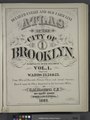
English: Maps from: Detailed Estate and Old Farm Line Atlas of the City of Brooklyn. Complete in Six Volumes. (Philadelphia: G. M. Hopkins, 1880).
Online at The New York Public Library Digital Collections website, Detailed estate and old farm line atlas. . .
Media in category "Hopkins maps of Brooklyn published in 1880"
The following 104 files are in this category, out of 104 total.
-
-

-

-

-

-

-
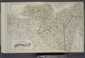
 Index Map of Brooklyn NYPL1627458.tiff 7,230 × 5,098; 105.46 MB
-
 Index Map of Brooklyn NYPL1627482.tiff 7,230 × 4,896; 101.28 MB
-
 Index Map of Brooklyn NYPL1627501.tiff 7,230 × 4,968; 102.77 MB
-
 Index Map of Brooklyn NYPL1627520.tiff 7,230 × 4,968; 102.77 MB
-
 Index Map of Brooklyn NYPL1627542.tiff 7,230 × 4,968; 102.77 MB
-

-

-
-

-

-

-

-

-

-

-

-

-

-

-
-

-

-

-

-

-

-

-

-

-

-

-

-

-

-

-

-
-
-

-

-

-

-

-

-

-

-

-

-

-

-
-

-

-

-

-

-

-

-

-

-
-

-

-

-

-

-

-

-

-

-

-

-

-

-
-

-

-
-

-

-

-

-

-

-

-

-

-

-

-
-

-

-

-

-

-

-

-
